

List of Allentown neighborhoods
Encyclopedia
The following is a list of neighborhoods, districts, and other places located in the city of Allentown
, Pennsylvania
, in the United States
. Allentown is the third largest city in Pennsylvania and the county seat
of Lehigh County
.
Allentown's neighborhoods have no official borders, such that some its neighborhoods may overlap geographically, and residents are sometimes not in agreement with where one neighborhood officially ends and another begins.
Center City
The City, in association with the Old Allentown Preservation Association, is a participant in the Commonwealth of Pennsylvania's Elm Street program. Covering the Old Allentown neighborhood, the Elm Street program's goals are to:
Efforts of the Old Allentown Preservation Association may be followed on their website: oldallentown.org or on their blog at: oldallentown.blogspot.com
The City plan which outlines the effort can be found on the Allentown City website at: http://www.allentownpa.gov/Portals/0/OpenDocLibraryRoot/Planning_Zoning/OLDALLENTOWNPLAN.PDF
The First and Sixth Wards are benefitted by the Weed and Seed Office operating out of the City of Allentown's Department of Community and Economic Development http://www.allentownweedandseed.org/

Allentown, Pennsylvania
Allentown is a city located in Lehigh County, Pennsylvania, in the United States. It is Pennsylvania's third most populous city, after Philadelphia and Pittsburgh, and the 215th largest city in the United States. As of the 2010 census, the city had a total population of 118,032 and is currently...
, Pennsylvania
Pennsylvania
The Commonwealth of Pennsylvania is a U.S. state that is located in the Northeastern and Mid-Atlantic regions of the United States. The state borders Delaware and Maryland to the south, West Virginia to the southwest, Ohio to the west, New York and Ontario, Canada, to the north, and New Jersey to...
, in the United States
United States
The United States of America is a federal constitutional republic comprising fifty states and a federal district...
. Allentown is the third largest city in Pennsylvania and the county seat
County seat
A county seat is an administrative center, or seat of government, for a county or civil parish. The term is primarily used in the United States....
of Lehigh County
Lehigh County, Pennsylvania
-Climate:Most of the county's climate is considered to fall in the humid continental climate zone. Summers are typically hot and muggy, fall and spring are generally mild, and winter is cold. Precipitation is almost uniformly distributed throughout the year....
.
Allentown's neighborhoods have no official borders, such that some its neighborhoods may overlap geographically, and residents are sometimes not in agreement with where one neighborhood officially ends and another begins.
Center CityCenter City, Allentown, PennsylvaniaCenter City is the downtown and Central Business District of Allentown, Pennsylvania, in the United States. It has a dense population and is currently undergoing an urban revitalizaton process.-Boundaries:...
- 7th Street
(North 7th Street from the city line to the north through Linden Street to the south)
7th Street is a retail and residential corridor just north of downtown Allentown. It is Allentown's fastest growing commercial corridor and serves as the primary gateway to the city with improved appearance in the last year through new street lights, planters and waste receptacles. Neighborhood service establishments and family-owned ethnic restaurants dominate business on 7th Street. A small colony of artists have begun to settle in this area of Allentown. 7th Street revitalization is organized by local volunteer citizen committees through a Main Street Program, 7th Street Allentown http://www.7thstreetallentown.org/ This program is a result of the City of Allentown participating in the State sponsored Main Street program for the area of North 7th Street between Linden and Washington Streets as a "Main Street". The Seventh Street Development Committee (SSDC) acts as the program's advisory body, and the Community Action Development Corporation-Allentown manages the program. The program follows the National Main Street Center's Four Point Approach of organization, economic restructuring, promotion, and design to structure the SSDC's comprehensive strategy. The SSDC follows an annual work plan and is assisted by a Main Street Manager. - Downtown
(4th through 12th Streets to the east and west, and Walnut through Linden Streets to the south and north)
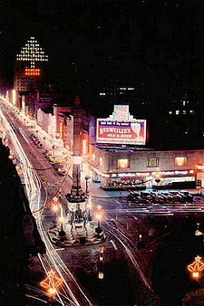
Downtown Allentown is the city’s central business district. It is home to several large employers such as PPLPPL (utility)PPL, formerly known as PP&L or Pennsylvania Power and Light, is an energy company headquartered in Allentown, Pennsylvania, USA. It currently controls about 19,000 megawatts of electrical generating capacity in the United States, primarily in Pennsylvania and Montana, and delivers electricity to...
and The Morning CallThe Morning CallThe Morning Call is a daily newspaper based in Allentown, Pennsylvania, in the United States. The newspaper is owned by the Tribune Company, whose other publications include the Chicago Tribune, Los Angeles Times and Baltimore Sun....
and is host to city, county, and federal government centers. While downtown is no longer considered the premier regional shopping destination of the Lehigh ValleyLehigh ValleyThe Lehigh Valley, known officially by the United States Census Bureau as the Allentown-Bethlehem-Easton, PA-NJ metropolitan area and referred to locally as The Valley and A-B-E, is a metropolitan region consisting of Lehigh, Northampton, Berks, and Carbon counties in eastern Pennsylvania and...
, dozens of small businesses and several prominent restaurants and nightclubs, including Robato of Tokyo, The Bay Leaf, the Allentown Brewworks, the Sterling, and others are located here. An ongoing effort to revitalize this area is progressing partially through the introduction of high-end loft apartments and townhomes and the application to the commonwealth by the city and the Chamber of Commerce for Main Street designation.http://www.allentownpa.gov/Government/DepartmentsBureaus/PlanningandZoning/CommunityPlanning/tabid/125/Default.aspx
- Arts District
One of the anchors of downtown Allentown is its arts district between N. 5th and N 6th Streets. The district is the home of many fine cultural arts and entertainment venues including the Allentown Art Museum, the Baum School of Art and Symphony Hall and most recently the Allentown Arts Park. The Arts District Master Plan was completed in 2004 for the purpose of providing a strategy for the district to grow and further develop its potential.http://www.allentownpa.gov/Government/DepartmentsBureaus/PlanningandZoning/CommunityPlanning/tabid/125/Default.aspx
- ""Jordan Creek""NOTI (North of Tilghman)
(Jordan Creek through 7th Street east to west north of Tilghman Street to the city line)
This area is mainly residential. Much of the area has historically been plagued by povertyPovertyPoverty is the lack of a certain amount of material possessions or money. Absolute poverty or destitution is inability to afford basic human needs, which commonly includes clean and fresh water, nutrition, health care, education, clothing and shelter. About 1.7 billion people are estimated to live...
. Prices of properties in this neighborhood are especially affordable and in recent years this neighborhood has been a magnet for working artists. - Old Allentown Historic District
(8th through 12th Streets east to west, and Linden through Liberty Streets south to north)
The Old Allentown Historic District was established on September 6, 1978 by City Ordinance #12314 and was certified by the Pennsylvania State Historical and Museum Commission on September 26, 1978. The neighborhood was laid out in the original plan for Allentown by order of William Allen in 1762. The area developed as the City grew northward and westward and today contains a mixture of housing styles including Federal, Italianate, Eastlake and Victorian. Old Allentown is also where the Allentown Promise Neighborhood is located. This initiative of the United Way was modeled on the work of Geoffrey Canada and the Harlem Children's Zone. The Allentown Promise Neighborhood takes a systems approach to improving the academic performance and the college and career readiness of the children in its nine block area.
The City, in association with the Old Allentown Preservation Association, is a participant in the Commonwealth of Pennsylvania's Elm Street program. Covering the Old Allentown neighborhood, the Elm Street program's goals are to:
- Revitalize neighborhoods in proximity to the existing downtown by improving the exterior appearance of the buildings and streetscape.
- Formalize a connection between established residential neighborhood areas with downtown revitalization activities.
- Prevent neighborhood decline by developing a plan that includes the establishment of a sustainable community organization that will implement a five year strategy.
- Assist municipalities in preparing and implementing a revitalization strategy for established residential neighborhoods either in the vicinity of a Main Street Program project or in proximity to an existing commercial district.
- The Old Allentown program has an Advisory Committee that executes an annual work plan based on the Old Allentown Neighborhood Improvement Plan, prepared with the assistance of the Bureau of Planning. The program's activities are managed by four committees, Organization, Promotion, Clean Safe and Green, Design, and Neighborhood Restructuring. A program manager assists in the program's implementation.http://www.allentownpa.gov/Government/DepartmentsBureaus/PlanningandZoning/CommunityPlanning/tabid/125/Default.aspx
Efforts of the Old Allentown Preservation Association may be followed on their website: oldallentown.org or on their blog at: oldallentown.blogspot.com
The City plan which outlines the effort can be found on the Allentown City website at: http://www.allentownpa.gov/Portals/0/OpenDocLibraryRoot/Planning_Zoning/OLDALLENTOWNPLAN.PDF
- Old Fairgrounds
(N. 5th and 6th Streets from Gorden to Tilghman Streets south to north)
The Old Fairgrounds Historic District was established on July 8, 1981 by City Ordinance #12314 and was certified by the Pennsylvania State Historical and Museum Commission on September 9, 1981. The district takes its name from the use of the area as the Lehigh County Agricultural Society's fairgrounds from 1852-1888. After the Society moved the fairgrounds to its current location at 17th and Chew Streets the land was auctioned off to developers. The area was developed with a mixture of housing styles with the most common being of Victorian character.
East Side
- Dutch Hill
(Residential areas of higher elevation on the southern portion of the East Side)
Mainly residential area located between East Hamilton Street and the Lehigh River. - East Allentown
(Dauphin Street through the Lehigh River east to west, and the Lehigh RiverLehigh RiverThe Lehigh River, a tributary of the Delaware River, is a river located in eastern Pennsylvania, in the United States. Part of the Lehigh, along with a number of its tributaries, is designated a Pennsylvania Scenic River by the state's Department of Conservation and Natural Resources...
through E. Hamilton StreetPennsylvania Route 222Pennsylvania Route 222 is a -long state highway contained entirely in Allentown, Lehigh County, Pennsylvania and its immediate suburbs mostly along Hamilton Boulevard. The route, in center city Allentown, is aligned along West Hamilton, West Linden, and West Walnut Streets...
/Hanover Avenue south to north)
A mix of both residential and industrial across the lower East Side of Allentown. - Midway Manor
(The BethlehemBethlehem, PennsylvaniaBethlehem is a city in Lehigh and Northampton Counties in the Lehigh Valley region of eastern Pennsylvania, in the United States. As of the 2010 census, the city had a total population of 74,982, making it the seventh largest city in Pennsylvania, after Philadelphia, Pittsburgh, Allentown, Erie,...
city line through N. Sherman Street east to west, and Union BoulevardState Route 1002 (Lehigh County, Pennsylvania)State Route 1002 ', locally known as Tilghman Street and Union Boulevard, is a major long east–west road in the Allentown-Bethlehem-Easton metropolitan area of the U.S. state of Pennsylvania. The majority of the roadway is the former alignment of U.S...
through E. Columbia Street south to north)
Residential area with larger homes than those in Center City. - Overlook Park
(Hanover Avenue/New England Avenue through the Lehigh RiverLehigh RiverThe Lehigh River, a tributary of the Delaware River, is a river located in eastern Pennsylvania, in the United States. Part of the Lehigh, along with a number of its tributaries, is designated a Pennsylvania Scenic River by the state's Department of Conservation and Natural Resources...
east to west, and E. Hamilton Street through E. Allen Street south to north)
A HOPE VIHOPE VIHOPE VI is a plan by the United States Department of Housing and Urban Development. It is meant to revitalize the worst public housing projects in the United States into mixed-income developments. Its philosophy is largely based on New Urbanism and the concept of Defensible space.The program began...
mixed income residential area containing privately managed low-income based rental housing as well as owner occupied single and multi-family dwellings. - Rittersville
(The BethlehemBethlehem, PennsylvaniaBethlehem is a city in Lehigh and Northampton Counties in the Lehigh Valley region of eastern Pennsylvania, in the United States. As of the 2010 census, the city had a total population of 74,982, making it the seventh largest city in Pennsylvania, after Philadelphia, Pittsburgh, Allentown, Erie,...
city line through N. Irving Street east to west, including neighborhoods along and adjacent to Hanover Avenue)
Not originally incorporated with the city, Rittersville is mainly residential, but has a small shopping center that was recently remodeled. The neighborhood is home to a psychiatric hospitalPsychiatric hospitalPsychiatric hospitals, also known as mental hospitals, are hospitals specializing in the treatment of serious mental disorders. Psychiatric hospitals vary widely in their size and grading. Some hospitals may specialise only in short-term or outpatient therapy for low-risk patients...
, the Allentown State HospitalAllentown State HospitalAllentown State Hospital was a psychiatric hospital located at 1600 Hanover Ave. in Allentown, Pennsylvania. It served the counties of Lehigh, Northampton, Carbon, Monroe, and Pike. It was one of seven remaining psychiatric hospitals in Pennsylvania....
.
South Side
- Alton Park
(Southwest of Interstate 78Interstate 78Interstate 78 is an Interstate Highway in the Northeast United States, running 144 miles from Interstate 81 northeast of Harrisburg, Pennsylvania, through Allentown, Pennsylvania, and western and northern New Jersey to the Holland Tunnel and Lower Manhattan in New York City.I-78 is a major road...
and north of Lehigh StreetLehigh StreetLehigh Street is a major road that connects Emmaus, Pennsylvania in the west to Allentown, Pennsylvania in the east, in the Lehigh Valley region of Pennsylvania, in the United States...
to the city line with Salisbury TownshipSalisbury Township, PennsylvaniaSalisbury Township is the name of some places in the U.S. state of Pennsylvania:*Salisbury Township, Lancaster County, Pennsylvania*Salisbury Township, Lehigh County, Pennsylvania...
and EmmausEmmaus, PennsylvaniaEmmaus is a borough in Lehigh County, Pennsylvania, in the United States. It is located five miles southwest of Allentown, Pennsylvania, in the Lehigh Valley region of the state.The population of Emmaus was 11,313 at the 2000 census...
)
Residential areas with a mix of some forest. - Cumberland Gardens
(E. Cumberland Street from S. Carlisle Street to S. Filbert Street)
Public housing area in the southeast area of Allentown, off of E. Susquehanna Street. - Lehigh Parkway
(residential areas to the south and east of the Lehigh Parkway)
Includes the area along the Jefferson Street corridor. Queen City Airport is located in this area. - Mountainville
(south eastern corner of the city centered around S. 5th Street and Emaus Avenue)
Named for the mountain that PA Route 145 travels over, this neighborhood is at the foot of the South Mountain. It has a mix of businesses, industry, and residential areas. Mack Truck Headquarters are located nearby.
The Wards
- 1st Ward (Lehigh RiverLehigh RiverThe Lehigh River, a tributary of the Delaware River, is a river located in eastern Pennsylvania, in the United States. Part of the Lehigh, along with a number of its tributaries, is designated a Pennsylvania Scenic River by the state's Department of Conservation and Natural Resources...
to the Jordan Creek east to west, and the Little Lehigh CreekLittle Lehigh CreekThe Little Lehigh Creek is approximately long, in eastern Pennsylvania, in the United States. It is also sometimes referred to as the Little Lehigh River. It is called the Little Lehigh because it is the largest tributary of the Lehigh River....
through Gordon Street south to north)
The First Ward was created under the name "Lehigh Ward" on August 30, 1852. It was the first section annexed to Allentown beyond the original boundaries of the city as established by city founder William AllenWilliam Allen (loyalist)William Allen was a wealthy merchant, Chief Justice of the Province of Pennsylvania, and mayor of Philadelphia. At the time of the American Revolution, Allen was one of the wealthiest and most powerful men in Philadelphia...
in 1762. The area near the river was mostly industrial use and has since been abandoned. - 6th Ward
(Lehigh RiverLehigh RiverThe Lehigh River, a tributary of the Delaware River, is a river located in eastern Pennsylvania, in the United States. Part of the Lehigh, along with a number of its tributaries, is designated a Pennsylvania Scenic River by the state's Department of Conservation and Natural Resources...
to the Jordan Creek east to west, and Gordon Street through the city line south to north)
A residential area that has a mix of cultures. Houses are spaced farther away when near the border with Whitehall.
The First and Sixth Wards are benefitted by the Weed and Seed Office operating out of the City of Allentown's Department of Community and Economic Development http://www.allentownweedandseed.org/
- The Waterfront (Opening approximately 2012)(Along the Lehigh RiverLehigh RiverThe Lehigh River, a tributary of the Delaware River, is a river located in eastern Pennsylvania, in the United States. Part of the Lehigh, along with a number of its tributaries, is designated a Pennsylvania Scenic River by the state's Department of Conservation and Natural Resources...
from Allen Street in the south to American Parkway in the north)
A plan to redevelop the former site of Lehigh Structural Steel. Plans include a walking path, an amphitheater, a marina, restaurants, a hotel, townhouses and condominiums, apartments, stores, offices, and a new bridge across the river, which would carry American Pkwy to the East Side.
West End
- Hamilton Park
(Union Terrace Park through the city line east to west, and the city line through Hamilton StreetPennsylvania Route 222Pennsylvania Route 222 is a -long state highway contained entirely in Allentown, Lehigh County, Pennsylvania and its immediate suburbs mostly along Hamilton Boulevard. The route, in center city Allentown, is aligned along West Hamilton, West Linden, and West Walnut Streets...
south to north)
Residential areas on the West End south of Cedar Creek Park. - Trexler Park
(All areas within the city limits west of Cedar Crest Boulevard) - West End Theatre District
(17th through 22nd Streets to the east and west, and Liberty through Washington Streets to the south and north)
Also known as the 19th Street Theatre District, this area is often viewed as Allentown’s most up and coming mixed use neighborhood. Centered on the Civic Theatre of AllentownCivic Theatre of AllentownCivic Theatre of Allentown is a historic community center that hosts theatre, arts education and film. It is located on 19th street in Allentown, Pennsylvania. The theatre was developed by Rubin Maiken and Alex Minker, and opened Sept. 17, 1928...
’s two neighborhood venues on 19th Street, the West End Theatre District is home to nearly 140 businesses. Within close proximity are Muhlenberg CollegeMuhlenberg CollegeMuhlenberg College is a private liberal arts college located in Allentown, Pennsylvania, United States. Founded in 1848, Muhlenberg is affiliated with the Evangelical Lutheran Church in America and is named for Henry Melchior Muhlenberg, the patriarch of the Lutheran Church in America.- History...
, Lehigh Valley HospitalLehigh Valley HospitalLehigh Valley Hospital, based in Allentown, Pennsylvania, is the largest hospital in the Lehigh Valley and the flagship hospital of the Lehigh Valley Hospital and Health Network .-Lehigh Valley Health Network:...
’s 17th Street Campus, and the Allentown Farmers Market. The opening of several boutique style small businesses over the past two years also has enhanced the neighborhood’s appeal as a specialty shopping destination. - West Park Historic District
(15th through 17th Streets east to west, and Hamilton through Chew Streets south to north plus the 1400 block of Linden Street)
Attractions such as historic Victorian and Craftsman-style homes and a public park founded by General Harry Trexler in 1908 can be found here. West Park features a newly restored bandshell where the Allentown Band and other musical venues can be heard throughout the summers. - West Walnut/Union Terrace
(15th Street through Union Terrace Park east to west, North to Hamilton StreetsPennsylvania Route 222Pennsylvania Route 222 is a -long state highway contained entirely in Allentown, Lehigh County, Pennsylvania and its immediate suburbs mostly along Hamilton Boulevard. The route, in center city Allentown, is aligned along West Hamilton, West Linden, and West Walnut Streets...
and South to South Street)
Known for the West End Pharmacy, Seward's Steak Shop, & the former Hersh's Market located in the south west region of Allentown the neighborhood of West Walnut known to its residents as Union Terrace and often called UT by many locals is a small community of row homes, small apartment complexes, bungalow style houses, and Victorian style homes. Union Terrace Elementary School and Francis D. Raub Middle School are also located inside the neighborhood.