

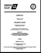
Light List
Encyclopedia
 |
|
| Purpose: | Provide detailed information on aids to navigation. |
|---|---|
| Publication Frequency: | Yearly |
| Published by: | United States Coast Guard |
| Available Online: | Yes |
The United States Coast Guard Light List is an American navigation
Navigation
Navigation is the process of monitoring and controlling the movement of a craft or vehicle from one place to another. It is also the term of art used for the specialized knowledge used by navigators to perform navigation tasks...
publication in 7 volumes made available yearly by the U.S. Coast Guard which gives information on lighted navigation aids, unlighted buoys, radiobeacons, radio direction finder calibration stations, daybeacons, racons, and LORAN
LORAN
LORAN is a terrestrial radio navigation system using low frequency radio transmitters in multiple deployment to determine the location and speed of the receiver....
stations.
Each volume of the Light List contains aids to navigation in geographic order from north to south along the Atlantic coast, from east to west along the Gulf coast, and from south to north along the Pacific coast. It lists seacoast aids first, followed by entrance and harbor aids listed from seaward.
Intracoastal Waterway
Intracoastal Waterway
The Intracoastal Waterway is a 3,000-mile waterway along the Atlantic and Gulf coasts of the United States. Some lengths consist of natural inlets, salt-water rivers, bays, and sounds; others are artificial canals...
aids are listed last in geographic order in the direction from New Jersey
New Jersey
New Jersey is a state in the Northeastern and Middle Atlantic regions of the United States. , its population was 8,791,894. It is bordered on the north and east by the state of New York, on the southeast and south by the Atlantic Ocean, on the west by Pennsylvania and on the southwest by Delaware...
to Florida
Florida
Florida is a state in the southeastern United States, located on the nation's Atlantic and Gulf coasts. It is bordered to the west by the Gulf of Mexico, to the north by Alabama and Georgia and to the east by the Atlantic Ocean. With a population of 18,801,310 as measured by the 2010 census, it...
to the border of Texas
Texas
Texas is the second largest U.S. state by both area and population, and the largest state by area in the contiguous United States.The name, based on the Caddo word "Tejas" meaning "friends" or "allies", was applied by the Spanish to the Caddo themselves and to the region of their settlement in...
and Mexico
Mexico
The United Mexican States , commonly known as Mexico , is a federal constitutional republic in North America. It is bordered on the north by the United States; on the south and west by the Pacific Ocean; on the southeast by Guatemala, Belize, and the Caribbean Sea; and on the east by the Gulf of...
.
The listings are preceded by a description of the aids to navigation system in the United States, luminous range diagram, geographic range tables, and other information.
Source
The text of this article originated from section 409 of The American Practical Navigator, a document produced by the government of the United States of AmericaUnited States
The United States of America is a federal constitutional republic comprising fifty states and a federal district...
.
See also
Similar publications are published by the U.S. National Geospatial-Intelligence AgencyNational Geospatial-Intelligence Agency
The National Geospatial-Intelligence Agency is an agency of the federal government of the United States with the primary mission of collecting, analyzing and distributing geospatial intelligence in support of national security. NGA was formerly known as the National Imagery and Mapping Agency ...
for use by the U.S. military and by the Canadian Coast Guard
Canadian Coast Guard
The Canadian Coast Guard is the coast guard of Canada. It is a federal agency responsible for providing maritime search and rescue , aids to navigation, marine pollution response, marine radio, and icebreaking...
.
- American Practical Navigator
- BuoyBuoyA buoy is a floating device that can have many different purposes. It can be anchored or allowed to drift. The word, of Old French or Middle Dutch origin, is now most commonly in UK English, although some orthoepists have traditionally prescribed the pronunciation...
- Coast PilotsCoast PilotsUnited States Coast Pilots is a nine-volume American navigation publication distributed yearly by the National Oceanic and Atmospheric Administration's Office of Coast Survey. The purpose of the publication is to supplement nautical charts of United States of America waters. Information comes...
- List of Lights
- Local Notice to MarinersLocal Notice to MarinersA Local Notice to Mariners is an authoritative instruction issued by a designated official, typically the harbormaster.-United States:In the United States, notices are issued by each U.S. Coast Guard District to disseminate important information affecting navigational safety within that District...
- Notice to MarinersNotice to MarinersA notice to mariners advises mariners of important matters affecting navigational safety, including new hydrographic information, changes in channels and aids to navigation, and other important data.Over 60 countries which produce nautical charts also...
- Sailing DirectionsSailing DirectionsSailing Directions is a 42-volume American navigation publication published by the National Geospatial-Intelligence Agency . Sailing Directions consists of 37 Enroute volumes, 4 Planning Guide volumes, and 1 volume combining both types...
External links
- Chapter 4: Nautical Publications - from the online edition of Nathaniel BowditchNathaniel BowditchNathaniel Bowditch was an early American mathematician remembered for his work on ocean navigation. He is often credited as the founder of modern maritime navigation; his book The New American Practical Navigator, first published in 1802, is still carried on board every commissioned U.S...
's American Practical Navigator - U.S. National Geo-spatial Agency (military)
- Canadian Coast Guard