

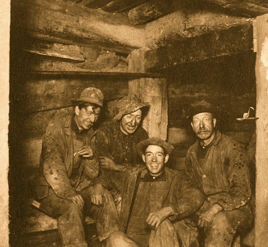
Leadville mining district
Encyclopedia

Colorado
Colorado is a U.S. state that encompasses much of the Rocky Mountains as well as the northeastern portion of the Colorado Plateau and the western edge of the Great Plains...
. It is located immediately east of the town of Leadville.
Cumulative production through 1963 was 240 million troy ounces of silver, 3 million troy ounces of gold, 987 million tonnes of lead, 712 million tonnes of zinc, and 48 million tonnes of copper. The district also produced byproduct bismuth, and iron-manganese ore.
History
Although silver was discovered in Colorado in 1859, the state's largest silver district, LeadvilleLeadville, Colorado
Leadville is a Statutory City that is the county seat of, and the only municipality in, Lake County, Colorado, United States. Situated at an elevation of , Leadville is the highest incorporated city and the second highest incorporated municipality in the United States...
, was not discovered until 1874. Placer gold was mined at nearby Oro City
Oro City, Colorado
Oro City, now a ghost town, was an early gold placer mining town in the Mosquito Range of Lake County, Colorado, United States. Oro is the Spanish word for gold.-History:...
starting in 1860, but it was not until 1874 that miners realized that the heavy brown sand that interfered with their gold cleanups was silver-bearing cerussite
Cerussite
Cerussite is a mineral consisting of lead carbonate , and an important ore of lead. The name is from the Latin cerussa, white lead. Cerussa nativa was mentioned by Conrad Gessner in 1565, and in 1832 F. S. Beudant applied the name cruse to the mineral, whilst the present form, cerussite, is due to...
. Prospectors traced the brown sand to its lode sources, and started the Colorado Silver Boom
Colorado Silver Boom
The Colorado Silver Boom was a dramatic expansionist period of silver mining activity in the U.S. state of Colorado in the late 19th century. The boom started in 1879 with the discovery of silver at Leadville...
.
The last active mine in the district, the Black Cloud mine, owned by ASARCO
ASARCO
ASARCO LLC is a mining, smelting, and refining company based in Tucson, Arizona that mines and processes primarily copper. The company, a subsidiary of Grupo México, is currently in Chapter 11 bankruptcy...
, closed in 1999.
Geology
The district is a highly faulted area, intruded with TertiaryTertiary
The Tertiary is a deprecated term for a geologic period 65 million to 2.6 million years ago. The Tertiary covered the time span between the superseded Secondary period and the Quaternary...
quartz monzonite porphyries, on the east side of the Arkansas River
Arkansas River
The Arkansas River is a major tributary of the Mississippi River. The Arkansas generally flows to the east and southeast as it traverses the U.S. states of Colorado, Kansas, Oklahoma, and Arkansas. The river's initial basin starts in the Western United States in Colorado, specifically the Arkansas...
graben
Graben
In geology, a graben is a depressed block of land bordered by parallel faults. Graben is German for ditch. Graben is used for both the singular and plural....
, part of the Rio Grande Rift
Rio Grande Rift
The Rio Grande Rift is a north-trending continental rift zone. It separates the Colorado Plateau in the west from the interior of the North American craton on the east. The rift extends from central Colorado in the north to the state of Chihuahua, Mexico in the south. The rift zone consists of four...
system.
The silver occurs associated with manganese and lead in veins, stockworks, and manto-type deposits
Manto ore deposits
Manto orebodies are stratabound irregular to rod shaped ore occurrences usually horizontal or near horizontal in attitude.Manto deposits are an important source of copper, forming one of the world major copper resources in Chile and southern North America....
in the Mississippian Leadville Limestone (here a dolomite
Dolomite
Dolomite is a carbonate mineral composed of calcium magnesium carbonate CaMg2. The term is also used to describe the sedimentary carbonate rock dolostone....
), the Devonian
Devonian
The Devonian is a geologic period and system of the Paleozoic Era spanning from the end of the Silurian Period, about 416.0 ± 2.8 Mya , to the beginning of the Carboniferous Period, about 359.2 ± 2.5 Mya...
Dyer Dolomite, and the Ordovician
Ordovician
The Ordovician is a geologic period and system, the second of six of the Paleozoic Era, and covers the time between 488.3±1.7 to 443.7±1.5 million years ago . It follows the Cambrian Period and is followed by the Silurian Period...
Manitou Dolomite. Ore minerals are pyrite
Pyrite
The mineral pyrite, or iron pyrite, is an iron sulfide with the formula FeS2. This mineral's metallic luster and pale-to-normal, brass-yellow hue have earned it the nickname fool's gold because of its resemblance to gold...
, sphalerite
Sphalerite
Sphalerite is a mineral that is the chief ore of zinc. It consists largely of zinc sulfide in crystalline form but almost always contains variable iron. When iron content is high it is an opaque black variety, marmatite. It is usually found in association with galena, pyrite, and other sulfides...
, and galena
Galena
Galena is the natural mineral form of lead sulfide. It is the most important lead ore mineral.Galena is one of the most abundant and widely distributed sulfide minerals. It crystallizes in the cubic crystal system often showing octahedral forms...
, in jasper
Jasper
Jasper, a form of chalcedony, is an opaque, impure variety of silica, usually red, yellow, brown or green in color; and rarely blue. This mineral breaks with a smooth surface, and is used for ornamentation or as a gemstone. It can be highly polished and is used for vases, seals, and at one time for...
oid and manganosiderite
Siderite
Siderite is a mineral composed of iron carbonate FeCO3. It takes its name from the Greek word σίδηρος sideros, “iron”. It is a valuable iron mineral, since it is 48% iron and contains no sulfur or phosphorus...
gangue
Gangue
In mining, gangue is the commercially worthless material that surrounds, or is closely mixed with, a wanted mineral in an ore deposit. The separation of mineral from gangue is known as mineral processing, mineral dressing or ore dressing and it is a necessary and often significant aspect of mining...
. In upper levels, the ore minerals are oxidized to cerussite
Cerussite
Cerussite is a mineral consisting of lead carbonate , and an important ore of lead. The name is from the Latin cerussa, white lead. Cerussa nativa was mentioned by Conrad Gessner in 1565, and in 1832 F. S. Beudant applied the name cruse to the mineral, whilst the present form, cerussite, is due to...
, anglesite
Anglesite
Anglesite is a lead sulfate mineral with the chemical formula PbSO4. It occurs as an oxidation product of primary lead sulfide ore, galena. Anglesite occurs as prismatic orthorhombic crystals and earthy masses, and is isomorphous with barite and celestine. It contains 74% of lead by mass and...
, and smithsonite
Smithsonite
Smithsonite, or zinc spar, is zinc carbonate , a mineral ore of zinc. Historically, smithsonite was identified with hemimorphite before it was realised that they were two distinct minerals. The two minerals are very similar in appearance and the term calamine has been used for both, leading to some...
.
Drainage tunnels
As in many mining districts, as the mines extended deeper, keeping the water pumped out of the workings became a major expense. To more economically drain the mines, two tunnels were driven to allow the water to drain by gravity. Water from both tunnels ultimately flows into the Arkansas RiverArkansas River
The Arkansas River is a major tributary of the Mississippi River. The Arkansas generally flows to the east and southeast as it traverses the U.S. states of Colorado, Kansas, Oklahoma, and Arkansas. The river's initial basin starts in the Western United States in Colorado, specifically the Arkansas...
.
Yak tunnel
The Yak tunnel, 3.5 miles long and built between 1895 and 1923 to drain the southern part of the district, has its outlet in California Gulch east of the town of Leadville. The tunnel became part of the California Gulch Superfund site in 1983. In October 1985, a large surge of water from the Yak tunnel reached the Arkansas River, and elevated the dissolved metals content of the river for tens of miles downstream. Water flowing from the tunnel has been treated by its owner, ASARCO, since June 1991, to remove metals.Leadville tunnel
The Leadville tunnel was started in 1943 by the US Bureau of Mines to drain the mines of the northern part of the district, and so increase metal production. The tunnel has its outlet north of the town of Leadville, on the East Fork of the Arkansas River. In 1959 the US Bureau of ReclamationUnited States Bureau of Reclamation
The United States Bureau of Reclamation , and formerly the United States Reclamation Service , is an agency under the U.S...
bought the tunnel for US$1, as a source for irrigation water.
Since March 1992, the Bureau of Reclamation has treated the water flowing out of the tunnel, to remove dissolved metals and bring the water quality into compliance with the Clean Water Act.
Collapses within the tunnel that began in 1995 partially blocked flow, and have created a large reservoir of an estimated one billion gallons (3.8 million cubic meters) of water within the tunnel behind the collapse. In February 2008, concerns became public that if the collapse dam should suddenly fail, as has happened in other mine drainage tunnels in Colorado (such as the Yak tunnel and the Argo Tunnel
Argo Tunnel
The Argo Tunnel, originally called the Newhouse Tunnel , is a mine drainage and access tunnel with its portal at Idaho Springs, Colorado, USA...
), a large slug of contaminated water would suddenly flow out of the tunnel, overwhelm the treatment facilities, and flow into the Arkansas River. The rise in water level inside the tunnel has caused water with high concentrations of dissolved metals to leak out to the ground surface through springs.
Opinions as to the threat posed varied widely. County Commissioner Mike Hickman said "If it blows, it could be a national catastrophe, not only to Leadville and Lake County but to the entire Arkansas River." On the other hand, Leadville Mayor Bud Elliott stated "This is what happens when you create an emergency when there isn't one." On June 30, 2008, the Bureau of Reclamation issued a report that concluded that a sudden burst of water from the tunnel was unlikely, and that the tunnel posed "no imminent public safety hazard."
On 27 February 2008, The US EPA began pumping 150 gallons per minute (216 thousand gallons per day, 818 cubic meters per day) from the tunnel system, to relieve water pressure upstream from the blockage. The water, pumped from the Gaw mine shaft, was clean enough to discharge to the Arkansas River without treatment. Meanwhile, the EPA drilled a new well into the tunnel system; a pump test was completed in early June 2008 to determine optimal pumping rate.