
Kabile Island
Encyclopedia
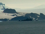
Kabile Island is an Antarctic island extending 700 m (765.5 yd) in south-north direction and 450 m (492.1 yd) wide, situated off the north coast of Greenwich Island in the South Shetland Islands
, Antarctica. Surface area 19 hectares (46.9 acre).
Named after the ancient Thracian
town of Kabile
near the present Bulgaria
n city of Yambol
.
, 1 km (0.621372736649807 mi) north of Crutch Peaks
, 200 m (218.7 yd) northwest of Miletich Point
, and 2.5 km (1.6 mi) west-southwest of Ongley Island
(Chilean mapping in 1966, British mapping in 1968 and Bulgarian in 2009).
South Shetland Islands
The South Shetland Islands are a group of Antarctic islands, lying about north of the Antarctic Peninsula, with a total area of . By the Antarctic Treaty of 1959, the Islands' sovereignty is neither recognized nor disputed by the signatories and they are free for use by any signatory for...
, Antarctica. Surface area 19 hectares (46.9 acre).
Named after the ancient Thracian
Thrace
Thrace is a historical and geographic area in southeast Europe. As a geographical concept, Thrace designates a region bounded by the Balkan Mountains on the north, Rhodope Mountains and the Aegean Sea on the south, and by the Black Sea and the Sea of Marmara on the east...
town of Kabile
Kabile
Kabile is a village in southeastern Bulgaria, part of the Tundzha municipality, Yambol Province. The ruins of an ancient Thracian royal city can be found nearby, and it remained an important fortress throughout the Middle Ages.- Geography :...
near the present Bulgaria
Bulgaria
Bulgaria , officially the Republic of Bulgaria , is a parliamentary democracy within a unitary constitutional republic in Southeast Europe. The country borders Romania to the north, Serbia and Macedonia to the west, Greece and Turkey to the south, as well as the Black Sea to the east...
n city of Yambol
Yambol
Yambol is a city in southeastern Bulgaria, an administrative centre of Yambol Province. It lies on both banks of the Tundzha river in the historical region of Thrace. As of February 2011, the town has a population of 72,843 inhabitants. It is occasionally spelt 'Jambol'.The administrative centres...
.
Location
The island is located at 62°26′30"S 59°56′33"W which is 950 m (1,038.9 yd) east of Pavlikeni PointPavlikeni Point
Pavlikeni Point projects 600 m from the north coast of Greenwich Island in the South Shetland Islands, Antarctica and is snow-free in summer...
, 1 km (0.621372736649807 mi) north of Crutch Peaks
Crutch Peaks
Crutch Peaks is a dark, rocky ridge extending 900 m in north-south direction and rising to 275 m in the north extremity of Dryanovo Heights, Greenwich Island in the South Shetland Islands, Antarctica...
, 200 m (218.7 yd) northwest of Miletich Point
Miletich Point
Miletich Point is the rocky point forming the west side of the entrance to Haskovo Cove in Greenwich Island, South Shetland Islands in Antarctica...
, and 2.5 km (1.6 mi) west-southwest of Ongley Island
Ongley Island
Ongley Island is a rugged rocky island lying off the north coast of Greenwich Island in the South Shetland Islands, Antarctica. Extending in west-northwest direction and wide, with a surface area of . The area was visited by early 19th century sealers....
(Chilean mapping in 1966, British mapping in 1968 and Bulgarian in 2009).
See also
- Composite Antarctic Gazetteer
- List of Antarctic islands south of 60° S
- SCARScientific Committee on Antarctic ResearchThe Scientific Committee on Antarctic Research is an interdisciplinary body of the International Council for Science . It was established in February 1958 to continue the international coordination of Antarctic scientific activities that had begun during the International Geophysical Year of 1957-58...
- Territorial claims in Antarctica