
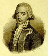
Josef de Mendoza y Ríos
Encyclopedia
Josef de Mendoza y Ríos was a Spanish
astronomer
and mathematician
of the 18th century, famous for his work on navigation
.
The first work of Mendoza y Ríos was published in 1787: his treatise about the science and technique of navigation in two tomes. He also published several tables for facilitating the calculations of nautical astronomy and useful in navigation to calculate the latitude of a ship at sea from two altitudes of the sun, and the longitude from the distances of the moon from a celestial body.
In the field of the nautical instruments, he improved the reflecting circle.
In 1816, he was elected a foreign member of the Royal Swedish Academy of Sciences
.
 1. Tratado de Navegación. Tomo I y tomo II, Madrid, Imprenta Real, 1787.
2. Memoria sobre algunos métodos nuevos de calcular la longitud por las distancias lunares. Madrid, Imprenta Real, 1795.
3. Colección de tablas para varios usos de la navegación. Madrid, Imprenta Real, 1800. (Traducida al inglés al año siguiente).
4. Table des latitudes croissantes Connoissance des Temps… pour l’annee comune 1793 (1791): 303.
5. Mémoire sur la methode de trouver la latitude par le moyen de deux hauteurs du soleil, del’intervalle de tems écoule entre les deux observations, et de la latitude estimée. Connoissance des Temps pour l’année comune 1793 (1791): 289-302.
6. Mémoire sur la méthode de trouver la latitude par le moyen de deux hauteurs du soleil, de l'intervalle de temps écoulé entre les deux observations et de la latitude estimée, … [Paris], [S.I.], [1793].8°, 14 p. et planche.
7. Memoire sur le calcul de la longitude en mer, par les distances de la lune au soleil et aux étoiles. Connaissance des Temps… (1796–1797): 258-284.
8. Recherches sur les solutions des principaux problemes de l'astronomie nautique. Philosophical Transactions, 87 (1797): 43-122.
9. Recherches sur les solutions des principaux problemes de l´astronomie nautique. London, [S.I.], 1797.4º, 4 + 85 p.
10. Tables to correct the observed altitudes of the sun, moon and the stars. London, [S.I.], [1801]4º, 92 p.
11. On an improved reflecting circle. Philosophical Transactions, 91 (1801): 363-374.
12. On an improved reflecting circle London, W. Bulmer, 1801.4º, 14 p.
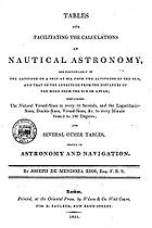
13. Tables for facilitating the calculations of nautical astronomy, and particularly of the latitude of a ship at sea from two altitudes of the sun, and that the longitude from the distances of the moon from the sun or a star, and particularly of the latitude of a ship at sea from two altitudes of the sun, and that of the longitude from the distances of the moon from the sun or a star; containing the natural versed – sines to every 10 seconds, and the logarithmic-sines, double-sines, versed-sines, &c. to every minute from 0 to 80 degrees; and several other tables, useful in astronomy and navigation. London, R. Faulder, 1801. 4º, 8 + 311 + 77 p. Appendix, containing tables for clearing the apparent distances of the moon from the sun or a star, from the effects of parallax and refraction. By H. Cavendish: 77 p. at end.
14. A complete collection of tables for navigation and nautical astronomy, with simple, concise and accurate methods for all the calculation useful at sea; particularly for deducing the longitude from lunar distance, and the latitude from two altitudes of the sun and the interval of time between the observations. London, printed by T. Bensley, sold by R. Faulder, etc., 1805. Folio, 12 + 47 + 670 p. + 1 h.
15. A Complete Collection of Tables for Navigation and Nautical Astronomy. With simple, concise and accurate methods for all the calculation useful at sea. Connaissance des Temps… pour l’an 1808 (1806): 443-447.
16. A Complete Collection of Tables for Navigation and Nautical Astronomy. With simple, concise and accurate methods for all the calculation useful at sea; particularly for deducing the longitude from lunar distance, and the latitude from lunar distance, and the latitude from two altitudes of the sun and the interval of time between the observations. 2nd ed. improved. London, T. Bensley, 1809. 4º, 6 p. + 1 h. + 604 p. + 58 p. + 1 h.
17. Tables for facilitating the calculation of nautical astronomy. London, 1812.
18. Forms for the ready calculation of the longitude... with the Tables published by Joseph de Mendoza Ríos. London, Black, Parry, & Co, 1814.4º, [76] + [2] p.
Spain
Spain , officially the Kingdom of Spain languages]] under the European Charter for Regional or Minority Languages. In each of these, Spain's official name is as follows:;;;;;;), is a country and member state of the European Union located in southwestern Europe on the Iberian Peninsula...
astronomer
Astronomer
An astronomer is a scientist who studies celestial bodies such as planets, stars and galaxies.Historically, astronomy was more concerned with the classification and description of phenomena in the sky, while astrophysics attempted to explain these phenomena and the differences between them using...
and mathematician
Mathematician
A mathematician is a person whose primary area of study is the field of mathematics. Mathematicians are concerned with quantity, structure, space, and change....
of the 18th century, famous for his work on navigation
Navigation
Navigation is the process of monitoring and controlling the movement of a craft or vehicle from one place to another. It is also the term of art used for the specialized knowledge used by navigators to perform navigation tasks...
.
The first work of Mendoza y Ríos was published in 1787: his treatise about the science and technique of navigation in two tomes. He also published several tables for facilitating the calculations of nautical astronomy and useful in navigation to calculate the latitude of a ship at sea from two altitudes of the sun, and the longitude from the distances of the moon from a celestial body.
In the field of the nautical instruments, he improved the reflecting circle.
In 1816, he was elected a foreign member of the Royal Swedish Academy of Sciences
Royal Swedish Academy of Sciences
The Royal Swedish Academy of Sciences or Kungliga Vetenskapsakademien is one of the Royal Academies of Sweden. The Academy is an independent, non-governmental scientific organization which acts to promote the sciences, primarily the natural sciences and mathematics.The Academy was founded on 2...
.
His work
2. Memoria sobre algunos métodos nuevos de calcular la longitud por las distancias lunares. Madrid, Imprenta Real, 1795.
3. Colección de tablas para varios usos de la navegación. Madrid, Imprenta Real, 1800. (Traducida al inglés al año siguiente).
4. Table des latitudes croissantes Connoissance des Temps… pour l’annee comune 1793 (1791): 303.
5. Mémoire sur la methode de trouver la latitude par le moyen de deux hauteurs du soleil, del’intervalle de tems écoule entre les deux observations, et de la latitude estimée. Connoissance des Temps pour l’année comune 1793 (1791): 289-302.
6. Mémoire sur la méthode de trouver la latitude par le moyen de deux hauteurs du soleil, de l'intervalle de temps écoulé entre les deux observations et de la latitude estimée, … [Paris], [S.I.], [1793].8°, 14 p. et planche.
7. Memoire sur le calcul de la longitude en mer, par les distances de la lune au soleil et aux étoiles. Connaissance des Temps… (1796–1797): 258-284.
8. Recherches sur les solutions des principaux problemes de l'astronomie nautique. Philosophical Transactions, 87 (1797): 43-122.
9. Recherches sur les solutions des principaux problemes de l´astronomie nautique. London, [S.I.], 1797.4º, 4 + 85 p.
10. Tables to correct the observed altitudes of the sun, moon and the stars. London, [S.I.], [1801]4º, 92 p.
11. On an improved reflecting circle. Philosophical Transactions, 91 (1801): 363-374.
12. On an improved reflecting circle London, W. Bulmer, 1801.4º, 14 p.
13. Tables for facilitating the calculations of nautical astronomy, and particularly of the latitude of a ship at sea from two altitudes of the sun, and that the longitude from the distances of the moon from the sun or a star, and particularly of the latitude of a ship at sea from two altitudes of the sun, and that of the longitude from the distances of the moon from the sun or a star; containing the natural versed – sines to every 10 seconds, and the logarithmic-sines, double-sines, versed-sines, &c. to every minute from 0 to 80 degrees; and several other tables, useful in astronomy and navigation. London, R. Faulder, 1801. 4º, 8 + 311 + 77 p. Appendix, containing tables for clearing the apparent distances of the moon from the sun or a star, from the effects of parallax and refraction. By H. Cavendish: 77 p. at end.
14. A complete collection of tables for navigation and nautical astronomy, with simple, concise and accurate methods for all the calculation useful at sea; particularly for deducing the longitude from lunar distance, and the latitude from two altitudes of the sun and the interval of time between the observations. London, printed by T. Bensley, sold by R. Faulder, etc., 1805. Folio, 12 + 47 + 670 p. + 1 h.
15. A Complete Collection of Tables for Navigation and Nautical Astronomy. With simple, concise and accurate methods for all the calculation useful at sea. Connaissance des Temps… pour l’an 1808 (1806): 443-447.
16. A Complete Collection of Tables for Navigation and Nautical Astronomy. With simple, concise and accurate methods for all the calculation useful at sea; particularly for deducing the longitude from lunar distance, and the latitude from lunar distance, and the latitude from two altitudes of the sun and the interval of time between the observations. 2nd ed. improved. London, T. Bensley, 1809. 4º, 6 p. + 1 h. + 604 p. + 58 p. + 1 h.
17. Tables for facilitating the calculation of nautical astronomy. London, 1812.
18. Forms for the ready calculation of the longitude... with the Tables published by Joseph de Mendoza Ríos. London, Black, Parry, & Co, 1814.4º, [76] + [2] p.
See also
- NavigationNavigationNavigation is the process of monitoring and controlling the movement of a craft or vehicle from one place to another. It is also the term of art used for the specialized knowledge used by navigators to perform navigation tasks...
- Celestial navigationCelestial navigationCelestial navigation, also known as astronavigation, is a position fixing technique that has evolved over several thousand years to help sailors cross oceans without having to rely on estimated calculations, or dead reckoning, to know their position...
- Nautical almanacNautical almanacA nautical almanac is a publication describing the positions of a selection of celestial bodies for the purpose of enabling navigators to use celestial navigation to determine the position of their ship while at sea...
- Lunar distance (navigation)Lunar distance (navigation)In celestial navigation, lunar distance is the angle between the Moon and another celestial body. A navigator can use a lunar distance and a nautical almanac to calculate Greenwich time...
- SextantSextantA sextant is an instrument used to measure the angle between any two visible objects. Its primary use is to determine the angle between a celestial object and the horizon which is known as the altitude. Making this measurement is known as sighting the object, shooting the object, or taking a sight...
- Reflecting instrumentReflecting instrumentReflecting instruments are those that use mirrors to enhance their ability to make measurements. In particular, the use of mirrors permits one to observe two objects simultaneously while measuring the angular distance between the objects...
- Repeating circleRepeating circleThe repeating circle is an instrument for geodetic surveying, invented by Etienne Lenoir in 1784, while an assistant of Jean-Charles de Borda, who later improved the instrument. It was notable as being the equal of the great theodolite created by the renowned instrument maker, Jesse Ramsden...
- American Practical Navigator
- History of longitudeHistory of longitudeThe history of longitude is a record of the effort, by navigators and scientists over several centuries, to discover a means of determining longitude....
- Navigational AlgorithmsNavigational AlgorithmsNavigational Algorithms is a source of information whose purpose is to make available the scientific part of the art of navigation, containing specialized articles and software that implements the various procedures of calculus...
- Marine sandglassMarine sandglassMarine sandglass, is an ancient marine instrument employed to measure the time at sea when used as a 30 minute hourglass. It was also used together with the chip log, to measure the boat speed through the water in knots .Originally, it consisted of two glass bottles one above the other with both...
External links
- On an Improved Reflecting Circle — Philosophical Transactions.
- Joseph de Mendoza y Rıos- Teorıa, observacion y tablas IMMR
- LA COLECCIÓN DE MENDOZA Y RÍOS EN EL MUSEO NAVAL DE MADRID
- Los mapas de la Colección Mendoza - Biblioteca Nacional de España
- Navigational Algorithms http://sites.google.com/site/navigationalalgorithms/ facsimile of the Latitude and Lunar Distance chapters.
- Tratado de Navegación. Tome I http://www.google.es/books?id=egw6EJqi3rYC
- Tratado de Navegación. Tome II http://www.google.es/books?id=GunvU8qfXzYC