
James Ross Island
Encyclopedia
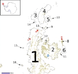
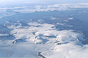
James Ross Island is a large island off the southeast side and near the northeastern extremity of Antarctic Peninsula
, from which it is separated by Prince Gustav Channel
. Rising to 1630 m (5,348 ft), it is irregularly shaped and extends 40 miles (64.4 km) in a north-south direction. It was charted in October 1903 by the Swedish Antarctic Expedition
under Otto Nordenskiöld
. He named it for Sir James Clark Ross
, leader of a British expedition to this area in 1842, who discovered and roughly charted a number of points along the eastern side of the island. The form James Ross Island is used to avoid confusion with the more widely known Ross Island
in McMurdo Sound
.
It is one of several islands around the peninsula known as Graham Land
, which is closer to South America than any other part of that continent.
The island was connected to the Antarctic mainland by an ice shelf
until 1995, when the ice shelf collapsed, making the Prince Gustav Channel passable for the first time.
The first Czech Antarctic Base
is located on the island.
oliveroi, a medium-sized ankylosaur found on James Ross Island by Argentinian
geologist
s Eduardo Olivero and Roberto Scasso in 1986. The dinosaur was recovered from the Campanian
stage of the Upper Cretaceous Santa Marta Formation
, about 2 km (1.2 mi) south of Santa Marta Cove on the north part of the island. The ankylosaur was not formally named until 2006.
 In December 2003, U.S. paleontologist Judd Case from Saint Mary's College of California
and U.S. geologist
James Martin from the South Dakota School of Mines & Technology discovered the bones of a theropod dinosaur on the island. Nicknamed "Naze" after the northerly Naze Peninsula on which it was found, the Late Cretaceous
remains include an upper jaw and teeth, and most of the lower legs and feet. Little information is available, but the shape of the leg and feet indicate it was a runner, and the size indicates it was probably 1.8 m (5.9 ft) tall and weighed 135 kg (298 lb). This is the second Antarctic theropod discovered, after Cryolophosaurus
.
Antarctic Peninsula
The Antarctic Peninsula is the northernmost part of the mainland of Antarctica. It extends from a line between Cape Adams and a point on the mainland south of Eklund Islands....
, from which it is separated by Prince Gustav Channel
Prince Gustav Channel
The Prince Gustav Channel was named in 1903 after Crown Prince Gustav of Sweden by Otto Nordenskiöld of the Swedish Antarctic Expedition.The channel is bounded on the west by the Antarctic Peninsula and on the east by James Ross Island...
. Rising to 1630 m (5,348 ft), it is irregularly shaped and extends 40 miles (64.4 km) in a north-south direction. It was charted in October 1903 by the Swedish Antarctic Expedition
Swedish Antarctic Expedition
The Swedish Antarctic Expedition was led by Otto Nordenskjöld and Carl Anton Larsen.-Background:Otto Nordenskjöld, a Swedish geologist and geographer, organized and lead a scientific expedition of the Antarctic Peninsula...
under Otto Nordenskiöld
Otto Nordenskiöld
Nils Otto Gustaf Nordenskjöld was a Finnish and Swedish geologist, geographer, and polar explorer.-Biography:...
. He named it for Sir James Clark Ross
James Clark Ross
Sir James Clark Ross , was a British naval officer and explorer. He explored the Arctic with his uncle Sir John Ross and Sir William Parry, and later led his own expedition to Antarctica.-Arctic explorer:...
, leader of a British expedition to this area in 1842, who discovered and roughly charted a number of points along the eastern side of the island. The form James Ross Island is used to avoid confusion with the more widely known Ross Island
Ross Island
Ross Island is an island formed by four volcanoes in the Ross Sea near the continent of Antarctica, off the coast of Victoria Land in McMurdo Sound.-Geography:...
in McMurdo Sound
McMurdo Sound
The ice-clogged waters of Antarctica's McMurdo Sound extend about 55 km long and wide. The sound opens into the Ross Sea to the north. The Royal Society Range rises from sea level to 13,205 feet on the western shoreline. The nearby McMurdo Ice Shelf scribes McMurdo Sound's southern boundary...
.
It is one of several islands around the peninsula known as Graham Land
Graham Land
Graham Land is that portion of the Antarctic Peninsula which lies north of a line joining Cape Jeremy and Cape Agassiz. This description of Graham Land is consistent with the 1964 agreement between the British Antarctic Place-names Committee and the US Advisory Committee on Antarctic Names, in...
, which is closer to South America than any other part of that continent.
The island was connected to the Antarctic mainland by an ice shelf
Ice shelf
An ice shelf is a thick, floating platform of ice that forms where a glacier or ice sheet flows down to a coastline and onto the ocean surface. Ice shelves are only found in Antarctica, Greenland and Canada. The boundary between the floating ice shelf and the grounded ice that feeds it is called...
until 1995, when the ice shelf collapsed, making the Prince Gustav Channel passable for the first time.
The first Czech Antarctic Base
Mendel Polar Station
Johann Gregor Mendel Czech Antarctic Station is a Czech research station built in Antarctica, on the coast of James Ross Island. The station, the project of the Masaryk University in Brno, Moravia, was opened in February 2006. It operates seasonally, during Antarctic summers...
is located on the island.
Frozen bones
The first dinosaur ever discovered in Antarctica was AntarctopeltaAntarctopelta
Antarctopelta was a genus of ankylosaurian dinosaur with one known species, A. oliveroi, which lived in Antarctica during the Late Cretaceous Period. It was a medium-sized ankylosaur, reaching no more than 4 meters in length, and showed characteristics of two different families, making more...
oliveroi, a medium-sized ankylosaur found on James Ross Island by Argentinian
Argentina
Argentina , officially the Argentine Republic , is the second largest country in South America by land area, after Brazil. It is constituted as a federation of 23 provinces and an autonomous city, Buenos Aires...
geologist
Geologist
A geologist is a scientist who studies the solid and liquid matter that constitutes the Earth as well as the processes and history that has shaped it. Geologists usually engage in studying geology. Geologists, studying more of an applied science than a theoretical one, must approach Geology using...
s Eduardo Olivero and Roberto Scasso in 1986. The dinosaur was recovered from the Campanian
Campanian
The Campanian is, in the ICS' geologic timescale, the fifth of six ages of the Late Cretaceous epoch . The Campanian spans the time from 83.5 ± 0.7 Ma to 70.6 ± 0.6 Ma ...
stage of the Upper Cretaceous Santa Marta Formation
Santa Marta Formation
The Santa Marta Formation is a geologic formation in Antarctica. It, along with the Mount Kirkpatrick Formation and the Snow Hill Island Formation, are the only formations yet known on the continent where dinosaur fossils have been found. The formation outcrops on James Ross Island off the coast of...
, about 2 km (1.2 mi) south of Santa Marta Cove on the north part of the island. The ankylosaur was not formally named until 2006.
Saint Mary's College of California
Saint Mary's College of California is a private, coeducational college located in Moraga, California, United States, a small suburban community about east of Oakland and 20 miles east of San Francisco. It has a 420-acre campus in the Moraga hills. It is affiliated with the Roman Catholic Church...
and U.S. geologist
Geologist
A geologist is a scientist who studies the solid and liquid matter that constitutes the Earth as well as the processes and history that has shaped it. Geologists usually engage in studying geology. Geologists, studying more of an applied science than a theoretical one, must approach Geology using...
James Martin from the South Dakota School of Mines & Technology discovered the bones of a theropod dinosaur on the island. Nicknamed "Naze" after the northerly Naze Peninsula on which it was found, the Late Cretaceous
Late Cretaceous
The Late Cretaceous is the younger of two epochs into which the Cretaceous period is divided in the geologic timescale. Rock strata from this epoch form the Upper Cretaceous series...
remains include an upper jaw and teeth, and most of the lower legs and feet. Little information is available, but the shape of the leg and feet indicate it was a runner, and the size indicates it was probably 1.8 m (5.9 ft) tall and weighed 135 kg (298 lb). This is the second Antarctic theropod discovered, after Cryolophosaurus
Cryolophosaurus
Cryolophosaurus was a large theropod dinosaur, with a crest on its head that looked like a Spanish comb. Due to the resemblance of this feature to Elvis Presley's pompadour haircut from the 1950s, this dinosaur was at one point informally known as "Elvisaurus".Cryolophosaurus was excavated from...
.
See also
- Composite Antarctic Gazetteer
- List of Antarctic and sub-Antarctic islands
- List of Antarctic islands south of 60° S
- SCARScientific Committee on Antarctic ResearchThe Scientific Committee on Antarctic Research is an interdisciplinary body of the International Council for Science . It was established in February 1958 to continue the international coordination of Antarctic scientific activities that had begun during the International Geophysical Year of 1957-58...
- Territorial claims in Antarctica