

Illinois Route 53
Encyclopedia
Illinois Route 53 is an arterial north–south state highway
in northeast Illinois
. Route 53 runs south from Long Grove
at Illinois Route 83
to Gardner
at Interstate 55
west of old U.S. Highway 66, a distance of 82.02 miles (132 km). It mainly cuts through the western suburbs of Chicago, passes through Joliet, and straddles I-55 at its southern extent.
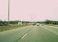 Illinois 53 is one of the state highways routed along expressways in the state. Before it becomes an expressway, Illinois 53 starts out in Long Grove going southwest towards Palatine
. South of Lake-Cook Road
, Illinois 53 follows Hicks Road, Rand Road (concurrent with U.S. 12) and Dundee Road (concurrent with Illinois 68
) through Palatine's northeast side before it joins an expressway that starts un-numbered (technically a spur of 53), one mile (1.6 km) north at Lake-Cook Rd as a bypass of northeast Palatine. The northeast Palatine stretch goes through the Rand and Dundee intersection, one of the country's deadliest intersections in traffic accidents. It forms the other half of the Interstate 290
/IL 53 combination in Schaumburg
before being routed west onto Biesterfield Road and back south onto Rohlwing Road. Until its first junction with I-55 by Bolingbrook
, it remains a mostly 2 to 4 lane road, largely replaced by the I-290 and I-355 combo. In the suburb of Lombard
, Illinois 53 is called Columbine Avenue.
South of the first junction with I-55, Illinois 53 follows old U.S. 66 and parallels Interstate 55, entering downtown Joliet
, which is about four miles (6 km) east of I-55. Illinois 53 also passes directly in front of Stateville Correctional Center
between Joliet and Romeoville. From Joliet it follows the original U.S. 66 alignment to the south. It remains a four-lane divided highway for about 15 miles (24.1 km), passing through Elwood
and the former Joliet Army Ammunition Plant
, part of which is now occupied by the Abraham Lincoln National Cemetery
. Route 53 narrows to two lanes just outside Wilmington
and crosses the Kankakee River
in downtown Wilmington. It then continues southwest through Braidwood
and Braceville
on its way to Gardner
, where it loops around the southern part of town before ending at I-55.
to Long Grove on Rohlwing Road and Hicks Road from 1924 to 1963. From 1963 through 1970, it was routed onto a new freeway from Addison
to Arlington Heights
and cosigned with Interstate 90
until that was changed to Interstate 290
.
In 1967 Illinois 53 was extended to Gardner, and in 1995 Illinois Route 129
was routed onto Illinois 53 south of Braidwood
. This lasted a year until Illinois 129 was dropped entirely south of Braidwood. Near the northern end, the freeway was extended from Dundee Road to Lake-Cook Road in 1989.
In 1990, with the construction of Interstate 355
, Illinois 53 was moved off of the Interstate 290/355 combination south of Biesterfield Road and back onto its original alignment.
. The studied corridor currently runs from its current terminus at Lake-Cook Road north to a planned bypass for Illinois Route 120
near Grayslake
. This bypass would carry through traffic to the Tri-State Tollway
around Gurnee
. The freeway would then turn west towards U.S. Route 12
and an existing freeway in south central Wisconsin
. Should the freeway ever be constructed, it is likely that it would be Interstate standard, and would result in a new Interstate designation, most likely Interstate 594.
The highway has been opposed by several organizations, notably the Illinois chapter of the Sierra Club
and vocal residents of Long Grove
, which lies directly in the path of the Illinois 53 freeway extension. The Sierra Club opposes the roadway extension due to the presence of numerous ecologically sensitive wetlands in the corridor, the potential of affordable arterial road improvements to provide more effective congestion relief without the extension, the potential of expanded mass transportation to relieve congestion more efficiently, unaccounted air pollution impacts from increased traffic that the extension would cause, the enormous multi-billion dollar cost of the proposed extension, and evidence that construction of the proposed tollway will merely spur more development and congestion in the future. This phenomenon is known as suburban sprawl
. They also point out that the proposed extension would not serve the primary NW to SE travel demand, and that attempts by interested state legislators to secure funding for the extension has frustrated efforts to secure funding for more affordable and less controversial transportation options. In 2000, they launched Let's Get Moving!, a campaign to generate consensus for congestion relief without the damaging extension.
Proponents of the tollway argue that congestion in Lake County has already reached economically damaging levels, and that a highway would save millions in fuel costs that would otherwise be lost in congestion. In addition, they argue that a new highway would substantially supplement the existing disorganized network of roads in the county; unlike neighboring Cook county, Lake and McHenry County
lack expanded arterial-capacity east–west and north–south state highways. In addition, proponents note that future projections call for housing and commerce development to reach the McHenry and Lake County areas regardless of the presence of a new highway. Finally, proponents claim that the majority of the affected population supports building the Illinois 53 extension.
In 1999, the Illinois Department of Transportation
talked of widening Illinois 53 south of U.S. Route 20
(Lake Street) and generally north of Interstate 88
to a five-lane section. Opposition from a citizen group called NIFTI (Neighbors Influencing Fifty-Three improvement) began to lobby for a smaller expansion plan of three-lanes. The road south of Lake Street runs through predominantly residential areas and light industry. The term Context Sensitive Design and Solutions
was introduced to the state of Illinois through the efforts of this group.
In April 2009, voters in Lake County approved (76% "Yes" to 24% "No") a non-binding referendum in favor of constructing the Illinois 53 extension.
Highway
A highway is any public road. In American English, the term is common and almost always designates major roads. In British English, the term designates any road open to the public. Any interconnected set of highways can be variously referred to as a "highway system", a "highway network", or a...
in northeast Illinois
Illinois
Illinois is the fifth-most populous state of the United States of America, and is often noted for being a microcosm of the entire country. With Chicago in the northeast, small industrial cities and great agricultural productivity in central and northern Illinois, and natural resources like coal,...
. Route 53 runs south from Long Grove
Long Grove, Illinois
Long Grove is an affluent village located in Lake County, Illinois, approximately northwest of Chicago. As of the 2005 census, the village had a total population of 6,735...
at Illinois Route 83
Illinois Route 83
Illinois Route 83 is a major north–south state road in northeast Illinois. It stretches from U.S. Highway 30 by Lynwood and Dyer, Indiana north to the Wisconsin border by Antioch at Highway 83. Incidentally, this alignment is concentric with Interstate 294...
to Gardner
Gardner, Illinois
Gardner is a village in Grundy County, Illinois, United States. The population was 1,463 at the 2010 census.-Geography:Gardner is located at .-Demographics:...
at Interstate 55
Interstate 55
Interstate 55 is an Interstate Highway in the central United States. Its odd number indicates that it is a north–south Interstate Highway. I-55 goes from LaPlace, Louisiana at Interstate 10 to Chicago at U.S. Route 41 , at McCormick Place. A common nickname for the highway is "double...
west of old U.S. Highway 66, a distance of 82.02 miles (132 km). It mainly cuts through the western suburbs of Chicago, passes through Joliet, and straddles I-55 at its southern extent.
Route description
Palatine, Illinois
Palatine is a village in Cook County, Illinois, United States. It is a northwestern residential suburb of Chicago. As of the 2000 census, the village had a total population of 65,479, making it the sixth-largest community in Cook County and the 16th-largest in the state of Illinois at that time...
. South of Lake-Cook Road
Lake Cook Road
Lake Cook Road is a major east–west highway in Cook, Lake, McHenry, and Kane Counties in Illinois. For much of its length, it marks the border between Cook and Lake Counties, hence the name of the road...
, Illinois 53 follows Hicks Road, Rand Road (concurrent with U.S. 12) and Dundee Road (concurrent with Illinois 68
Illinois Route 68
Illinois Route 68 is an east–west state highway in northeast Illinois. It runs east from Illinois Route 72 in the Dundee area to the Interstate 94/U.S. Route 41 concurrency in Glencoe. This is a distance of ....
) through Palatine's northeast side before it joins an expressway that starts un-numbered (technically a spur of 53), one mile (1.6 km) north at Lake-Cook Rd as a bypass of northeast Palatine. The northeast Palatine stretch goes through the Rand and Dundee intersection, one of the country's deadliest intersections in traffic accidents. It forms the other half of the Interstate 290
Interstate 290 (Illinois)
Interstate 290 is a main Interstate freeway that runs westwards from the Chicago Loop. A portion of I-290 is officially called the Dwight D. Eisenhower Expressway. In short form, it is known as "the Ike" or the Eisenhower...
/IL 53 combination in Schaumburg
Schaumburg, Illinois
Schaumburg is a city located in Cook County in northeastern Illinois. A common misspelling of the city name is Schaumberg, a spelling which persists on some modern maps. Schaumburg is located just under northwest of downtown Chicago and approximately northwest of O'Hare International Airport. As...
before being routed west onto Biesterfield Road and back south onto Rohlwing Road. Until its first junction with I-55 by Bolingbrook
Bolingbrook, Illinois
Bolingbrook is a large village in Will and DuPage Counties in the U.S. state of Illinois. As of the 2010 US Census, the population is 73,366...
, it remains a mostly 2 to 4 lane road, largely replaced by the I-290 and I-355 combo. In the suburb of Lombard
Lombard, Illinois
Lombard, "The Lilac Village", is a suburb of Chicago in DuPage County, Illinois. The population was 42,322 at the 2000 census. The United States Census Bureau estimated the population in 2004 to be 42,975.-History:...
, Illinois 53 is called Columbine Avenue.
South of the first junction with I-55, Illinois 53 follows old U.S. 66 and parallels Interstate 55, entering downtown Joliet
Joliet, Illinois
Joliet is a city in Will and Kendall Counties in the U.S. state of Illinois, located southwest of Chicago. It is the county seat of Will County. As of the 2010 census, the city was the fourth-most populated in Illinois, with a population of 147,433. It continues to be Illinois' fastest growing...
, which is about four miles (6 km) east of I-55. Illinois 53 also passes directly in front of Stateville Correctional Center
Stateville Correctional Center
Stateville Correctional Center is a maximum security state prison for men in Crest Hill, Illinois, USA.-History:Opened in 1925, Stateville was built to accommodate 1,506 inmates. Parts of the prison were designed according to the panopticon concept proposed by the British philosopher and prison...
between Joliet and Romeoville. From Joliet it follows the original U.S. 66 alignment to the south. It remains a four-lane divided highway for about 15 miles (24.1 km), passing through Elwood
Elwood, Illinois
Elwood is a village in Will County, Illinois, United States. The population was 2,300 at the 2006 population estimation.-Geography:Elwood is located at . The nearest major highways are Interstate 80 to the north and Interstate 55 to the west. The former Route 66 highway passes through the...
and the former Joliet Army Ammunition Plant
Joliet Army Ammunition Plant
Joliet Army Ammunition Plant formerly known as the Joliet Arsenal was a United States Army arsenal located in Will County, Illinois, near Elwood, Illinois, south of Joliet, Illinois. Opened in 1940 during World War II, the facility consisted of the Elwood Ordnance Plant and the Kankakee Ordnance...
, part of which is now occupied by the Abraham Lincoln National Cemetery
Abraham Lincoln National Cemetery
The Abraham Lincoln National Cemetery covers in Elwood, Illinois. It is located approximately southwest of Chicago, Illinois. When fully completed, it will provide 400,000 burial spaces....
. Route 53 narrows to two lanes just outside Wilmington
Wilmington, Will County, Illinois
One of Wilmington's most notable geographical features is a large island in the Kankakee River, much of which is occupied by a city park. This island divides the river into a large channel and a smaller one which was used as a natural mill race during the early years of the city...
and crosses the Kankakee River
Kankakee River
The Kankakee River is a tributary of the Illinois River, approximately long, in northwestern Indiana and northeastern Illinois in the United States. At one time the river drained one of the largest wetlands in North America and furnished a significant portage between the Great Lakes and the...
in downtown Wilmington. It then continues southwest through Braidwood
Braidwood, Illinois
eBraidwood is a city in Will County, Illinois, United States, approximately southwest of Chicago and south of Joliet. The population was 5,203 at the 2000 census....
and Braceville
Braceville, Illinois
Braceville is a village in Grundy County, Illinois, United States. The population was 793 at the 2010 census. Braceville annexed a small portion of land in Will County in 2005.-Geography:Braceville is located at ....
on its way to Gardner
Gardner, Illinois
Gardner is a village in Grundy County, Illinois, United States. The population was 1,463 at the 2010 census.-Geography:Gardner is located at .-Demographics:...
, where it loops around the southern part of town before ending at I-55.
Junction list
| County | Location | Junction | Notes |
|---|---|---|---|
| Lake Lake County, Illinois Lake County is a county in the northeastern corner of the state of Illinois, on the shore of Lake Michigan. According to the 2010 census, it has a population of 703,462, which is an increase of 9.2% from 644,356 in 2000. Its county seat is Waukegan. The county is part of the Chicago metropolitan area... |
Long Grove Long Grove, Illinois Long Grove is an affluent village located in Lake County, Illinois, approximately northwest of Chicago. As of the 2005 census, the village had a total population of 6,735... |
Northern Terminus | |
| Cook Cook County, Illinois Cook County is a county in the U.S. state of Illinois, with its county seat in Chicago. It is the second most populous county in the United States after Los Angeles County. The county has 5,194,675 residents, which is 40.5 percent of all Illinois residents. Cook County's population is larger than... |
Palatine Palatine, Illinois Palatine is a village in Cook County, Illinois, United States. It is a northwestern residential suburb of Chicago. As of the 2000 census, the village had a total population of 65,479, making it the sixth-largest community in Cook County and the 16th-largest in the state of Illinois at that time... |
Along Rand Road | |
| On Dundee Road before entering freeway southbound | |||
| Outbound exit, inbound entrance | |||
| Palatine Road | |||
| Rolling Meadows Rolling Meadows, Illinois Rolling Meadows is a city in Cook County, Illinois, United States. The population was 24,607 at the 2000 census.-Geography:Rolling Meadows is located at .... |
Euclid Avenue | ||
| Kirchoff Road | |||
| Schaumburg Schaumburg, Illinois Schaumburg is a city located in Cook County in northeastern Illinois. A common misspelling of the city name is Schaumberg, a spelling which persists on some modern maps. Schaumburg is located just under northwest of downtown Chicago and approximately northwest of O'Hare International Airport. As... |
Begins concurrency with I-290 | ||
| No direct access - use frontage roads | |||
| Elk Grove Village Elk Grove Village, Illinois Elk Grove Village is a municipality located in northeastern Illinois adjacent to O'Hare International Airport and the City of Chicago. Elk Grove Village encompasses in land area with located in Cook County and located in DuPage County, Illinois. The population was 32,745 at the 2010 census... |
west | IL 53 continues as a surface road | |
| DuPage DuPage County, Illinois As of the 2010 Census, the population of the county was 916,924, White Americans made up 77.9% of Dupage County's population; non-Hispanic whites represented 70.5% of the population. Black Americans made up 4.6% of the population. Native Americans made up 0.3% of Dupage County's population... |
Itasca Itasca, Illinois Itasca is a village in DuPage County, Illinois, United States. The population was 8,302 at the 2000 census.In 2009, BusinessWeek rated Itasca as the 'Best Affordable Suburb' in the state of Illinois... |
||
| Addison Addison, Illinois Addison is a village located west of the Chicago Metropolitan Area, in DuPage County, Illinois, United States. The population was 35,914 at the 2000 census. The estimated population was 36,378 as of 2002.The Village of Addison lies on Salt Creek... |
No direct access - use Lake Street | ||
| Lombard Lombard, Illinois Lombard, "The Lilac Village", is a suburb of Chicago in DuPage County, Illinois. The population was 42,322 at the 2000 census. The United States Census Bureau estimated the population in 2004 to be 42,975.-History:... |
|||
| Glen Ellyn Glen Ellyn, Illinois Glen Ellyn is an affluent village in DuPage County, Illinois, United States. As of the 2000 Census, the village population was 26,999.-Geography:... |
No direct access - use side streets | ||
| Lisle Lisle, Illinois Lisle is a village in DuPage County, Illinois, United States. The population was 22,930 at the 2011 census, and estimated to be 23,135 as of 2008. It is part of the Chicago metropolitan area and the Illinois Technology and Research Corridor... |
|||
History
SBI Route 53 ran from RomeovilleRomeoville, Illinois
Romeoville is a village in Will County, Illinois, United States. The population was 21,153 at the 2000 census. As of 2006 the population has grown to 36,837. It is located in the southwest suburban area of Chicago near the newly constructed I-355 extension south from the Stevenson Expressway to I-80...
to Long Grove on Rohlwing Road and Hicks Road from 1924 to 1963. From 1963 through 1970, it was routed onto a new freeway from Addison
Addison, Illinois
Addison is a village located west of the Chicago Metropolitan Area, in DuPage County, Illinois, United States. The population was 35,914 at the 2000 census. The estimated population was 36,378 as of 2002.The Village of Addison lies on Salt Creek...
to Arlington Heights
Arlington Heights, Illinois
Arlington Heights is a village in Cook and Lake counties in the U.S. state of Illinois. A suburb of Chicago, it lies about 25 miles northwest of the city's downtown. The population was 75,101 at the 2010 census....
and cosigned with Interstate 90
Interstate 90
Interstate 90 is the longest Interstate Highway in the United States at . It is the northernmost coast-to-coast interstate, and parallels US 20 for the most part. Its western terminus is in Seattle, at Edgar Martinez Drive S. near Safeco Field and CenturyLink Field, and its eastern terminus is in...
until that was changed to Interstate 290
Interstate 290 (Illinois)
Interstate 290 is a main Interstate freeway that runs westwards from the Chicago Loop. A portion of I-290 is officially called the Dwight D. Eisenhower Expressway. In short form, it is known as "the Ike" or the Eisenhower...
.
In 1967 Illinois 53 was extended to Gardner, and in 1995 Illinois Route 129
Illinois Route 129
Illinois Route 129 is a north–south state road in northeastern Illinois. It runs from Illinois Route 113 in downtown Braidwood north to Interstate 55. This is a distance of .- Route description :...
was routed onto Illinois 53 south of Braidwood
Braidwood, Illinois
eBraidwood is a city in Will County, Illinois, United States, approximately southwest of Chicago and south of Joliet. The population was 5,203 at the 2000 census....
. This lasted a year until Illinois 129 was dropped entirely south of Braidwood. Near the northern end, the freeway was extended from Dundee Road to Lake-Cook Road in 1989.
In 1990, with the construction of Interstate 355
Interstate 355
Interstate 355 , also known as the Veterans Memorial Tollway, is an Interstate Highway and tollway in the western and southwest suburbs of Chicago, Illinois, U.S. Like most other toll roads in the northeastern portion of the state, I-355 is maintained by a State Highway Authority...
, Illinois 53 was moved off of the Interstate 290/355 combination south of Biesterfield Road and back onto its original alignment.
Future
Illinois 53 has been at the center of a major dispute regarding its northern extension (also known as FAP 342) into Lake CountyLake County, Illinois
Lake County is a county in the northeastern corner of the state of Illinois, on the shore of Lake Michigan. According to the 2010 census, it has a population of 703,462, which is an increase of 9.2% from 644,356 in 2000. Its county seat is Waukegan. The county is part of the Chicago metropolitan area...
. The studied corridor currently runs from its current terminus at Lake-Cook Road north to a planned bypass for Illinois Route 120
Illinois Route 120
Illinois Route 120 is a major east–west state highway in northeastern Illinois. It runs from U.S. Route 14 near Woodstock to Illinois Route 131 in Waukegan. It travels a distance of and is one of the few roads that provides direct access from McHenry County to Interstate 94 in Lake County...
near Grayslake
Grayslake, Illinois
Grayslake is a village in Lake County in the U.S. state of Illinois. It is located in the Chicago metropolitan area, about north of Chicago’s downtown, west of Lake Michigan, and south of the Wisconsin border....
. This bypass would carry through traffic to the Tri-State Tollway
Tri-State Tollway
The Tri-State Tollway is a U.S. toll road maintained by the Illinois State Toll Highway Authority in northeastern Illinois which is considered one of the most heavily traveled highways in the country...
around Gurnee
Gurnee, Illinois
Gurnee is a village in Lake County, Illinois, United States. The population was 28,834 at the 2000 census, and estimated to be 30,772 in 2005. The village borders the city of Waukegan and is considered a part of the Chicago metropolitan area. Gurnee is perhaps best known for being the location of...
. The freeway would then turn west towards U.S. Route 12
U.S. Route 12
U.S. Route 12 or US 12 is an east–west United States highway, running from Grays Harbor on the Pacific Ocean, in the state of Washington, to downtown Detroit, for almost . As a thoroughfare, it has mostly been supplanted by I-90 and I-94, but remains an important road for local travel.The...
and an existing freeway in south central Wisconsin
Wisconsin
Wisconsin is a U.S. state located in the north-central United States and is part of the Midwest. It is bordered by Minnesota to the west, Iowa to the southwest, Illinois to the south, Lake Michigan to the east, Michigan to the northeast, and Lake Superior to the north. Wisconsin's capital is...
. Should the freeway ever be constructed, it is likely that it would be Interstate standard, and would result in a new Interstate designation, most likely Interstate 594.
The highway has been opposed by several organizations, notably the Illinois chapter of the Sierra Club
Sierra Club
The Sierra Club is the oldest, largest, and most influential grassroots environmental organization in the United States. It was founded on May 28, 1892, in San Francisco, California, by the conservationist and preservationist John Muir, who became its first president...
and vocal residents of Long Grove
Long Grove, Illinois
Long Grove is an affluent village located in Lake County, Illinois, approximately northwest of Chicago. As of the 2005 census, the village had a total population of 6,735...
, which lies directly in the path of the Illinois 53 freeway extension. The Sierra Club opposes the roadway extension due to the presence of numerous ecologically sensitive wetlands in the corridor, the potential of affordable arterial road improvements to provide more effective congestion relief without the extension, the potential of expanded mass transportation to relieve congestion more efficiently, unaccounted air pollution impacts from increased traffic that the extension would cause, the enormous multi-billion dollar cost of the proposed extension, and evidence that construction of the proposed tollway will merely spur more development and congestion in the future. This phenomenon is known as suburban sprawl
Urban sprawl
Urban sprawl, also known as suburban sprawl, is a multifaceted concept, which includes the spreading outwards of a city and its suburbs to its outskirts to low-density and auto-dependent development on rural land, high segregation of uses Urban sprawl, also known as suburban sprawl, is a...
. They also point out that the proposed extension would not serve the primary NW to SE travel demand, and that attempts by interested state legislators to secure funding for the extension has frustrated efforts to secure funding for more affordable and less controversial transportation options. In 2000, they launched Let's Get Moving!, a campaign to generate consensus for congestion relief without the damaging extension.
Proponents of the tollway argue that congestion in Lake County has already reached economically damaging levels, and that a highway would save millions in fuel costs that would otherwise be lost in congestion. In addition, they argue that a new highway would substantially supplement the existing disorganized network of roads in the county; unlike neighboring Cook county, Lake and McHenry County
McHenry County, Illinois
McHenry County is a county located in the U.S. state of Illinois. According to the 2010 census, it has a population of 308,760, which is an increase of 18.7% from 260,077 in 2000. Its county seat is Woodstock. This county is part of the Chicago metropolitan area. It is the sixth largest county, in...
lack expanded arterial-capacity east–west and north–south state highways. In addition, proponents note that future projections call for housing and commerce development to reach the McHenry and Lake County areas regardless of the presence of a new highway. Finally, proponents claim that the majority of the affected population supports building the Illinois 53 extension.
In 1999, the Illinois Department of Transportation
Illinois Department of Transportation
The Illinois Department of Transportation is a state agency in charge of state-maintained public roadways of the U.S. state of Illinois. In addition, IDOT provides funding for rail, public transit and airport projects and administers fuel tax and federal funding to local juridictions in the...
talked of widening Illinois 53 south of U.S. Route 20
U.S. Route 20
U.S. Route 20 is an east–west United States highway. As the "0" in its route number implies, US 20 is a coast-to-coast route. Spanning , it is the longest road in the United States, and the route sparsely parallels Interstate 90...
(Lake Street) and generally north of Interstate 88
Interstate 88 (west)
Interstate 88 is an intrastate Interstate Highway in the state of Illinois. It runs from an interchange with Interstate 80 near Silvis and Moline to an interchange with Interstates 290 and 294 in Hillside, near Chicago...
to a five-lane section. Opposition from a citizen group called NIFTI (Neighbors Influencing Fifty-Three improvement) began to lobby for a smaller expansion plan of three-lanes. The road south of Lake Street runs through predominantly residential areas and light industry. The term Context Sensitive Design and Solutions
Context Sensitive Solutions
Context-sensitive solutions is a theoretical and practical approach to transportation decision-making and design that takes into consideration the communities and lands which streets, roads, and highways pass through...
was introduced to the state of Illinois through the efforts of this group.
In April 2009, voters in Lake County approved (76% "Yes" to 24% "No") a non-binding referendum in favor of constructing the Illinois 53 extension.