

Ikotos County
Encyclopedia
Ikotos County is an administrative area in the Eastern Equatoria state of South Sudan
with headquarters in the town of Ikotos
. The people, who live by subsistence agriculture and cattle herding, are poverty-stricken. Years of civil war have made violence commonplace: most people have experienced the murder of a close family member. In 2009, AK-47
rifles were used in 42 per cent of killings.
n border to the south, Magwi county to the west, Torit county
to the north, and Budi county
to the east.
Ikotos was part of Torit county until 2004. The county is administratively divided into six payams, which are further sub-divided into bomas.
Payams are Chahari, Ikotos, Ikotos Central, Imotong, Lomohidang and Lomohidang North.
The county contains the eastern part of the Imatong mountains
, which include the highest peak in Sudan, Mount Kinyeti at 3187 metres (10,456 ft).
The mountains rise steeply from the surrounding plains, which are at an elevation of 1000 metres (3,280.8 ft) on the Sudan-Uganda border, sloping down gradually to the north. These plains are crossed by many streams, separated by low, rounded ridges, and dotted with small gneiss hills, outliers of the main mountain range.
The mountains are sharply faulted and are the source of many year-round rivers.
Average annual rainfall in the mountains is about 1500 millimetres (4.9 ft)
The plains and the lower parts of the mountains are covered by deciduous woodland, wooded grassland and bamboo thickets to the north and west. The areas to the east and southeast are in the rain shadow of the mountains, with dry subdesert grassland or deciduous or semi-evergreen bush.
An estimate of the population of the county in mid-2010 was 88,536 in 17,280 households, 90% engaged in agriculture.
Total cereal harvested area was 14774 hectares (36,507.3 acre).
The county is home to the Lango people, who have a total population of 25,000 – 30,000 people in Ikotos and elsewhere, and speak dialects of the Lotuko language.
The Lango tribe has six distinct sub-tribes — the Lokwa, Dongotona, Ketebo, Logir, Lorwama and Imatong.
The Lango keep cattle and cultivate millet, melons, sweet potatoes, beans, bananas, tobacco.
The Dongotona live in dense settlements, cultivate sorghum, groundnuts, simsim, telebun, dukn and sweet potatoes, and keep large herds of cattle, sheep and goats.
Cattle play a central role in social life, used in contracting marriages and performing rituals, and exchanged as gifts. The tribes have always indulged in cattle raiding, particularly during the dry season when the grass is short and cattle can be moved faster. There have always been conflicts between the tribes, notably in the Kidepo valley
, using the traditional weapons of spears and sticks. In the past, the number of lives lost was limited, and peace would soon be made through formal ceremonies.
The people of the region live by subsistence agriculture, mostly growing sorghum and millet, and livestock raising.
90% of the agricultural work is undertaken by women using hand tools. Crops are generally rain-fed, with no irrigation, making them vulnerable to reduced rainfall or drought in either of the two growing seasons.
Fishing, natural resource exploitation, mining and trade are practiced in a small way.
The people live in extreme poverty with no rights of land tenure, and chronic insecurity.
There is no infrastructure and no legal framework to make investment practical.
 Little is known of the Lango country before the arrival of Europeans.
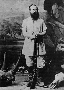
The explorer Samuel Baker
was the first European to visit the region, travelling in the northwest and west of the area in 1863. He visiting Tarrangolle (Tirangore) and observed unnamed mountains to the south. Later he passed through these mountains, the western Acholi range of the Imatongs.
Baker formally annexed the region around the upper Nile for the Khedive of Egypt in 1871.
In 1878 Emin Pasha
was appointed Bey of Equatoria
, then nominally under Egyptian control, with his base at Lado.
In 1881, Emin Pasha made a trip from Gondokoro
on the Nile
to Tirangore, and from there travelled south along the eastern side of the Imatong mountains along the valley of the Koss River
, past the village of Ikotos and then southwest to the Nile.
Emin Pasha was cut off from Egypt by the revolt of Muhammad Ahmad
in the northern Sudan, which began in 1881, and in 1885 withdrew to the south.
Chief Lomoro Xujang was ruler of the Lotuko of Tirrangore from 1892, and extended his authority over all the Lokuto people and their neighbors. He cooperated with the Ugandan government, which sent Colonel (Later Major General) J.R.L. Macdonald on a patrol into his country, and which later set up a post at Ikotos. Xujang aroused opposition for his dictatorial ways, and was assassinated in 1912.
Following the defeat of Muhammad Ahmad in 1898, the region came under the British Protectorate of Uganda in 1899. In 1914 it was transferred to the Anglo-Egyptian Sudan
.
The first rough topographical map was published in 1917 by H. Pellew-Wright, a District Commissioner of Uganda who crossed the Imatong mountains from northeast to southwest, but the official map of the Anglo-Egyptian Sudan in 1922 only showed the outlines of the Imatong mountains in the heart of present-day Ikotos county.
In 1929 the botanist Thomas Ford Chipp, then deputy director of the Royal Botanic Gardens at Kew, reached the peak of Kinyeti. The same year he published a report on the flora with several photographs.
The first detailed map appeared in 1931. The region remained isolated and underdeveloped.
Sudan became independent in 1956, but a year earlier civil disturbances had broken out in the southern regions that did not want to come under control of the Arab-dominated government in Khartoum
.
(1955–1972).
During the Second Sudanese civil war
(1983–2005) large areas of Eastern Equatoria State were ravaged by fighting between the Sudanese Armed Forces and the Sudan People’s Liberation Army (SPLA), and by many armed groups supported by both sides.
In the late 1980s many Lango civilians were displaced to camps in government-controlled areas including Torit
, Juba and Khartoum
, and others to refugee camps in Uganda and Kenya
.
The SPLM was not always united. For example, the Nuer leader William Nyuon Bany
defected from the SPLM mainstream in September 1992. He withdrew his forces from Pageri towards the SPLA headquarters at Magwi
, which he attacked and captured. In early 1993 Nyuon captured Ikotos, holding several women hostage before turning them over to Ugandan authorities.
Control of Ikotos changed hands several times.
In November 1993 Nyuon was again attacking SPLA troops around Ikotos.
The influx of SPLA fighters and government troops led to a sharp rise in the number of guns available, and to their use in cattle raids and murders. Ambushes, rapes and killings by tribesmen armed with Kalashnikov
s or even rocket launchers became common through the 1990s and into the 2000s.
The security problem was compounded by the presence of the Ugandan rebel group, the Lord's Resistance Army
(LRA), notorious for killing, looting for food, destroying property and abducting women and children.
In 1986 the government of Sudan had started to provide arms, training and sanctuary for the LRA, who began to raid and plunder villages along the Sudan – Uganda border. In February 1993 a major shipment of arms arrived in Kitgum
, Uganda, for transit to the SPLA in Ikotos. In return, the SPLA began to help Uganda in their ineffectual attempts to suppress the LRA.
Over 400 people were massacred by the LRA in the Imotong area in the west of Ikotos county in March 2002. Faced with this threat, the people refused to hand over their guns, which they needed for self defense.
In May 2002 the area around Ikotos was a no-go zone for aid workers. The steep, gully-filled and densely forested mountains provided a natural haven for remnants of the LRA.
After the LRA clashed with the Uganda People's Defence Force in October 2002, Uganda closed the road being used by aid workers to carry supplies from Kitgum
to Ikotos.
In May 2003 the Imatong and Ikotos districts, then in Torit County, reported 178 suspected cases of Yellow Fever
and 27 deaths.
On a positive note, during this period Norwegian Church Aid
made a significant contribution with the Ikotos County Education Centre, which trained 120 teachers in 2004 and 2005.
The region suffered from an outbreak of Cholera in the first half of 2006. The village of Ikotos reported 3,359 cholera infections and 103 deaths out of its population of 8,000. Aid workers were at risk of being ambushed and killed by the LRA.
The LRA finally withdrew from the county in April 2007.
The local authorities started to tighten up gun controls. However, by May 2006 an estimated ten people per day were being killed.
On 14–18 May 2006 the community leaders in the county came together for a peace and reconciliation meeting. They signed a declaration committing to eliminate all obstacles to the unity of the six Lango tribes and set up a task force to implement recommendations for keeping the peace.
The prolonged violence has disrupted families, destroyed trust and has often created a passion for vengeance. Economic growth has been minimal, even compared to neighboring counties such as Budi, and many people have failed to obtain a formal education.
The violence did not cease with the ending of the war. Continued violent crimes included ambushes to obtain firearms, cattle raids to obtain bride price, and retaliatory raids to obtain revenge.
In November and December 2009 a survey was conducted of almost 2,400 households in the adjacent Torit, Magwi, and Ikotos counties. Results showed high levels of violence throughout the region, but particularly in Ikotos.
63% of households in Ikotos said they owned a firearm. Actual numbers may be much higher, with all households possessing at least one firearm and some as many as eight.
The main security providers were said to be traditional leaders (90%), followed by neighbors (48%), religious leaders (38%), police (27%) and the SPLA (6%). This indicates massive distrust of the security forces which are considered both corrupt and weak.
Almost one third of the Ikotos respondents said there had been an incident of crime or armed violence against one of their household members in the last year, 47% of these being killings.
In 2007 the Lutheran World Federation
(LWF) implemented an emergency response project that provided food, agricultural tools, crop seeds, and non-food items to refugee returnees, Internally Displaced People (IDPs) and the resident communities in Ikotos country.
The project also helped local government authorities to build their capacity, and constructed boreholes and schools.
Between April 2007 and March 2008 an estimated 3,700 IDP households and 12,000 refugee returnee households moved to Ikotos, some assisted by the UNHCR, and numbers were expected to increase.
Conditions for returnees have been difficult, in some cases much harder than in the IDP camps. Despite help from charities, returnees faced difficulty obtaining seeds, and then faced the normal problems of drought or excess rain.
In September 2009 the Food and Agriculture Organization
published a mid-season crop and food security assessment for Southern Sudan.
It reported that a prolonged dry spell from late April until July and erratic rainfall had caused the first season harvest to fail completely in parts of Ikotos and other parts of Eastern Equatoria, and farmers had lost hope in the second season crop.
The most affected areas included Lomohindang South, Losite, and parts of Imatong and Lomohindang North in Ikotos.
The Ikotos Teacher Training College opened in March 2010, with the capacity to train, house and feed 50 teachers, a joint project of the charities All Nations Christian Care and World Emergency Relief.
In September 2010 Ikotos County Commissioner Peter Lokenge Lotone stated that there had recently been a decrease in violence, attributing the improvement to cooperation between county authorities and the youth, women, elders and chiefs in catching thieves.
In January 2011 leaders of the Lango communities gathered in Torit
for a three-day reconciliation meeting that had been organized by the Lango of Juba, aiming to restore unity following disputes in the past year's elections.
The leaders also passed a resolution to eliminate cattle rustling, in part by launching vocational training institutions for youths of the county.
In the January 2011 referendum on independence in Ikotos county five votes were cast for unity with northern Sudan while 57,041 were cast for secession as a separate state of South Sudan.
South Sudan
South Sudan , officially the Republic of South Sudan, is a landlocked country located in the Sahel region of northeastern Africa. It is also part of the North Africa UN sub-region. Its current capital is Juba, which is also its largest city; the capital city is planned to be moved to the more...
with headquarters in the town of Ikotos
Ikotos
Ikotos is a town in the Eastern Equatoria state of South Sudan, headquarters of Ikotos County.The town is home to the Lango people, who have a total population of 25,000 - 30,000 people in Ikotos county and elsewhere, and speak dialects of the Lotuko language....
. The people, who live by subsistence agriculture and cattle herding, are poverty-stricken. Years of civil war have made violence commonplace: most people have experienced the murder of a close family member. In 2009, AK-47
AK-47
The AK-47 is a selective-fire, gas-operated 7.62×39mm assault rifle, first developed in the Soviet Union by Mikhail Kalashnikov. It is officially known as Avtomat Kalashnikova . It is also known as a Kalashnikov, an "AK", or in Russian slang, Kalash.Design work on the AK-47 began in the last year...
rifles were used in 42 per cent of killings.
Location
Ikotos county is in the south of Eastern Equatoria state, adjoining the UgandaUganda
Uganda , officially the Republic of Uganda, is a landlocked country in East Africa. Uganda is also known as the "Pearl of Africa". It is bordered on the east by Kenya, on the north by South Sudan, on the west by the Democratic Republic of the Congo, on the southwest by Rwanda, and on the south by...
n border to the south, Magwi county to the west, Torit county
Torit County
Torit County is an administrative region in Eastern Equatoria State of South Sudan, with headquarters in the town of Torit, which is also the state capital.-Location:...
to the north, and Budi county
Budi County
Budi County is an administrative area of Eastern Equatoria state in South Sudan, with headquarters in Chukudum.-Location:Budi county is located in the south of Eastern Equatoria state, bordered by Uganda to the south, Ikotos County to the south west, Lafon County to the north west, and Kapoeta to...
to the east.
Ikotos was part of Torit county until 2004. The county is administratively divided into six payams, which are further sub-divided into bomas.
Payams are Chahari, Ikotos, Ikotos Central, Imotong, Lomohidang and Lomohidang North.
The county contains the eastern part of the Imatong mountains
Imatong Mountains
The Imatong Mountains are located in the southeast of South Sudan in the state of Eastern Equatoria, and extend into Uganda. Mount Kinyeti is the highest mountain of the range at , and the highest in the whole of South Sudan....
, which include the highest peak in Sudan, Mount Kinyeti at 3187 metres (10,456 ft).
The mountains rise steeply from the surrounding plains, which are at an elevation of 1000 metres (3,280.8 ft) on the Sudan-Uganda border, sloping down gradually to the north. These plains are crossed by many streams, separated by low, rounded ridges, and dotted with small gneiss hills, outliers of the main mountain range.
The mountains are sharply faulted and are the source of many year-round rivers.
Average annual rainfall in the mountains is about 1500 millimetres (4.9 ft)
The plains and the lower parts of the mountains are covered by deciduous woodland, wooded grassland and bamboo thickets to the north and west. The areas to the east and southeast are in the rain shadow of the mountains, with dry subdesert grassland or deciduous or semi-evergreen bush.
People
In 2002 the Sudan Relief and Rehabilitation Association, the humanitarian wing of the Sudan People's Liberation Movement, estimated that the population was 67,340, including internally displaced persons.An estimate of the population of the county in mid-2010 was 88,536 in 17,280 households, 90% engaged in agriculture.
Total cereal harvested area was 14774 hectares (36,507.3 acre).
The county is home to the Lango people, who have a total population of 25,000 – 30,000 people in Ikotos and elsewhere, and speak dialects of the Lotuko language.
The Lango tribe has six distinct sub-tribes — the Lokwa, Dongotona, Ketebo, Logir, Lorwama and Imatong.
The Lango keep cattle and cultivate millet, melons, sweet potatoes, beans, bananas, tobacco.
The Dongotona live in dense settlements, cultivate sorghum, groundnuts, simsim, telebun, dukn and sweet potatoes, and keep large herds of cattle, sheep and goats.
Cattle play a central role in social life, used in contracting marriages and performing rituals, and exchanged as gifts. The tribes have always indulged in cattle raiding, particularly during the dry season when the grass is short and cattle can be moved faster. There have always been conflicts between the tribes, notably in the Kidepo valley
Kidepo River
The Kidepo River is a seasonal river along the Kidepo Valley in the Karamoja region of Uganda, and in East Equatoria area of South Sudan.-See also:* List of rivers of Uganda* List of rivers of South Sudan...
, using the traditional weapons of spears and sticks. In the past, the number of lives lost was limited, and peace would soon be made through formal ceremonies.
The people of the region live by subsistence agriculture, mostly growing sorghum and millet, and livestock raising.
90% of the agricultural work is undertaken by women using hand tools. Crops are generally rain-fed, with no irrigation, making them vulnerable to reduced rainfall or drought in either of the two growing seasons.
Fishing, natural resource exploitation, mining and trade are practiced in a small way.
The people live in extreme poverty with no rights of land tenure, and chronic insecurity.
There is no infrastructure and no legal framework to make investment practical.
Colonial era
The explorer Samuel Baker
Samuel Baker
Sir Samuel White Baker, KCB, FRS, FRGS was a British explorer, officer, naturalist, big game hunter, engineer, writer and abolitionist. He also held the titles of Pasha and Major-General in the Ottoman Empire and Egypt. He served as the Governor-General of the Equatorial Nile Basin between Apr....
was the first European to visit the region, travelling in the northwest and west of the area in 1863. He visiting Tarrangolle (Tirangore) and observed unnamed mountains to the south. Later he passed through these mountains, the western Acholi range of the Imatongs.
Baker formally annexed the region around the upper Nile for the Khedive of Egypt in 1871.
In 1878 Emin Pasha
Emin Pasha
Mehmed Emin Pasha — he was born Isaak Eduard Schnitzer and baptized Eduard Carl Oscar Theodor Schnitzer — was a physician, naturalist, and governor of the Egyptian province of Equatoria on the upper Nile...
was appointed Bey of Equatoria
Equatoria
Equatoria is a region in the south of present-day South Sudan along the upper reaches of the White Nile. Originally a province of Egypt, it also contained most of Northern part of present day Uganda including Albert Lake...
, then nominally under Egyptian control, with his base at Lado.
In 1881, Emin Pasha made a trip from Gondokoro
Gondokoro
Gondokoro was a trading-station on the east bank of the White Nile in Southern Sudan, 750 miles south of Khartoum. Its importance lay in the fact that it was within a few miles of the limit of navigability of the Nile from Khartoum upstream...
on the Nile
Nile
The Nile is a major north-flowing river in North Africa, generally regarded as the longest river in the world. It is long. It runs through the ten countries of Sudan, South Sudan, Burundi, Rwanda, Democratic Republic of the Congo, Tanzania, Kenya, Ethiopia, Uganda and Egypt.The Nile has two major...
to Tirangore, and from there travelled south along the eastern side of the Imatong mountains along the valley of the Koss River
Koss River
The Koss River is a river that flows in a north of northwest direction through the Eastern Equatoria state of South Sudan, fed by streams from the Imatong Mountains to the west.The Koss river rises near Ikotos....
, past the village of Ikotos and then southwest to the Nile.
Emin Pasha was cut off from Egypt by the revolt of Muhammad Ahmad
Muhammad Ahmad
Muhammad Ahmad bin Abd Allah was a religious leader of the Samaniyya order in Sudan who, on June 29, 1881, proclaimed himself as the Mahdi or messianic redeemer of the Islamic faith...
in the northern Sudan, which began in 1881, and in 1885 withdrew to the south.
Chief Lomoro Xujang was ruler of the Lotuko of Tirrangore from 1892, and extended his authority over all the Lokuto people and their neighbors. He cooperated with the Ugandan government, which sent Colonel (Later Major General) J.R.L. Macdonald on a patrol into his country, and which later set up a post at Ikotos. Xujang aroused opposition for his dictatorial ways, and was assassinated in 1912.
Following the defeat of Muhammad Ahmad in 1898, the region came under the British Protectorate of Uganda in 1899. In 1914 it was transferred to the Anglo-Egyptian Sudan
Anglo-Egyptian Sudan
Anglo-Egyptian Sudan referred to the manner by which Sudan was administered between 1899 and 1956, when it was a condominium of Egypt and the United Kingdom.-Union with Egypt:...
.
The first rough topographical map was published in 1917 by H. Pellew-Wright, a District Commissioner of Uganda who crossed the Imatong mountains from northeast to southwest, but the official map of the Anglo-Egyptian Sudan in 1922 only showed the outlines of the Imatong mountains in the heart of present-day Ikotos county.
In 1929 the botanist Thomas Ford Chipp, then deputy director of the Royal Botanic Gardens at Kew, reached the peak of Kinyeti. The same year he published a report on the flora with several photographs.
The first detailed map appeared in 1931. The region remained isolated and underdeveloped.
Sudan became independent in 1956, but a year earlier civil disturbances had broken out in the southern regions that did not want to come under control of the Arab-dominated government in Khartoum
Khartoum
Khartoum is the capital and largest city of Sudan and of Khartoum State. It is located at the confluence of the White Nile flowing north from Lake Victoria, and the Blue Nile flowing west from Ethiopia. The location where the two Niles meet is known as "al-Mogran"...
.
Civil war years
Ikotos was relatively untouched by the fighting in the First Sudanese civil warFirst Sudanese Civil War
The First Sudanese Civil War was a conflict from 1955 to 1972 between the northern part of Sudan and the southern Sudan region that demanded representation and more regional autonomy...
(1955–1972).
During the Second Sudanese civil war
Second Sudanese Civil War
The Second Sudanese Civil War started in 1983, although it was largely a continuation of the First Sudanese Civil War of 1955 to 1972. Although it originated in southern Sudan, the civil war spread to the Nuba mountains and Blue Nile by the end of the 1980s....
(1983–2005) large areas of Eastern Equatoria State were ravaged by fighting between the Sudanese Armed Forces and the Sudan People’s Liberation Army (SPLA), and by many armed groups supported by both sides.
In the late 1980s many Lango civilians were displaced to camps in government-controlled areas including Torit
Torit
-Location:The town is located in Torit County, Eastern Equatoria State, in the southeastern part of South Sudan, close to the International border with the Republic of Uganda. Its location lies approximately , by road, east of Juba, the capital and largest city in that country...
, Juba and Khartoum
Khartoum
Khartoum is the capital and largest city of Sudan and of Khartoum State. It is located at the confluence of the White Nile flowing north from Lake Victoria, and the Blue Nile flowing west from Ethiopia. The location where the two Niles meet is known as "al-Mogran"...
, and others to refugee camps in Uganda and Kenya
Kenya
Kenya , officially known as the Republic of Kenya, is a country in East Africa that lies on the equator, with the Indian Ocean to its south-east...
.
The SPLM was not always united. For example, the Nuer leader William Nyuon Bany
William Nyuon Bany
William Nyuon Bany was a Southern Sudanese politician who was also a high-ranking officer in The Sudan People's Liberation Army. While he worked as a commander of the SPLA he lived in Itang a small Ethiopian town in the Gambela Region. He was older than Dr. John Garang, Salva Kiir, Arok Thon...
defected from the SPLM mainstream in September 1992. He withdrew his forces from Pageri towards the SPLA headquarters at Magwi
Magwi
Magwi County, also Magwe County, is a county in South Sudan.-Location:The county is located in Eastern Equatoria State, in southern South Sudan. It is bordered to the west and north by Juba County, by Torit County to the north east, by Ikotos County to the southeast and by the Republic of Uganda to...
, which he attacked and captured. In early 1993 Nyuon captured Ikotos, holding several women hostage before turning them over to Ugandan authorities.
Control of Ikotos changed hands several times.
In November 1993 Nyuon was again attacking SPLA troops around Ikotos.
The influx of SPLA fighters and government troops led to a sharp rise in the number of guns available, and to their use in cattle raids and murders. Ambushes, rapes and killings by tribesmen armed with Kalashnikov
Kalashnikov
Kalashnikov is commonly used to refer to a type of rifle, but it and similar words also have other meanings:-People:*Mikhail Kalashnikov , Russian small arms designer*Maxim Kalashnikov , Russian writer and political activist...
s or even rocket launchers became common through the 1990s and into the 2000s.
The security problem was compounded by the presence of the Ugandan rebel group, the Lord's Resistance Army
Lord's Resistance Army
The Lord's Resistance Army insurgency is an ongoing guerrilla campaign waged since 1987 by the Lord's Resistance Army rebel group, operating mainly in northern Uganda, but also in South Sudan and eastern Democratic Republic of the Congo...
(LRA), notorious for killing, looting for food, destroying property and abducting women and children.
In 1986 the government of Sudan had started to provide arms, training and sanctuary for the LRA, who began to raid and plunder villages along the Sudan – Uganda border. In February 1993 a major shipment of arms arrived in Kitgum
Kitgum
Kitgum is a municipality in Kitgum District, in Northern Uganda. The town is administered by Kitgum Town Council, an Urban Local Government within Kitgum District Administration...
, Uganda, for transit to the SPLA in Ikotos. In return, the SPLA began to help Uganda in their ineffectual attempts to suppress the LRA.
Over 400 people were massacred by the LRA in the Imotong area in the west of Ikotos county in March 2002. Faced with this threat, the people refused to hand over their guns, which they needed for self defense.
In May 2002 the area around Ikotos was a no-go zone for aid workers. The steep, gully-filled and densely forested mountains provided a natural haven for remnants of the LRA.
After the LRA clashed with the Uganda People's Defence Force in October 2002, Uganda closed the road being used by aid workers to carry supplies from Kitgum
Kitgum
Kitgum is a municipality in Kitgum District, in Northern Uganda. The town is administered by Kitgum Town Council, an Urban Local Government within Kitgum District Administration...
to Ikotos.
In May 2003 the Imatong and Ikotos districts, then in Torit County, reported 178 suspected cases of Yellow Fever
Yellow fever
Yellow fever is an acute viral hemorrhagic disease. The virus is a 40 to 50 nm enveloped RNA virus with positive sense of the Flaviviridae family....
and 27 deaths.
On a positive note, during this period Norwegian Church Aid
Norwegian Church Aid
Norwegian Church Aid , "Kirkens Nødhjelp" in Norwegian, is an independent humanitarian and ecumenical organisation with headquarters in Oslo, Norway. The organisation also has offices in 65 countries worldwide and receives funding from the Norwegian Protestant church, their institutions and...
made a significant contribution with the Ikotos County Education Centre, which trained 120 teachers in 2004 and 2005.
Post war
An uneasy peace between the SPLA and government of Sudan was established in January 2005.The region suffered from an outbreak of Cholera in the first half of 2006. The village of Ikotos reported 3,359 cholera infections and 103 deaths out of its population of 8,000. Aid workers were at risk of being ambushed and killed by the LRA.
The LRA finally withdrew from the county in April 2007.
The local authorities started to tighten up gun controls. However, by May 2006 an estimated ten people per day were being killed.
On 14–18 May 2006 the community leaders in the county came together for a peace and reconciliation meeting. They signed a declaration committing to eliminate all obstacles to the unity of the six Lango tribes and set up a task force to implement recommendations for keeping the peace.
The prolonged violence has disrupted families, destroyed trust and has often created a passion for vengeance. Economic growth has been minimal, even compared to neighboring counties such as Budi, and many people have failed to obtain a formal education.
The violence did not cease with the ending of the war. Continued violent crimes included ambushes to obtain firearms, cattle raids to obtain bride price, and retaliatory raids to obtain revenge.
In November and December 2009 a survey was conducted of almost 2,400 households in the adjacent Torit, Magwi, and Ikotos counties. Results showed high levels of violence throughout the region, but particularly in Ikotos.
63% of households in Ikotos said they owned a firearm. Actual numbers may be much higher, with all households possessing at least one firearm and some as many as eight.
The main security providers were said to be traditional leaders (90%), followed by neighbors (48%), religious leaders (38%), police (27%) and the SPLA (6%). This indicates massive distrust of the security forces which are considered both corrupt and weak.
Almost one third of the Ikotos respondents said there had been an incident of crime or armed violence against one of their household members in the last year, 47% of these being killings.
In 2007 the Lutheran World Federation
Lutheran World Federation
The Lutheran World Federation is a global communion of national and regional Lutheran churches headquartered in the Ecumenical Centre in Geneva, Switzerland. The federation was founded in the Swedish city of Lund in the aftermath of the Second World War in 1947 to coordinate the activities of the...
(LWF) implemented an emergency response project that provided food, agricultural tools, crop seeds, and non-food items to refugee returnees, Internally Displaced People (IDPs) and the resident communities in Ikotos country.
The project also helped local government authorities to build their capacity, and constructed boreholes and schools.
Between April 2007 and March 2008 an estimated 3,700 IDP households and 12,000 refugee returnee households moved to Ikotos, some assisted by the UNHCR, and numbers were expected to increase.
Conditions for returnees have been difficult, in some cases much harder than in the IDP camps. Despite help from charities, returnees faced difficulty obtaining seeds, and then faced the normal problems of drought or excess rain.
In September 2009 the Food and Agriculture Organization
Food and Agriculture Organization
The Food and Agriculture Organization of the United Nations is a specialised agency of the United Nations that leads international efforts to defeat hunger. Serving both developed and developing countries, FAO acts as a neutral forum where all nations meet as equals to negotiate agreements and...
published a mid-season crop and food security assessment for Southern Sudan.
It reported that a prolonged dry spell from late April until July and erratic rainfall had caused the first season harvest to fail completely in parts of Ikotos and other parts of Eastern Equatoria, and farmers had lost hope in the second season crop.
The most affected areas included Lomohindang South, Losite, and parts of Imatong and Lomohindang North in Ikotos.
The Ikotos Teacher Training College opened in March 2010, with the capacity to train, house and feed 50 teachers, a joint project of the charities All Nations Christian Care and World Emergency Relief.
In September 2010 Ikotos County Commissioner Peter Lokenge Lotone stated that there had recently been a decrease in violence, attributing the improvement to cooperation between county authorities and the youth, women, elders and chiefs in catching thieves.
In January 2011 leaders of the Lango communities gathered in Torit
Torit
-Location:The town is located in Torit County, Eastern Equatoria State, in the southeastern part of South Sudan, close to the International border with the Republic of Uganda. Its location lies approximately , by road, east of Juba, the capital and largest city in that country...
for a three-day reconciliation meeting that had been organized by the Lango of Juba, aiming to restore unity following disputes in the past year's elections.
The leaders also passed a resolution to eliminate cattle rustling, in part by launching vocational training institutions for youths of the county.
In the January 2011 referendum on independence in Ikotos county five votes were cast for unity with northern Sudan while 57,041 were cast for secession as a separate state of South Sudan.