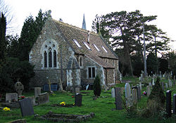
Huntingdon Road
Encyclopedia

Arterial road
An arterial road, or arterial thoroughfare, is a high-capacity urban road. The primary function of an arterial road is to deliver traffic from collector roads to freeways, and between urban centres at the highest level of service possible. As such, many arteries are limited-access roads, or feature...
linking central Cambridge
Cambridge
The city of Cambridge is a university town and the administrative centre of the county of Cambridgeshire, England. It lies in East Anglia about north of London. Cambridge is at the heart of the high-technology centre known as Silicon Fen – a play on Silicon Valley and the fens surrounding the...
, England
England
England is a country that is part of the United Kingdom. It shares land borders with Scotland to the north and Wales to the west; the Irish Sea is to the north west, the Celtic Sea to the south west, with the North Sea to the east and the English Channel to the south separating it from continental...
with Junction 14 of the M11 motorway
M11 motorway
The M11 motorway in England is a major road running approximately north from the North Circular Road in South Woodford in north-east London to the A14, north-west of Cambridge.-Route:...
and the A14 northwest from the city centre. The road is designated the A1307.
At the southeastern end, the road links with Histon Road
Histon Road
Histon Road is an arterial road linking central Cambridge, England with the A14 road north of the city. The road is designated the B1049. At the southern end, the road links with Huntingdon Road , Victoria Road , Mount Pleasant, and Castle Street...
(B1049), Victoria Road
Victoria Road, Cambridge
Victoria Road is a major road in the north of Cambridge, England. The road is designated the A1134. At the western end, the road links with Histon Road , Huntingdon Road , Mount Pleasant, and Castle Street.In...
(A1134) and Mount Pleasant. It continues as Castle Street
Castle Street, Cambridge
Castle Street is a street in the north of central Cambridge, England. To the southeast is a junction with Northampton Street, Magdalene Street, and Chesterton Lane...
, then Magdalene Street
Magdalene Street
Magdalene Street is a street in the north of central Cambridge, England. It runs between Castle Street, by Castle Hill, at the junction with Northampton Street and Chesterton Lane, then Chesterton Road , to the northwest and Bridge Street at the junction with Thompson's Lane to the southeast.The...
over the River Cam
River Cam
The River Cam is a tributary of the River Great Ouse in the east of England. The two rivers join to the south of Ely at Pope's Corner. The Great Ouse connects the Cam to England's canal system and to the North Sea at King's Lynn...
and Bridge Street
Bridge Street, Cambridge
Bridge Street is a historic street in the north of central Cambridge, England. It runs between Magdalene Street at the junction with Thompson's Lane to the northwest and Sidney Street at the junction with Jesus Lane to the southeast...
, into the centre of the city.
The University of Cambridge
University of Cambridge
The University of Cambridge is a public research university located in Cambridge, United Kingdom. It is the second-oldest university in both the United Kingdom and the English-speaking world , and the seventh-oldest globally...
colleges Fitzwilliam College
Fitzwilliam College, Cambridge
Fitzwilliam College is one of the constituent colleges of the University of Cambridge in England.The college traces its origins back to 1869 and the foundation of the Non-Collegiate Students Board, a venture intended to offer students from less financially privileged backgrounds a chance to study...
(front entrance on Storey's Way
Storey's Way
Storey's Way is a mainly residential road, approximately 650 metres to the west of the city centre in Cambridge, England. It falls within the Castle Electoral Ward of Cambridge City Council, and feeds on to the major arterial roads Huntingdon Road to the north and Madingley Road to the west.It is...
, south off Huntingdon Road), Girton College
Girton College, Cambridge
Girton College is one of the 31 constituent colleges of the University of Cambridge. It was England's first residential women's college, established in 1869 by Emily Davies and Barbara Bodichon. The full college status was only received in 1948 and marked the official admittance of women to the...
, and Murray Edwards College (formerly New Hall
New Hall, Cambridge
Murray Edwards College is a women-only constituent college of the University of Cambridge. It was founded as "New Hall" in 1954, at a time when Cambridge had the lowest proportion of women undergraduates of any university in the United Kingdom, and when only two other colleges admitted women...
), are located off the road. Girton College is some distance from central Cambridge as a former women's college, just south of the village of Girton
Girton
Girton is a place name that could refer to:*Girton College, Cambridge*Girton, Cambridgeshire, England*Girton, Nottinghamshire, England*Girton High School, Mumbai, India...
.
Also on the road are:
- Ascension Parish Burial GroundAscension Parish Burial Ground, CambridgeThe Ascension Parish Burial Ground, formerly St Giles and St Peter's Parish, is a cemetery just off Huntingdon Road near the junction with Storey's Way in the northwest of Cambridge, England. It includes the graves of many Cambridge academics and non-conformists of the 19th and early 20th century...
, where many Cambridge academics are buried - Cambridge Seed Testing Station
- Cambridge Genetics Station
- Trinity HallTrinity Hall, CambridgeTrinity Hall is a constituent college of the University of Cambridge, England. It is the fifth-oldest college of the university, having been founded in 1350 by William Bateman, Bishop of Norwich.- Foundation :...
Sports Ground

