

Hunter Island (Ontario)
Encyclopedia
North American Fur Trade
The North American fur trade was the industry and activities related to the acquisition, exchange, and sale of animal furs in the North American continent. Indigenous peoples of different regions traded among themselves in the Pre-Columbian Era, but Europeans participated in the trade beginning...
waterway routes in northern Ontario, Canada: the Kaministiquia
Fort Kaministiquia
Fort Camanistigoyan, now standardized as Fort Kaministiquia, located at the mouth of the Kaministiquia River on Lake Superior in what is now northwestern Ontario, Canada, was established in 1717 by Zacharie Robutel de la Noue following the restoration of the system of trading permits by...
and the Grand Portage
Grand Portage National Monument
Grand Portage National Monument is a United States National Monument located on the north shore of Lake Superior in northeastern Minnesota that preserves a vital center of fur trade activity and Anishinaabeg Ojibwe heritage....
. It is an area of large, remote and windy lakes and is now the southern half of the Quetico Provincial Park
Quetico Provincial Park
Quetico Provincial Park is a large wilderness park in Northwestern Ontario, Canada, renowned for its excellent canoeing and fishing. This park shares its southern border with Minnesota's Boundary Waters Canoe Area Wilderness, which is part of the larger Superior National Forest...
.
Geography
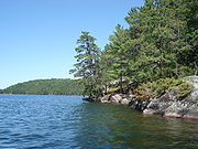
Hunter Island is bounded to the south by Ottertrack, Knife, and Basswood Lakes on the international US/Canada border, to the east by Lake SaganagaLake Saganaga
Saganaga Lake is a large lake on the Minnesota – Ontario international border. It is protected by the Boundary Waters Canoe Area Wilderness in the United States and by Quetico Provincial Park and La Verendrye Provincial Park in Canada....
, to the north by Lakes Kawnipi and Sturgeon, and on the west by the Maligne River. With the Saganaga-Maligne drainage to the east and north and the Basswood drainage to the south and west, Hunter Island can be thought of as a peninsula
Peninsula
A peninsula is a piece of land that is bordered by water on three sides but connected to mainland. In many Germanic and Celtic languages and also in Baltic, Slavic and Hungarian, peninsulas are called "half-islands"....
connected to the United States across the 90 rod Monument Portage between Swamp and Ottertrack Lakes. The "island" is approximately 45 miles (72.4 km) across at its maximum east/west extent and about 32 miles (51.5 km) north to south.
History
A very early French map of the region indicates Iles des Chasseurs ("Isles of the Hunters") for the area now called Hunter Island.In the 1890s, the Hunter Island region was the focus of a boundary dispute between the US and Canada, owing to the millions of tons of iron ore in the area. The controversy was settled in favor of Canada.
Canoeing
A canoe loop circumnavigating Hunter Island measures over 200 miles (321.9 km) and normally takes at least twelve days to complete. It passes through some of the busiest access points to the park and wilderness areas as well as many notable natural and historical features.Lakes of the Hunter Island region
- Agnes Lake
- Kahshahpiwi Lake
- Kawnipi Lake
- Saganaga Lake
- Sarah Lake
- McIntyre Lake
- Brent Lake
- Basswood Lake
- Sturgeon Lake (Quetico)