
Grand Portage National Monument
Encyclopedia
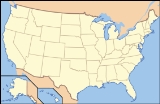
Grand Portage National Monument is a United States National Monument
located on the north shore of Lake Superior
in northeastern Minnesota
that preserves a vital center of fur trade
activity and Anishinaabeg Ojibwe heritage.
The Grand Portage is an 8.5 miles (13.7 km) (2720 rod) footpath
which bypasses a set of waterfalls and rapids on the last 20 miles (32.2 km) of the Pigeon River before it flows into Lake Superior
. This path is part of the historic trade route
of the French-Canadian Voyageurs
and Coureur des bois
between their wintering grounds and their depots to the east.
Composed of the Pigeon River and other strategic interior waterways, as well as the Grand Portage and many other important land portage
s, this route was of enormous importance in pre-industrial times. It provided quick water access from Canada's settled areas and Atlantic ports to the fur-rich NorthWest
. Some 50 miles (80.5 km) upstream from Lake Superior, this trade route crosses the Height of Land Portage
, located in the Rove Formation. The portage connected South Lake on the Pigeon River watershed with North Lake of the Rainy River
watershed. This portage crosses the Northern Continental divide
; it thus provides passage between the drainage basin
of the Arctic Ocean
and that of the Great Lakes
and Saint Lawrence River
to the Atlantic Ocean
.
 As early as 2,000 years ago, Indian
Nations probably used Gichi-onigaming, or “the Great Carrying Place”, to travel from summer homes on Lake Superior to winter hunting grounds in the interior of Minnesota and Ontario
. In 1729 Cree
guide Auchagah drew a map for some of the first French
fur traders, to show them how to reach the "western sea" of Lake Winnipeg
. In time, Grand Portage became the gateway into rich northern fur-bearing country, where it connected remote interior outposts to lucrative international markets.
The Grand Portage trail is an 8.5 miles (13.7 km) trail connecting Grand Portage with Fort Charlotte on the Pigeon River. Voyageurs from the interior of Canada would carry their furs by canoe to Fort Charlotte, and portage the bundles of fur to Grand Portage. There they met traders from Montreal, and exchanged the furs for trade goods and supplies. Each canoe "brigade" then returned to its starting place. The fur traders built Fort Charlotte as a trading fort at Grand Portage. There they built the Grand Hall in the French colonial style, which housed their meetings, a general store, and other facilities. See Canadian canoe routes (early)
.
 In mid-July 1802, partners of the North West Company
, the most successful fur trade company in North America, met in their Grand Hall at Grand Portage. They voted to move their summer headquarters from the protected shores of Lake Superior’s Grand Portage Bay 50 miles (80.5 km) north to the mouth of the Kaministiquia River
. Almost from the time the Anglo-Scot Nor’Westers had organized at Grand Portage in the mid 1780s, an emerging United States
wanted them to stop competing with Americans in this territory.
The July vote meant that the North West Company would tear down its 18 buildings and transport the materials north in company schooners for use in constructing the planned new Fort William
, far from U.S. soil. The buildings were constructed from native squared spruce
, pine
and birch
and were surrounded by more than 2,000 cedar
pickets.
In 1951 the property was designated as the Grand Portage National Historic Site and opened for visitors. In 1958, it was designated a National Monument
. The portage trail has also been separately designated a Minnesota State Historic Site. The monument's 710 acres (2.9 km²) lie entirely within the boundaries of Grand Portage Ojibwe Indian Reservation
. The depot was reconstructed to allow celebration of the fur trade and Ojibwe lifeways. It was added to the National Register of Historic Places
in 1966.
trail exists in much the same location and condition as in historic times. Visitors can hike 8.5 miles (13.7 km) from Lake Superior to the Pigeon River.
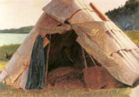
Volunteers and park staff at the monument dress in period attire. They staff the Kitchen, Canoe Warehouse and Great Hall in and around the Stockade, and explain and interpret what life was like at the trading fort at the turn of the 18th century. During the second weekend of August, the Grand Portage National Monument hosts a rendezvous re-enactment. At the same time, the Grand Portage Ojibwa Indian Reservation
holds a pow wow
, which attracts many Indians and visitors. The Rendezvous and Pow Wow coincide with the Perseid meteor shower.
and the Grand Portage Band of Lake Superior Chippewa. It overlooks the reconstructed fur trading post.
route from Grand Portage westward to the juncture of the route from Fort William at Lac La Croix. For background see Canadian canoe routes (early)
. The Pigeon River is about 3 miles (5 km) directly north of the reconstructed fort. The Pigeon flows basically east and enters Lake Superior at a bay about 5 miles (8 km) east northeast. The portage trail meets the Pigeon about 7 miles (11.3 km) northwest at the former Fort Charlotte. It was this lower part of the Pigeon that had to be avoided. The canoe route then went west up the Pigeon past the mouth of the Arrow River to the east-west Mountain Lake. The old Indian route went north, with a drop of 125 feet (38.1 m), to the east-west Arrow Lake. The voyageurs, with their heavy freight canoes, cut a new route that ran west over the Petit Neuf or Watape Portage to Watape Lake which is in the Arrow River drainage. Then through the Petit Detroit to Rove Lake and the Grand Neuf or Long Portage to Rose Lake at the west end of Arrow Lake. From Rose Lake up the Arrow to South Lake. From South Lake north over the 700-yard Height of Land Portage
to North Lake whose waters flow west to Lake Winnipeg. From here the route went west down the ? river through several lakes to Lac La Croix where the route from Fort William
came in. Lac La Croix is about 100 mile west of Grand Portage and about 66 miles (106.2 km) west of Height of Land Portage. For the route westward see Canadian canoe routes (early)
.
, the 8.5 miles (13.7 km) trail leads westward into the wilderness to a mid-point on the Pigeon River
. It passes numerous rapids and a variety of waterfalls. The most notable are Middle Falls and Pigeon Falls. Both are part of the Grand Portage State Park
and are within the Rove Formation
. Middle Falls is most easily seen from Pigeon River Provincial Park on the Canadian side of the border. To avoid numerous short portages, the Grand Portage was developed.
Route description
The portage begins on Lake Superior, elevation 610 feet (185.9 m), rising as it moves westward through two notches in the Sawtooth Mountain
range. It briefly levels off around 1000 feet (304.8 m) after 2.6 miles (4.2 km). Another 1.5 miles (2.4 km) you reach the inland county highway. From here, the trail is more level, rising to 1300 feet (396.2 m), the highest location on the trail, before dropping back to 1260 feet (384 m) at Fort Charlotte on the Pigeon River. The trail's high point is the head of a drainage flowing to the Pigeon River at Fort Charlotte. The headwaters has become a large beaver
pond. The dam is located along the trail route and has used the raised boardwalk (added for modern visitors and it is not historic), as part of the dam.
U.S. National Monument
A National Monument in the United States is a protected area that is similar to a National Park except that the President of the United States can quickly declare an area of the United States to be a National Monument without the approval of Congress. National monuments receive less funding and...
located on the north shore of Lake Superior
Lake Superior
Lake Superior is the largest of the five traditionally-demarcated Great Lakes of North America. It is bounded to the north by the Canadian province of Ontario and the U.S. state of Minnesota, and to the south by the U.S. states of Wisconsin and Michigan. It is the largest freshwater lake in the...
in northeastern Minnesota
Minnesota
Minnesota is a U.S. state located in the Midwestern United States. The twelfth largest state of the U.S., it is the twenty-first most populous, with 5.3 million residents. Minnesota was carved out of the eastern half of the Minnesota Territory and admitted to the Union as the thirty-second state...
that preserves a vital center of fur trade
Fur trade
The fur trade is a worldwide industry dealing in the acquisition and sale of animal fur. Since the establishment of world market for in the early modern period furs of boreal, polar and cold temperate mammalian animals have been the most valued...
activity and Anishinaabeg Ojibwe heritage.
The Grand Portage is an 8.5 miles (13.7 km) (2720 rod) footpath
Portage
Portage or portaging refers to the practice of carrying watercraft or cargo over land to avoid river obstacles, or between two bodies of water. A place where this carrying occurs is also called a portage; a person doing the carrying is called a porter.The English word portage is derived from the...
which bypasses a set of waterfalls and rapids on the last 20 miles (32.2 km) of the Pigeon River before it flows into Lake Superior
Lake Superior
Lake Superior is the largest of the five traditionally-demarcated Great Lakes of North America. It is bounded to the north by the Canadian province of Ontario and the U.S. state of Minnesota, and to the south by the U.S. states of Wisconsin and Michigan. It is the largest freshwater lake in the...
. This path is part of the historic trade route
Trade route
A trade route is a logistical network identified as a series of pathways and stoppages used for the commercial transport of cargo. Allowing goods to reach distant markets, a single trade route contains long distance arteries which may further be connected to several smaller networks of commercial...
of the French-Canadian Voyageurs
Voyageurs
The Voyageurs were the persons who engaged in the transportation of furs by canoe during the fur trade era. Voyageur is a French word which literally translates to "traveler"...
and Coureur des bois
Coureur des bois
A coureur des bois or coureur de bois was an independent entrepreneurial French-Canadian woodsman who traveled in New France and the interior of North America. They travelled in the woods to trade various things for fur....
between their wintering grounds and their depots to the east.
Composed of the Pigeon River and other strategic interior waterways, as well as the Grand Portage and many other important land portage
Portage
Portage or portaging refers to the practice of carrying watercraft or cargo over land to avoid river obstacles, or between two bodies of water. A place where this carrying occurs is also called a portage; a person doing the carrying is called a porter.The English word portage is derived from the...
s, this route was of enormous importance in pre-industrial times. It provided quick water access from Canada's settled areas and Atlantic ports to the fur-rich NorthWest
North-Western Territory
The North-Western Territory was a region of British North America until 1870. Named for where it lay in relation to Rupert's Land, the territory at its greatest extent covered what is now Yukon, mainland Northwest Territories, northwestern mainland Nunavut, northwestern Saskatchewan, northern...
. Some 50 miles (80.5 km) upstream from Lake Superior, this trade route crosses the Height of Land Portage
Height of Land Portage
Height of Land Portage is a portage along the historic Boundary Waters route between Canada and the United States. Located at the border of the Canadian province of Ontario and the U.S...
, located in the Rove Formation. The portage connected South Lake on the Pigeon River watershed with North Lake of the Rainy River
Rainy River (Minnesota-Ontario)
The Rainy River is a river, approximately long, which forms part of the U.S.-Canada border separating northern Minnesota and Northwestern Ontario....
watershed. This portage crosses the Northern Continental divide
Continental divide
A continental divide is a drainage divide on a continent such that the drainage basin on one side of the divide feeds into one ocean or sea, and the basin on the other side either feeds into a different ocean or sea, or else is endorheic, not connected to the open sea...
; it thus provides passage between the drainage basin
Drainage basin
A drainage basin is an extent or an area of land where surface water from rain and melting snow or ice converges to a single point, usually the exit of the basin, where the waters join another waterbody, such as a river, lake, reservoir, estuary, wetland, sea, or ocean...
of the Arctic Ocean
Arctic Ocean
The Arctic Ocean, located in the Northern Hemisphere and mostly in the Arctic north polar region, is the smallest and shallowest of the world's five major oceanic divisions...
and that of the Great Lakes
Great Lakes
The Great Lakes are a collection of freshwater lakes located in northeastern North America, on the Canada – United States border. Consisting of Lakes Superior, Michigan, Huron, Erie, and Ontario, they form the largest group of freshwater lakes on Earth by total surface, coming in second by volume...
and Saint Lawrence River
Saint Lawrence River
The Saint Lawrence is a large river flowing approximately from southwest to northeast in the middle latitudes of North America, connecting the Great Lakes with the Atlantic Ocean. It is the primary drainage conveyor of the Great Lakes Basin...
to the Atlantic Ocean
Atlantic Ocean
The Atlantic Ocean is the second-largest of the world's oceanic divisions. With a total area of about , it covers approximately 20% of the Earth's surface and about 26% of its water surface area...
.
History
Native Americans in the United States
Native Americans in the United States are the indigenous peoples in North America within the boundaries of the present-day continental United States, parts of Alaska, and the island state of Hawaii. They are composed of numerous, distinct tribes, states, and ethnic groups, many of which survive as...
Nations probably used Gichi-onigaming, or “the Great Carrying Place”, to travel from summer homes on Lake Superior to winter hunting grounds in the interior of Minnesota and Ontario
Ontario
Ontario is a province of Canada, located in east-central Canada. It is Canada's most populous province and second largest in total area. It is home to the nation's most populous city, Toronto, and the nation's capital, Ottawa....
. In 1729 Cree
Cree
The Cree are one of the largest groups of First Nations / Native Americans in North America, with 200,000 members living in Canada. In Canada, the major proportion of Cree live north and west of Lake Superior, in Ontario, Manitoba, Saskatchewan, Alberta and the Northwest Territories, although...
guide Auchagah drew a map for some of the first French
France
The French Republic , The French Republic , The French Republic , (commonly known as France , is a unitary semi-presidential republic in Western Europe with several overseas territories and islands located on other continents and in the Indian, Pacific, and Atlantic oceans. Metropolitan France...
fur traders, to show them how to reach the "western sea" of Lake Winnipeg
Lake Winnipeg
Lake Winnipeg is a large, lake in central North America, in the province of Manitoba, Canada, with its southern tip about north of the city of Winnipeg...
. In time, Grand Portage became the gateway into rich northern fur-bearing country, where it connected remote interior outposts to lucrative international markets.
The Grand Portage trail is an 8.5 miles (13.7 km) trail connecting Grand Portage with Fort Charlotte on the Pigeon River. Voyageurs from the interior of Canada would carry their furs by canoe to Fort Charlotte, and portage the bundles of fur to Grand Portage. There they met traders from Montreal, and exchanged the furs for trade goods and supplies. Each canoe "brigade" then returned to its starting place. The fur traders built Fort Charlotte as a trading fort at Grand Portage. There they built the Grand Hall in the French colonial style, which housed their meetings, a general store, and other facilities. See Canadian canoe routes (early)
Canadian canoe routes (early)
This article covers the water routes used by early explorers of Canada with special emphasis on the fur trade.-Canada and Siberia:Both Canada and Siberia were explored mainly by river. Both countries have many navigable rivers with short portages between them. There are no serious barriers to canoe...
.
North West Company
The North West Company was a fur trading business headquartered in Montreal from 1779 to 1821. It competed with increasing success against the Hudson's Bay Company in what was to become Western Canada...
, the most successful fur trade company in North America, met in their Grand Hall at Grand Portage. They voted to move their summer headquarters from the protected shores of Lake Superior’s Grand Portage Bay 50 miles (80.5 km) north to the mouth of the Kaministiquia River
Kaministiquia River
The Kaministiquia River is a river which empties into western Lake Superior at the city of Thunder Bay, Ontario. Kaministiquia is an Ojibwe word meaning " with islands" due to two large islands at the mouth of the river...
. Almost from the time the Anglo-Scot Nor’Westers had organized at Grand Portage in the mid 1780s, an emerging United States
United States
The United States of America is a federal constitutional republic comprising fifty states and a federal district...
wanted them to stop competing with Americans in this territory.
The July vote meant that the North West Company would tear down its 18 buildings and transport the materials north in company schooners for use in constructing the planned new Fort William
Fort William, Ontario
Fort William was a city in Northern Ontario, located on the Kaministiquia River, at its entrance to Lake Superior. It amalgamated with Port Arthur and the townships of Neebing and McIntyre to form the city of Thunder Bay in January 1970. Ever since then it has been the largest city in Northwestern...
, far from U.S. soil. The buildings were constructed from native squared spruce
Spruce
A spruce is a tree of the genus Picea , a genus of about 35 species of coniferous evergreen trees in the Family Pinaceae, found in the northern temperate and boreal regions of the earth. Spruces are large trees, from tall when mature, and can be distinguished by their whorled branches and conical...
, pine
Pine
Pines are trees in the genus Pinus ,in the family Pinaceae. They make up the monotypic subfamily Pinoideae. There are about 115 species of pine, although different authorities accept between 105 and 125 species.-Etymology:...
and birch
Birch
Birch is a tree or shrub of the genus Betula , in the family Betulaceae, closely related to the beech/oak family, Fagaceae. The Betula genus contains 30–60 known taxa...
and were surrounded by more than 2,000 cedar
Atlas Cedar
Cedrus atlantica, the Atlas Cedar, is a cedar native to the Atlas Mountains of Algeria and Morocco . A majority of the modern sources treat it as a distinct species Cedrus atlantica, but some sources consider it a subspecies of Lebanon Cedar Cedrus atlantica, the Atlas Cedar, is a cedar native to...
pickets.
In 1951 the property was designated as the Grand Portage National Historic Site and opened for visitors. In 1958, it was designated a National Monument
U.S. National Monument
A National Monument in the United States is a protected area that is similar to a National Park except that the President of the United States can quickly declare an area of the United States to be a National Monument without the approval of Congress. National monuments receive less funding and...
. The portage trail has also been separately designated a Minnesota State Historic Site. The monument's 710 acres (2.9 km²) lie entirely within the boundaries of Grand Portage Ojibwe Indian Reservation
Grand Portage Indian Reservation
The Grand Portage Indian Reservation is located in Cook County near the tip of Minnesota's Arrowhead Region in the extreme northeast part of the state. The community was considered part of the Lake Superior Band of Chippewa, but is not a party to the treaties that group signed...
. The depot was reconstructed to allow celebration of the fur trade and Ojibwe lifeways. It was added to the National Register of Historic Places
National Register of Historic Places
The National Register of Historic Places is the United States government's official list of districts, sites, buildings, structures, and objects deemed worthy of preservation...
in 1966.
Attractions and events
The portagePortage
Portage or portaging refers to the practice of carrying watercraft or cargo over land to avoid river obstacles, or between two bodies of water. A place where this carrying occurs is also called a portage; a person doing the carrying is called a porter.The English word portage is derived from the...
trail exists in much the same location and condition as in historic times. Visitors can hike 8.5 miles (13.7 km) from Lake Superior to the Pigeon River.
Volunteers and park staff at the monument dress in period attire. They staff the Kitchen, Canoe Warehouse and Great Hall in and around the Stockade, and explain and interpret what life was like at the trading fort at the turn of the 18th century. During the second weekend of August, the Grand Portage National Monument hosts a rendezvous re-enactment. At the same time, the Grand Portage Ojibwa Indian Reservation
Grand Portage Indian Reservation
The Grand Portage Indian Reservation is located in Cook County near the tip of Minnesota's Arrowhead Region in the extreme northeast part of the state. The community was considered part of the Lake Superior Band of Chippewa, but is not a party to the treaties that group signed...
holds a pow wow
Pow woW
Pow woW is French musical group. Their biggest hit was "Le Chat" in 1992. Their next single was the French version of song "The Lion Sleeps Tonight", titled "Le lion est mort ce soir".- Albums :* Regagner les plaines...
, which attracts many Indians and visitors. The Rendezvous and Pow Wow coincide with the Perseid meteor shower.
Grand Portage National Monument Heritage Center
Opened in 2007, the Grand Portage National Monument Heritage Center features exhibit galleries about Ojibwe culture and the fur trade, a bookstore, multi-media programs, park offices, archives and a classroom. The center is a collaboration between the National Park ServiceNational Park Service
The National Park Service is the U.S. federal agency that manages all national parks, many national monuments, and other conservation and historical properties with various title designations...
and the Grand Portage Band of Lake Superior Chippewa. It overlooks the reconstructed fur trading post.
Voyageur Route
This section covers the voyageurVoyageur
Voyageur is a French word meaning "voyager" or "traveler".Voyageur can refer to:*Voyageurs, persons who transported furs by canoe during the fur trade era....
route from Grand Portage westward to the juncture of the route from Fort William at Lac La Croix. For background see Canadian canoe routes (early)
Canadian canoe routes (early)
This article covers the water routes used by early explorers of Canada with special emphasis on the fur trade.-Canada and Siberia:Both Canada and Siberia were explored mainly by river. Both countries have many navigable rivers with short portages between them. There are no serious barriers to canoe...
. The Pigeon River is about 3 miles (5 km) directly north of the reconstructed fort. The Pigeon flows basically east and enters Lake Superior at a bay about 5 miles (8 km) east northeast. The portage trail meets the Pigeon about 7 miles (11.3 km) northwest at the former Fort Charlotte. It was this lower part of the Pigeon that had to be avoided. The canoe route then went west up the Pigeon past the mouth of the Arrow River to the east-west Mountain Lake. The old Indian route went north, with a drop of 125 feet (38.1 m), to the east-west Arrow Lake. The voyageurs, with their heavy freight canoes, cut a new route that ran west over the Petit Neuf or Watape Portage to Watape Lake which is in the Arrow River drainage. Then through the Petit Detroit to Rove Lake and the Grand Neuf or Long Portage to Rose Lake at the west end of Arrow Lake. From Rose Lake up the Arrow to South Lake. From South Lake north over the 700-yard Height of Land Portage
Height of Land Portage
Height of Land Portage is a portage along the historic Boundary Waters route between Canada and the United States. Located at the border of the Canadian province of Ontario and the U.S...
to North Lake whose waters flow west to Lake Winnipeg. From here the route went west down the ? river through several lakes to Lac La Croix where the route from Fort William
Kaministiquia River
The Kaministiquia River is a river which empties into western Lake Superior at the city of Thunder Bay, Ontario. Kaministiquia is an Ojibwe word meaning " with islands" due to two large islands at the mouth of the river...
came in. Lac La Croix is about 100 mile west of Grand Portage and about 66 miles (106.2 km) west of Height of Land Portage. For the route westward see Canadian canoe routes (early)
Canadian canoe routes (early)
This article covers the water routes used by early explorers of Canada with special emphasis on the fur trade.-Canada and Siberia:Both Canada and Siberia were explored mainly by river. Both countries have many navigable rivers with short portages between them. There are no serious barriers to canoe...
.
The trail today
Beginning at the stockade on Grand Portage Bay of Lake SuperiorLake Superior
Lake Superior is the largest of the five traditionally-demarcated Great Lakes of North America. It is bounded to the north by the Canadian province of Ontario and the U.S. state of Minnesota, and to the south by the U.S. states of Wisconsin and Michigan. It is the largest freshwater lake in the...
, the 8.5 miles (13.7 km) trail leads westward into the wilderness to a mid-point on the Pigeon River
Pigeon River (Minnesota-Ontario)
The Pigeon River forms part of the US-Canada border between the State of Minnesota and the Province of Ontario west of Lake Superior. In pre-industrial times the river was a waterway of great importance for transportation and trade.-Geography:...
. It passes numerous rapids and a variety of waterfalls. The most notable are Middle Falls and Pigeon Falls. Both are part of the Grand Portage State Park
Grand Portage State Park
Grand Portage State Park is a state park at the northeastern tip of Minnesota, USA, on the Canada – United States border. It contains a waterfall, the tallest in the state, on the Pigeon River. The High Falls and other waterfalls and rapids upstream necessitated a historically important portage...
and are within the Rove Formation
History of the Rove Formation
The Rove Formation is located in the upper northeastern part of Cook County, Minnesota, United States, and extends into Ontario, Canada. It is the youngest of the many Animikie layers, a layer of sedimentary rocks....
. Middle Falls is most easily seen from Pigeon River Provincial Park on the Canadian side of the border. To avoid numerous short portages, the Grand Portage was developed.
Route description
The portage begins on Lake Superior, elevation 610 feet (185.9 m), rising as it moves westward through two notches in the Sawtooth Mountain
Sawtooth Mountains (Minnesota)
The Sawtooth Mountains are a range of low, serrated ridges situated on the North Shore of Lake Superior in the U.S. state of Minnesota, extending about 30 miles from Carlton Peak near Tofte on the west, to Grand Marais on the east.-Description:...
range. It briefly levels off around 1000 feet (304.8 m) after 2.6 miles (4.2 km). Another 1.5 miles (2.4 km) you reach the inland county highway. From here, the trail is more level, rising to 1300 feet (396.2 m), the highest location on the trail, before dropping back to 1260 feet (384 m) at Fort Charlotte on the Pigeon River. The trail's high point is the head of a drainage flowing to the Pigeon River at Fort Charlotte. The headwaters has become a large beaver
Beaver
The beaver is a primarily nocturnal, large, semi-aquatic rodent. Castor includes two extant species, North American Beaver and Eurasian Beaver . Beavers are known for building dams, canals, and lodges . They are the second-largest rodent in the world...
pond. The dam is located along the trail route and has used the raised boardwalk (added for modern visitors and it is not historic), as part of the dam.
Archeology
Almost all the information known about the physical layout of Grand Portage National Monument comes from archeological studies.- Cooper, David J., Of Sextants and Satellites: David Thompson and the Grand Portage GIS Study CRLS Colloquium, Kenora, Ontario, Canada, 2004.
- Hamilton, Scott, Graham, James, Norris, Dave, "If These Walls Could Speak:" Using GIS to Explore the Fort at Grand Portage National Monument, Department of Anthropology, Lakehead University, Thunder Bay Ontario, Canada, 2004.
- Birk, Douglas A., Archeologist/Historian, Grand Portage National Monument Maintenance Area Preliminary Survey, February 2006.
- Clark, Caven, Ph.D., Late Prehistoric Cultural Affiliation Study, Grand Portage National Monument, Prepared by Archeological Consulting Services, Ltd., Tempe, Arizona, November 9, 1999
- Woolworth, Alan R., An Historical Study of the Grand Portage, Grand Portage National Monument, Minnesota, Minnesota Historical Society, St. Paul, Minnesota, 1993
- Woolworth, Alan. Archaeological Excavations at the North West Company's Depot, Grand Portage, Minnesota in 1970–1971 (1975)
- Woolworth, Alan. Archaeological Excavations at Grand Portage National Monument: 1963–1964 Field Season (1969)
- Woolworth, Alan. Archaeological Excavations at Grand Portage National Monument: 1962 Field Season (1968)
- Woolworth, Alan. Archaeological Excavations at the North West Company's Fur Trade Post, Grand Portage, Minnesota, in 1936–1937 (1963)
The route west
John McDonell, a clerk for the Northwest Company, identified the routes between Grand Portage and Rainy Lake in the 1790s. Henry Hind in 1860 traced the route and provided more details than provided by McDonell.| Name | Length | Distance from Lake Superior |
|---|---|---|
| Grand Portage | 8.16 miles | 8.16 miles |
| Pigeon River | 1.52 | 9.66 |
| Partridge Portage | 0.25 | 9.91 |
| Pigeon River | 4.25 | 14.16 |
| Decharge | 0.25 | 14.41 |
| Pigeon River | 1.75 | 16.16 |
| Décharge | 0.35 | 16.51 |
| Pigeon River | 3.13 | 19.64 |
| Fowl Portage | 1.13 | 20.77 |
| Fowl Lake | 4.55 | 25.32 |
| Moose Portage | 0.41 | 25.73 |
| Moose Lake | 4.25 | 29.98 |
| Great Cherry Portage | 0.48 | 30.46 |
| Lake | 0.25 | 30.71 |
| Mud Portage | 0.15 | 30.86 |
| Lake | 0.30 | 31.16 |
| Lesser Cherry Portage | 0.13 | 31.29 |
| Mountain Lake | 7.81 | 39.10 |
| Watap Portage | 0.30 | 39.40 |
| Watap Lake | 3.70 | 43.10 |
| Great New Portage | 1.46 | 44.56 |
| Rose Lake | 3.0 | 47.56 |
| Portage | 0.01 | 47.57 |
| Mud Lake | 2.62 | 50.19 |
| Portage | 0.21 | 50.40 |
| South Lake | 2.84 | 53.24 |
| Height of Land Portage | 0.26 | 53.5 miles (86.1 km) |
| Gun Flint Lake E. | 2.77 | 56.27 |
| Décharge | 0.01 | 56.28 |
| Gun Flint Lake W. | 8.92 | 65.20 |
| Rpd | 0.01 | 65.21 |
| Lake Strait | 0.25 | 65.46 |
| Little Rock Portage | 0.02 | 65.48 |
| Lake Strait | 0.75 | 66.23 |
| Rapid | 0.01 | 66.24 |
| Lake Strait | 0.25 | 66.49 |
| Mid-Fall Portage | 0.06 | 66.55 |
| Lake Strait | 0.25 | 66.80 |
| Island Portage | 0.29 | 67.09 |
| Lake | 1.35 | 68.44 |
| Rapid | 0.02 | 68.46 |
| Lake | 0.85 | 69.31 |
| Rapid | 0.07 | 69.38 |
| Lake Strait | 0.75 | 70.13 |
| Rapid | 0.05 | 70.18 |
| Lake Strait | 0.50 | 70.68 |
| Rapid | 0.40 | 70.72 |
| Lake Strait | 0.20 | 70.84 [sic] |
| Rapid | 0.01 | 70.85 |
| Lake Strait | 0.45 | 71.05 |
| Rapid | 0.01 | 71.06 |
| Lake Strait | 0.70 | 71.51 [sic] |
| Rapid | 0.02 | 71.53 |
| Lake | 5.35 | 76.88 |
| Décharge | 0.05 | 76.93 |
| Lake Strait | — | 77.63 |
| Portage | 0.01 | 77.64 |
| Lake Seiganagh | 10.07 | 87.71 |
| Portage | 0.01 | 87.72 |
| Swamp Lake | 0.82 | 88.54 |
| Swamp Portage | 0.24 | 88.78 |
| Cypress Lake | 5.35 | 94.13 |
| Portage | 0.02 | 94.15 |
| Knife Lake | 10.70 | 104.85 |
| Portage | 0.04 | 104.89 |
| Lake Strait | 0.20 | 105.09 |
| Portage | 0.09 | 105.18 |
| Lake | 0.60 | 105.78 |
| Carp Portage | 0.15 | 105.93 |
| Birch Lake | 4.0 | 109.03 |
| Portage | 0.11 | 110.04 [sic] |
| Basswood Lake | 16.00 | 126.04 |
| Portage | 0.10 | 126.14 |
| Lake Strait | 0.25 | 126.39 |
| Fir Portage | 0.20 | 126.59 |
| Lake Strait | 0.22 | 126.81 |
| Rapid | 0.04 | 126.85 |
| Lake Strait | 0.35 | 127.20 |
| Rapid | 0.02 | 127.22 |
| Lake Strait | 1.50 | 128.72 |
| Portage | 0.07 | 128.79 |
| Lake | 0.65 | 129.44 |
| Portage | 0.09 | 129.53 |
| Crooked Lake | 16.80 | 146.33 |
| Curtain-Fall Portage | 0.10 | 146.43 |
| Rapid | 0.03 | 146.46 |
| Iron Lake | 4.50 | 150.96 |
| Bottle Portage | 0.25 | 151.21 |
| Nequaquon Lake | 22.10 | 173.31 |
| Portage | 0.02 | 173.43 |
| Lake | 5.60 | 179.03 |
| Portage | 0.15 | 179.18 |
| Lake Strait | 0.50 | 179.68 |
| Portage | 0.04 | 179.72 |
| Loon's Narrows | 7.60 | 187.32 |
| Sand Point Lake | 9.67 | 196.99 |
| Nameukan Lake | 5.20 | 202.19 |
| Nu. Portage | 0.08 | 202.27 |
| Lakelet | 0.25 | 202.52 |
| Portage | 0.14 | 202.66 |
| Lake Strait | 5.20 | 207.86 miles (334.5 km) |
See also
- VoyageursVoyageursThe Voyageurs were the persons who engaged in the transportation of furs by canoe during the fur trade era. Voyageur is a French word which literally translates to "traveler"...
- Coureur des boisCoureur des boisA coureur des bois or coureur de bois was an independent entrepreneurial French-Canadian woodsman who traveled in New France and the interior of North America. They travelled in the woods to trade various things for fur....
- Fur trade
- Grand Portage, MinnesotaGrand Portage, MinnesotaGrand Portage is an unorganized territory in Cook County, Minnesota, on Lake Superior, at the northeast corner of the state near the border with northwestern Ontario. The population was 557 at the 2000 census...
- Grand Portage Indian ReservationGrand Portage Indian ReservationThe Grand Portage Indian Reservation is located in Cook County near the tip of Minnesota's Arrowhead Region in the extreme northeast part of the state. The community was considered part of the Lake Superior Band of Chippewa, but is not a party to the treaties that group signed...
- Grand Portage State ParkGrand Portage State ParkGrand Portage State Park is a state park at the northeastern tip of Minnesota, USA, on the Canada – United States border. It contains a waterfall, the tallest in the state, on the Pigeon River. The High Falls and other waterfalls and rapids upstream necessitated a historically important portage...
, Minnesota - Indiana Dunes National Lakeshore and the Joseph Bailly HomesteadJoseph Bailly HomesteadThe Joseph Bailly Homestead, also known as Joseph Bailly Homestead and Cemetery, in Porter, Indiana, is a U.S. National Historic Landmark....
- Isle Royale National ParkIsle Royale National ParkIsle Royale National Park is a U.S. National Park in the state of Michigan. Isle Royale, the largest island in Lake Superior, is over 45 miles in length and 9 miles wide at its widest point. The park is made of Isle Royale itself and approximately 400 smaller islands, along with any submerged...
- Joseph Bailly
- North West CompanyNorth West CompanyThe North West Company was a fur trading business headquartered in Montreal from 1779 to 1821. It competed with increasing success against the Hudson's Bay Company in what was to become Western Canada...
- Pigeon RiverPigeon River (Minnesota-Ontario)The Pigeon River forms part of the US-Canada border between the State of Minnesota and the Province of Ontario west of Lake Superior. In pre-industrial times the river was a waterway of great importance for transportation and trade.-Geography:...
- Witch TreeWitch TreeThe Witch Tree as it is commonly known, also called Manidoo-giizhikens, or Little Cedar Spirit Tree by the Ojibwa Indian tribe is an ancient Thuja occidentalis growing on the shore of Lake Superior in Cook County, Minnesota...