
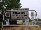
Howlong, New South Wales
Encyclopedia
Howlong is a town 28 kilometres (17.4 mi) west of Albury
, and is situated on the Murray River
which separates the Australia
n states of New South Wales
and Victoria
. The town is located on the Riverina Highway
. There is a bridge across
the Murray into Victoria. Howlong is in the Corowa Shire
Local government area. At the 2006 census
, Howlong had a population of 2,111 people.
Three years later two men with a property in the area set off on the second longest cattle drive of its kind attempted in Australia at that time driving 300 head to South Australia
.
Also in 1838 the site of the Mitchell river crossing became the location of the first postage mail delivery by a mail carrier, John Conway Bourke when he undertook to deliver the overland mail from Sydney
to what would later be called Melbourne
.
 The township appears to have taken its title from a property named Hoolong in the area which was owned by Isaac Rudd and was named after an Aboriginal place name meaning 'beginning of the plains'.
Howlong as a township was laid out in 1854. The Post Office opened on 1 January 1861.
, Walbundrie
& Chiltern
Local sporting clubs include the Howlong Football Club, an Australian rules football
team, who compete in the Hume Football League
.
The town is immortalised in the song "By the time I get to Howlong" from Spiderbait
's album Grand Slam.
Albury, New South Wales
Albury is a major regional city in New South Wales, Australia, located on the Hume Highway on the northern side of the Murray River. It is located wholly within the boundaries of the City of Albury Local Government Area...
, and is situated on the Murray River
Murray River
The Murray River is Australia's longest river. At in length, the Murray rises in the Australian Alps, draining the western side of Australia's highest mountains and, for most of its length, meanders across Australia's inland plains, forming the border between New South Wales and Victoria as it...
which separates the Australia
Australia
Australia , officially the Commonwealth of Australia, is a country in the Southern Hemisphere comprising the mainland of the Australian continent, the island of Tasmania, and numerous smaller islands in the Indian and Pacific Oceans. It is the world's sixth-largest country by total area...
n states of New South Wales
New South Wales
New South Wales is a state of :Australia, located in the east of the country. It is bordered by Queensland, Victoria and South Australia to the north, south and west respectively. To the east, the state is bordered by the Tasman Sea, which forms part of the Pacific Ocean. New South Wales...
and Victoria
Victoria (Australia)
Victoria is the second most populous state in Australia. Geographically the smallest mainland state, Victoria is bordered by New South Wales, South Australia, and Tasmania on Boundary Islet to the north, west and south respectively....
. The town is located on the Riverina Highway
Riverina Highway
Riverina Highway is a highway in New South Wales, Australia.Westwards, the highway stretches from Hume Weir, immediately east of Albury to Deniliquin...
. There is a bridge across
Murray River crossings
The Murray River in south-eastern Australia has been a significant barrier to land-based travel and trade. This article lists and briefly describes all of the recognised crossing points. Many of these had also developed as river ports for transport of goods along the Murray...
the Murray into Victoria. Howlong is in the Corowa Shire
Corowa Shire Council
Corowa Shire is a local government area in New South Wales, Australia in the Riverina region. It is on the Murray River and the Riverina Highway.Its includes the towns of Corowa, Howlong, Balldale, Coreen and Daysdale, Rennie and Mulwala.- Council :...
Local government area. At the 2006 census
Census in Australia
The Australian census is administered once every five years by the Australian Bureau of Statistics. The most recent census was conducted on 9 August 2011; the next will be conducted in 2016. Prior to the introduction of regular censuses in 1961, they had also been run in 1901, 1911, 1921, 1933,...
, Howlong had a population of 2,111 people.
History
Prior to the founding of the township the Surveyor-General of New South Wales at that time Major Thomas Mitchell crossed the Murray River during his exploration of the area. There is a monument to Mitchell on the Victorian side of the river which states that Mitchell and his party camped at the location on 17 October 1836 and then crossed the river slightly downstream of their camping point on the following day.Three years later two men with a property in the area set off on the second longest cattle drive of its kind attempted in Australia at that time driving 300 head to South Australia
South Australia
South Australia is a state of Australia in the southern central part of the country. It covers some of the most arid parts of the continent; with a total land area of , it is the fourth largest of Australia's six states and two territories.South Australia shares borders with all of the mainland...
.
Also in 1838 the site of the Mitchell river crossing became the location of the first postage mail delivery by a mail carrier, John Conway Bourke when he undertook to deliver the overland mail from Sydney
Sydney
Sydney is the most populous city in Australia and the state capital of New South Wales. Sydney is located on Australia's south-east coast of the Tasman Sea. As of June 2010, the greater metropolitan area had an approximate population of 4.6 million people...
to what would later be called Melbourne
Melbourne
Melbourne is the capital and most populous city in the state of Victoria, and the second most populous city in Australia. The Melbourne City Centre is the hub of the greater metropolitan area and the Census statistical division—of which "Melbourne" is the common name. As of June 2009, the greater...
.
Howlong as a township was laid out in 1854. The Post Office opened on 1 January 1861.
Today
Howlong is now an important inland township which services the smaller villages of the area with a range of stores that meet most of the everyday needs of the people of the area. Nearby villages in the area include BrocklesbyBrocklesby, New South Wales
Brocklesby is a small village situated north-west of Albury and west of Holbrook in Greater Hume Shire Council in the Riverina area of New South Wales. Nearby neighbours are Walbundrie to the north and Howlong to the south.-Historical significance:Brocklesby village was once a main railway...
, Walbundrie
Walbundrie, New South Wales
Walbundrie is a village in the eastern Riverina district of New South Wales, Australia. The village is located south-west of the state capital, Sydney and north of Melbourne. Situated on the bank of the Billabong Creek, at the 2006 census, Walbundrie had a population of 190. Walbundrie is in...
& Chiltern
Chiltern, Victoria
Chiltern is a town in Victoria, Australia, located in the north east of the state between Wangaratta and Wodonga, in the Shire of Indigo. At the 2006 census, Chiltern had a population of 1063. The town is close to the Chiltern-Mount Pilot National Park...
Local sporting clubs include the Howlong Football Club, an Australian rules football
Australian rules football
Australian rules football, officially known as Australian football, also called football, Aussie rules or footy is a sport played between two teams of 22 players on either...
team, who compete in the Hume Football League
Hume Football League
The Hume Football League is an Australian rules football competition in the southern Riverina region of New South Wales, with clubs coming from a number of farming communities. Some players also come from the city of Albury, which is at the south of the area covered by the league...
.
The town is immortalised in the song "By the time I get to Howlong" from Spiderbait
Spiderbait
Spiderbait are an Australian alternative rock band formed in Finley in 1989 by bass guitarist Janet English, singer-drummer Mark Maher , and guitarist Damian Whitty. In 2004 the group's cover version of the 1930s Lead Belly song "Black Betty" reached number one on the ARIA Singles Chart...
's album Grand Slam.