
Hempstead County, Arkansas
Encyclopedia

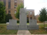
Hempstead County is a county
County (United States)
In the United States, a county is a geographic subdivision of a state , usually assigned some governmental authority. The term "county" is used in 48 of the 50 states; Louisiana is divided into parishes and Alaska into boroughs. Parishes and boroughs are called "county-equivalents" by the U.S...
located in the U.S. state
U.S. state
A U.S. state is any one of the 50 federated states of the United States of America that share sovereignty with the federal government. Because of this shared sovereignty, an American is a citizen both of the federal entity and of his or her state of domicile. Four states use the official title of...
of Arkansas
Arkansas
Arkansas is a state located in the southern region of the United States. Its name is an Algonquian name of the Quapaw Indians. Arkansas shares borders with six states , and its eastern border is largely defined by the Mississippi River...
. As of 2010, the population was 22,609. The county seat
County seat
A county seat is an administrative center, or seat of government, for a county or civil parish. The term is primarily used in the United States....
is Hope
Hope, Arkansas
Hope is a small city in Hempstead County, Arkansas, United States. According to 2008 United States Census Bureau estimates, the population of the city was 10,378...
. Hempstead County is Arkansas's fourth county, formed on December 15, 1818, alongside Clark
Clark County, Arkansas
Clark County is a county located in the U.S. state of Arkansas. As of 2010, the population was 22,995. The county seat is Arkadelphia.The Arkadelphia Micropolitan Statistical Area includes all of Clark County.-Geography:...
and Pulaski counties. The county is named for Edward Hempstead
Edward Hempstead
Edward Hempstead was an American lawyer, pioneer, and one of the early settlers in the new Louisiana Purchase in 1805. Born in New London, Connecticut, Hempstead was the delegate in the U.S. House for the Missouri Territory from 1812 to 1814...
, a delegate to the U.S. Congress
United States House of Representatives
The United States House of Representatives is one of the two Houses of the United States Congress, the bicameral legislature which also includes the Senate.The composition and powers of the House are established in Article One of the Constitution...
from the Missouri Territory
Missouri Territory
The Territory of Missouri was an organized incorporated territory of the United States that existed from June 4, 1812 until August 10, 1821, when the southeastern portion of the territory was admitted to the Union as the State of Missouri.-History:...
, which included present-day Arkansas at the time. It is an alcohol prohibition or dry county
Dry county
A dry county is a county in the United States whose government forbids the sale of alcoholic beverages. Some prohibit off-premises sale, some prohibit on-premises sale, and some prohibit both. Hundreds of dry counties exist across the United States, almost all of them in the South...
.
Hempstead County is part of the Hope Micropolitan Statistical Area
Hope micropolitan area
The Hope Micropolitan Statistical Area, as defined by the United States Census Bureau, is an area consisting of two counties in the U.S. state of Arkansas, anchored by the city of Hope....
.
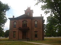
Historic Washington State Park is located in Hempstead County some nine miles northwest of Hope in the historic village of Washington, Arkansas. The state park
State park
State parks are parks or other protected areas managed at the federated state level within those nations which use "state" as a political subdivision. State parks are typically established by a state to preserve a location on account of its natural beauty, historic interest, or recreational...
opened in 1973 as "Old Washington Historic State Park", but the "Old" was dropped from the name in 2006. The park offers walking tours of the historic village, which contains more than a dozen historic structures from the 19th and early 20th centuries.
Geography
According to the 2000 census, the county has a total area of 741.36 square miles (1,920.1 km²), of which 728.77 square miles (1,887.5 km²) (or 98.30%) is land and 12.59 square miles (32.6 km²) (or 1.70%) is water. Hempstead County is alternately considered as part of the greater regions of South ArkansasSouth Arkansas
South Arkansas lies within the southern most portions of Arkansas Gulf Coastal Plain and Delta regions. It encompasses the lower 15 counties of the state.-History:...
or Southwest Arkansas.
Major highways
.svg.png) Interstate 30
Interstate 30 U.S. Highway 67
 U.S. Highway 278
 U.S. Highway 371
 Highway 4
 Highway 27
 Highway 29
 Highway 32
Adjacent counties
- Pike CountyPike County, ArkansasPike County is a county located in the U.S. state of Arkansas. As of 2010, the population was 11,291. The county seat is Murfreesboro. Pike County is Arkansas's 25th county, formed on November 1, 1833, and named for Lieutenant Zebulon Pike, the explorer who discovered Pikes Peak...
(north) - Nevada County (east)
- Lafayette County (south)
- Miller County (southwest)
- Little River CountyLittle River County, ArkansasLittle River County is a county located in the U.S. state of Arkansas. As of 2010, the population was 13,171. The county seat is Ashdown. Little River County is Arkansas's 59th county, formed from Sevier County on March 5, 1867, and named for the Little River...
(west) - Howard CountyHoward County, ArkansasHoward County is a county located in the U.S. state of Arkansas. As of 2010, the population was 13,789. The county seat is Nashville. Howard County is Arkansas's 74th county, formed on April 17, 1873, and named for James Howard, a state senator...
(northwest)
Demographics

Census
A census is the procedure of systematically acquiring and recording information about the members of a given population. It is a regularly occurring and official count of a particular population. The term is used mostly in connection with national population and housing censuses; other common...
of 2000, there were 23,587 people, 8,959 households, and 6,378 families residing in the county. The population density
Population density
Population density is a measurement of population per unit area or unit volume. It is frequently applied to living organisms, and particularly to humans...
was 32 people per square mile (12/km²). There were 10,166 housing units at an average density of 14 per square mile (5/km²). The racial makeup of the county was 63.28% White
Race (United States Census)
Race and ethnicity in the United States Census, as defined by the Federal Office of Management and Budget and the United States Census Bureau, are self-identification data items in which residents choose the race or races with which they most closely identify, and indicate whether or not they are...
, 30.36% Black
Race (United States Census)
Race and ethnicity in the United States Census, as defined by the Federal Office of Management and Budget and the United States Census Bureau, are self-identification data items in which residents choose the race or races with which they most closely identify, and indicate whether or not they are...
or African American
Race (United States Census)
Race and ethnicity in the United States Census, as defined by the Federal Office of Management and Budget and the United States Census Bureau, are self-identification data items in which residents choose the race or races with which they most closely identify, and indicate whether or not they are...
, 0.42% Native American
Race (United States Census)
Race and ethnicity in the United States Census, as defined by the Federal Office of Management and Budget and the United States Census Bureau, are self-identification data items in which residents choose the race or races with which they most closely identify, and indicate whether or not they are...
, 0.17% Asian
Race (United States Census)
Race and ethnicity in the United States Census, as defined by the Federal Office of Management and Budget and the United States Census Bureau, are self-identification data items in which residents choose the race or races with which they most closely identify, and indicate whether or not they are...
, 0.02% Pacific Islander
Race (United States Census)
Race and ethnicity in the United States Census, as defined by the Federal Office of Management and Budget and the United States Census Bureau, are self-identification data items in which residents choose the race or races with which they most closely identify, and indicate whether or not they are...
, 4.17% from other races
Race (United States Census)
Race and ethnicity in the United States Census, as defined by the Federal Office of Management and Budget and the United States Census Bureau, are self-identification data items in which residents choose the race or races with which they most closely identify, and indicate whether or not they are...
, and 1.59% from two or more races. 8.25% of the population were Hispanic
Race (United States Census)
Race and ethnicity in the United States Census, as defined by the Federal Office of Management and Budget and the United States Census Bureau, are self-identification data items in which residents choose the race or races with which they most closely identify, and indicate whether or not they are...
or Latino
Race (United States Census)
Race and ethnicity in the United States Census, as defined by the Federal Office of Management and Budget and the United States Census Bureau, are self-identification data items in which residents choose the race or races with which they most closely identify, and indicate whether or not they are...
of any race.
There were 8,959 households out of which 33.40% had children under the age of 18 living with them, 51.40% were married couples
Marriage
Marriage is a social union or legal contract between people that creates kinship. It is an institution in which interpersonal relationships, usually intimate and sexual, are acknowledged in a variety of ways, depending on the culture or subculture in which it is found...
living together, 15.30% had a female householder with no husband present, and 28.80% were non-families. 25.50% of all households were made up of individuals and 11.70% had someone living alone who was 65 years of age or older. The average household size was 2.60 and the average family size was 3.09.
In the county the population was spread out with 27.30% under the age of 18, 9.60% from 18 to 24, 27.20% from 25 to 44, 21.70% from 45 to 64, and 14.10% who were 65 years of age or older. The median age was 35 years. For every 100 females there were 93.70 males. For every 100 females age 18 and over, there were 89.70 males.
The median income for a household in the county was $28,622, and the median income for a family was $34,082. Males had a median income of $25,830 versus $17,383 for females. The per capita income
Per capita income
Per capita income or income per person is a measure of mean income within an economic aggregate, such as a country or city. It is calculated by taking a measure of all sources of income in the aggregate and dividing it by the total population...
for the county was $14,103. About 16.00% of families and 20.30% of the population were below the poverty line, including 29.20% of those under age 18 and 16.70% of those age 65 or over.
Cities and towns
|
McNab, Arkansas McNab is a town in Hempstead County, Arkansas, United States. The population was 37 at the 2000 census. It is part of the Hope Micropolitan Statistical Area.-Geography:McNab is located at .... Oakhaven, Arkansas Oakhaven is a city in Hempstead County, Arkansas, United States. The population was 54 at the 2000 census. It is part of the Hope Micropolitan Statistical Area.-Geography:Oakhaven is located at .... Ozan, Arkansas Ozan is a city in Hempstead County, Arkansas, United States. The population was 81 at the 2000 census. It is part of the Hope Micropolitan Statistical Area.-Geography:Ozan is located at .... Patmos, Arkansas Patmos is a town in Hempstead County, Arkansas, United States. The population was 61 at the 2000 census. It bears the same name as the Greek Island of Patmos, where the Book of Revelation was written.Patmos is part of the Hope Micropolitan Statistical Area.... |
Perrytown, Arkansas Perrytown is a city in Hempstead County, Arkansas, United States. The population was 255 at the 2000 census. It is part of the Hope Micropolitan Statistical Area.-Geography:Perrytown is located at .... Washington, Arkansas Washington is a city in Hempstead County, Arkansas, United States. The population was 148 at the 2000 census. It is part of the Hope Micropolitan Statistical Area.The city is also home to Old Washington Historic State Park.... |
Townships
- Bodcaw (PatmosPatmos, ArkansasPatmos is a town in Hempstead County, Arkansas, United States. The population was 61 at the 2000 census. It bears the same name as the Greek Island of Patmos, where the Book of Revelation was written.Patmos is part of the Hope Micropolitan Statistical Area....
) - Bois d'Arc (FultonFulton, ArkansasFulton is a city in Hempstead County, Arkansas, United States. The population was 245 at the 2000 census. It is part of the Hope Micropolitan Statistical Area...
, McNabMcNab, ArkansasMcNab is a town in Hempstead County, Arkansas, United States. The population was 37 at the 2000 census. It is part of the Hope Micropolitan Statistical Area.-Geography:McNab is located at ....
) - De Roan (HopeHope, ArkansasHope is a small city in Hempstead County, Arkansas, United States. According to 2008 United States Census Bureau estimates, the population of the city was 10,378...
, PerrytownPerrytown, ArkansasPerrytown is a city in Hempstead County, Arkansas, United States. The population was 255 at the 2000 census. It is part of the Hope Micropolitan Statistical Area.-Geography:Perrytown is located at ....
) - Garland
- Mine Creek (part of OzanOzan, ArkansasOzan is a city in Hempstead County, Arkansas, United States. The population was 81 at the 2000 census. It is part of the Hope Micropolitan Statistical Area.-Geography:Ozan is located at ....
) - Noland (small part of EmmetEmmet, ArkansasEmmet is a city in Hempstead and Nevada counties in the U.S. state of Arkansas. The population was 506 at the 2000 census.-Geography:Emmet is located at ....
) - Ozan (OakhavenOakhaven, ArkansasOakhaven is a city in Hempstead County, Arkansas, United States. The population was 54 at the 2000 census. It is part of the Hope Micropolitan Statistical Area.-Geography:Oakhaven is located at ....
, WashingtonWashington, ArkansasWashington is a city in Hempstead County, Arkansas, United States. The population was 148 at the 2000 census. It is part of the Hope Micropolitan Statistical Area.The city is also home to Old Washington Historic State Park....
, most of OzanOzan, ArkansasOzan is a city in Hempstead County, Arkansas, United States. The population was 81 at the 2000 census. It is part of the Hope Micropolitan Statistical Area.-Geography:Ozan is located at ....
) - Redland (McCaskillMcCaskill, ArkansasMcCaskill is a city in Hempstead County, Arkansas, United States. The population was 84 at the 2000 census. It is part of the Hope Micropolitan Statistical Area.-Geography:McCaskill is located at ....
) - Saline
- Springhill
- Wallaceburg (BlevinsBlevins, ArkansasBlevins is a city in Hempstead County, Arkansas, United States. The population was 365 at the 2000 census. It is part of the Hope Micropolitan Statistical Area.-Geography:Blevins is located at ....
) - Water Creek