
Hampstead, New Hampshire
Encyclopedia
Hampstead is a town in Rockingham County
, New Hampshire
, United States
. The population was 8,523 at the 2010 census. Hampstead, which includes the village of East Hampstead
, is home to a portion of the Rockingham Recreational Trail.
 Once part of Haverhill
and Amesbury
, Massachusetts
settled in 1640, this town was formed as a result of the 1739 change in boundary lines between Massachusetts
and the new province of New Hampshire
. It was originally known as "Timberlane Parish" because of the heavy growth of native trees. The town would be incorporated in 1749 by Colonial
Governor Benning Wentworth
, who renamed it after Hampstead, England
, the residence of William Pitt
, a close friend.
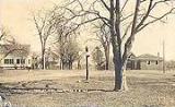
Hampstead's Main Street is lined with antique homes. The town was a popular summer camp
location.
, the town has a total area of 14 square miles (36.3 km²), of which 13.3 sq mi (34.4 km²) is land and 0.7 sq mi (1.8 km²) is water, comprising 4.93% of the town. Island Pond
is in the west, with Angle and Wash ponds in the north. The highest point in Hampstead is greater than 460 feet (140.2 m) above sea level
at the town's northwestern corner, near the summit of Butman Hill in neighboring Sandown
. Hampstead lies mostly within the Merrimack River
watershed
, though the northern slope of Butman Hill drains into the Piscataqua River
(Coastal) watershed. Hampstead is home to Camp Tel Noar
, an overnight summer camp on Wash Pond (Sunset Lake).
of 2000, there were 8,297 people, 3,044 households, and 2,279 families residing in the town. The population density
was 623.0 people per square mile (240.5/km²). There were 3,276 housing units at an average density of 246.0 per square mile (95.0/km²). The racial makeup of the town was 98.47% White, 0.23% African American, 0.08% Native American, 0.54% Asian, 0.05% Pacific Islander, 0.16% from other races
, and 0.47% from two or more races. Hispanic or Latino of any race were 0.78% of the population.
There were 3,044 households out of which 41.1% had children under the age of 18 living with them, 66.2% were married couples
living together, 6.0% had a female householder with no husband present, and 25.1% were non-families. 20.7% of all households were made up of individuals and 6.1% had someone living alone who was 65 years of age or older. The average household size was 2.72 and the average family size was 3.19.
In the town the population was spread out with 28.9% under the age of 18, 5.1% from 18 to 24, 31.0% from 25 to 44, 25.6% from 45 to 64, and 9.3% who were 65 years of age or older. The median age was 38 years. For every 100 females there were 98.4 males. For every 100 females age 18 and over, there were 95.7 males.
The median income for a household in the town was $68,533, and the median income for a family was $79,114. Males had a median income of $56,625 versus $31,449 for females. The per capita income
for the town was $29,195. About 2.4% of families and 3.8% of the population were below the poverty line, including 6.3% of those under age 18 and 3.7% of those age 65 or over.
Rockingham County, New Hampshire
-Demographics:As of the census of 2000, there were 277,359 people, 104,529 households, and 74,320 families residing in the county. The population density was 399 people per square mile . There were 113,023 housing units at an average density of 163 per square mile...
, New Hampshire
New Hampshire
New Hampshire is a state in the New England region of the northeastern United States of America. The state was named after the southern English county of Hampshire. It is bordered by Massachusetts to the south, Vermont to the west, Maine and the Atlantic Ocean to the east, and the Canadian...
, United States
United States
The United States of America is a federal constitutional republic comprising fifty states and a federal district...
. The population was 8,523 at the 2010 census. Hampstead, which includes the village of East Hampstead
East Hampstead, New Hampshire
East Hampstead is an unincorporated village in the town of Hampstead in Rockingham County, New Hampshire, United States.It is located near the northeast corner of the town of Hampstead, at the intersection of New Hampshire Route 111 and Route 121A...
, is home to a portion of the Rockingham Recreational Trail.
History
Haverhill, Massachusetts
Haverhill is a city in Essex County, Massachusetts, United States. The population was 60,879 at the 2010 census.Located on the Merrimack River, it began as a farming community that would evolve into an important industrial center, beginning with sawmills and gristmills run by water power. In the...
and Amesbury
Amesbury, Massachusetts
Amesbury is a city in Essex County, Massachusetts, United States. Though it officially became a city in 1996, its formal name remains "The Town of Amesbury." In 1890, 9798 people lived in Amesbury; in 1900, 9473; in 1910, 9894; in 1920, 10,036; and in 1940, 10,862. The population was 16,283 at...
, Massachusetts
Massachusetts
The Commonwealth of Massachusetts is a state in the New England region of the northeastern United States of America. It is bordered by Rhode Island and Connecticut to the south, New York to the west, and Vermont and New Hampshire to the north; at its east lies the Atlantic Ocean. As of the 2010...
settled in 1640, this town was formed as a result of the 1739 change in boundary lines between Massachusetts
Massachusetts
The Commonwealth of Massachusetts is a state in the New England region of the northeastern United States of America. It is bordered by Rhode Island and Connecticut to the south, New York to the west, and Vermont and New Hampshire to the north; at its east lies the Atlantic Ocean. As of the 2010...
and the new province of New Hampshire
New Hampshire
New Hampshire is a state in the New England region of the northeastern United States of America. The state was named after the southern English county of Hampshire. It is bordered by Massachusetts to the south, Vermont to the west, Maine and the Atlantic Ocean to the east, and the Canadian...
. It was originally known as "Timberlane Parish" because of the heavy growth of native trees. The town would be incorporated in 1749 by Colonial
Colony
In politics and history, a colony is a territory under the immediate political control of a state. For colonies in antiquity, city-states would often found their own colonies. Some colonies were historically countries, while others were territories without definite statehood from their inception....
Governor Benning Wentworth
Benning Wentworth
Benning Wentworth was the colonial governor of New Hampshire from 1741 to 1766.-Biography:The eldest child of the John Wentworth who had been Lieutenant Governor, he was born and died in Portsmouth, New Hampshire. Wentworth graduated from Harvard College in 1715...
, who renamed it after Hampstead, England
Hampstead
Hampstead is an area of London, England, north-west of Charing Cross. Part of the London Borough of Camden in Inner London, it is known for its intellectual, liberal, artistic, musical and literary associations and for Hampstead Heath, a large, hilly expanse of parkland...
, the residence of William Pitt
William Pitt, 1st Earl of Chatham
William Pitt, 1st Earl of Chatham PC was a British Whig statesman who led Britain during the Seven Years' War...
, a close friend.
Hampstead's Main Street is lined with antique homes. The town was a popular summer camp
Summer camp
Summer camp is a supervised program for children or teenagers conducted during the summer months in some countries. Children and adolescents who attend summer camp are known as campers....
location.
Geography
According to the United States Census BureauUnited States Census Bureau
The United States Census Bureau is the government agency that is responsible for the United States Census. It also gathers other national demographic and economic data...
, the town has a total area of 14 square miles (36.3 km²), of which 13.3 sq mi (34.4 km²) is land and 0.7 sq mi (1.8 km²) is water, comprising 4.93% of the town. Island Pond
Island Pond (Derry, New Hampshire)
Island Pond is a water body located in Rockingham County in southern New Hampshire, United States, in the towns of Derry, Hampstead and Atkinson...
is in the west, with Angle and Wash ponds in the north. The highest point in Hampstead is greater than 460 feet (140.2 m) above sea level
Sea level
Mean sea level is a measure of the average height of the ocean's surface ; used as a standard in reckoning land elevation...
at the town's northwestern corner, near the summit of Butman Hill in neighboring Sandown
Sandown, New Hampshire
Sandown is a town in Rockingham County, New Hampshire, United States. The population was 5,986 at the 2010 census.- History :Once part of Kingston, Sandown was incorporated as a separate town in 1756 by Colonial Governor Benning Wentworth. It was named for picturesque Sandown on the Isle of Wight...
. Hampstead lies mostly within the Merrimack River
Merrimack River
The Merrimack River is a river in the northeastern United States. It rises at the confluence of the Pemigewasset and Winnipesaukee rivers in Franklin, New Hampshire, flows southward into Massachusetts, and then flows northeast until it empties into the Atlantic Ocean at Newburyport...
watershed
Drainage basin
A drainage basin is an extent or an area of land where surface water from rain and melting snow or ice converges to a single point, usually the exit of the basin, where the waters join another waterbody, such as a river, lake, reservoir, estuary, wetland, sea, or ocean...
, though the northern slope of Butman Hill drains into the Piscataqua River
Piscataqua River
The Piscataqua River, in the northeastern United States, is a long tidal estuary formed by the confluence of the Salmon Falls and Cocheco rivers...
(Coastal) watershed. Hampstead is home to Camp Tel Noar
Camp Tel Noar
Camp Tel Noar is a Jewish summer camp for children ages 8 through 15. It is located in Hampstead, New Hampshire, in the United States, which is about 1 hour north of Boston. The camp sits on Sunset Lake and has about 275 campers.-History:...
, an overnight summer camp on Wash Pond (Sunset Lake).
Demographics
As of the censusCensus
A census is the procedure of systematically acquiring and recording information about the members of a given population. It is a regularly occurring and official count of a particular population. The term is used mostly in connection with national population and housing censuses; other common...
of 2000, there were 8,297 people, 3,044 households, and 2,279 families residing in the town. The population density
Population density
Population density is a measurement of population per unit area or unit volume. It is frequently applied to living organisms, and particularly to humans...
was 623.0 people per square mile (240.5/km²). There were 3,276 housing units at an average density of 246.0 per square mile (95.0/km²). The racial makeup of the town was 98.47% White, 0.23% African American, 0.08% Native American, 0.54% Asian, 0.05% Pacific Islander, 0.16% from other races
Race (United States Census)
Race and ethnicity in the United States Census, as defined by the Federal Office of Management and Budget and the United States Census Bureau, are self-identification data items in which residents choose the race or races with which they most closely identify, and indicate whether or not they are...
, and 0.47% from two or more races. Hispanic or Latino of any race were 0.78% of the population.
There were 3,044 households out of which 41.1% had children under the age of 18 living with them, 66.2% were married couples
Marriage
Marriage is a social union or legal contract between people that creates kinship. It is an institution in which interpersonal relationships, usually intimate and sexual, are acknowledged in a variety of ways, depending on the culture or subculture in which it is found...
living together, 6.0% had a female householder with no husband present, and 25.1% were non-families. 20.7% of all households were made up of individuals and 6.1% had someone living alone who was 65 years of age or older. The average household size was 2.72 and the average family size was 3.19.
In the town the population was spread out with 28.9% under the age of 18, 5.1% from 18 to 24, 31.0% from 25 to 44, 25.6% from 45 to 64, and 9.3% who were 65 years of age or older. The median age was 38 years. For every 100 females there were 98.4 males. For every 100 females age 18 and over, there were 95.7 males.
The median income for a household in the town was $68,533, and the median income for a family was $79,114. Males had a median income of $56,625 versus $31,449 for females. The per capita income
Per capita income
Per capita income or income per person is a measure of mean income within an economic aggregate, such as a country or city. It is calculated by taking a measure of all sources of income in the aggregate and dividing it by the total population...
for the town was $29,195. About 2.4% of families and 3.8% of the population were below the poverty line, including 6.3% of those under age 18 and 3.7% of those age 65 or over.
Private schools
- Hampstead AcademyHampstead AcademyHampstead Academy is an independent school situated on a wooded campus in southern New Hampshire. Established in 1978, Hampstead Academy is approved by the New Hampshire State Department of Education and Health and Human Services, and is fully accredited by New England Association of Schools and...
- Pinkerton AcademyPinkerton AcademyPinkerton Academy is a secondary school in Derry, New Hampshire. It is the largest independent academy in the United States, serving roughly 3,600 students as the high school for the communities of Derry, Hampstead, Chester and sometimes Auburn...
in DerryDerry, New Hampshire-Climate:-Demographics:As of the census of 2010, there were 33,109 people, 12,537 households, and 8,767 families residing in the town. The population density was 924.8 people per square mile . There were 13,277 housing units at an average density of 143.2/km²...
(Town of Hampstead pays tuition for town students to attend)