

Grand Bay-Westfield, New Brunswick
Encyclopedia
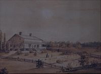
Grand Bay-Westfield (2010 population: 4,981) is a Canadian
Canada
Canada is a North American country consisting of ten provinces and three territories. Located in the northern part of the continent, it extends from the Atlantic Ocean in the east to the Pacific Ocean in the west, and northward into the Arctic Ocean...
suburban town in the western part of Kings County
Kings County, New Brunswick
Kings County is located in southern New Brunswick, Canada.Both the Saint John and Kennebecasis rivers pass through the county.Dairy farming is an important industry in the area...
, New Brunswick
New Brunswick
New Brunswick is one of Canada's three Maritime provinces and is the only province in the federation that is constitutionally bilingual . The provincial capital is Fredericton and Saint John is the most populous city. Greater Moncton is the largest Census Metropolitan Area...
.
The town is an amalgamation
Amalgamation (politics)
A merger or amalgamation in a political or administrative sense is the combination of two or more political or administrative entities such as municipalities , counties, districts, etc. into a single entity. This term is used when the process occurs within a sovereign entity...
of the original town of Grand Bay and the neighbouring village of Westfield immediately to the north.
Grand Bay-Westfield is situated on the west bank of the Saint John River immediately north of the boundary between Kings County and Saint John County
Saint John County, New Brunswick
St. John County is located in southern New Brunswick, Canada. The city of Saint John dominates the county. In the rest of the county, tourists flock to see the many scenic views on the Bay of Fundy.-Communities:...
. The town is a suburb of the city of Saint John
Saint John, New Brunswick
City of Saint John , or commonly Saint John, is the largest city in the province of New Brunswick, and the first incorporated city in Canada. The city is situated along the north shore of the Bay of Fundy at the mouth of the Saint John River. In 2006 the city proper had a population of 74,043...
and its population is split with 3,405 residents in the Grand Bay neighbourhood and 1,544 located in Westfield.
Many residents of Grand Bay-Westfield find employment in Saint John; many are tradespeople who work at the Point Lepreau Nuclear Generating Station
Point Lepreau Nuclear Generating Station
Point Lepreau Nuclear Generating Station is a Canadian nuclear power station located 2 km northeast of Point Lepreau, New Brunswick. The facility was constructed between 1975-1983 by NB Power, the provincially-owned public utility....
, or the Coleson Cove Generating Station, as well as various J.D. Irving Limited pulp and paper factories and the Moosehead
Moosehead
Moosehead is Canada's oldest independent brewery, located in Saint John, New Brunswick. The brewery was founded in 1867 by Susannah Oland and is still operated by the Oland family, now in the sixth generation of ownership under Derek Oland...
brewery - all located on the west side of the city.
History
Samuel de Champlain
Samuel de Champlain , "The Father of New France", was a French navigator, cartographer, draughtsman, soldier, explorer, geographer, ethnologist, diplomat, and chronicler. He founded New France and Quebec City on July 3, 1608....
, who named Grand Bay (Grande Baie) for its wide view. Westfield is either named after Westfield, MA
Westfield, Massachusetts
Westfield is a city in Hampden County, in the Pioneer Valley of western Massachusetts, United States. It is part of the Springfield, Massachusetts Metropolitan Statistical Area. The population was 41,094 at the 2010 census. The ZIP Code is 01085 for homes and businesses, 01086 for Westfield State...
, where some of its settlers came from, or for its geographic location on the west shore of the Saint John River and Nerepis River
Nerepis River
The Nerepis River is a river approximately 25 miles long, located in New Brunswick. A popular river for canoeists and anglers, it is a tributary of the Saint John River. The river has been subjected to significant environmental stress over many years....
. The area started out as "cottage country" for the Saint John area, and remained so for a long time (and is still considered to be so by some). Due to the steep hills and rock, the area never became heavily engaged in agriculture, although some did exist and still does.
The two municipal governments were merged in 1998 with the new municipality occupying much of the western portion of King's County.
Rail
In 1869 the European and North American RailwayEuropean and North American Railway
The European and North American Railway is the name for three historic Canadian and American railways which were built in New Brunswick and Maine....
Western Extension was opened through the area between Saint John and Vanceboro, Maine
Vanceboro, Maine
Vanceboro is a town in Washington County, Maine, United States. The town was named after landowner William Vance. The town is located at the eastern terminus of Maine State Route 6. Vanceboro is across the St. Croix River from St. Croix, New Brunswick, Canada, to which it is connected by the Saint...
. The rail line changed ownership to the New Brunswick Railway
New Brunswick Railway
The New Brunswick Railway was a historic Canadian railway operating in western New Brunswick. Its headquarters were in Woodstock.The original NBR lines were built to the narrow gauge of...
before becoming part of the Canadian Pacific Railway
Canadian Pacific Railway
The Canadian Pacific Railway , formerly also known as CP Rail between 1968 and 1996, is a historic Canadian Class I railway founded in 1881 and now operated by Canadian Pacific Railway Limited, which began operations as legal owner in a corporate restructuring in 2001...
mainline from Saint John to Montreal
Montreal
Montreal is a city in Canada. It is the largest city in the province of Quebec, the second-largest city in Canada and the seventh largest in North America...
in the 1880s. CPR established several stations through the area (Grand Bay, Pamdenec, Epworth Park, Ingleside, Ononette, Hillandale, Westfield Beach, Lingley, Sagwa, and Nerepis). The rail line was sold in 1995 and is now operated as the New Brunswick Southern Railway
New Brunswick Southern Railway
The New Brunswick Southern Railway and Eastern Maine Railway form a 189-mile railway system operating a former Canadian Pacific Railway mainline between Saint John, New Brunswick and Brownville Junction, Maine....
.
Roads
Route 177New Brunswick Route 177
Route 177 is a provincial highway in the southwestern portion of the Canadian province of New Brunswick. Its main purpose is to serve the town of Grand Bay-Westfield. Route 177 is a former alignment of Route 7 and is 19.6 kilometres long....
is the town's main road, called River Valley Drive in the Grand Bay section of town and Nerepis Road in the Westfield part. Other main streets are Woolastook Drive, which winds through the highlands of Grand Bay, and Inglewood Drive is host to the Pamdenec, Epworth Park, Brandy Point & Ingleside subdivisions on Grand Bay's shore front. Also, NB Route 102
New Brunswick Route 102
Route 102 is a highway that follows the west bank of the Saint John River for 157 kilometres from Pokiok to Westfield. Most of the route is colloquially known as the Old River Road, as it was the original road connecting Fredericton and Saint John.The section from Pokiok to Fredericton, a former...
which begins north of Fredericton ends in Westfield. Highway 7
New Brunswick Route 7
Route 7 is 97 kilometres long and runs from Fredericton, near an interchange with Route 8, to an interchange with Route 1 in Saint John. Most of the highway is either a divided expressway or has limited access....
, the main route from Saint John to Fredericton, passes through the western extremity of the town.
In September, 2008, part of the ground that supports the railway tracks were washed away after Hurrican Hannah.
Marine
The town has a ferry landing at the end of Ferry Road in Westfield. The Westfield FerryWestfield Ferry
The Westfield Ferry is a cable ferry in the Canadian province of New Brunswick. The ferry crosses the Saint John River, linking Grand Bay-Westfield on the west bank to Hardings Point on the east bank....
, a cable ferry
Cable ferry
A cable ferry is guided and in many cases propelled across a river or other larger body of water by cables connected to both shores. They are also called chain ferries, floating bridges, or punts....
route operated by the provincial Department of Transportation using a pair of ferries, connects Westfield with the community of Hardings Point on the Kingston Peninsula
Kingston Peninsula
The Kingston Peninsula is a peninsula in southern New Brunswick, Canada, located between the Saint John River and the Kennebecasis River in Kings County.The peninsula was the site of the first United Empire Loyalist settlement in New Brunswick in 1783....
. There is a popular campground just a few feet from the Hardings Point ferry landing.
The Canadian Coast Guard
Canadian Coast Guard
The Canadian Coast Guard is the coast guard of Canada. It is a federal agency responsible for providing maritime search and rescue , aids to navigation, marine pollution response, marine radio, and icebreaking...
maintains a seasonal (summer only) search and rescue
Search and rescue
Search and rescue is the search for and provision of aid to people who are in distress or imminent danger.The general field of search and rescue includes many specialty sub-fields, mostly based upon terrain considerations...
station at Brundage Point near the Westfield ferry landing. Inshore Rescue Boat Station Saint John (IRB Station Saint John) operates a Zodiac Hurricane 733 fast rescue craft in the lower Saint John River, covering all areas downstream from Evandale
Evandale, New Brunswick
Evandale is a community in Canada, in the province of New Brunswick. It is situated on the west bank of the Saint John River, and on New Brunswick Route 102.The Evandale Ferry, a cable ferry, carries Route 124 across the river from Kars on the east bank....
to the Revering Falls, including the Kennebecasis River and Belleisle Bay. IRB Station Saint John is tasked by Joint Rescue Coordination Centre Halifax.
Grand Bay
- Grand Bay- These three neighbourhoods (areas around Murray St, Thompson Rd & Bayview Rd) constitute the original Village of Grand Bay. It is the downtown core of the town. Most businesses are located here and the area borders the City of Saint John, although the closest hint of an urban environment is almost 20 minutes away.
- Highlands/Round Lake- heavily wooded and very steep, wind through the backlands and end at Round Lake.
- Pamdenec- Once a former municipality (Village of Pamdenec) itself, Pamdenec amalgamated with the Village of Grand Bay in the 1970s. The town hall and fire department are located here at 609-615 River Valley Drive.
- Epworth Park- A former cottage community, it is nestled in the woods right on the Saint John River shore. The arena and middle school are located here.
- Brandy Point Estates- A suburban-type neighbourhood built in the 1970s and 1980s. Historically part of Epworth Park, it is now much larger in population than Epworth.
- Ingleside- The last community before Milligan Brook before you enter Westfield.
- Panoramic Estates- This is a new neighbourhood being built just north of the Centrum.
- Epworth Park Heights- This neighbourhood is west of Epworth Park and is much higher. Epworth Park Heights is very distinct from Epworth Park proper.
- Beverly Hills & Valley View Estates- This growing neighbourhood is located off Woolastook Drive. The streets of the area are characterized by extremely steep hills and dense woods.
- Brookdale Heights- A hilly neighbourhood on the edge of Milligan Brook. Brookside Park is a small garden area located near the entrance to the neighbourhood.
Westfield
- Ononette- A very old community. Home of Unity Park.
- Hillandale- Also very old, Hillandale strteches along the wide Saint John River and includes the school and ferry to Hardings Point.
- Westfield Beach & Lingley- The former a very old cottage community, the latter a suburban-style neighbourhood stretching far back into the hills. Lingley is the last part of town to touch the Saint John River as it bends towards Brown's Flat at this point. Lingley is home to the highway exchanges from Route 177 to 102 and Route 7 to 102. The area also has a large steel bridge across the marshes at the mouth of the Nerepis River. Also, a small mobile home park is located off Carriage House Lane in the northern stretch of Lingley.
- Sagwa & Nerepis Station- Two very sparse communities stretching along the Nerepis River, as the Saint John River has dramatically turns towards the northeast. Sagwa is home to a small subdivision, and Nerepis is home to historic Mount Hope Farm. Nerepis Station, commonly called Nerepis is not to be confused with the separate community of Nerepis, which lies immediately to the east of this Nerepis, across the Brittain Road Bridge.
Parks
Grand Bay-Westfield has many parks, from simple greenspace to ballfields and playgrounds. They are listed below, in geographical order from south to north.- Henderson Brook Nature Park: A tiny, new park, Henderson Brook is a great place to watch beavers and birds. It is located on Shannon Road.
- Southwood Park: playground at corner of Bayview Road and Cavalier Lane.
- Inglewood School: playground and baseball diamond.
- Grand Bay Primary School: playground and fieldspace.
- Grand Bay Tennis Courts: 3 regulation-sized tennis courts, located at the corner of Inglewood Drive and Pamdenec Road.
- Pamdenec Place: simple park setting accessible from Pamdenec Road and Frederick Street.
- Lions Field: On Inglewood Drive near Broad Street, two ballfields and a playground.
- Epworth Park Field: green space at corner of Central Avenue and Smith Lane.
- River Valley Middle School: Baseball field, soccer field, football field and, as of summer 2008, a running and walking track
- Brookside Park: A small sitting area near the corner of Brookdale Avenue and Woolastook Drive.
- Unity Park: Could be considered the town's commons, this park was created to symbolize the joining of the two communities. It is located next to Milligan Brook where the former boundary was (corner of Nerepis Road and Mullen Lane). The small stage is used in the summer for events every Wednesday, including children's nights, folk music, local talent, etc.
- Westfield School: A large playground.
- Brundage Point Trailhead/Westfield River Landing: Located at Ferry Road and Brundage Point Road.
See also
- Amalgamations of New BrunswickAmalgamations of New BrunswickThe Canadian province of New Brunswick's municipalities cover only 20% of its landmass, but 80% of its population. Many of those 101 municipalities have been created from amalgamations of several former municipalities, or by annexing unincorporated areas. Prior to several amalgamations that...
- Fundy-River ValleyFundy-River ValleyFundy-River Valley is a provincial electoral district for the Legislative Assembly of New Brunswick, Canada. It was established in the 1994 redistribution as Grand Bay-Westfield and, though its boundaries were not changed much in 2006, it was decided to change its name to Fundy-River Valley to...
(provincial electoral district) - New Brunswick School District 08New Brunswick School District 08School District 08 is a Canadian school district in New Brunswick.District 08 is an Anglophone district operating 36 public schools in Saint John and parts of Kings and Queens Counties....
- New Brunswick SouthwestNew Brunswick SouthwestCharlotte redirects here, for the provincial electoral district, see Charlotte New Brunswick Southwest is a federal electoral district in New Brunswick, Canada, that has been represented in the Canadian House of Commons since 2004...
(federal electoral district)