
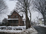
Westfield, Massachusetts
Encyclopedia
Westfield is a city in Hampden County
, in the Pioneer Valley
of western Massachusetts
, United States
. It is part of the Springfield, Massachusetts
Metropolitan Statistical Area
. The population was 41,094 at the 2010 census. The ZIP Code is 01085 for homes and businesses, 01086 for Westfield State University and U.S. Post Office boxes.
tribe, and was called Woronoco (meaning "the winding land"). Trading houses were built in 1639-40 by settlers from the Connecticut Colony
. Massachusetts asserted jurisdiction, and prevailed after a boundary survey. In 1647, Massachusetts made Woronoco part of Springfield, Massachusetts
. Land was incrementally purchased from the Indians and granted by the Springfield town meeting to English settlers, beginning in 1658. The area of Woronoco or "Streamfield" began to be permanently settled in the 1660s. In 1669 (OS), "Westfield" was incorporated as an independent town; in 1920, it would be re-incorporated as a city.
From its founding until 1725, Westfield was the westernmost settlement in Massachusetts Colony. Town meetings were held in a church meeting house until 1839 when Town Hall was erected on Broad Street. This building also served as City Hall from 1920 to 1958. Due to its alluvial
lands, the inhabitants of this area were entirely devoted to agricultural pursuits for about 150 years.
Early in the 19th century manufacture of bricks, whips, and cigars became economically important. At one point in the 19th century, Westfield was a prominent center of the buggy whip industry, and the city is still known as the "Whip City." Other firms produced bicycles, paper products, pipe organs
, boilers and radiators, textile machinery, abrasives, wood products, and precision tools. Westfield transformed itself from an agricultural town into a thriving industrial city in the 19th century, but in the second half of the 20th century its manufacturing base was eroded by wage competition in the U.S. Southeast, then overseas.
Meanwhile, with cheap land and convenient access to east-west and north-south interstate highways, the north side developed into a warehousing center to C & S Wholesale, Home Depot, Lowes and other corporations. South of the river, the intersecting trends of growth of Westfield State University and declining manufacturing changed the city's character. Students comprise some 15% of Westfield's population and the old downtown business district caters increasingly to them while mainstream shopping relocates to a commercial strip called East Main St., actually part of U.S. Route 20
. A Home Depot Store and a Price-Rite were recently added to Westfield's wide array of shopping centers. These stores are located along Route 20.
Only four buildings exceed four stories. Until a major fire on January 6, 1952 the Westfield Professional Building covered half a downtown city block and was six stories tall. The entire building was consumed with extensive damage to neighboring buildings because fire department's ladder and snorkel vehicles weren't tall enough and the building did not have a sprinkler system. Subsequent zoning prohibited virtually all new construction over three stories, even after improvements in fire suppression technologies and vehicles became available. No building is allowed to be taller than the town's firetruck ladders.
In the early 20th century, Westfield was at the center of the Pure Food movement, an effort to require stricter standards on the production of food. Louis B. Allyn
, a Westfield resident and pure foods expert for McClure's
, lived in Westfield until his murder. In 1906, Congress
passed the Pure Food and Drug Act of 1906.
 Westfield is located at 42°7′46"N 72°44′46"W (42.129492, -72.745986). It is bordered on the north by Southampton
, on the northeast by Holyoke
, on the east by West Springfield
, on the southeast by Agawam
, on the south by Southwick
, on the southwest by Granville
, on the west by Russell
, and on the northwest by Montgomery
. Westfield is split into the "South Side" and the "North Side" by the Westfield River, and the northwestern section of town is known as Wyben.
According to the United States Census Bureau
, the city has a total area of 47.3 square miles (122.5 km²), of which 46.6 square miles (120.7 km²) is land and 0.7 square miles (1.8 km²) (1.56%) is water.
Westfield is situated at the western edge of the downfaulted Connecticut River Valley where the Westfield River
emerges from the Berkshire Hills and flows through the center of the city on its way to the Connecticut River
some ten miles (15 km) downstream. Because of its large, steep and rocky upstream watershed the river has a history of severe flood episodes, inundating adjacent parts of Westfield several times. In spite of a complicated system of pumps, dikes, waterways, and upstream dams, Westfield lies in a floodplain
zone and is still considered flood prone.
Westfield is bordered on the east by linear cliffs of volcanic trap rock
known as East Mountain
and Provin Mountain
. They are part of the Metacomet Ridge
, a mountainous trap rock ridgeline that stretches from Long Island Sound
to nearly the Vermont
border. Both are traversed by the 110-mile Metacomet-Monadnock Trail
.
Westfield is on the fringe of the greater Northeast megalopolis
—the most densely populated region of the United States—and has experienced substantial land development for suburban residential and commercial uses for the past six decades. Yet it borders hilltowns to the west that were depopulated of subsistence farmers
in the 19th century as land became readily available on the western frontier
. With population dipping below ten per square kilometer in some upland townships, forests are reverting
almost to pre-settlement conditions with wild turkey, bears, coyotes and even moose returning after absences perhaps measured in centuries. This transition over a few kilometers from the 21st century urbanization to populations densities nearly as low as early colonial times is notable if not unique.
, there were 40,072 people, 14,797 households and 10,017 families residing in the city. The population density
was 860.3 per square mile (332.2/km²). There were 15,441 housing units at an average density of 331.5 per square mile (128.0/km²). The racial makeup of the city was 94.53% White, 0.91% African American, 0.22% Native American, 0.82% Asian, 0.05% Pacific Islander, 2.12% from other races
, and 1.34% from two or more races. Hispanic or Latino of any race were 5.01% of the population.
There were 14,797 households of which 31.5% had children under the age of 18 living with them, 53.0% were married couples
living together, 10.6% had a female householder with no husband present, and 32.3% were non-families. 25.9% of all households were made up of individuals and 10.9% had someone living alone who was 65 years of age or older. The average household size was 2.54 and the average family size was 3.07.
Age distribution was 23.8% under the age of 18, 12.6% from 18 to 24, 28.0% from 25 to 44, 21.9% from 45 to 64, and 13.7% who were 65 years of age or older. The median age was 36 years. For every 100 females there were 93.7 males. For every 100 females age 18 and over, there were 90.8 males.
The median household income
was $45,240, and the median family income was $55,327. Males had a median income of $38,316 versus $27,459 for females. The per capita income
for the city was $20,600. About 6.9% of families and 11.3% of the population were below the poverty line, including 16.2% of those under age 18 and 9.5% of those age 65 or over.
The Office of the Mayor is responsible for a variety of services throughout the city and the mayor also serves as Chairman of the School Committee. The City Council meets the 1st and 3rd Thursday of every month at 7:30 in City Hall.
The current mayor of Westfield is Daniel Knapik. The representative in the Massachusetts General Court
is Donald F. Humason
.
s, two middle school
s and two high school
s.
crosses Westfield just north of the central business district. The "Mass Pike" is part of I-90 extending east to Boston
and west to Albany
, Buffalo
, Cleveland, Chicago
, and across the Upper Midwest
, Wyoming
, Montana
and Idaho
to Spokane
and Seattle. About 3 miles (4.8 km) east of Westfield, the turnpike intersects I-91 which generally follows the Connecticut River
Valley south to Springfield
, Hartford
and New Haven
or north to Canada
(Quebec
).
Westfield's main north-south thoroughfare is US 202/Route 10, which includes parts of Southwick Rd., S. Maple St., W. Silver St., Pleasant St., Court St., Broad St., Elm St., North Elm St., and Southampton Rd. At the intersection of Southampton Rd. and North Rd., Rte. 10 continues on Southampton Rd. toward Southampton
while US 202 follows North Rd. toward Holyoke
.
Apart from limited-access I-90, the main east-west thoroughfare is US 20, which includes parts of Russell Rd., Franklin St., Elm St., Main St., E. Main St., and Springfield Rd. Route 187 also ends in Westfield. Other main roads include Western Ave., Granville Rd., Union St., and Montgomery Rd. East Mountain Rd. is the longest road in Westfield.
commonly known as the "Green Bridge" over the Westfield River
. This is a three lane through truss bridge
. Currently (August 2007), there is an active project to create a second bridge just to the east (downstream). The new bridge will be a similar through-truss bridge with two spans totaling 368 feet (112.2 m). After the second bridge is completed the existing bridge will be refurbished; then each bridge will carry traffic in one direction. Blessed Sacrament Church on North Elm Street was torn down for this project to start. The Church was reconstructed on Holyoke Road and was finished in October 2009. The new bridge opened for traffic and the old one was closed for renovations on August 18, 2009.
and a north-south spur of the New York, New Haven and Hartford Railroad
. There is no more passenger service, however Pioneer Valley Railroad
and CSX provide freight service. More than 35 motor freight carriers with nearby terminals provide competitive freight service locally and to all distant points.
bus routes to Springfield and Holyoke. Bus and rail service to all points is available at Springfield.
in Westfield has charter passenger services.
Bradley International Airport
at Windsor Locks, Connecticut
within 40 minutes driving time has scheduled flights by most airlines.
Albany International Airport
is a practical alternative to Bradley—similar flight offerings and about a 90 minute drive west via I-90.
Hampden County, Massachusetts
-Demographics:As of the census of 2004, there were 461,228 people, 175,288 households, and 115,690 families residing in the county. The population density was 738 people per square mile . There were 185,876 housing units at an average density of 301 per square mile...
, in the Pioneer Valley
Pioneer Valley
The Pioneer Valley is the colloquial name for the U.S. Commonwealth of Massachusetts's portion of the Connecticut River Valley. The Pioneer Valley consists of three counties in Massachusetts which collectively feature much of New England's most fertile farmland...
of western Massachusetts
Western Massachusetts
Western Massachusetts is a loosely defined geographical region of the U.S. state of Massachusetts which contains the Berkshires, the Pioneer Valley, and some or all of the Swift River Valley. The region is always considered to include Berkshire, Franklin, Hampshire, and Hampden counties, and the...
, United States
United States
The United States of America is a federal constitutional republic comprising fifty states and a federal district...
. It is part of the Springfield, Massachusetts
Springfield, Massachusetts
Springfield is the most populous city in Western New England, and the seat of Hampden County, Massachusetts, United States. Springfield sits on the eastern bank of the Connecticut River near its confluence with three rivers; the western Westfield River, the eastern Chicopee River, and the eastern...
Metropolitan Statistical Area
Springfield, Massachusetts metropolitan area
The Springfield Metropolitan Area is a region that is socio-economically and culturally tied to the City of Springfield, Massachusetts. The U.S. Office of Management and Budget defines the Springfield metropolitan statistical area as consisting of three counties in Western Massachusetts. As of...
. The population was 41,094 at the 2010 census. The ZIP Code is 01085 for homes and businesses, 01086 for Westfield State University and U.S. Post Office boxes.
History
The area was originally inhabited by the PocomtucPocomtuc
The Pocumtuck, also Pocomtuc or Deerfield Indians, were a Native American tribe formerly inhabiting western Massachusetts, especially around the confluence of the Deerfield and Connecticut Rivers in Franklin County. Their territory also included parts of Hampden and Hampshire County, as well as...
tribe, and was called Woronoco (meaning "the winding land"). Trading houses were built in 1639-40 by settlers from the Connecticut Colony
Connecticut Colony
The Connecticut Colony or Colony of Connecticut was an English colony located in British America that became the U.S. state of Connecticut. Originally known as the River Colony, it was organized on March 3, 1636 as a haven for Puritan noblemen. After early struggles with the Dutch, the English...
. Massachusetts asserted jurisdiction, and prevailed after a boundary survey. In 1647, Massachusetts made Woronoco part of Springfield, Massachusetts
Springfield, Massachusetts
Springfield is the most populous city in Western New England, and the seat of Hampden County, Massachusetts, United States. Springfield sits on the eastern bank of the Connecticut River near its confluence with three rivers; the western Westfield River, the eastern Chicopee River, and the eastern...
. Land was incrementally purchased from the Indians and granted by the Springfield town meeting to English settlers, beginning in 1658. The area of Woronoco or "Streamfield" began to be permanently settled in the 1660s. In 1669 (OS), "Westfield" was incorporated as an independent town; in 1920, it would be re-incorporated as a city.
From its founding until 1725, Westfield was the westernmost settlement in Massachusetts Colony. Town meetings were held in a church meeting house until 1839 when Town Hall was erected on Broad Street. This building also served as City Hall from 1920 to 1958. Due to its alluvial
Alluvium
Alluvium is loose, unconsolidated soil or sediments, eroded, deposited, and reshaped by water in some form in a non-marine setting. Alluvium is typically made up of a variety of materials, including fine particles of silt and clay and larger particles of sand and gravel...
lands, the inhabitants of this area were entirely devoted to agricultural pursuits for about 150 years.
Early in the 19th century manufacture of bricks, whips, and cigars became economically important. At one point in the 19th century, Westfield was a prominent center of the buggy whip industry, and the city is still known as the "Whip City." Other firms produced bicycles, paper products, pipe organs
Johnson Organs
The William A. Johnson Organ Company of Westfield, Massachusetts, which later became Johnson & Son Organ Company, was a highly respected firm which built 860 pipe organs throughout the United States and in Canada and Bermuda. The company operated from 1844 through 1898...
, boilers and radiators, textile machinery, abrasives, wood products, and precision tools. Westfield transformed itself from an agricultural town into a thriving industrial city in the 19th century, but in the second half of the 20th century its manufacturing base was eroded by wage competition in the U.S. Southeast, then overseas.
Meanwhile, with cheap land and convenient access to east-west and north-south interstate highways, the north side developed into a warehousing center to C & S Wholesale, Home Depot, Lowes and other corporations. South of the river, the intersecting trends of growth of Westfield State University and declining manufacturing changed the city's character. Students comprise some 15% of Westfield's population and the old downtown business district caters increasingly to them while mainstream shopping relocates to a commercial strip called East Main St., actually part of U.S. Route 20
U.S. Route 20
U.S. Route 20 is an east–west United States highway. As the "0" in its route number implies, US 20 is a coast-to-coast route. Spanning , it is the longest road in the United States, and the route sparsely parallels Interstate 90...
. A Home Depot Store and a Price-Rite were recently added to Westfield's wide array of shopping centers. These stores are located along Route 20.
Only four buildings exceed four stories. Until a major fire on January 6, 1952 the Westfield Professional Building covered half a downtown city block and was six stories tall. The entire building was consumed with extensive damage to neighboring buildings because fire department's ladder and snorkel vehicles weren't tall enough and the building did not have a sprinkler system. Subsequent zoning prohibited virtually all new construction over three stories, even after improvements in fire suppression technologies and vehicles became available. No building is allowed to be taller than the town's firetruck ladders.
In the early 20th century, Westfield was at the center of the Pure Food movement, an effort to require stricter standards on the production of food. Louis B. Allyn
Louis B. Allyn
Lewis B. Allyn was an American chemistry professor and influential figure in the pure food movement at the time of his murder....
, a Westfield resident and pure foods expert for McClure's
McClure's
McClure's or McClure's Magazine was an American illustrated monthly periodical popular at the turn of the 20th century. The magazine is credited with creating muckraking journalism. Ida Tarbell's series in 1902 exposing the monopoly abuses of John D...
, lived in Westfield until his murder. In 1906, Congress
United States Congress
The United States Congress is the bicameral legislature of the federal government of the United States, consisting of the Senate and the House of Representatives. The Congress meets in the United States Capitol in Washington, D.C....
passed the Pure Food and Drug Act of 1906.
Geography
Southampton, Massachusetts
Southampton is a town in Hampshire County, Massachusetts, United States. It was established first as a district of Northampton in 1753. It was incorporated in 1753. The name Southampton was given to it during its first town meeting in 1773. Its ZIP code is 01073...
, on the northeast by Holyoke
Holyoke, Massachusetts
Holyoke is a city in Hampden County, Massachusetts, United States, between the western bank of the Connecticut River and the Mount Tom Range of mountains. As of the 2010 Census, the city had a population of 39,880...
, on the east by West Springfield
West Springfield, Massachusetts
The Town of West Springfield is a city in Hampden County, Massachusetts, United States. It is part of the Springfield, Massachusetts Metropolitan Statistical Area. The population was 28,391 at the 2010 census...
, on the southeast by Agawam
Agawam, Massachusetts
The Town of Agawam is a city in Hampden County, Massachusetts, United States. The population was 28,438 at the 2010 census. Agawam sits on the western side of the Connecticut River, directly across from the City of Springfield, Massachusetts...
, on the south by Southwick
Southwick, Massachusetts
Southwick is a town in Hampden County, Massachusetts, United States. The population was 9,502 at the 2010 census. It is part of the Springfield, Massachusetts Metropolitan Statistical Area.- History :...
, on the southwest by Granville
Granville, Massachusetts
Granville is a town in Hampden County, Massachusetts, United States. The population was 1,566 at the 2010 census. It is part of the Springfield, Massachusetts Metropolitan Statistical Area.- History and Description :...
, on the west by Russell
Russell, Massachusetts
Russell is a town in Hampden County, Massachusetts, United States. The population was 1,775 at the 2010 census. It is part of the Springfield, Massachusetts Metropolitan Statistical Area.-Geography:...
, and on the northwest by Montgomery
Montgomery, Massachusetts
Montgomery is a town in Hampden County, Massachusetts, United States. The population was 838 at the 2010 census. It is part of the Springfield, Massachusetts Metropolitan Statistical Area.-History:...
. Westfield is split into the "South Side" and the "North Side" by the Westfield River, and the northwestern section of town is known as Wyben.
According to the United States Census Bureau
United States Census Bureau
The United States Census Bureau is the government agency that is responsible for the United States Census. It also gathers other national demographic and economic data...
, the city has a total area of 47.3 square miles (122.5 km²), of which 46.6 square miles (120.7 km²) is land and 0.7 square miles (1.8 km²) (1.56%) is water.
Westfield is situated at the western edge of the downfaulted Connecticut River Valley where the Westfield River
Westfield River
The Westfield River in Metropolitan Springfield, Massachusetts, is a major tributary of the Connecticut River in Hampden County, Massachusetts. The Westfield River has four major tributary branches that confluence in the City of Westfield, for which the river is named...
emerges from the Berkshire Hills and flows through the center of the city on its way to the Connecticut River
Connecticut River
The Connecticut River is the largest and longest river in New England, and also an American Heritage River. It flows roughly south, starting from the Fourth Connecticut Lake in New Hampshire. After flowing through the remaining Connecticut Lakes and Lake Francis, it defines the border between the...
some ten miles (15 km) downstream. Because of its large, steep and rocky upstream watershed the river has a history of severe flood episodes, inundating adjacent parts of Westfield several times. In spite of a complicated system of pumps, dikes, waterways, and upstream dams, Westfield lies in a floodplain
Floodplain
A floodplain, or flood plain, is a flat or nearly flat land adjacent a stream or river that stretches from the banks of its channel to the base of the enclosing valley walls and experiences flooding during periods of high discharge...
zone and is still considered flood prone.
Westfield is bordered on the east by linear cliffs of volcanic trap rock
Trap rock
Trap rock is a form of igneous rock that tends to form polygonal vertical fractures, most typically hexagonal, but also four to eight sided. The fracture pattern forms when magma of suitable chemical composition intrudes as a sill or extrudes as a thick lava flow, and slowly cools.Because of the...
known as East Mountain
East Mountain (Hampden County, Massachusetts)
East Mountain is a traprock mountain ridge located in the Connecticut River Valley of Massachusetts. It is part of the narrow, linear Metacomet Ridge that extends from Long Island Sound near New Haven, Connecticut, north through the Connecticut River Valley of Massachusetts to the Vermont border...
and Provin Mountain
Provin Mountain
Provin Mountain is a very narrow traprock mountain ridge located in the Connecticut River Valley of Massachusetts. It is part of the Metacomet Ridge which extends from Long Island Sound near New Haven, Connecticut, north through the Connecticut River Valley of Massachusetts to the Vermont border...
. They are part of the Metacomet Ridge
Metacomet Ridge
The Metacomet Ridge, Metacomet Ridge Mountains, or Metacomet Range of southern New England, United States, is a narrow and steep fault-block mountain ridge known for its extensive cliff faces, scenic vistas, microclimate ecosystems, and communities of plants considered rare or endangered...
, a mountainous trap rock ridgeline that stretches from Long Island Sound
Long Island Sound
Long Island Sound is an estuary of the Atlantic Ocean, located in the United States between Connecticut to the north and Long Island, New York to the south. The mouth of the Connecticut River at Old Saybrook, Connecticut, empties into the sound. On its western end the sound is bounded by the Bronx...
to nearly the Vermont
Vermont
Vermont is a state in the New England region of the northeastern United States of America. The state ranks 43rd in land area, , and 45th in total area. Its population according to the 2010 census, 630,337, is the second smallest in the country, larger only than Wyoming. It is the only New England...
border. Both are traversed by the 110-mile Metacomet-Monadnock Trail
Metacomet-Monadnock Trail
The Metacomet-Monadnock Trail is a hiking trail that traverses the Metacomet Ridge of the Pioneer Valley region of Massachusetts and the central uplands of Massachusetts and southern New Hampshire...
.
Westfield is on the fringe of the greater Northeast megalopolis
Northeast megalopolis
The Northeast megalopolis or Boston–Washington megalopolis is the heavily urbanized area of the United States stretching from the the northern suburbs of Boston, Massachusetts to the southern suburbs of Washington, D.C. On a map, the region appears almost as a perfectly straight line. As of 2000,...
—the most densely populated region of the United States—and has experienced substantial land development for suburban residential and commercial uses for the past six decades. Yet it borders hilltowns to the west that were depopulated of subsistence farmers
Subsistence agriculture
Subsistence agriculture is self-sufficiency farming in which the farmers focus on growing enough food to feed their families. The typical subsistence farm has a range of crops and animals needed by the family to eat and clothe themselves during the year. Planting decisions are made with an eye...
in the 19th century as land became readily available on the western frontier
Homesteading
Broadly defined, homesteading is a lifestyle of simple self-sufficiency.-Current practice:The term may apply to anyone who follows the back-to-the-land movement by adopting a sustainable, self-sufficient lifestyle. While land is no longer freely available in most areas of the world, homesteading...
. With population dipping below ten per square kilometer in some upland townships, forests are reverting
Reforestation
Reforestation is the natural or intentional restocking of existing forests and woodlands that have been depleted, usually through deforestation....
almost to pre-settlement conditions with wild turkey, bears, coyotes and even moose returning after absences perhaps measured in centuries. This transition over a few kilometers from the 21st century urbanization to populations densities nearly as low as early colonial times is notable if not unique.
Demographics
At the 2000 censusCensus
A census is the procedure of systematically acquiring and recording information about the members of a given population. It is a regularly occurring and official count of a particular population. The term is used mostly in connection with national population and housing censuses; other common...
, there were 40,072 people, 14,797 households and 10,017 families residing in the city. The population density
Population density
Population density is a measurement of population per unit area or unit volume. It is frequently applied to living organisms, and particularly to humans...
was 860.3 per square mile (332.2/km²). There were 15,441 housing units at an average density of 331.5 per square mile (128.0/km²). The racial makeup of the city was 94.53% White, 0.91% African American, 0.22% Native American, 0.82% Asian, 0.05% Pacific Islander, 2.12% from other races
Race (United States Census)
Race and ethnicity in the United States Census, as defined by the Federal Office of Management and Budget and the United States Census Bureau, are self-identification data items in which residents choose the race or races with which they most closely identify, and indicate whether or not they are...
, and 1.34% from two or more races. Hispanic or Latino of any race were 5.01% of the population.
There were 14,797 households of which 31.5% had children under the age of 18 living with them, 53.0% were married couples
Marriage
Marriage is a social union or legal contract between people that creates kinship. It is an institution in which interpersonal relationships, usually intimate and sexual, are acknowledged in a variety of ways, depending on the culture or subculture in which it is found...
living together, 10.6% had a female householder with no husband present, and 32.3% were non-families. 25.9% of all households were made up of individuals and 10.9% had someone living alone who was 65 years of age or older. The average household size was 2.54 and the average family size was 3.07.
Age distribution was 23.8% under the age of 18, 12.6% from 18 to 24, 28.0% from 25 to 44, 21.9% from 45 to 64, and 13.7% who were 65 years of age or older. The median age was 36 years. For every 100 females there were 93.7 males. For every 100 females age 18 and over, there were 90.8 males.
The median household income
Median household income
The median household income is commonly used to generate data about geographic areas and divides households into two equal segments with the first half of households earning less than the median household income and the other half earning more...
was $45,240, and the median family income was $55,327. Males had a median income of $38,316 versus $27,459 for females. The per capita income
Per capita income
Per capita income or income per person is a measure of mean income within an economic aggregate, such as a country or city. It is calculated by taking a measure of all sources of income in the aggregate and dividing it by the total population...
for the city was $20,600. About 6.9% of families and 11.3% of the population were below the poverty line, including 16.2% of those under age 18 and 9.5% of those age 65 or over.
Government
Westfield is governed by a mayor and a city council, elected every two years.The Office of the Mayor is responsible for a variety of services throughout the city and the mayor also serves as Chairman of the School Committee. The City Council meets the 1st and 3rd Thursday of every month at 7:30 in City Hall.
The current mayor of Westfield is Daniel Knapik. The representative in the Massachusetts General Court
Massachusetts General Court
The Massachusetts General Court is the state legislature of the Commonwealth of Massachusetts. The name "General Court" is a hold-over from the Colonial Era, when this body also sat in judgment of judicial appeals cases...
is Donald F. Humason
Donald F. Humason
Donald F. Humason is a Republican member of the Massachusetts House of Representatives, representing Westfield, Massachusetts. His district office is located at 64 Noble street, Westfield MA 01086.- External links :*http://www.mass.gov/legis/member/dfh1.htm...
.
| Ward | Councilor | Years on City Council |
|---|---|---|
| Ward 1 | Christopher Keefe | 2003, 2008–Present |
| Ward 2 | James Brown | 2010–Present |
| Ward 3 | Peter J. Miller, Jr. | 2004–Present |
| Ward 4 | Mary O'Connell | 2006–Present |
| Ward 5 | Richard Onofrey, Jr. | 2006–Present |
| Ward 6 | Christopher Crean | 2000–2005, 2008–Present |
| At-Large | Patti A. Andras | 2010–Present |
| At-Large | Brent B. Bean, II | 2002–2007, 2010–Present |
| At-Large | John J. Beltrandi, III | 2010–Present |
| At-Large | David A. Flaherty | 2010–Present |
| At-Large | Nicholas Morganelli, Jr. | 2008–Present |
| At-Large | City Council Pres. Brian Sullivan | 1998–Present |
| At-Large | Gerald Tracy | 2010–Present |
| Voter Registration and Party Enrollment as of October 15, 2008 | |||||||||||||||
|---|---|---|---|---|---|---|---|---|---|---|---|---|---|---|---|
| Party | Number of Voters | Percentage |
Democratic Democratic Party (United States) The Democratic Party is one of two major contemporary political parties in the United States, along with the Republican Party. The party's socially liberal and progressive platform is largely considered center-left in the U.S. political spectrum. The party has the lengthiest record of continuous... |
7,390 | 30.42% |
Republican Republican Party (United States) The Republican Party is one of the two major contemporary political parties in the United States, along with the Democratic Party. Founded by anti-slavery expansion activists in 1854, it is often called the GOP . The party's platform generally reflects American conservatism in the U.S... |
4,675 | 19.25% |
Unaffiliated | 12,023 | 49.50% |
Minor Parties | 203 | 0.84% | |
| Total | 24,291 | 100% | |||||||||||||
Library
The Westfield Athenaeum began in the 1860s. In fiscal year 2008, the city of Westfield spent 0.87% ($811,000) of its budget on its public library—some $19 per person.Education
Westfield's public school system consists of two preschools, seven elementary schoolElementary school
An elementary school or primary school is an institution where children receive the first stage of compulsory education known as elementary or primary education. Elementary school is the preferred term in some countries, particularly those in North America, where the terms grade school and grammar...
s, two middle school
Middle school
Middle School and Junior High School are levels of schooling between elementary and high schools. Most school systems use one term or the other, not both. The terms are not interchangeable...
s and two high school
High school
High school is a term used in parts of the English speaking world to describe institutions which provide all or part of secondary education. The term is often incorporated into the name of such institutions....
s.
Preschools
Elementary schools
- Abner Gibbs Elementary School
- Franklin Avenue Elementary School
- Highland Elementary School
- Juniper Park Elementary School (Before the 2009 school year, Juniper Park Elementary School was reduced to Kindergarten through 3rd Grade. 4th and 5th graders now attend Highland Elementary School.)
- (Moseley ES was closed before the 2009 school year. Students now attend either Southampton Rd. ES or Paper Mill ES, depending on where they live.)
- Munger Hill Elementary School
- Paper Mill Elementary School
- Southampton Road Elementary School
Middle schools
High schools
- Westfield High SchoolWestfield High School (Westfield, Massachusetts)Westfield High School is a public high school located in Westfield, Massachusetts established in 1855. It serves as the public high school for students in grades 9 through 12, and has a student enrollment of 1,630.-References:...
- Westfield Vocational-Technical High School
Private schools
Media
- Westfield Evening News/Pennysaver
- PredvestnikPredvestnikPredvestnik was a Russian language newspaper published in the Pioneer Valley, Massachusetts. Founded in 2004, it ceased publication in 2008....
, a Russian Language Newspaper, (Official website)
Major highways
The Massachusetts TurnpikeMassachusetts Turnpike
The Massachusetts Turnpike is the easternmost stretch of Interstate 90. The Turnpike begins at the western border of Massachusetts in West Stockbridge connecting with the Berkshire Connector portion of the New York State Thruway...
crosses Westfield just north of the central business district. The "Mass Pike" is part of I-90 extending east to Boston
Boston
Boston is the capital of and largest city in Massachusetts, and is one of the oldest cities in the United States. The largest city in New England, Boston is regarded as the unofficial "Capital of New England" for its economic and cultural impact on the entire New England region. The city proper had...
and west to Albany
Albany, New York
Albany is the capital city of the U.S. state of New York, the seat of Albany County, and the central city of New York's Capital District. Roughly north of New York City, Albany sits on the west bank of the Hudson River, about south of its confluence with the Mohawk River...
, Buffalo
Buffalo, New York
Buffalo is the second most populous city in the state of New York, after New York City. Located in Western New York on the eastern shores of Lake Erie and at the head of the Niagara River across from Fort Erie, Ontario, Buffalo is the seat of Erie County and the principal city of the...
, Cleveland, Chicago
Chicago
Chicago is the largest city in the US state of Illinois. With nearly 2.7 million residents, it is the most populous city in the Midwestern United States and the third most populous in the US, after New York City and Los Angeles...
, and across the Upper Midwest
Upper Midwest
The Upper Midwest is a region in the northern portion of the U.S. Census Bureau's Midwestern United States. It is largely a sub-region of the midwest. Although there are no uniformly agreed-upon boundaries, the region is most commonly used to refer to the states of Minnesota, Wisconsin, and...
, Wyoming
Wyoming
Wyoming is a state in the mountain region of the Western United States. The western two thirds of the state is covered mostly with the mountain ranges and rangelands in the foothills of the Eastern Rocky Mountains, while the eastern third of the state is high elevation prairie known as the High...
, Montana
Montana
Montana is a state in the Western United States. The western third of Montana contains numerous mountain ranges. Smaller, "island ranges" are found in the central third of the state, for a total of 77 named ranges of the Rocky Mountains. This geographical fact is reflected in the state's name,...
and Idaho
Idaho
Idaho is a state in the Rocky Mountain area of the United States. The state's largest city and capital is Boise. Residents are called "Idahoans". Idaho was admitted to the Union on July 3, 1890, as the 43rd state....
to Spokane
Spokane, Washington
Spokane is a city located in the Northwestern United States in the state of Washington. It is the largest city of Spokane County of which it is also the county seat, and the metropolitan center of the Inland Northwest region...
and Seattle. About 3 miles (4.8 km) east of Westfield, the turnpike intersects I-91 which generally follows the Connecticut River
Connecticut River
The Connecticut River is the largest and longest river in New England, and also an American Heritage River. It flows roughly south, starting from the Fourth Connecticut Lake in New Hampshire. After flowing through the remaining Connecticut Lakes and Lake Francis, it defines the border between the...
Valley south to Springfield
Springfield, Massachusetts
Springfield is the most populous city in Western New England, and the seat of Hampden County, Massachusetts, United States. Springfield sits on the eastern bank of the Connecticut River near its confluence with three rivers; the western Westfield River, the eastern Chicopee River, and the eastern...
, Hartford
Hartford, Connecticut
Hartford is the capital of the U.S. state of Connecticut. The seat of Hartford County until Connecticut disbanded county government in 1960, it is the second most populous city on New England's largest river, the Connecticut River. As of the 2010 Census, Hartford's population was 124,775, making...
and New Haven
New Haven, Connecticut
New Haven is the second-largest city in Connecticut and the sixth-largest in New England. According to the 2010 Census, New Haven's population increased by 5.0% between 2000 and 2010, a rate higher than that of the State of Connecticut, and higher than that of the state's five largest cities, and...
or north to Canada
Canada
Canada is a North American country consisting of ten provinces and three territories. Located in the northern part of the continent, it extends from the Atlantic Ocean in the east to the Pacific Ocean in the west, and northward into the Arctic Ocean...
(Quebec
Quebec
Quebec or is a province in east-central Canada. It is the only Canadian province with a predominantly French-speaking population and the only one whose sole official language is French at the provincial level....
).
Westfield's main north-south thoroughfare is US 202/Route 10, which includes parts of Southwick Rd., S. Maple St., W. Silver St., Pleasant St., Court St., Broad St., Elm St., North Elm St., and Southampton Rd. At the intersection of Southampton Rd. and North Rd., Rte. 10 continues on Southampton Rd. toward Southampton
Southampton, Massachusetts
Southampton is a town in Hampshire County, Massachusetts, United States. It was established first as a district of Northampton in 1753. It was incorporated in 1753. The name Southampton was given to it during its first town meeting in 1773. Its ZIP code is 01073...
while US 202 follows North Rd. toward Holyoke
Holyoke, Massachusetts
Holyoke is a city in Hampden County, Massachusetts, United States, between the western bank of the Connecticut River and the Mount Tom Range of mountains. As of the 2010 Census, the city had a population of 39,880...
.
Apart from limited-access I-90, the main east-west thoroughfare is US 20, which includes parts of Russell Rd., Franklin St., Elm St., Main St., E. Main St., and Springfield Rd. Route 187 also ends in Westfield. Other main roads include Western Ave., Granville Rd., Union St., and Montgomery Rd. East Mountain Rd. is the longest road in Westfield.
Great River Bridge project
A notable choke point for north/south travel is the Great River BridgeGreat River Bridge (Westfield)
The Great River Bridge in Westfield, Massachusetts is a camelback truss bridge over the Westfield River.-History:Built starting in 1938, following the flood that year, and completed in 1939, it was the main north-south crossing of the river for the next 70 years...
commonly known as the "Green Bridge" over the Westfield River
Westfield River
The Westfield River in Metropolitan Springfield, Massachusetts, is a major tributary of the Connecticut River in Hampden County, Massachusetts. The Westfield River has four major tributary branches that confluence in the City of Westfield, for which the river is named...
. This is a three lane through truss bridge
Truss bridge
A truss bridge is a bridge composed of connected elements which may be stressed from tension, compression, or sometimes both in response to dynamic loads. Truss bridges are one of the oldest types of modern bridges...
. Currently (August 2007), there is an active project to create a second bridge just to the east (downstream). The new bridge will be a similar through-truss bridge with two spans totaling 368 feet (112.2 m). After the second bridge is completed the existing bridge will be refurbished; then each bridge will carry traffic in one direction. Blessed Sacrament Church on North Elm Street was torn down for this project to start. The Church was reconstructed on Holyoke Road and was finished in October 2009. The new bridge opened for traffic and the old one was closed for renovations on August 18, 2009.
Rail
Westfield is at the junction of the east-west Boston and Albany RailroadBoston and Albany Railroad
The Boston and Albany Railroad was a railroad connecting Boston, Massachusetts to Albany, New York, later becoming part of the New York Central Railroad system, Conrail and CSX. The line is used by CSX for freight...
and a north-south spur of the New York, New Haven and Hartford Railroad
New York, New Haven and Hartford Railroad
The New York, New Haven and Hartford Railroad , was a railroad that operated in the northeast United States from 1872 to 1968 which served the states of Connecticut, New York, Rhode Island, and Massachusetts...
. There is no more passenger service, however Pioneer Valley Railroad
Pioneer Valley Railroad
Pioneer Valley Railroad, a subsidiary of Pinsly Railroad Company was founded in 1982. Based in Westfield, Massachusetts, this short line railroad controls portions of track between Southampton, Westfield and Holyoke. The rail lines were owned by Conrail prior to 1982....
and CSX provide freight service. More than 35 motor freight carriers with nearby terminals provide competitive freight service locally and to all distant points.
Bus
The city is presently served by two PVTAPioneer Valley Transit Authority
The Pioneer Valley Transit Authority oversees and coordinates public transportation in the Pioneer Valley of Western Massachusetts. Currently the PVTA offers fixed-route bus service as well as paratransit service for the elderly and disabled. The PVTA was created by Chapter 161B of the...
bus routes to Springfield and Holyoke. Bus and rail service to all points is available at Springfield.
Air
Barnes Municipal AirportBarnes Municipal Airport
Barnes Municipal Airport , also known as Westfield-Barnes Airport, is a tower-controlled joint civil-military public airport located three miles north of the central business district of Westfield, a city in Hampden County, Massachusetts, United States. This airport is owned by City of Westfield...
in Westfield has charter passenger services.
Bradley International Airport
Bradley International Airport
Bradley International Airport is a joint civil-military public airport located in Windsor Locks on the border with East Granby and Suffield, in Hartford County, Connecticut, United States. It is owned by the State of Connecticut....
at Windsor Locks, Connecticut
Windsor Locks, Connecticut
Windsor Locks is a town located in Hartford County, Connecticut, United States. As of the 2000 census, its population was 12,043. It is the site of Bradley International Airport, which serves the Greater Hartford-Springfield region. It is also the site of the New England Air Museum...
within 40 minutes driving time has scheduled flights by most airlines.
Albany International Airport
Albany International Airport
Albany International Airport is a public use airport located six nautical miles northwest of the central business district of Albany, in Albany County, New York, United States. It is owned by the Albany County Airport Authority....
is a practical alternative to Bradley—similar flight offerings and about a 90 minute drive west via I-90.
Points of interest
- Amelia Park Ice Rink and Memorial GardenAmelia Park Ice Rink and Memorial GardenThe Amelia Park facilities are located in Westfield, Massachusetts. The Amelia Park Ice Rink is the only ice rink in Westfield. The main building is a facility, a figure skating lounge, three party rooms, a skate rental and sharpening area, four locker rooms and a food concession area. A 65' x...
- Stanley Park of WestfieldStanley Park of WestfieldStanley Park of Westfield is a privately owned park, including an arboretum and botanical garden, located in Westfield, Massachusetts. It is open to the public daily without charge from May to November....
- The Metacomet-Monadnock TrailMetacomet-Monadnock TrailThe Metacomet-Monadnock Trail is a hiking trail that traverses the Metacomet Ridge of the Pioneer Valley region of Massachusetts and the central uplands of Massachusetts and southern New Hampshire...
- East MountainEast Mountain (Hampden County, Massachusetts)East Mountain is a traprock mountain ridge located in the Connecticut River Valley of Massachusetts. It is part of the narrow, linear Metacomet Ridge that extends from Long Island Sound near New Haven, Connecticut, north through the Connecticut River Valley of Massachusetts to the Vermont border...
- United States Whip Company ComplexUnited States Whip Company ComplexUnited States Whip Company Complex or "United States Line Company Complex" is a historic factory located in Westfield, Massachusetts.The factory was built in 1855 and added to the National Register of Historic Places in 1983....
Notable residents
- Edward BancroftEdward BancroftEdward Bancroft was an American physician and double-agent spy during the American Revolution.He worked as a spy for Benjamin Franklin in Britain before the Revolution, and also while serving as secretary to the American Commission in Paris...
(1744–1821) physician and double agent in the American Revolution - Lou BarlowLou BarlowLouis Knox Barlow is an American alternative rock musician and songwriter. A founding member of the groups Deep Wound, Dinosaur Jr., Sebadoh and The Folk Implosion. Barlow is credited with helping to pioneer the lo-fi style of rock music in the late 1980s and early 1990s...
(b. 1966), alternative rock singer, songwriter, musician - Kacey Bellamy, Olympian, 2010 Winter Olymipics, Women's Ice Hockey Sliver Matalist
- Emma Helen BlairEmma Helen BlairEmma Helen Blair was a United States historian, journalist and editor, whose most notable work was a monumental documentary history of the Philippines....
(1851—1911) historian, journalist and editor who attended high school in town - Asahel BushAsahel BushAsahel Bush was an American newspaper publisher and businessman in Salem, Oregon. As publisher the Oregon Statesman newspaper, he moved the paper to Salem when the territorial capital moved to that city...
(1824–1913), printer and publisher the Oregon Statesman newspaper; His estate is now preserved as Bush's Pasture ParkBush's Pasture ParkBush's Pasture Park is a public park and botanical garden in Salem, Oregon, United States. It is also the site of the Asahel Bush House, which was placed on the National Register of Historic Places in 1974, and is now operated as the Bush House Museum.-Bush House Museum:The park and Italianate...
and his home, Asahel Bush House, is on the National Register of Historic Places - Joseph Buell ElyJoseph B. ElyJoseph Buell Ely was the 52nd Governor of the U.S. state of Massachusetts.Born in Westfield, Massachusetts, Joseph B. Ely graduated from Williams College in 1902, before earning a degree from Harvard Law School in 1905. He returned to Westfield and practiced law as a partner of Ely & Ely and...
(1881–1956), 52nd Governor of Massachusetts - Richard Falley Jr.Richard Falley Jr.Richard Falley Jr. was a soldier who fought in the Battle of Bunker Hill....
(1740-1808) an ensign at the Battle of Bunker HillBattle of Bunker HillThe Battle of Bunker Hill took place on June 17, 1775, mostly on and around Breed's Hill, during the Siege of Boston early in the American Revolutionary War...
and armorer during the American Revolutionary WarAmerican Revolutionary WarThe American Revolutionary War , the American War of Independence, or simply the Revolutionary War, began as a war between the Kingdom of Great Britain and thirteen British colonies in North America, and ended in a global war between several European great powers.The war was the result of the... - Ray FitzgeraldRay FitzgeraldRaymond Francis Fitzgerald was a Major League Baseball player...
(1904–1977), Major League Baseball player who died in town - Frederick H. GillettFrederick H. GillettFrederick Huntington Gillett was an American politician during the early 20th century. Frederick H. Gillett was born in Westfield, Massachusetts to Edward Bates Gillett and Lucy Fowler Gillett . He graduated from Amherst College in 1874 and Harvard Law School in 1877. He began the practice of...
(1851–1935), U.S. Congressman, Speaker of the U.S. House of Representatives - Manuel GonzalesManuel GonzalesManuel Gonzales was a Spanish-American Disney comics artist. He emigrated from Spain to the USA in 1918 via Ellis Island, and was employed at the Walt Disney Studios in September 1936, where he initially worked as an "in-betweener" on the motion picture, Snow White.Later working in the comic strip...
(1913–1993), comics artist - Ferdinand Vandeveer HaydenFerdinand Vandeveer HaydenDr. Ferdinand Vandeveer Hayden was an American geologist noted for his pioneering surveying expeditions of the Rocky Mountains in the late 19th century. He was also a physician who served with the Union Army during the Civil War.-Early life:Ferdinand Hayden was born in Westfield, Massachusetts...
(1829–1887) pioneering geologist - Thomas IngersollThomas IngersollThomas Ingersoll was an early settler in Upper Canada, later Ontario. He is best known as the father of Laura Secord, who warned the British of an impending American attack on Upper Canada during the War of 1812....
(1749–1812), early settler of Ingersoll, OntarioIngersoll, OntarioIngersoll is a town in Oxford County on the Thames River in southwestern Ontario, Canada. The nearest cities are Woodstock to the east and London to the west....
, and for whom that town is named - William Allen JohnsonWilliam Allen JohnsonWilliam Allen Johnson of Westfield, Massachusetts, USA, was a builder of pipe organs during the later half of the nineteenth century....
, organ builder. Johnson OrgansJohnson OrgansThe William A. Johnson Organ Company of Westfield, Massachusetts, which later became Johnson & Son Organ Company, was a highly respected firm which built 860 pipe organs throughout the United States and in Canada and Bermuda. The company operated from 1844 through 1898... - Michael Kelley formerly of the NFL, who played for the Houston Oilers, and the Philadelphia Eagles
- Jackie French KollerJackie French KollerJackie French Koller is an American author of picture books, chapter books, and novels for children and young adults. She lives and writes in western Massachusetts.Koller is also an accomplished painter...
, author and painter - Walt KowalczykWalt KowalczykWalter Joseph Kowalczyk is a former American football defensive back and fullback in the National Football League for the Philadelphia Eagles and the Dallas Cowboys. He also played in the American Football League for the Oakland Raiders...
(b. 1935), professional football player with the Philadelphia Eagles, Dallas Cowboys and Oakland Raiders - Jesse LeachJesse LeachJesse David Leach is an American musician from Providence, Rhode Island, and is best known as being the former lead vocalist of Killswitch Engage and later for being the vocalist for the blues rock band Seemless...
, rock singer and musician - Kay LifeKay LifeKay Life is an American children's book illustrator and painter. She lives and works in Westfield, Massachusetts.-Selected Books:* Adventures of Benny and Watch books * Hats Off to Hair! Kay Life is an American children's book illustrator and painter. She lives and works in Westfield,...
, artist, children's book illustrator - Don PardoDon PardoDominick George "Don" Pardo is an American radio and television announcer. He is best known as the voice of the long-running late night sketch comedy show Saturday Night Live....
, longtime Saturday Night LiveSaturday Night LiveSaturday Night Live is a live American late-night television sketch comedy and variety show developed by Lorne Michaels and Dick Ebersol. The show premiered on NBC on October 11, 1975, under the original title of NBC's Saturday Night.The show's sketches often parody contemporary American culture...
announcer - Gorham ParksGorham ParksGorham Parks was a U.S. Representative from Maine, and a Democratic Party candidate for Maine Governor.Born in Westfield, Massachusetts, Parks attended the common schools and graduated from Harvard University in 1813, where he studied law.He was admitted to the bar in 1819 and began his practice...
, U.S. Congressman from MaineMaineMaine is a state in the New England region of the northeastern United States, bordered by the Atlantic Ocean to the east and south, New Hampshire to the west, and the Canadian provinces of Quebec to the northwest and New Brunswick to the northeast. Maine is both the northernmost and easternmost...
and American Consul in Rio de JaneiroRio de JaneiroRio de Janeiro , commonly referred to simply as Rio, is the capital city of the State of Rio de Janeiro, the second largest city of Brazil, and the third largest metropolitan area and agglomeration in South America, boasting approximately 6.3 million people within the city proper, making it the 6th... - Frederic RzewskiFrederic RzewskiFrederic Anthony Rzewski is an American composer and virtuoso pianist.- Biography :Rzewski began playing piano at age 5. He attended Phillips Academy, Harvard and Princeton, where his teachers included Randall Thompson, Roger Sessions, Walter Piston and Milton Babbitt...
, composer - SebadohSebadohSebadoh is an American indie rock band, formed in 1986 in Westfield, Massachusetts by Eric Gaffney and Dinosaur Jr bass player Lou Barlow. Along with such bands as Pavement and Guided by Voices, Sebadoh helped pioneer lo-fi music, a style of indie rock characterized by low-fidelity recording...
, indie rock band - Major General William L. Shepard, revolutionary war general William ShepardWilliam ShepardWilliam Lyman Shepard was a United States Representative from Massachusetts. Born in Westfield, he attended the common schools, engaged in agricultural pursuits, and served in the French and Indian wars for six years. He was a member of the committee of correspondence for Westfield in 1774, and...
- Walter Scott StoryWalter Scott StoryWalter Scott Story was an author of children's books and over 140 pulp magazine stories and novelettes.He was born in Springfield, Massachusetts, the son of Benjamin Franklin Story, a printer from Lyndon, Vermont and Rebecca Jennie Turner of St. Joseph, Michigan...
(1879–1955), author - Rick SullivanRick SullivanRichard K. "Rick" Sullivan, Jr. is an American politician who is the current Secretary of Energy and Environmental Affairs of the Commonwealth of Massachusetts and the former Mayor of Westfield, Massachusetts....
, current Secretary of Energy and Environmental Affairs for the Commonwealth of Massachusetts and the former Mayor of Westfield - Edward TaylorEdward TaylorEdward Taylor was a colonial American poet, pastor and physician.-Early life:...
(c. 1642–1729) poet, physician, and pastor - Mark TraftonMark TraftonMark Trafton was a Methodist Episcopal minister who, as a member of the American Party served one term as a U.S...
, U.S. Congressman - Jon Wysocki, drummer for the alternative metal band StaindStaindStaind is an American rock band that was formed in 1995 in Springfield, Massachusetts. For 16 years, the band consisted of lead vocalist and rhythm guitarist Aaron Lewis, lead guitarist Mike Mushok, bassist Johnny April, and drummer Jon Wysocki...
.
Bands from Westfield
- Killswitch EngageKillswitch EngageKillswitch Engage is an American metalcore band from Westfield, Massachusetts, formed in 1999 after the disbandment of Overcast and Aftershock. Killswitch Engage's current lineup consists of vocalist Howard Jones, bassist Mike D'Antonio, guitarists Joel Stroetzel and Adam Dutkiewicz, and drummer...
, Metalcore band - SebadohSebadohSebadoh is an American indie rock band, formed in 1986 in Westfield, Massachusetts by Eric Gaffney and Dinosaur Jr bass player Lou Barlow. Along with such bands as Pavement and Guided by Voices, Sebadoh helped pioneer lo-fi music, a style of indie rock characterized by low-fidelity recording...
, Indie rock band - Within the RuinsWithin the RuinsWithin the Ruins is a metal band from Westfield, Massachusetts. They are currently signed to Victory Records. The group released two albums and one EP—Creature , Invade , and Omen-EP —via Victory Records-Biography:...
, Technical Metalcore band
External links
- Macaroni Kid Westfield-Southwick Edition Find all the family-friendly events going on each week in your area!
- Official Site
- Westfield State University
- Westfield Athenaeum, the library in Westfield
- Westfield is home to Barnes Airport, which hosts The 104th Fighter Wing
- A Record of Marriages, Births and Deaths in Westfield, Massachusetts Prior to the Year 1700 - Communicated by the Rev. Emerson Davis of that town, Corresponding Member of the New England Historic-Genealogical Society
- MHC Reconnaissance Town Survey Report: Westfield Massachusetts Historical Commission, 1982.