
Grade I listed buildings in Waveney
Encyclopedia
.jpg)
Waveney
Waveney is a local government district in Suffolk, England, named after the River Waveney that forms its north-west border. The district council is based in Lowestoft, the major settlement in Waveney, which is the only unparished area in the district...
, a non-metropolitan district
Non-metropolitan district
Non-metropolitan districts, or colloquially shire districts, are a type of local government district in England. As created, they are sub-divisions of non-metropolitan counties in a so-called "two-tier" arrangement...
of in the county of Suffolk
Suffolk
Suffolk is a non-metropolitan county of historic origin in East Anglia, England. It has borders with Norfolk to the north, Cambridgeshire to the west and Essex to the south. The North Sea lies to the east...
in England.
In the United Kingdom, the term listed building refers to a building or other structure officially designated as being of "exceptional architectural or historic special interest"; Grade I structures are those considered to be "buildings of "exceptional interest, sometimes considered to be internationally important. Just 2.5% of listed buildings are Grade I." The total number of listed buildings in England is 372,905. Listing was begun by a provision in the Town and Country Planning Act 1947. Listing a building imposes severe restrictions on what the owner might wish to change or modify in the structure or its fittings. In England, the authority for listing under the Planning (Listed Buildings and Conservation Areas) Act 1990
Planning (Listed Buildings and Conservation Areas) Act 1990
The Planning Act 1990 is an Act of Parliament of the United Kingdom that altered the laws on granting of planning permission for building works, notably including those of the listed building system in England and Wales....
rests with English Heritage
English Heritage
English Heritage . is an executive non-departmental public body of the British Government sponsored by the Department for Culture, Media and Sport...
, a non-departmental public body
Non-departmental public body
In the United Kingdom, a non-departmental public body —often referred to as a quango—is a classification applied by the Cabinet Office, Treasury, Scottish Government and Northern Ireland Executive to certain types of public bodies...
sponsored by the Department for Culture, Media and Sport
Department for Culture, Media and Sport
The Department for Culture, Media and Sport is a department of the United Kingdom government, with responsibility for culture and sport in England, and some aspects of the media throughout the whole UK, such as broadcasting and internet....
.
Waveney is a local government district with its administrative headquarters at Lowestoft
Lowestoft
Lowestoft is a town in the English county of Suffolk. The town is on the North Sea coast and is the most easterly point of the United Kingdom. It is north-east of London, north-east of Ipswich and south-east of Norwich...
, that is also the main town in the district and the second in Suffolk. The other towns are Beccles
Beccles
Beccles is a market town and civil parish in the Waveney District of the English county of Suffolk. The town is shown on the milestone as from London via the A145 Blythburgh and A12 road, northeast of London as the crow flies, southeast of Norwich, and north northeast of the county town of...
, Bungay
Bungay, Suffolk
Bungay is a market town in the English county of Suffolk. It lies in the Waveney valley, west of Beccles on the edge of The Broads, and at the neck of a meander of the River Waveney.-Early history:...
, Halesworth
Halesworth
Halesworth is a small market town in the northeastern corner of Suffolk, England. It is located south west of Lowestoft, and straddles the River Blyth, 9 miles upstream from Southwold. The town is served by Halesworth railway station on the Ipswich-Lowestoft East Suffolk Line...
and Southwold
Southwold
Southwold is a town on the North Sea coast, in the Waveney district of the English county of Suffolk. It is located on the North Sea coast at the mouth of the River Blyth within the Suffolk Coast and Heaths Area of Outstanding Natural Beauty. The town is around south of Lowestoft and north-east...
. The number of inhabitants of the area is 117,300 with a density of 317 inhabitants per km². There are 57 civil parish
Civil parish
In England, a civil parish is a territorial designation and, where they are found, the lowest tier of local government below districts and counties...
es in the area, with Lowestoft being the only unparished area
Unparished area
In England, an unparished area is an area that is not covered by a civil parish. Most urbanised districts of England are either entirely or partly unparished. Many towns and some cities in otherwise rural districts are also unparished areas and therefore no longer have a town council or city...
.
| Name | Image | Date completed | Location | Notes | Ref(s) |
|---|---|---|---|---|---|
| Church of All Saints All Saints Church, South Elmham All Saints Church, South Elmham, is a redundant Anglican church in the village of All Saints, South Elmham, one of a group of villages jointly known as The Saints, in Suffolk, England . It has been designated by English Heritage as a Grade I listed building, and is under the care of the... |
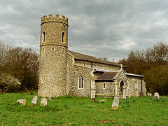 |
14th-century | All Saints, South Elmham |
||
| Church of St Mary | 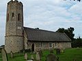 |
16th-century | Ashby Ashby, Suffolk Ashby is a small hamlet located to the north east of Suffolk very close to the border with Norfolk. It is close to the village of Herringfleet on the B1074 road. The closest town is Lowestoft.-External links:... |
||
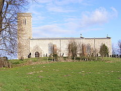
| Church of the Holy Trinity | 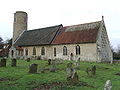 |
15th-century | Barsham Barsham, Suffolk Barsham is a village and civil parish in the Waveney district of Suffolk, England. It is about two miles west of Beccles in the district of Waveney, and is on the edge of The Broads... |
||
| Church of St Michael |  |
1350 c. | Beccles Beccles Beccles is a market town and civil parish in the Waveney District of the English county of Suffolk. The town is shown on the milestone as from London via the A145 Blythburgh and A12 road, northeast of London as the crow flies, southeast of Norwich, and north northeast of the county town of... |
||
| Beccles bell tower Beccles bell tower The Beccles bell tower is a free-standing Grade I listed edifice associated with the adjacent St. Michael's church in the market town of Beccles, Suffolk, England.... |
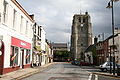 |
1540 | Beccles Beccles Beccles is a market town and civil parish in the Waveney District of the English county of Suffolk. The town is shown on the milestone as from London via the A145 Blythburgh and A12 road, northeast of London as the crow flies, southeast of Norwich, and north northeast of the county town of... |
||
| Leman House John Leman Sir John Leman was a tradesman from Beccles, England who became Lord Mayor of London.-Career:Leman's business interests grew across the district of Waveney, which spans the Norfolk-Suffolk border. In the 1580s he moved to London and extended his business interests to trading in dairy products... |
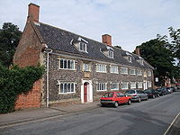 |
16th-century | Beccles Beccles Beccles is a market town and civil parish in the Waveney District of the English county of Suffolk. The town is shown on the milestone as from London via the A145 Blythburgh and A12 road, northeast of London as the crow flies, southeast of Norwich, and north northeast of the county town of... |
||
| Roos Hall Roos Hall thumb|right|Roos Hall, near BecclesRoos Hall is a manor house and former manor ½ a mile west of Beccles in Suffolk. It is a Grade I listed building.... |
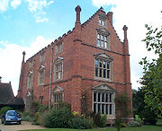 |
16th-century | Beccles Beccles Beccles is a market town and civil parish in the Waveney District of the English county of Suffolk. The town is shown on the milestone as from London via the A145 Blythburgh and A12 road, northeast of London as the crow flies, southeast of Norwich, and north northeast of the county town of... |
||
| Waveney House | 16th-century | Beccles Beccles Beccles is a market town and civil parish in the Waveney District of the English county of Suffolk. The town is shown on the milestone as from London via the A145 Blythburgh and A12 road, northeast of London as the crow flies, southeast of Norwich, and north northeast of the county town of... |
|||
| St Peter's House | 18th-century | Beccles Beccles Beccles is a market town and civil parish in the Waveney District of the English county of Suffolk. The town is shown on the milestone as from London via the A145 Blythburgh and A12 road, northeast of London as the crow flies, southeast of Norwich, and north northeast of the county town of... |
|||
| Church of St Mary | 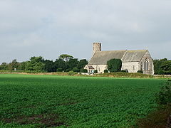 |
14th-century | Blundeston Blundeston Blundeston is a village and civil parish in the Waveney district of Suffolk, England. It is about inland, and between Great Yarmouth and Lowestoft... |
||
| Church of All Saints | 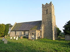 |
13th-century | Blyford Blyford Blyford is a village and civil parish in the Waveney district of Suffolk, England, about east of Halesworth and separated from Wenhaston by the River Blyth, Suffolk to the south.Not to be confused with... |
||
| Church of St Peter | 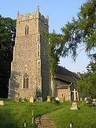 |
13th-century | Brampton Brampton, Suffolk Brampton is a village in Suffolk, England, located approximately four miles north east of Halesworth, five miles south of Beccles and nine miles south west of Lowestoft. The mid-2005 population estimate for Brampton with Stoven parish was 460... |
||
| Bungay Castle Bungay Castle Bungay Castle is in the town of Bungay, Suffolk by the River Waveney.-Details:Originally this was a Norman castle built by Roger Bigod, around 1100, which took advantage of the protection given by the curve of the River Waveney... |
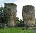 |
12th-century | Bungay Bungay, Suffolk Bungay is a market town in the English county of Suffolk. It lies in the Waveney valley, west of Beccles on the edge of The Broads, and at the neck of a meander of the River Waveney.-Early history:... |
||
| Church of St Mary St Mary's Church, Bungay St Mary's Church, Bungay, is a redundant Anglican church in the town of Bungay, Suffolk, England. The church and the ruins of the adjacent priory have been designated by English Heritage as a Grade I listed building, and are under the care of the Churches Conservation Trust... and ruins of Bungay Priory Bungay Priory Bungay Priory was a Benedictine nunnery in the town of Bungay in the English county of Suffolk. It was founded in about 1160 by Roger de Glanville and his wife the Countess Gundreda and dissolved in about 1536 during the dissolution of the monasteries at which time it consisted of a prioress and 11... |
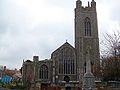 |
15th-century | Bungay Bungay, Suffolk Bungay is a market town in the English county of Suffolk. It lies in the Waveney valley, west of Beccles on the edge of The Broads, and at the neck of a meander of the River Waveney.-Early history:... |
||
| Church of the Holy Trinity | 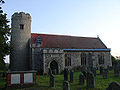 |
15th-century | Bungay Bungay, Suffolk Bungay is a market town in the English county of Suffolk. It lies in the Waveney valley, west of Beccles on the edge of The Broads, and at the neck of a meander of the River Waveney.-Early history:... |
||
| Butter Cross | 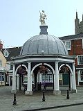 |
1689 | Bungay Bungay, Suffolk Bungay is a market town in the English county of Suffolk. It lies in the Waveney valley, west of Beccles on the edge of The Broads, and at the neck of a meander of the River Waveney.-Early history:... |
||
| Church of St Andrew | 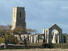 |
1672 | Covehithe Covehithe Covehithe, formerly North Hales, is a hamlet in a parish in Blything district, Suffolk, England. Lying on the coast around North-east of Southwold,also 8 miles South from the town of Lowestoft... |
||
| Church of All Saints All Saints Church, Ellough All Saints Church, Ellough, is a redundant Anglican church in the parish of Ellough in the English county of Suffolk. The church is medieval in origin and has been designated by English Heritage as a Grade I listed building, and is under the care of the Churches Conservation Trust... |
 |
15th-century | Ellough Ellough Ellough is a parish in the English county of Suffolk located approximately south-east of Beccles. The area is sparsely populated with a mid-2005 population estimate of 40. Neighbouring villages include North Cove, Weston, Sotterley and Henstead... |
||
| Church of All Saints | 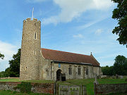 |
15th-century | Frostenden Frostenden Frostenden is a small village in Suffolk, England. Its church, All Saints, is one of 38 existing round-tower churches in Suffolk. It is situated west to the A 12 and can be seen from this major road.-External links:*, a round-tower church... |
||
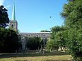
| Church of the Holy Trinity | 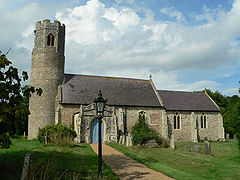 |
12th-century | Gisleham Gisleham Gisleham is a small village located on the western edge of Lowestoft in the English county of Suffolk. It is situated between Carlton Colville and Kessingland. Gisleham church, Holy Trinity, is one of 38 existing round-tower churches in Suffolk.... |
||
| Church of St Mary |  |
15th-century | Halesworth Halesworth Halesworth is a small market town in the northeastern corner of Suffolk, England. It is located south west of Lowestoft, and straddles the River Blyth, 9 miles upstream from Southwold. The town is served by Halesworth railway station on the Ipswich-Lowestoft East Suffolk Line... |
||
| Church of St Mary |  |
15th-century | Henstead Henstead Henstead is near Kessingland and the A12 in Suffolk in England. It has a church called Church of St Mary which is a Grade I listed building.In 1771 the landscape artist, Thomas Hearne spent six weeks with the young George Beaumont in Henstead at the home of the latters tutor at Eton, Revd Charles... |
||
| Church of St Margaret |  |
16th-century | Herringfleet Herringfleet Herringfleet is a small village on the River Waveney, between Somerleyton and St. Olaves in Suffolk, England within The Broads National Park.Herringfleet was occupied by the Roman Empire, and archaeologists have made a number of finds, including a Roman bronze 'patera', a 'soup ladle' vessel with... |
||
| Church of St Edmund | 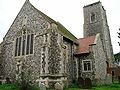 |
16th-century | Kessingland Kessingland Kessingland is a large village in the Waveney District of the English county of Suffolk. It is located around south of Lowestoft. It is of interest to archaeologists as Palaeolithic and Neolithic implements have been found here; the remains of an ancient forest lie buried on the seabed.There has... |
||
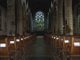
| Church of St Margaret St. Margaret's Church, Lowestoft Saint Margaret's Church is situated on the north-western edge of the town centre of the Suffolk town of Lowestoft. It is most notable for its large illuminated blue spire which can be seen across the town... |
 |
15th-century | Lowestoft Lowestoft Lowestoft is a town in the English county of Suffolk. The town is on the North Sea coast and is the most easterly point of the United Kingdom. It is north-east of London, north-east of Ipswich and south-east of Norwich... |
||
| Church of All Saints | 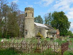 |
14th-century | Mettingham Mettingham Mettingham is a village in Suffolk, England, close to the border with Norfolk.Its church, All Saints, is one of 38 existing round-tower churches in Suffolk, UK.... |
||
| Church of St Andrew | 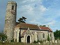 |
14th-century | Mutford Mutford Mutford is a small village and civil parish located south-west of Lowestoft in the English county of Suffolk. The village is located between Lowestoft and Beccles in a rural area south of the A146 at Barnby. Nearby villages include Gisleham and Henstead... |
||
| Church of St Botolph | 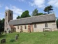 |
15th-century | North Cove North Cove North Cove is on the A146, in between Beccles and Lowestoft in Suffolk. The local church is called St. Boltoph and contains medieval wall paintings.... |
||
| Church of St Michael | 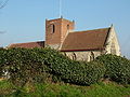 |
14th-century | Oulton Oulton Broad Oulton Broad refers to both the lake and the suburb of Lowestoft in Suffolk, England located 2 miles west of the centre of the town.-Oulton Broad:... |
||
| Church of St Peter | 14th-century | Redisham Redisham Redisham is a village and civil parish in the English county of Suffolk. It is located 3½ miles south-west of Beccles and 4⅓ miles north-east of Halesworth in Waveney district. The mid-2005 population estimate for Redisham parish was 110... |
|||
| Church of St Michael and St Felix |  |
15th-century | Rumburgh Rumburgh Rumburgh is a village in Suffolk in England.-Etymology:Its name is first found in is this entry in Latin in the Register of St Benet's Abbey of Hulme near Horning north of Norwich, which can be dated to 1047-64: ... in cella quadam que Romburch dicitur ... = "in a certain cell which is called... |
||
| Church of St Michael and All Angels | 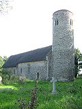 |
14th-century | Rushmere Rushmere, Suffolk Rushmere is a small village adjacent to the town of Ipswich, Suffolk. The village lies within the parish of Rushmere St. Andrew. The parish has a population of over 6,000. In Rushmere, there is a pub, The Garland, a CofE church, a Baptist church, two rugby clubs and a village hall. There are lots... |
||
| Church of St John the Baptist | 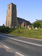 |
13th-century | Shadingfield Shadingfield Shadingfield is a village in the English county of Suffolk located approximately 4 miles south of Beccles along the A145. The village is joined with Willingham St Mary and 1½ miles west of Sotterley. The mid-2005 population estimate for Shadingfield parish was 170... |
||
| Sotterley Hall | 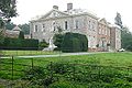 |
1745 | Sotterley Sotterley Sotterley, originally Southern-lea from its situation south of the river, is a parish in the English county of Suffolk, located approximately south-east of Beccles and east of Willingham St Mary and Shadingfield. The parish is primarily agricultural with a dispersed population of 110... |
||
| Church of St Margaret | 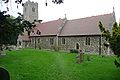 |
14th-century | Sotterley Sotterley Sotterley, originally Southern-lea from its situation south of the river, is a parish in the English county of Suffolk, located approximately south-east of Beccles and east of Willingham St Mary and Shadingfield. The parish is primarily agricultural with a dispersed population of 110... |
||
| Church of St Lawrence | 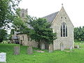 |
15th-century | South Cove |
||
| Church of St Edmund | 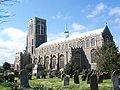 |
15th-century | Southwold Southwold Southwold is a town on the North Sea coast, in the Waveney district of the English county of Suffolk. It is located on the North Sea coast at the mouth of the River Blyth within the Suffolk Coast and Heaths Area of Outstanding Natural Beauty. The town is around south of Lowestoft and north-east... |
||
| Church of St Andrew |  |
15th-century | St Andrew, Ilketshall |
||
| South Elmham Hall | 16th-century | St Cross, South Elmham |
|||
| Church of St George |  |
15th-century | St Cross, South Elmham |
||
| Church of St James |  |
15th-century | St James, South Elmham |
||
| Church of St Margaret | 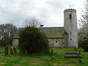 |
12th-century | St Margaret, Ilketshall |
||
| Church of St Margaret | 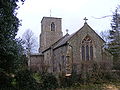 |
14th-century | St Margaret, South Elmham |
||
| Church of St Michael | 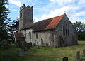 |
13th-century | St Michael, South Elmham |
||
| Church of St Mary | 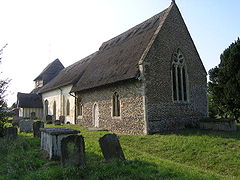 |
12th-century | Uggeshall Uggeshall Uggeshall is a village in Suffolk, England, located approximately 6 miles south of Beccles and 4 miles north east of Halesworth close to the A145. The mid-2005 population estimate for Uggeshall parish was 170. Sotherton is located just to the south-west, Wangford to the south-east and Brampton... |
||
| Church of St Peter and St Paul | 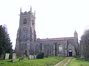 |
15th-century | Wangford Wangford Wangford is a village in Suffolk, England, just off the A12 trunk road on the edge of the Henham Park estate just outside Southwold. .Wangford is connected to the rest of Suffolk by two main roads... |
||
| Church of St Andrew | 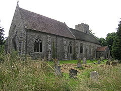 |
14th-century | Westhall Westhall Westhall is a village in Suffolk, England about north east of Halesworth, south west of Brampton and south of Beccles, close to the A145. The mid-2005 population estimate for Westhall parish was 390. Sotherton is located to the south east and Holton to the south west.The village church, which... |
||
| Church of St Peter | 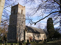 |
15th-century | Weston Weston, Suffolk Weston is a village and civil parish in the English county of Suffolk located approximately south of Beccles in the District of Waveney. The parish lies either side of the A145 and is crossed by the Ipswich to Lowestoft railway line. Neighbouring villages include Ellough, Ringsfield, Willingham St... |
||
| Church of St Andrew | 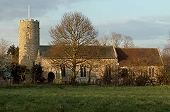 |
14th-century | Wissett Wissett Wissett is a village and parish in the Waveney district of Suffolk, England located at 52.35N 01.46E TM3679 about 2 km northwest of Halesworth. Historically, it was in the hundred of Blything. It has a population of about 200.... |
||
| Worlingham Hall | 18th-century | Worlingham Worlingham Worlingham is a village and civil parish in the Waveney district of Suffolk, England about east of Beccles. As of 2008 it is effectively a suburb of Beccles... |
|||
| Church of St Nicholas | 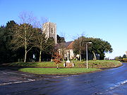 |
15th-century | Wrentham Wrentham, Suffolk Wrentham is a village in the north-east of the English county of Suffolk. Wrentham is located about 2 miles from the coast along the A12 trunk road... |
||