
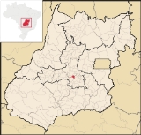
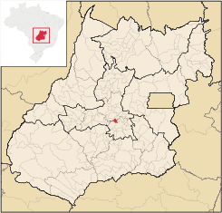
Goianira
Encyclopedia
| Goianira | |
|---|---|
| State | Goiás Goiás Goiás is a state of Brazil, located in the central part of the country. The name Goiás comes from the name of an indigenous community... |
| Area: | 200.4 km² |
| Population: | 24,110 (IBGE 2007) |
| Elevation: | 757 m above sea level |
| Postcode (CEP): | 75370-000 |
| Became a city: | 1958 |
| Distance to Goiânia Goiânia -Climate:The city has a tropical wet and dry climate with an average temperature of . There's a wet season, from October to April, and a dry one, from May to September. Annual rainfall is around 1,520 mm.... : |
32 km. |
| IBGE statistical microregion: | Goiânia Microregion Goiânia Microregion The Goiânia Microregion is a region in central Goiás state, Brazil. It includes 17 municipalities with a population of 2,032,305 in a total area of 6,848.00 km².... |
| Website: | none |
City
A city is a relatively large and permanent settlement. Although there is no agreement on how a city is distinguished from a town within general English language meanings, many cities have a particular administrative, legal, or historical status based on local law.For example, in the U.S...
and municipality
Municipality
A municipality is essentially an urban administrative division having corporate status and usually powers of self-government. It can also be used to mean the governing body of a municipality. A municipality is a general-purpose administrative subdivision, as opposed to a special-purpose district...
in central Goiás
Goiás
Goiás is a state of Brazil, located in the central part of the country. The name Goiás comes from the name of an indigenous community...
state, Brazil
Brazil
Brazil , officially the Federative Republic of Brazil , is the largest country in South America. It is the world's fifth largest country, both by geographical area and by population with over 192 million people...
, located 32 kilometers northwest of the state capital, Goiânia
Goiânia
-Climate:The city has a tropical wet and dry climate with an average temperature of . There's a wet season, from October to April, and a dry one, from May to September. Annual rainfall is around 1,520 mm....
. The population was 24,110 (2007) in a total area of 200.4 km² (10/10/2002). Goianira is becoming a major producer of shoes.
Goianira is four kilometers east of highway BR-457 / GO-415, which links Goiânia
Goiânia
-Climate:The city has a tropical wet and dry climate with an average temperature of . There's a wet season, from October to April, and a dry one, from May to September. Annual rainfall is around 1,520 mm....
to Aruanã
Aruanã
Aruanã is a small town and municipality in north-western Goiás state, Brazil. It has a total area of 3,050.3 km², with a population of 6,476 in 2007. Aruanã is a tourist spot on the Araguaia River and is a major producer of cattle.-Location:...
. It is in the Meia Ponte River
Meia Ponte River
The Meia Ponte River is one of the most important rivers in the state of Goiás, Brazil. Its source lies 60 km north of the city of Goiânia and it flows through that city in a southern direction joining the Paranaíba river just downriver of Cachoeira Dourada Dam. The Paranaíba River marks the...
valley.
Neighboring municipalities are:
- north: CaturaíCaturaíCaturaí is a small town and municipality in central Goiás state, Brazil.Caturaí is 32 kilometers north of Goiânia and belongs to the Anápolis Microregion. It is connected to the state capital by highway GO-070...
- south: GoiâniaGoiânia-Climate:The city has a tropical wet and dry climate with an average temperature of . There's a wet season, from October to April, and a dry one, from May to September. Annual rainfall is around 1,520 mm....
and TrindadeTrindade-Transportation:Trindade are linked with São Tomé and Príncipe's only highways linking to the capital city of São Tomé, another linking Neves and Santana and another linking to Guadalupe as well.... - east: Santo Antônio de GoiásSanto Antônio de GoiásSanto Antônio de Goiás is a small town and municipality in central Goiás state, Brazil, located just north of the state capital, Goiânia.*Distance from Goiânia: 42 km...
- west: AvelinópolisAvelinópolisAvelinópolis is a small town and municipality in eastern Goiás state, Brazil.-Communications and Location:The distance to the regional center of is 26 km. Highway connections from the state capital are made by state highway BR-069 west from Goiânia, through Trindade, Santa Bárbara de Goiás,...
History
Goianira began in 1920 with the name São Geraldo, founded by Padre Pelágio Sáuter. In 1935 São Geraldo became a district. In 1940 it served as a base for the construction of the new capital of the state of Goiás, and the name was changed to Itaim. This name lasted until 1942 when it was changed to Itaité. After a popular movement the name was changed back again to São Geraldo. This name lasted until 1943 when it was changed to its final name, Goianira. This name was supposedly chosen because of the name of the daughter of a popular school teacher of the town. Source: SepinPolitical Data
- Eligible voters: 16,182 (12/2007)
- Mayor: Carlos Alberto Andrade Oliveira (January 2005)
- Vice-mayor: Dirley Correa de Oliveira
- Councilmembers: 09
Economic Data
- Industrial units: 56 (06/2007)
- Retail units: 160 (08/2007)
- Banking institutions: Banco Itaú S.A. (08/2007)
- Dairies: none (07/06/2005)
- Meat packing houses: Frigorífico Centro-Oeste SP Ltda.; - Boa Vista Alimentos Ltda. (22/05/2006)
- Industrial Park: Distrito Agroindustrial - DAG (Pólo Calçadista)
Main agricultural activities (2006):
- Cattle raising: 24,000 head (2006)
- Poultry: 90,600
- Agriculture: rice (650 hectares), sugarcane (365 hectares), beans (165 hectares), and corn (900 hectares). There is modest production of coffee, coconuts, citrus fruits, and tomatoes. Statistics are from IBGE
Education (2006) and Health (2007)
- Literacy rate: 88.1%
- Infant mortality rate: 23.50 in 1,000 live births
- Schools: 14 (2006)
- Classrooms: 124
- Teachers: 277
- Students: 7,179
- Hospitals: 01 (July 2007)
- Hospital beds: 34
- Walk-in public health clinics: 12
Human Development Index
Human Development Index
The Human Development Index is a composite statistic used to rank countries by level of "human development" and separate "very high human development", "high human development", "medium human development", and "low human development" countries...
: 0.739
- State ranking: 106 out of 242 municipalities in 2000
- National ranking: 2,161 out of 5,507 municipalities in 2000
For the complete list see Frigoletto