
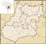
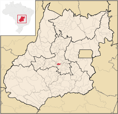
Caturaí
Encyclopedia
| Caturaí | |
|---|---|
| State | Goiás Goiás Goiás is a state of Brazil, located in the central part of the country. The name Goiás comes from the name of an indigenous community... |
| Area: | 206.0 km² |
| Population: | 4,477 (IBGE 2007) |
| Elevation: | 763m above sea level |
| Postcode (CEP): | 75430-000 |
| IBGE statistical microregion: | Anápolis Microregion Anápolis Microregion The Anápolis Microregion is a region of central Goiás state, Brazil, including municipalities surrounding the city of Anápolis. For a map see *Population: 517,221 inhabitants *Cities: 19*Total Area: 8,386.80 km²... |
| Became a city: | 1958 |
| Distance to Goiânia Goiânia -Climate:The city has a tropical wet and dry climate with an average temperature of . There's a wet season, from October to April, and a dry one, from May to September. Annual rainfall is around 1,520 mm.... : |
32 km. |
| Website: | none |
| Coordinates: | 16°26′48"S 49°29′21"W |
Town
A town is a human settlement larger than a village but smaller than a city. The size a settlement must be in order to be called a "town" varies considerably in different parts of the world, so that, for example, many American "small towns" seem to British people to be no more than villages, while...
and municipality
Municipality
A municipality is essentially an urban administrative division having corporate status and usually powers of self-government. It can also be used to mean the governing body of a municipality. A municipality is a general-purpose administrative subdivision, as opposed to a special-purpose district...
in central Goiás
Goiás
Goiás is a state of Brazil, located in the central part of the country. The name Goiás comes from the name of an indigenous community...
state, Brazil
Brazil
Brazil , officially the Federative Republic of Brazil , is the largest country in South America. It is the world's fifth largest country, both by geographical area and by population with over 192 million people...
.
Caturaí is 32 kilometers north of Goiânia
Goiânia
-Climate:The city has a tropical wet and dry climate with an average temperature of . There's a wet season, from October to April, and a dry one, from May to September. Annual rainfall is around 1,520 mm....
and belongs to the Anápolis Microregion
Anápolis Microregion
The Anápolis Microregion is a region of central Goiás state, Brazil, including municipalities surrounding the city of Anápolis. For a map see *Population: 517,221 inhabitants *Cities: 19*Total Area: 8,386.80 km²...
. It is connected to the state capital by highway GO-070. Neighboring municipalities are: Inhumas
Inhumas
Inhumas is a small city and municipality in central Goiás state, Brazil. The population was 47,361 in a total area of 613.3 km²...
, Goiânia
Goiânia
-Climate:The city has a tropical wet and dry climate with an average temperature of . There's a wet season, from October to April, and a dry one, from May to September. Annual rainfall is around 1,520 mm....
, Santa Bárbara de Goiás
Santa Bárbara de Goiás
Santa Bárbara de Goiás is a small town and municipality in eastern Goiás state, Brazil.-Location:Santa Bárbara is located due west of Goiânia. Nearby towns are Trindade , and Nazário is 25 km...
, Araçu
Araçu
Araçu is a small town and municipality in central Goiás state, Brazil.-Location:Araçu is part of the Anápolis Microregion and is a short distance northwest of the state capital, Goiânia. It has boundaries with Itaberaí, Itauçu, and Caturaí...
, Avelinópolis
Avelinópolis
Avelinópolis is a small town and municipality in eastern Goiás state, Brazil.-Communications and Location:The distance to the regional center of is 26 km. Highway connections from the state capital are made by state highway BR-069 west from Goiânia, through Trindade, Santa Bárbara de Goiás,...
, and Trindade
Trindade
-Transportation:Trindade are linked with São Tomé and Príncipe's only highways linking to the capital city of São Tomé, another linking Neves and Santana and another linking to Guadalupe as well....
.
Geography
The climate is tropical with minimum temperatures of 17 °C and maximums of 27 °C. The terrain is flat and is bathed by the Rio Peixe, which has its source in the municipality of InhumasInhumas
Inhumas is a small city and municipality in central Goiás state, Brazil. The population was 47,361 in a total area of 613.3 km²...
, and the Rio Anicuns, which forms the boundary with Avelinópolis
Avelinópolis
Avelinópolis is a small town and municipality in eastern Goiás state, Brazil.-Communications and Location:The distance to the regional center of is 26 km. Highway connections from the state capital are made by state highway BR-069 west from Goiânia, through Trindade, Santa Bárbara de Goiás,...
. The vegetation, characterised by cerrado
Cerrado
The Cerrado, is a vast tropical savanna ecoregion of Brazil, particularly in the states of Gioas and Minas Gerais...
is rich in forest and fertile lands.
Demographics
- Population density: 21.61 inhab/km² (2007)
- Population growth rate: 0.79% 1996/2007
- Population in 2007: 4,477 (3,899 in 1980)
- Urban population in 2007: 3,341 (1,553 in 1980)
- Rural population in 2007: 1,136 (2,346 in 1980)
The economy
The main economic activity is cattle raising, but there are also plantations of beans, soybeans, corn, and peanuts.- Industrial establishments: 12 (June 2007)
- Retail commerce establishments: 22 (August 2007)
- Banking establishments: none (August 2007)
Agricultural data 2006
- Farms: 325
- Total area: 14,359 ha.
- Area of permanent crops: 217 ha.
- Area of perennial crops: 1,848 ha.
- Area of natural pasture: 10,147 ha.
- Area of woodland and forests: 1,863 ha.
- Persons dependent on farming: 1,060
- Farms with tractors: 58
- Number of tractors: 75
- Cattle herd: 22,500 head IBGE
Health and education
The infant mortality rate in 2000 was 21.15. There were 03 public health clinics (SUS) in 2003. The literacy rate in 2000 was 83.2. There were 03 primary schools in 2006, with 23 classrooms, 48 teachers, and 1,482 students. Caturaí had a score of 0.728 on the Municipal Human Development IndexHuman Development Index
The Human Development Index is a composite statistic used to rank countries by level of "human development" and separate "very high human development", "high human development", "medium human development", and "low human development" countries...
, ranking it 152 (out of 242 municipalities) in the state and 2,471 (out of 5,507 municipalities) in the country.
History
The town of Caturaí was founded in 1940 by members of the Spiritualist religion near the river called Rio do Peixe in the municipality of InhumasInhumas
Inhumas is a small city and municipality in central Goiás state, Brazil. The population was 47,361 in a total area of 613.3 km²...
. A church, Centro Espírita Santo Antônia de Pádua, was built and it soon attracted more settlers who came seeking miraculous cures. The first name of the town was Santo Antônio de Pádua. Soon there were around 600 inhabitants. In 1958 it was elevated to municipal status.
See also
List of municipalities in Goiás
Sources of Data