
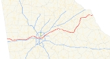
Georgia State Route 8
Encyclopedia
State Route 8 is a west–east route located in the U.S. state
of Georgia
. The route is cosigned
with either U.S. 29 or U.S. 78
for much of its entire length.
U.S. state
A U.S. state is any one of the 50 federated states of the United States of America that share sovereignty with the federal government. Because of this shared sovereignty, an American is a citizen both of the federal entity and of his or her state of domicile. Four states use the official title of...
of Georgia
Georgia (U.S. state)
Georgia is a state located in the southeastern United States. It was established in 1732, the last of the original Thirteen Colonies. The state is named after King George II of Great Britain. Georgia was the fourth state to ratify the United States Constitution, on January 2, 1788...
. The route is cosigned
Concurrency (road)
A concurrency, overlap, or coincidence in a road network is an instance of one physical road bearing two or more different highway, motorway, or other route numbers...
with either U.S. 29 or U.S. 78
U.S. Route 78
U.S. Highway 78 is an east–west United States highway that runs for 715 miles from Memphis, Tennessee, to Charleston, South Carolina. Between Memphis and Birmingham, Alabama, it is being upgraded to become Interstate 22....
for much of its entire length.
Major intersections
| County | Location | Roads intersected | Notes |
|---|---|---|---|
| Haralson Haralson County, Georgia Haralson County is a county located in the U.S. state of Georgia. It was created on January 26, 1856 and was named for Hugh A. Haralson. As of 2000, the population was 25,690. The 2007 Census Estimate shows a population of 28,718... |
Tallapoosa Tallapoosa, Georgia Tallapoosa is a city in Haralson County, Georgia, United States. The population was 2,789 at the 2000 census.-Geography:Tallapoosa, incorporated in 1860, is located in Haralson County, in northwest Georgia, about west of Atlanta, just north of Interstate 20 and east of the Alabama state line... |
SR 100 South joins SR 8/US 78 East. | |
| SR 100 South separates from SR 8/US 78 East. | |||
| Bremen Bremen, Georgia Bremen is a city in Haralson County and Carroll County, Georgia, United States. As of the 2010 census, the city had a population of 6,227.Locally the name of the city is pronounced BREE-muhn... |
Atlantic Avenue | To | |
| Temple Road | |||
| Carroll Carroll County, Georgia Carroll County is a county located in the U.S. state of Georgia. As of the 2000 census, the population was 87,268. The 2007 Census Estimate shows a population of 111,954... |
Temple Temple, Georgia Temple is a city in Carroll and Haralson Counties in the U.S. state of Georgia. The population was 2,383 at the 2000 census. Census Estimates for 2005 show a population of 3,910.-Geography:Temple is located at .... |
||
| To | |||
| Villa Rica Villa Rica, Georgia Villa Rica is a city in Carroll and Douglas Counties in the U.S. state of Georgia. The population was 4,134 at the 2000 census. By the 2010 census, the population had grown to 13,956. The estimated growth was around 211.34%... |
GA 61 North joins US 78/SR 8 East. To |
||
| GA 61 North diverges from US 78/SR 8 East. | |||
| Douglas Douglas County, Georgia Douglas County, Georgia has been experiencing numerous natural disasters over the most recent decades. Being located in the South Eastern United States the county experiences strong storms and tornadoes often because of its location in Dixie Alley.... |
Liberty Road | To | |
| Winston Winston, Georgia Winston is an unincorporated community, formerly incorporated as a city, in southwestern Douglas County, Georgia, United States.Winston is assigned the United States Postal Service ZIP code 30187.... |
Post Road | To | |
| Douglasville Douglasville, Georgia The city of Douglasville is the county seat of Douglas County, Georgia, United States. As of the 2010 census, the city had a population of 30,961... |
To SR 5 North joins US 78/SR 8 East. |
||
| Rose Avenue / Chicago Avenue | To | ||
| SR 92 East joins US 78/SR 8 East/SR 5 North. | |||
| SR 92 East leaves US 78/SR 8 East/SR 5 North. | |||
| Lithia Springs Lithia Springs, Georgia Lithia Springs is an unincorporated area, formerly incorporated as a city, located in northeastern Douglas County, Georgia, United States. As of the 2000 census, the city had a total population of 2,072. The city is named for its historic Lithia Springs springs.Incorporated in 1882, Lithia... |
US 278 East joins SR 8/US 78 East/SR 5 North. | ||
| Cobb Cobb County, Georgia Cobb County is a county located in the U.S. state of Georgia. Its county seat and largest city is Marietta, which is located in the center of the county. The county was named for Thomas Willis Cobb, who in the early 19th century was a United States representative and senator from Georgia... |
Austell Austell, Georgia Austell is a city in Cobb County in the U.S. state of Georgia. As of the 2010 census, the city had a population of 6,581.-History:Austell used to be known as Salt Springs, and was frequented by hunters who would trap and hunt game on their way to the salt licks. Some enterprising hunters claimed... |
Interchange SR 5 North leaves SR 8/US 78 East. |
|
| Mableton Mableton, Georgia Mableton is a census-designated place in Cobb County, Georgia, United States. As of the 2010 census, the CDP had a population of 37,115.It was named for Robert Mable, who in 1843 bought 300 acres of land on September 11... |
To | ||
| Fulton Fulton County, Georgia Fulton County is a county located in the U.S. state of Georgia. Its county seat is Atlanta, the state capital since 1868 and the principal county of the Atlanta metropolitan area... |
Atlanta Atlanta, Georgia Atlanta is the capital and most populous city in the U.S. state of Georgia. According to the 2010 census, Atlanta's population is 420,003. Atlanta is the cultural and economic center of the Atlanta metropolitan area, which is home to 5,268,860 people and is the ninth largest metropolitan area in... |
To Newnan Newnan, Georgia Newnan is a city in Coweta County, Georgia, about 30 miles southwest of Atlanta. The population was 16,242 at the 2000 Census. Newnan is one of the fastest growing cities in Georgia, with an estimated population of 27,097 in 2006 and 33,293 in July 2008... |
|
| Interchange | |||
| North to Smyrna; South to | |||
| US 29 North joins GA 8 East. | |||
| SR 10 East joins SR 8/US 29 North/US 78/US 278 East | |||
| US 23 North joins SR 8/US 29 North/US 78/US 278/SR 10 East. | |||
| DeKalb DeKalb County, Georgia DeKalb County is a county located in the U.S. state of Georgia. The population of the county was 691,893 at the 2010 census. Its county seat is the city of Decatur. It is bordered to the west by Fulton County and contains roughly 10% of the city of Atlanta... |
|||
| Decatur Decatur, Georgia Decatur is a city in, and county seat of, DeKalb County, Georgia, United States. With a population of 19,335 in the 2010 census, the city is sometimes assumed to be larger since multiple zip codes in unincorporated DeKalb County bear the Decatur name... |
North to Chamblee; South to Decatur | ||
| Tucker Tucker, Georgia Tucker is a census-designated place in DeKalb County, Georgia, United States. The population was 27,581 at the 2010 Census. Although central Tucker, also known as "Main Street Tucker", is laid out as a planned "railroad town," it has never been formally incorporated. Municipal services such as... |
Interchange | ||
| SR 236 West joins US 29/SR 8 North. To Stone Mountain Park |
|||
| SR 236 West leaves US 29/SR 8 North. |