
Eustis, Maine
Encyclopedia
Eustis is a town
in Franklin County
, Maine
, United States
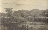
. The population was 685 at the 2000 census. Eustis, which includes the village of Stratton, is a popular recreation area.
and his troops passed through the area on October 19, 1775 on their way up the North Branch of the Dead River to fight in the ill-fated Battle of Quebec
.
Eustis was first called Township No. 1 of Range 4, West of Bingham's Kennebec Purchase. The original settler was Caleb Stevens from New Hampshire
, who brought his wife and nine children. About 1831, the northern half of the township was purchased from the state of Maine by two men, one of whom was Charles L. Eustis of Lewiston
. That same year he built a sawmill
and gristmill
. In 1840, the township was organized as Hanover Plantation, which about 1850 became part of the larger Jackson Plantation. On March 30, 1857, however, the township was set off and organized as Eustis Plantation, named after its early proprietor. Then on February 18, 1871, with a population of 342, it was officially incorporated as a town.
, the town has a total area of 41.3 square miles (107 km²), of which, 39.1 square miles (101.3 km²) of it is land and 2.2 square miles (5.7 km²) of it (5.39%) is water. Eustis is drained by the Dead River.
of 2000, there were 685 people, 302 households, and 170 families residing in the town. The population density
was 17.5 people per square mile (6.8/km²). There were 747 housing units at an average density of 19.1 per square mile (7.4/km²). The racial makeup of the town was 95.47% White, 0.44% African American, 2.04% Native American, 0.15% Asian, and 1.90% from two or more races.
There were 302 households out of which 26.2% had children under the age of 18 living with them, 44.4% were married couples
living together, 8.6% had a female householder with no husband present, and 43.4% were non-families. 32.1% of all households were made up of individuals and 11.3% had someone living alone who was 65 years of age or older. The average household size was 2.27 and the average family size was 2.90.
In the town the population was spread out with 24.4% under the age of 18, 7.6% from 18 to 24, 28.0% from 25 to 44, 26.6% from 45 to 64, and 13.4% who were 65 years of age or older. The median age was 40 years. For every 100 females there were 106.9 males. For every 100 females age 18 and over, there were 101.6 males.
The median income for a household in the town was $28,000, and the median income for a family was $35,000. Males had a median income of $27,614 versus $21,111 for females. The per capita income
for the town was $13,274. About 7.7% of families and 14.3% of the population were below the poverty line, including 10.8% of those under age 18 and 9.4% of those age 65 or over.
New England town
The New England town is the basic unit of local government in each of the six New England states. Without a direct counterpart in most other U.S. states, New England towns are conceptually similar to civil townships in other states, but are incorporated, possessing powers like cities in other...
in Franklin County
Franklin County, Maine
Franklin County is a county located in the U.S. state of Maine. As of 2010, the population was 30,768. Its county seat is Farmington.Franklin County was established on 9 May 1838.-Geography:...
, Maine
Maine
Maine is a state in the New England region of the northeastern United States, bordered by the Atlantic Ocean to the east and south, New Hampshire to the west, and the Canadian provinces of Quebec to the northwest and New Brunswick to the northeast. Maine is both the northernmost and easternmost...
, United States
United States
The United States of America is a federal constitutional republic comprising fifty states and a federal district...
. The population was 685 at the 2000 census. Eustis, which includes the village of Stratton, is a popular recreation area.
History
Benedict ArnoldBenedict Arnold
Benedict Arnold V was a general during the American Revolutionary War. He began the war in the Continental Army but later defected to the British Army. While a general on the American side, he obtained command of the fort at West Point, New York, and plotted to surrender it to the British forces...
and his troops passed through the area on October 19, 1775 on their way up the North Branch of the Dead River to fight in the ill-fated Battle of Quebec
Battle of Quebec (1775)
The Battle of Quebec was fought on December 31, 1775 between American Continental Army forces and the British defenders of the city of Quebec, early in the American Revolutionary War. The battle was the first major defeat of the war for the Americans, and it came at a high price...
.
Eustis was first called Township No. 1 of Range 4, West of Bingham's Kennebec Purchase. The original settler was Caleb Stevens from New Hampshire
New Hampshire
New Hampshire is a state in the New England region of the northeastern United States of America. The state was named after the southern English county of Hampshire. It is bordered by Massachusetts to the south, Vermont to the west, Maine and the Atlantic Ocean to the east, and the Canadian...
, who brought his wife and nine children. About 1831, the northern half of the township was purchased from the state of Maine by two men, one of whom was Charles L. Eustis of Lewiston
Lewiston, Maine
Lewiston is a city in Androscoggin County in Maine, and the second-largest city in the state. The population was 41,592 at the 2010 census. It is one of two principal cities of and included within the Lewiston-Auburn, Maine metropolitan New England city and town area and the Lewiston-Auburn, Maine...
. That same year he built a sawmill
Sawmill
A sawmill is a facility where logs are cut into boards.-Sawmill process:A sawmill's basic operation is much like those of hundreds of years ago; a log enters on one end and dimensional lumber exits on the other end....
and gristmill
Gristmill
The terms gristmill or grist mill can refer either to a building in which grain is ground into flour, or to the grinding mechanism itself.- Early history :...
. In 1840, the township was organized as Hanover Plantation, which about 1850 became part of the larger Jackson Plantation. On March 30, 1857, however, the township was set off and organized as Eustis Plantation, named after its early proprietor. Then on February 18, 1871, with a population of 342, it was officially incorporated as a town.
Geography
According to the United States Census BureauUnited States Census Bureau
The United States Census Bureau is the government agency that is responsible for the United States Census. It also gathers other national demographic and economic data...
, the town has a total area of 41.3 square miles (107 km²), of which, 39.1 square miles (101.3 km²) of it is land and 2.2 square miles (5.7 km²) of it (5.39%) is water. Eustis is drained by the Dead River.
Demographics
As of the censusCensus
A census is the procedure of systematically acquiring and recording information about the members of a given population. It is a regularly occurring and official count of a particular population. The term is used mostly in connection with national population and housing censuses; other common...
of 2000, there were 685 people, 302 households, and 170 families residing in the town. The population density
Population density
Population density is a measurement of population per unit area or unit volume. It is frequently applied to living organisms, and particularly to humans...
was 17.5 people per square mile (6.8/km²). There were 747 housing units at an average density of 19.1 per square mile (7.4/km²). The racial makeup of the town was 95.47% White, 0.44% African American, 2.04% Native American, 0.15% Asian, and 1.90% from two or more races.
There were 302 households out of which 26.2% had children under the age of 18 living with them, 44.4% were married couples
Marriage
Marriage is a social union or legal contract between people that creates kinship. It is an institution in which interpersonal relationships, usually intimate and sexual, are acknowledged in a variety of ways, depending on the culture or subculture in which it is found...
living together, 8.6% had a female householder with no husband present, and 43.4% were non-families. 32.1% of all households were made up of individuals and 11.3% had someone living alone who was 65 years of age or older. The average household size was 2.27 and the average family size was 2.90.
In the town the population was spread out with 24.4% under the age of 18, 7.6% from 18 to 24, 28.0% from 25 to 44, 26.6% from 45 to 64, and 13.4% who were 65 years of age or older. The median age was 40 years. For every 100 females there were 106.9 males. For every 100 females age 18 and over, there were 101.6 males.
The median income for a household in the town was $28,000, and the median income for a family was $35,000. Males had a median income of $27,614 versus $21,111 for females. The per capita income
Per capita income
Per capita income or income per person is a measure of mean income within an economic aggregate, such as a country or city. It is calculated by taking a measure of all sources of income in the aggregate and dividing it by the total population...
for the town was $13,274. About 7.7% of families and 14.3% of the population were below the poverty line, including 10.8% of those under age 18 and 9.4% of those age 65 or over.
Sites of interest
- Dead River Area Historical Society
- Flagstaff LakeFlagstaff Lake (Maine)Flagstaff Lake is located in Somerset County and Franklin County, Maine in the United States. The North Branch Dead River and South Branch Dead River join in the lake, forming the Dead River....