

European route E71
Encyclopedia
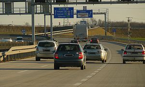
European route E 71 is a north-south Class-A intermediate European road route
. It begins in Košice
, Slovakia
, passes through Budapest
in Hungary
, Zagreb
in Croatia
and Bihać
in Bosnia and Herzegovina
, and ends at Split
in Croatia on the Adriatic Sea
coast. The total length of the route is 989 km (614.5 mi). The E71 mostly consists of motorways, but considerable sections are either expressway
s or two-lane
roads with at-grade intersection
s. Nearly all motorway sections of the E71 are tolled, using various toll collection systems including Electronic toll collection
(ETC) and ticket system
s. Individual segments of the E71 route are shared with several other European routes. The E71 section between Karlovac
and Split is inconsistently physically signposted or marked on maps and route planning software
. The E71 route has gradually been upgraded from a regular two-lane road to motorway standards since the 1970s; upgrades are still being carried out in some areas.
 The European route E71 is part of the International E-road network
, and is 989 km (614.5 mi) long, connecting parts of the Slovakia
n, Hungarian
and Croatia
n hinterland to the Adriatic
coast. The route is a Class A intermediate north-south road, mostly consisting of motorways, but also comprising two-lane roads with at-grade intersection
s. The E71 starts in Košice
, Slovakia, and proceeds south towards Milhost' and the Hungarian border along the Slovak route 68. The Slovak section of the E71 is 18 kilometres (11.2 mi) long.
The northernmost section of the E71 in Hungary connects the border crossing with Slovakia at Tornyosnémeti
, and Miskolc
. It is signposted as route 3, and this section is a two-lane road with at-grade intersections. The Tornyosnémeti–Miskolc section is concurrent
with the European route E79
. At Miskolc, the E71 switches to the M30 motorway
which takes it to Emőd
, where the E71 switches to the M3 motorway
and turns west towards Budapest
. The M3 carries the E71 route to Gödöllő
, where the E71 switches to the M31 motorway
. The M31 in turn takes the E71 to the Budapest ring motorway signposted as M0 motorway
, where the E71 is concurrent with the European routes E60
and E75
. The M0 motorway carries the E71 (along with the E60 and E75) around Budapest to its western outskirts. The M0 is interrupted in a short segment, where the Budapest ring motorway is carried by a 6 kilometres (3.7 mi) section of the M5 motorway
connecting two parts of the M0. The final leg of the E71 route in Hungary is the M7 motorway
between Érd
just to the west of Budapest, via Székesfehérvár
and Nagykanizsa to the Letenye
border crossing to Croatia
. South of Nagykanizsa, the E71 is concurrent with the European route E65
. The Hungarian section of the E71 is 495 kilometres (307.6 mi) long.
The E71 route through Croatia starts at the Zrinski Bridge
and the Goričan
border crossing at the northern terminus of the A4 motorway
near Čakovec
and reaches Ivanja Reka interchange
where it defaults to the westbound A3 motorway
and proceeds to Lučko interchange
, where the E71 switches to the A1 motorway
. In that area the E71 reaches Zagreb
and connects to the city through a number of interchanges along the Zagreb bypass
. Along the three motorways, the E71 is concurrent with the E65, and in the A3 motorway section of the E71, the route is also concurrent with the European route E70
. The E71 route diverges from the A1 motorway at Karlovac
interchange and switches to the D1 state road passing through Karlovac towards Plitvice Lakes
, switches to the D217 and reaches Ličko Petrovo Selo
/Izačić
border crossing to Bosnia and Herzegovina
. It further specifies that the E71 runs through Bihać
, Bosnia and Herzegovina and back to Croatian border, passing via Užljebić
border crossing and D218 state road to Otrić
, where the E71 rejoins the D1 state road running to Split
via Podi interchange with the A1 motorway. All the Croatian state road sections of the E71 and the E71 sections in Bosnia and Herzegovina consist of two-lane roads with at-grade intersections except for the northernmost section of the D1/E71 concurrency running through Karlovac, and the final 12 kilometres (7.5 mi) of the D1/E71 concurrency between the Podi interchange (A1 motorway) and Split, both of which are executed as expressways. Southbound E71 traffic reaching Split defaults to the D8 state road.
As of August 2011, Hrvatske autoceste and Autocesta Rijeka - Zagreb operators of the A1 motorway signposted the A1 south of Karlovac as the E71 all the way south to the Dugopolje
interchange connecting to the Podi interchange of the D1, contrary to the United Nations Economic Commission for Europe
(UNECE) specification of the route. This is also observed on roads connecting to the A1 between Karlovac and Dugopolje, as well as on large proportion of maps and major route planning software
. The E71 route through Croatia, conforming to the UNECE specification, is 448 km (278.4 mi) long, and the section in Bosnia and Herzegovina is 28 km (17.4 mi) long.
using an electronic toll collection
(ETC) system with charges differing for various categories of vehicles and length of period when the e-vignette
is valid. A notable exception is the M0 motorway which is not tolled, however some sections of the M0 do not conform to motorway standards. Croatian motorways are also generally tolled, using a ticket system
. All sections of the A1 motorway are tolled, but those A4 sections south of Sveta Helena interchange and the A3 sections concurrent with the E71 are not tolled as they are a part of the Zagreb bypass
. As of August 2011, the toll charged along the Croatian section of the E71 route between various toll plazas at each motorway exit and two mainline toll plazas, varies depending on the length of route travelled and the vehicle classification in Croatia
. The toll is payable in either Croatian kuna or euros and by major credit and debit cards. A prepaid ETC system is also used.
–Bremen
–Bremerhaven
road and assigned it to Košice–Budapest–Zagreb route. The same documents assigned the Zagreb–Bihać–Split section to the E59, as the E71 terminated in Zagreb at the time, however, the most recent revision of the E-network truncated the E59 in Zagreb, and transferred its former southern leg to the E71, extending the E71 considerably.
Since the E71 route was first defined between Košice and Zagreb, efforts were made to improve the roads connecting the two cities to Budapest. In 1970s, Hungary started construction of the M7 as its first motorway, and Zagreb–Karlovac section of the A1 motorway was completed in Croatia (within Yugoslavia at the time), representing the first sections of the present-day E71 to become a modern road traffic route, and the first modern motorways in Hungary and Croatia respectively. Subsequently, the two motorways, as well as other along the route in Croatia and Hungary, were gradually extended towards national borders, as well as to bypass capitals of the two nations—Budapest and Zagreb. Croatian and Hungarian motorways spanning the E71 route linked up in 2008.
rather than Bihać. The A1 section is even physically signposted as the E71. Likewise, there are no plans to perform any upgrades to the E71 in Bosnia and Herzegovina in existence as of 2011. Still, there are proposals to upgrade the route, possibly connecting Bihać to Zagreb via Sisak
rather than Karlovac, made from time to time in Bosnia and Herzegovina and in Croatia. The E71 route, especially its Budapest–Zagreb–Karlovac section was given further importance in June 1997 at the Pan-European Transport Conference in Helsinki
, when the section was made a part of the Pan-European Corridor Vb
, spanning Budapest and Rijeka
via Zagreb.
|-
| align=center bgcolor=#f2f2f2 | Country
| align=center bgcolor=#f2f2f2 | km
| align=center bgcolor=#f2f2f2 | Route
| align=center bgcolor=#f2f2f2 | Control
cities
| align=center bgcolor=#f2f2f2 | Connecting
routes
| align=center bgcolor=#f2f2f2 | Notes
|-
| Slovakia
| nowrap|0-18
| style="align=center | 68
| Košice
Milhost'
| 50
| The northern terminus of the segment is located at an interchange where northbound E71 traffic defaults to Južná trieda (South Avenue) in Košice, or switches to the route 50 (E58
and E571
).
The route is scheduled to be replaced by the R4 expressway by February 2013.
The northernmost segment of the E71 consisting of a regular road with at-grade intersection
s.
|-
| rowspan=8 |Hungary
| nowrap|18-75
| style="align=center | 3
| Tornyosnémeti
Miskolc
| 37
| Regular road with at-grade intersections.
|-
| nowrap|75-104
| style="align=center | M30
| Miskolc
Emőd
| 35
| The M30 motorway is concurrent
with the E71 and the E79
.
Southbound E71 traffic leaving the segment switches to the M3 motorway at exit 2.
|-
| nowrap|104-227
| style="align=center | M3
| Emőd
Gödöllő
| 21
33
| Northbound E71 traffic leaves the M3 switches to the M30 motorway at exit 151, while southbound E71 traffic leaves the M3 at exit 27.
|-
| nowrap|227-241
| style="align=center | M31
| Gödöllő
Budapest
| 3
| The entire connecting motorway route is a part of the E71, and M31 traffic leaving the motorway defaults to the M3 (northbound) and M0 (southbound) motorways, following the E71 route.
|-
| 241-264
| style="align=center | M0
| Budapest
| 4
| Budapest ring motorway
Southbound E71 switches to the M5
motorway, towards Budapest centre (exit 31), merging with European routes E60
and E75
. Northbound E71 switches to the M31 at exit 54.
|-
| 264-270
| style="align=center | M5
| Budapest
|
| The E71 follows a 6 kilometres (3.7 mi) segment of the M5 motorway connecting it to two separate segments of the M0 Budapest ring motorway. Southbound and northbound E71 traffic leave the M5 to join the M0 at exits 17 and 23 respectively.
This segment is concurrent with European routes E60 and E75.
|-
| 270-296
| style="align=center | M0
| Budapest
Érd
| 5
6
7
51
| Southbound E71 traffic leaves the segment at exit 4 towards the Lake Balaton
, while the northbound E71 leaves the segment at exit 31.
This segment is concurrent with European routes E60 and E75.
|-
| 296-513
| style="align=center | M7
| Érd
Székesfehérvár
Nagykanizsa
Letenye
| M70
7
61
62
64
65
71
74
| Northbound E71 traffic leaves the M7 at exit 15 to Budapest ring motorway (M0). Southbound E71 traffic crosses Letenye border crossing and defaults to the Croatian A4 motorway
South of exit 211 near Nagykanizsa, where Hungarian route 74 connects to the motorway, the E71 is concurrent with the European route E65
.
|-
| rowspan=5 |Croatia
| 513-611
| style="align=center | A4
| Goričan
Varaždin
Zagreb
| A12
D20
D28
D528
D530
| Northbound E71 traffic leaving this segment crosses Goričan border crossing to Hungary and defaults to the Hungarian M7 motorway. Southbound E71 leaving this segment defaults to westbound A3 motorway
in Ivanja Reka interchange (exit 12). The southern part of the segment, south of the A12
/D28 junction represents a part of the Zagreb bypass
.
The E71 is concurrent with the E65 in this segment of its route.
|-
| 611-631
| style="align=center | A3
| Zagreb
| D30
| Zagreb bypass. Northbound and southbound E71 traffic leaves the segment at Ivanja Reka
(exit 6) and Lučko
(exit 4) interchanges respectively.
The E71 is concurrent with the European routes E65 and E70
in this segment of its route.
|-
| 631-671
| style="align=center | A1
| Zagreb
Karlovac
| D310
| Southbound and northbound E71 traffic leaves this segment at Karlovac (exit 3) and Lučko (exit 1) interchanges respectively.
Conversely, the interchange and the motorway south of it are physically signposted as a part of the E71, carrying the route to Dugopolje
interchange of the A1 near Split
.
The E71 is concurrent with the E65 in this segment of its route.
|-
| 671-746
| style="align=center | D1
| Karlovac
Rakovica
| D6
| Two-lane road with at-grade intersection
s.
|-
| 746-762
| style="align=center nowrap=yes| D217
| Rakovica
Ličko Petrovo Selo
| D504
| Two-lane road with at-grade intersections.
Southbound E71 traffic leaving the segment crosses to Bosnia and Herzegovina at Ličko Petrovo Selo/Izačić
border crossing.
|-
| Bosnia and Herzegovina
| 762-790
| style="align=center | E71
E71
| Izačić
Bihać
Ripač
| E761
E761
| Two-lane road with at-grade intersections.
Northbound E71 traffic leaving the segment through Bosnia and Herzegovina crosses to Croatia at Izačić/Ličko Petrovo Selo border crossing and switches to the D217 state road. Southbound E71 traffic leaving the segment crosses to Croatia at the Užljebić-Ripač border crossing and switches to D218 moving the E71 route again towards the Croatian D1 state road.
|-
| rowspan=2|Croatia
| 790-859
| style="align=center | D218
| Užljebić
Otrić
| D506
| Two-lane road with at-grade intersections.
Northbound E71 traffic leaving the segment crosses to Bosnia and Herzegovina at Užljebić border crossing. Southbound E71 traffic leaving the segment rejoins the Croatian D1 state road at Otrić.
|-
| 859-989
| style="align=center | D1
| Otrić
Split
| A1
D8
D33
D60
| The southernmost segment of the E71. Southbound E71 traffic switches to the D8 in the city of Split
. The segment north of Podi interchange near Dugopolje
is not physically signposted as the E71, rather the designation is found along the A1 motorway
north of the Dugopolje interchange. Road north of the Podi interchange is a two-lane road with at-grade intersections, and south of it, there is a 12 kilometres (7.5 mi) expressway
connecting the A1 motorway and the city of Split.
International E-road network
The international E-road network is a numbering system for roads in Europe developed by the United Nations Economic Commission for Europe . The network is numbered from E 1 up and its roads cross national borders...
. It begins in Košice
Košice
Košice is a city in eastern Slovakia. It is situated on the river Hornád at the eastern reaches of the Slovak Ore Mountains, near the border with Hungary...
, Slovakia
Slovakia
The Slovak Republic is a landlocked state in Central Europe. It has a population of over five million and an area of about . Slovakia is bordered by the Czech Republic and Austria to the west, Poland to the north, Ukraine to the east and Hungary to the south...
, passes through Budapest
Budapest
Budapest is the capital of Hungary. As the largest city of Hungary, it is the country's principal political, cultural, commercial, industrial, and transportation centre. In 2011, Budapest had 1,733,685 inhabitants, down from its 1989 peak of 2,113,645 due to suburbanization. The Budapest Commuter...
in Hungary
Hungary
Hungary , officially the Republic of Hungary , is a landlocked country in Central Europe. It is situated in the Carpathian Basin and is bordered by Slovakia to the north, Ukraine and Romania to the east, Serbia and Croatia to the south, Slovenia to the southwest and Austria to the west. The...
, Zagreb
Zagreb
Zagreb is the capital and the largest city of the Republic of Croatia. It is in the northwest of the country, along the Sava river, at the southern slopes of the Medvednica mountain. Zagreb lies at an elevation of approximately above sea level. According to the last official census, Zagreb's city...
in Croatia
Croatia
Croatia , officially the Republic of Croatia , is a unitary democratic parliamentary republic in Europe at the crossroads of the Mitteleuropa, the Balkans, and the Mediterranean. Its capital and largest city is Zagreb. The country is divided into 20 counties and the city of Zagreb. Croatia covers ...
and Bihać
Bihac
Bihać is a city and municipality on the river Una in the north-western part of Bosnia and Herzegovina, in the Bosanska Krajina region. Bihać is located in the Una-Sana Canton in the Federation of Bosnia and Herzegovina.-History:...
in Bosnia and Herzegovina
Bosnia and Herzegovina
Bosnia and Herzegovina , sometimes called Bosnia-Herzegovina or simply Bosnia, is a country in Southern Europe, on the Balkan Peninsula. Bordered by Croatia to the north, west and south, Serbia to the east, and Montenegro to the southeast, Bosnia and Herzegovina is almost landlocked, except for the...
, and ends at Split
Split (city)
Split is a Mediterranean city on the eastern shores of the Adriatic Sea, centered around the ancient Roman Palace of the Emperor Diocletian and its wide port bay. With a population of 178,192 citizens, and a metropolitan area numbering up to 467,899, Split is by far the largest Dalmatian city and...
in Croatia on the Adriatic Sea
Adriatic Sea
The Adriatic Sea is a body of water separating the Italian Peninsula from the Balkan peninsula, and the system of the Apennine Mountains from that of the Dinaric Alps and adjacent ranges...
coast. The total length of the route is 989 km (614.5 mi). The E71 mostly consists of motorways, but considerable sections are either expressway
Limited-access road
A limited-access road known by various terms worldwide, including limited-access highway, dual-carriageway and expressway, is a highway or arterial road for high-speed traffic which has many or most characteristics of a controlled-access highway , including limited or no access to adjacent...
s or two-lane
Lane
A lane is a part of the roadway within a road marked out for use by a single line of vehicles in such a way as to control and guide drivers for the purpose of reducing traffic conflicts. Most public roads have at least two lanes, one for traffic in each direction, separated by Lane markings...
roads with at-grade intersection
At-grade intersection
An at-grade intersection is a junction at which two or more transport axes cross at the same level .-Traffic management:With areas of high or fast traffic, an at-grade intersection normally requires a traffic control device such as a stop sign, traffic light or railway signal to manage conflicting...
s. Nearly all motorway sections of the E71 are tolled, using various toll collection systems including Electronic toll collection
Electronic toll collection
Electronic toll collection , an adaptation of military "identification friend or foe" technology, aims to eliminate the delay on toll roads by collecting tolls electronically. It is thus a technological implementation of a road pricing concept...
(ETC) and ticket system
Ticket system
A ticket system toll road A ticket system toll road A ticket system toll road (also known as closed toll collection system, as opposed to a flat-rate toll road, is utilized by some state toll road or highway agencies that allows a motorist to pay a toll rate based on the number of miles traveled...
s. Individual segments of the E71 route are shared with several other European routes. The E71 section between Karlovac
Karlovac
Karlovac is a city and municipality in central Croatia. The city proper has a population of 49,082, while the municipality has a population of 59,395 inhabitants .Karlovac is the administrative centre of Karlovac County...
and Split is inconsistently physically signposted or marked on maps and route planning software
Route planning software
Route planning software is a computer software programme, designed to plan a route between two geographical locations using a journey planning engine, typically specialised for road networks as a road route planner. It can typically provide a list of places one will pass by, with crossroads and...
. The E71 route has gradually been upgraded from a regular two-lane road to motorway standards since the 1970s; upgrades are still being carried out in some areas.
Route description
International E-road network
The international E-road network is a numbering system for roads in Europe developed by the United Nations Economic Commission for Europe . The network is numbered from E 1 up and its roads cross national borders...
, and is 989 km (614.5 mi) long, connecting parts of the Slovakia
Slovakia
The Slovak Republic is a landlocked state in Central Europe. It has a population of over five million and an area of about . Slovakia is bordered by the Czech Republic and Austria to the west, Poland to the north, Ukraine to the east and Hungary to the south...
n, Hungarian
Hungary
Hungary , officially the Republic of Hungary , is a landlocked country in Central Europe. It is situated in the Carpathian Basin and is bordered by Slovakia to the north, Ukraine and Romania to the east, Serbia and Croatia to the south, Slovenia to the southwest and Austria to the west. The...
and Croatia
Croatia
Croatia , officially the Republic of Croatia , is a unitary democratic parliamentary republic in Europe at the crossroads of the Mitteleuropa, the Balkans, and the Mediterranean. Its capital and largest city is Zagreb. The country is divided into 20 counties and the city of Zagreb. Croatia covers ...
n hinterland to the Adriatic
Adriatic Sea
The Adriatic Sea is a body of water separating the Italian Peninsula from the Balkan peninsula, and the system of the Apennine Mountains from that of the Dinaric Alps and adjacent ranges...
coast. The route is a Class A intermediate north-south road, mostly consisting of motorways, but also comprising two-lane roads with at-grade intersection
At-grade intersection
An at-grade intersection is a junction at which two or more transport axes cross at the same level .-Traffic management:With areas of high or fast traffic, an at-grade intersection normally requires a traffic control device such as a stop sign, traffic light or railway signal to manage conflicting...
s. The E71 starts in Košice
Košice
Košice is a city in eastern Slovakia. It is situated on the river Hornád at the eastern reaches of the Slovak Ore Mountains, near the border with Hungary...
, Slovakia, and proceeds south towards Milhost' and the Hungarian border along the Slovak route 68. The Slovak section of the E71 is 18 kilometres (11.2 mi) long.
The northernmost section of the E71 in Hungary connects the border crossing with Slovakia at Tornyosnémeti
Tornyosnémeti
Tornyosnémeti is a village in Borsod-Abaúj-Zemplén County in northeastern Hungary.-References:...
, and Miskolc
Miskolc
Miskolc is a city in northeastern Hungary, mainly with heavy industrial background. With a population close to 170,000 Miskolc is the fourth largest city of Hungary It is also the county capital of Borsod-Abaúj-Zemplén and the regional centre of Northern Hungary.- Geography :Miskolc is located...
. It is signposted as route 3, and this section is a two-lane road with at-grade intersections. The Tornyosnémeti–Miskolc section is concurrent
Concurrency (road)
A concurrency, overlap, or coincidence in a road network is an instance of one physical road bearing two or more different highway, motorway, or other route numbers...
with the European route E79
European route E79
European route E 79 is a road part of the International E-road network. It begins in Miskolc, Hungary and ends in Thessaloniki, Greece, also running through Romania and Bulgaria...
. At Miskolc, the E71 switches to the M30 motorway
M30 motorway (Hungary)
The M30 is a Hungarian motorway that connects the M3 to Miskolc. It follows the route of the 3 one-lane highway. It was opened to the public on December 2, 2004....
which takes it to Emőd
Emod
Emőd is a small town in Borsod-Abaúj-Zemplén county, Northern Hungary, 25 kilometers from county capital Miskolc.-History:The area has been inhabited since the Conquest of Hungary. Its name comes from an old Hungarian personal name. The town was first mentioned by Anonymus. Emőd has been a...
, where the E71 switches to the M3 motorway
M3 motorway (Hungary)
The M3 is a Hungarian motorway connecting Budapest to Nyíregyháza. It will eventually connect Budapest to the Ukrainian border. Two other motorways branch off it, the M30 and the M35 . The M3 follows the route of route 3, and, later, route 4...
and turns west towards Budapest
Budapest
Budapest is the capital of Hungary. As the largest city of Hungary, it is the country's principal political, cultural, commercial, industrial, and transportation centre. In 2011, Budapest had 1,733,685 inhabitants, down from its 1989 peak of 2,113,645 due to suburbanization. The Budapest Commuter...
. The M3 carries the E71 route to Gödöllő
Gödöllo
Gödöllő is a town situated in Pest county, Budapest metropolitan area, Hungary, about northeast from the outskirts of Budapest. Its population is about 31,000 according to the 2001 census. It can be easily reached from Budapest with the suburban railway . Gödöllő is home to the Szent István...
, where the E71 switches to the M31 motorway
M31 motorway (Hungary)
The M31 motorway is a motorway in Hungary. The motorway is between M0 at Nagytarcsa and M3 at Gödöllő and has been completed in July 2010.-External links:*...
. The M31 in turn takes the E71 to the Budapest ring motorway signposted as M0 motorway
M0 motorway (Hungary)
The M0 motorway is a ringroad around Budapest, the capital of Hungary. The ring presently connects motorways M1, M7, M6, M5, M4, M3, M2, connecting currently to Highway 11. The southern section of the ringroad currently does not comply with formal motorway specifications. The whole length of the...
, where the E71 is concurrent with the European routes E60
European route E60
European route E 60 is a E-road running from Brest, France , to Irkeshtam, Kyrgyzstan...
and E75
European route E75
European route E 75 is part of the International E-road network, which is a series of main roads in Europe.The E 75 starts from Vardø, Norway in the Barents Sea and runs south through Finland, Poland, Czech Republic, Slovakia, Hungary, Serbia and Republic of Macedonia to Sitia, Greece on...
. The M0 motorway carries the E71 (along with the E60 and E75) around Budapest to its western outskirts. The M0 is interrupted in a short segment, where the Budapest ring motorway is carried by a 6 kilometres (3.7 mi) section of the M5 motorway
M5 motorway (Hungary)
The 108 mile long M5 motorway connects Budapest, the capital city of Hungary with the south-eastern regions of the country, the cities of Kecskemét, Szeged, and finally Röszke on the Serbian border...
connecting two parts of the M0. The final leg of the E71 route in Hungary is the M7 motorway
M7 motorway (Hungary)
The M7 motorway is a Hungarian motorway which runs from Budapest towards the Croatian border at Letenye, reaching Székesfehérvár, then Siófok, a town on Lake Balaton, and the city of Nagykanizsa in the southwest of the country....
between Érd
Érd
Érd is city and urban county in Pest county, Budapest metropolitan area, Hungary.-History:The area has been inhabited since ancient times. Archaeological findings indicate that prehistoric men lived here 50,000 years ago....
just to the west of Budapest, via Székesfehérvár
Székesfehérvár
Székesfehérvár is a city in central Hungary and is the 9th largest in the country. Located around southwest of Budapest. It is inhabited by 101,973 people , with 136,995 in the Székesfehérvár Subregion. The city is the centre of Fejér county and the regional centre of Central Transdanubia...
and Nagykanizsa to the Letenye
Letenye
Letenye is a town in Zala County, Hungary, on the border with Croatia. Across the border is the town of Goričan. Letenye was elevated to town status in 1989.-History:...
border crossing to Croatia
Croatia
Croatia , officially the Republic of Croatia , is a unitary democratic parliamentary republic in Europe at the crossroads of the Mitteleuropa, the Balkans, and the Mediterranean. Its capital and largest city is Zagreb. The country is divided into 20 counties and the city of Zagreb. Croatia covers ...
. South of Nagykanizsa, the E71 is concurrent with the European route E65
European route E65
European route E 65 is a north-south Class-A European route that begins in Malmö, Sweden and ends in Chaniá, Greece. The road is about in length.-Itinerary:* Sweden** E 65: Malmö – Ystad* Baltic sea, ferry Ystad-Świnoujście* Poland...
. The Hungarian section of the E71 is 495 kilometres (307.6 mi) long.
The E71 route through Croatia starts at the Zrinski Bridge
Zrinski Bridge
The Zrinski Bridge or Zrínyi Bridge connects the Croatian A4 and the Hungarian M7 motorways, spanning the Mura River. As it also spans Hungarian–Croatian border, a joint border checkpoint is located north of the bridge. The bridge is located between Goričan interchange of the A4 motorway and...
and the Goričan
Gorican
Goričan is a municipality in Međimurje County, Croatia.Goričan is the only village belonging to the municipality. Its population in the 2001 census was 3,148. Of the entire population, 3,088 people identified themselves as Croats....
border crossing at the northern terminus of the A4 motorway
A4 (Croatia)
The A4 motorway is a motorway in Croatia spanning . It connects the nation's capital, Zagreb, to the city of Varaždin and to Budapest, Hungary via the Goričan border crossing. The motorway represents a major north–south transportation corridor in Croatia and is a part of European routes E65...
near Čakovec
Cakovec
Čakovec is a city in northern Croatia, located around 90 kilometres north of Zagreb, the Croatian capital. Čakovec is both the county seat and largest city of Međimurje County, the northernmost, smallest and most densely populated Croatian county.-Population:...
and reaches Ivanja Reka interchange
Ivanja Reka interchange
The Ivanja Reka interchange is a cloverleaf interchange east of Zagreb, Croatia. The interchange represents the southern terminus of the A4 motorway and it connects the A4 route to the A3 motorway representing major a link in the Croatian motorway system. The interchange is a part of Pan-European...
where it defaults to the westbound A3 motorway
A3 (Croatia)
The A3 motorway is a major motorway in Croatia spanning . The motorway connects Zagreb, the nation's capital, to the Slavonia region and a number of cities along the Sava River. It represents a major east–west transportation corridor in Croatia and a significant part of the Pan-European Corridor...
and proceeds to Lučko interchange
Lučko interchange
The Lučko interchange is a stack interchange in Zagreb, Croatia. It is named after nearby Zagreb neighborhood of Lučko. The interchange represents the northern terminus of the A1 motorway and it connects the A1 route to the A3 motorway between Jankomir interchange and Buzin exit, also representing...
, where the E71 switches to the A1 motorway
A1 (Croatia)
The A1 motorway is the longest motorway in Croatia spanning . As it connects Zagreb, the nation's capital, to Split, the second largest city in the country and the largest city in Dalmatia, the motorway represents a major north–south transportation corridor in Croatia and a significant part of the...
. In that area the E71 reaches Zagreb
Zagreb
Zagreb is the capital and the largest city of the Republic of Croatia. It is in the northwest of the country, along the Sava river, at the southern slopes of the Medvednica mountain. Zagreb lies at an elevation of approximately above sea level. According to the last official census, Zagreb's city...
and connects to the city through a number of interchanges along the Zagreb bypass
Zagreb bypass
Zagreb bypass , is an U-shaped motorway partially encircling Zagreb, Croatia. The largest part by far, between Jankomir and Ivanja Reka interchanges, has been built between 1977 and 1979, while Ivanja Reka - Sveta Helena section has been built between 1996 and 1999. The bypass is long, tracing...
. Along the three motorways, the E71 is concurrent with the E65, and in the A3 motorway section of the E71, the route is also concurrent with the European route E70
European route E70
European route E 70 is an A-Class West-East European route, extending from A Coruña in Spain in the west to the Georgian city of Poti in the east.-Itinerary:...
. The E71 route diverges from the A1 motorway at Karlovac
Karlovac
Karlovac is a city and municipality in central Croatia. The city proper has a population of 49,082, while the municipality has a population of 59,395 inhabitants .Karlovac is the administrative centre of Karlovac County...
interchange and switches to the D1 state road passing through Karlovac towards Plitvice Lakes
Plitvice Lakes
Plitvice Lakes National Park is the oldest national park in Southeast Europe and the largest national park in Croatia. The national park was founded in 1949 and is situated in the mountainous karst area of central Croatia, at the border to Bosnia and Herzegovina...
, switches to the D217 and reaches Ličko Petrovo Selo
Ličko Petrovo Selo
Ličko Petrovo Selo is a village in Lika, Croatia. It is located near the Plitvice Lakes. The road bypassing the national park, the D504, connects it to the D1 highway. East of the village, the D217 ends at the Ličko Petrovo Selo border crossing with Bosnia and Herzegovina ....
/Izačić
Izačić
Izačić is a village in the municipality of Bihać, Bosnia and Herzegovina. Its population is a mix of the various Balkan states that border this region.-References:...
border crossing to Bosnia and Herzegovina
Bosnia and Herzegovina
Bosnia and Herzegovina , sometimes called Bosnia-Herzegovina or simply Bosnia, is a country in Southern Europe, on the Balkan Peninsula. Bordered by Croatia to the north, west and south, Serbia to the east, and Montenegro to the southeast, Bosnia and Herzegovina is almost landlocked, except for the...
. It further specifies that the E71 runs through Bihać
Bihac
Bihać is a city and municipality on the river Una in the north-western part of Bosnia and Herzegovina, in the Bosanska Krajina region. Bihać is located in the Una-Sana Canton in the Federation of Bosnia and Herzegovina.-History:...
, Bosnia and Herzegovina and back to Croatian border, passing via Užljebić
Užljebić
Užljebić is a hamlet in Croatia, located on the border with Bosnia and Herzegovina near Ripač. It is a border crossing and the endpoint of the D218 highway...
border crossing and D218 state road to Otrić
Otrić
Otrić is a village in Croatia. It is connected by the D1 highway....
, where the E71 rejoins the D1 state road running to Split
Split (city)
Split is a Mediterranean city on the eastern shores of the Adriatic Sea, centered around the ancient Roman Palace of the Emperor Diocletian and its wide port bay. With a population of 178,192 citizens, and a metropolitan area numbering up to 467,899, Split is by far the largest Dalmatian city and...
via Podi interchange with the A1 motorway. All the Croatian state road sections of the E71 and the E71 sections in Bosnia and Herzegovina consist of two-lane roads with at-grade intersections except for the northernmost section of the D1/E71 concurrency running through Karlovac, and the final 12 kilometres (7.5 mi) of the D1/E71 concurrency between the Podi interchange (A1 motorway) and Split, both of which are executed as expressways. Southbound E71 traffic reaching Split defaults to the D8 state road.
As of August 2011, Hrvatske autoceste and Autocesta Rijeka - Zagreb operators of the A1 motorway signposted the A1 south of Karlovac as the E71 all the way south to the Dugopolje
Dugopolje
Dugopolje is a highly developed municipality in Croatia in the Split-Dalmatia county. It has a population of over 3500, 99.5% which are Croats. Noted in Dugopolje is a vranjaca, or cave. The city of Split, where considerable early history is centred, is located 15 km from Dugopolje...
interchange connecting to the Podi interchange of the D1, contrary to the United Nations Economic Commission for Europe
United Nations Economic Commission for Europe
The United Nations Economic Commission for Europe was established in 1947 to encourage economic cooperation among its member states. It is one of five regional commissions under the administrative direction of United Nations headquarters. It has 56 member states, and reports to the UN Economic and...
(UNECE) specification of the route. This is also observed on roads connecting to the A1 between Karlovac and Dugopolje, as well as on large proportion of maps and major route planning software
Route planning software
Route planning software is a computer software programme, designed to plan a route between two geographical locations using a journey planning engine, typically specialised for road networks as a road route planner. It can typically provide a list of places one will pass by, with crossroads and...
. The E71 route through Croatia, conforming to the UNECE specification, is 448 km (278.4 mi) long, and the section in Bosnia and Herzegovina is 28 km (17.4 mi) long.
Toll
Various sections of the E71 are tolled, using a range of toll collection systems. Motorways in Hungary are tolledToll road
A toll road is a privately or publicly built road for which a driver pays a toll for use. Structures for which tolls are charged include toll bridges and toll tunnels. Non-toll roads are financed using other sources of revenue, most typically fuel tax or general tax funds...
using an electronic toll collection
Electronic toll collection
Electronic toll collection , an adaptation of military "identification friend or foe" technology, aims to eliminate the delay on toll roads by collecting tolls electronically. It is thus a technological implementation of a road pricing concept...
(ETC) system with charges differing for various categories of vehicles and length of period when the e-vignette
Vignette (road tax)
A road tax vignette is a form of tax on vehicles, used in several non-English speaking European countries. The term is of French origin, and is now used throughout Central Europe....
is valid. A notable exception is the M0 motorway which is not tolled, however some sections of the M0 do not conform to motorway standards. Croatian motorways are also generally tolled, using a ticket system
Ticket system
A ticket system toll road A ticket system toll road A ticket system toll road (also known as closed toll collection system, as opposed to a flat-rate toll road, is utilized by some state toll road or highway agencies that allows a motorist to pay a toll rate based on the number of miles traveled...
. All sections of the A1 motorway are tolled, but those A4 sections south of Sveta Helena interchange and the A3 sections concurrent with the E71 are not tolled as they are a part of the Zagreb bypass
Zagreb bypass
Zagreb bypass , is an U-shaped motorway partially encircling Zagreb, Croatia. The largest part by far, between Jankomir and Ivanja Reka interchanges, has been built between 1977 and 1979, while Ivanja Reka - Sveta Helena section has been built between 1996 and 1999. The bypass is long, tracing...
. As of August 2011, the toll charged along the Croatian section of the E71 route between various toll plazas at each motorway exit and two mainline toll plazas, varies depending on the length of route travelled and the vehicle classification in Croatia
Vehicle classification in Croatia
There are two forms of vehicle classification in Croatia. Vehicles are classified by categories in the driving license and by categories for toll highways.- Driving license classification :- Toll categories :...
. The toll is payable in either Croatian kuna or euros and by major credit and debit cards. A prepaid ETC system is also used.
History
UNECE was formed in 1947, and their first major act to improve transportation was a joint UN declaration no. 1264, the Declaration on the Construction of Main International Traffic Arteries, signed in Geneva on September 16, 1950, which defined the first E-road network. This declaration was amended several times before November 15, 1975, when it was replaced by the European Agreement on Main International Traffic Arteries or "AGR", which set up a route numbering system and improved standards for roads in the list. The AGR went through several changes, with the last one, as of 2011, in 2008. Reorganization of the E-roads network of 1975 and 1983 redefined the E71 designation previously associated with HanoverHanover
Hanover or Hannover, on the river Leine, is the capital of the federal state of Lower Saxony , Germany and was once by personal union the family seat of the Hanoverian Kings of Great Britain, under their title as the dukes of Brunswick-Lüneburg...
–Bremen
Bremen
The City Municipality of Bremen is a Hanseatic city in northwestern Germany. A commercial and industrial city with a major port on the river Weser, Bremen is part of the Bremen-Oldenburg metropolitan area . Bremen is the second most populous city in North Germany and tenth in Germany.Bremen is...
–Bremerhaven
Bremerhaven
Bremerhaven is a city at the seaport of the free city-state of Bremen, a state of the Federal Republic of Germany. It forms an enclave in the state of Lower Saxony and is located at the mouth of the River Weser on its eastern bank, opposite the town of Nordenham...
road and assigned it to Košice–Budapest–Zagreb route. The same documents assigned the Zagreb–Bihać–Split section to the E59, as the E71 terminated in Zagreb at the time, however, the most recent revision of the E-network truncated the E59 in Zagreb, and transferred its former southern leg to the E71, extending the E71 considerably.
Since the E71 route was first defined between Košice and Zagreb, efforts were made to improve the roads connecting the two cities to Budapest. In 1970s, Hungary started construction of the M7 as its first motorway, and Zagreb–Karlovac section of the A1 motorway was completed in Croatia (within Yugoslavia at the time), representing the first sections of the present-day E71 to become a modern road traffic route, and the first modern motorways in Hungary and Croatia respectively. Subsequently, the two motorways, as well as other along the route in Croatia and Hungary, were gradually extended towards national borders, as well as to bypass capitals of the two nations—Budapest and Zagreb. Croatian and Hungarian motorways spanning the E71 route linked up in 2008.
Planned development
Currently, the E71 section in Slovakia now signposted as the route 68 is being upgraded to an expressway already designated as R4 expressway, while the Hungarian M30 motorway is scheduled to be extended north to the Slovak border. As of August 2011, the R4 expressway is scheduled to be completed by February 2013. As of August 2011, the Croatian section of the E71 south of Karlovac is not planned to be upgraded substantially as there already is the A1 motorway running parallel to the designated E71 route via ZadarZadar
Zadar is a city in Croatia on the Adriatic Sea. It is the centre of Zadar county and the wider northern Dalmatian region. Population of the city is 75,082 citizens...
rather than Bihać. The A1 section is even physically signposted as the E71. Likewise, there are no plans to perform any upgrades to the E71 in Bosnia and Herzegovina in existence as of 2011. Still, there are proposals to upgrade the route, possibly connecting Bihać to Zagreb via Sisak
Sisak
Sisak is a city in central Croatia. The city's population in 2011 was 33,049, with a total of 49,699 in the administrative region and it is also the administrative centre of the Sisak-Moslavina county...
rather than Karlovac, made from time to time in Bosnia and Herzegovina and in Croatia. The E71 route, especially its Budapest–Zagreb–Karlovac section was given further importance in June 1997 at the Pan-European Transport Conference in Helsinki
Helsinki
Helsinki is the capital and largest city in Finland. It is in the region of Uusimaa, located in southern Finland, on the shore of the Gulf of Finland, an arm of the Baltic Sea. The population of the city of Helsinki is , making it by far the most populous municipality in Finland. Helsinki is...
, when the section was made a part of the Pan-European Corridor Vb
Pan-European corridors
The ten Pan-European transport corridors were defined at the second Pan-European transport Conference in Crete, March 1994, as routes in Central and Eastern Europe that required major investment over the next ten to fifteen years. Additions were made at the third conference in Helsinki in 1997...
, spanning Budapest and Rijeka
Rijeka
Rijeka is the principal seaport and the third largest city in Croatia . It is located on Kvarner Bay, an inlet of the Adriatic Sea and has a population of 128,735 inhabitants...
via Zagreb.
Concurrencies
{| class="wikitable"|-
| align=center bgcolor=#f2f2f2 | Country
| align=center bgcolor=#f2f2f2 | km
| align=center bgcolor=#f2f2f2 | Route
| align=center bgcolor=#f2f2f2 | Control
cities
| align=center bgcolor=#f2f2f2 | Connecting
routes
| align=center bgcolor=#f2f2f2 | Notes
|-
| Slovakia
Slovakia
The Slovak Republic is a landlocked state in Central Europe. It has a population of over five million and an area of about . Slovakia is bordered by the Czech Republic and Austria to the west, Poland to the north, Ukraine to the east and Hungary to the south...
| nowrap|0-18
| style="align=center | 68
| Košice
Košice
Košice is a city in eastern Slovakia. It is situated on the river Hornád at the eastern reaches of the Slovak Ore Mountains, near the border with Hungary...
Milhost'
| 50
| The northern terminus of the segment is located at an interchange where northbound E71 traffic defaults to Južná trieda (South Avenue) in Košice, or switches to the route 50 (E58
European route E58
European route E 58 is a road part of the International E-road network. It begins in Vienna, Austria and ends in Rostov-na-Donu, Russia....
and E571
European route E571
European route E 571 is a Class B road part of the International E-road network. It runs only through Slovakia on the southern route from Bratislava to Košice.Route: Bratislava - Nitra - Zvolen - Košice...
).
The route is scheduled to be replaced by the R4 expressway by February 2013.
The northernmost segment of the E71 consisting of a regular road with at-grade intersection
At-grade intersection
An at-grade intersection is a junction at which two or more transport axes cross at the same level .-Traffic management:With areas of high or fast traffic, an at-grade intersection normally requires a traffic control device such as a stop sign, traffic light or railway signal to manage conflicting...
s.
|-
| rowspan=8 |Hungary
Hungary
Hungary , officially the Republic of Hungary , is a landlocked country in Central Europe. It is situated in the Carpathian Basin and is bordered by Slovakia to the north, Ukraine and Romania to the east, Serbia and Croatia to the south, Slovenia to the southwest and Austria to the west. The...
| nowrap|18-75
| style="align=center | 3
| Tornyosnémeti
Miskolc
Miskolc
Miskolc is a city in northeastern Hungary, mainly with heavy industrial background. With a population close to 170,000 Miskolc is the fourth largest city of Hungary It is also the county capital of Borsod-Abaúj-Zemplén and the regional centre of Northern Hungary.- Geography :Miskolc is located...
| 37
| Regular road with at-grade intersections.
|-
| nowrap|75-104
| style="align=center | M30
M30 motorway (Hungary)
The M30 is a Hungarian motorway that connects the M3 to Miskolc. It follows the route of the 3 one-lane highway. It was opened to the public on December 2, 2004....
| Miskolc
Emőd
Emod
Emőd is a small town in Borsod-Abaúj-Zemplén county, Northern Hungary, 25 kilometers from county capital Miskolc.-History:The area has been inhabited since the Conquest of Hungary. Its name comes from an old Hungarian personal name. The town was first mentioned by Anonymus. Emőd has been a...
| 35
| The M30 motorway is concurrent
Concurrency (road)
A concurrency, overlap, or coincidence in a road network is an instance of one physical road bearing two or more different highway, motorway, or other route numbers...
with the E71 and the E79
European route E79
European route E 79 is a road part of the International E-road network. It begins in Miskolc, Hungary and ends in Thessaloniki, Greece, also running through Romania and Bulgaria...
.
Southbound E71 traffic leaving the segment switches to the M3 motorway at exit 2.
|-
| nowrap|104-227
| style="align=center | M3
M3 motorway (Hungary)
The M3 is a Hungarian motorway connecting Budapest to Nyíregyháza. It will eventually connect Budapest to the Ukrainian border. Two other motorways branch off it, the M30 and the M35 . The M3 follows the route of route 3, and, later, route 4...
| Emőd
Gödöllő
Gödöllo
Gödöllő is a town situated in Pest county, Budapest metropolitan area, Hungary, about northeast from the outskirts of Budapest. Its population is about 31,000 according to the 2001 census. It can be easily reached from Budapest with the suburban railway . Gödöllő is home to the Szent István...
| 21
33
| Northbound E71 traffic leaves the M3 switches to the M30 motorway at exit 151, while southbound E71 traffic leaves the M3 at exit 27.
|-
| nowrap|227-241
| style="align=center | M31
M31 motorway (Hungary)
The M31 motorway is a motorway in Hungary. The motorway is between M0 at Nagytarcsa and M3 at Gödöllő and has been completed in July 2010.-External links:*...
| Gödöllő
Budapest
Budapest
Budapest is the capital of Hungary. As the largest city of Hungary, it is the country's principal political, cultural, commercial, industrial, and transportation centre. In 2011, Budapest had 1,733,685 inhabitants, down from its 1989 peak of 2,113,645 due to suburbanization. The Budapest Commuter...
| 3
| The entire connecting motorway route is a part of the E71, and M31 traffic leaving the motorway defaults to the M3 (northbound) and M0 (southbound) motorways, following the E71 route.
|-
| 241-264
| style="align=center | M0
M0 motorway (Hungary)
The M0 motorway is a ringroad around Budapest, the capital of Hungary. The ring presently connects motorways M1, M7, M6, M5, M4, M3, M2, connecting currently to Highway 11. The southern section of the ringroad currently does not comply with formal motorway specifications. The whole length of the...
| Budapest
| 4
| Budapest ring motorway
Southbound E71 switches to the M5
M5 motorway (Hungary)
The 108 mile long M5 motorway connects Budapest, the capital city of Hungary with the south-eastern regions of the country, the cities of Kecskemét, Szeged, and finally Röszke on the Serbian border...
motorway, towards Budapest centre (exit 31), merging with European routes E60
European route E60
European route E 60 is a E-road running from Brest, France , to Irkeshtam, Kyrgyzstan...
and E75
European route E75
European route E 75 is part of the International E-road network, which is a series of main roads in Europe.The E 75 starts from Vardø, Norway in the Barents Sea and runs south through Finland, Poland, Czech Republic, Slovakia, Hungary, Serbia and Republic of Macedonia to Sitia, Greece on...
. Northbound E71 switches to the M31 at exit 54.
|-
| 264-270
| style="align=center | M5
M5 motorway (Hungary)
The 108 mile long M5 motorway connects Budapest, the capital city of Hungary with the south-eastern regions of the country, the cities of Kecskemét, Szeged, and finally Röszke on the Serbian border...
| Budapest
|
| The E71 follows a 6 kilometres (3.7 mi) segment of the M5 motorway connecting it to two separate segments of the M0 Budapest ring motorway. Southbound and northbound E71 traffic leave the M5 to join the M0 at exits 17 and 23 respectively.
This segment is concurrent with European routes E60 and E75.
|-
| 270-296
| style="align=center | M0
M0 motorway (Hungary)
The M0 motorway is a ringroad around Budapest, the capital of Hungary. The ring presently connects motorways M1, M7, M6, M5, M4, M3, M2, connecting currently to Highway 11. The southern section of the ringroad currently does not comply with formal motorway specifications. The whole length of the...
| Budapest
Érd
Érd
Érd is city and urban county in Pest county, Budapest metropolitan area, Hungary.-History:The area has been inhabited since ancient times. Archaeological findings indicate that prehistoric men lived here 50,000 years ago....
| 5
6
7
51
| Southbound E71 traffic leaves the segment at exit 4 towards the Lake Balaton
Lake Balaton
Lake Balaton is a freshwater lake in the Transdanubian region of Hungary. It is the largest lake in Central Europe, and one of its foremost tourist destinations. As Hungary is landlocked , Lake Balaton is often affectionately called the "Hungarian Sea"...
, while the northbound E71 leaves the segment at exit 31.
This segment is concurrent with European routes E60 and E75.
|-
| 296-513
| style="align=center | M7
M7 motorway (Hungary)
The M7 motorway is a Hungarian motorway which runs from Budapest towards the Croatian border at Letenye, reaching Székesfehérvár, then Siófok, a town on Lake Balaton, and the city of Nagykanizsa in the southwest of the country....
| Érd
Székesfehérvár
Székesfehérvár
Székesfehérvár is a city in central Hungary and is the 9th largest in the country. Located around southwest of Budapest. It is inhabited by 101,973 people , with 136,995 in the Székesfehérvár Subregion. The city is the centre of Fejér county and the regional centre of Central Transdanubia...
Nagykanizsa
Letenye
Letenye
Letenye is a town in Zala County, Hungary, on the border with Croatia. Across the border is the town of Goričan. Letenye was elevated to town status in 1989.-History:...
| M70
M70 motorway (Hungary)
The M70 motorway is a motorway in Hungary, connecting the M7 motorway to the A5 motorway in Slovenia. The last section was completed in 2006. After the opening of the last missing sections of the M7 on August 19, 2008, there is a direct motorway link from Budapest to Slovenia....
7
61
62
64
65
71
74
| Northbound E71 traffic leaves the M7 at exit 15 to Budapest ring motorway (M0). Southbound E71 traffic crosses Letenye border crossing and defaults to the Croatian A4 motorway
A4 (Croatia)
The A4 motorway is a motorway in Croatia spanning . It connects the nation's capital, Zagreb, to the city of Varaždin and to Budapest, Hungary via the Goričan border crossing. The motorway represents a major north–south transportation corridor in Croatia and is a part of European routes E65...
South of exit 211 near Nagykanizsa, where Hungarian route 74 connects to the motorway, the E71 is concurrent with the European route E65
European route E65
European route E 65 is a north-south Class-A European route that begins in Malmö, Sweden and ends in Chaniá, Greece. The road is about in length.-Itinerary:* Sweden** E 65: Malmö – Ystad* Baltic sea, ferry Ystad-Świnoujście* Poland...
.
|-
| rowspan=5 |Croatia
Croatia
Croatia , officially the Republic of Croatia , is a unitary democratic parliamentary republic in Europe at the crossroads of the Mitteleuropa, the Balkans, and the Mediterranean. Its capital and largest city is Zagreb. The country is divided into 20 counties and the city of Zagreb. Croatia covers ...
| 513-611
| style="align=center | A4
A4 (Croatia)
The A4 motorway is a motorway in Croatia spanning . It connects the nation's capital, Zagreb, to the city of Varaždin and to Budapest, Hungary via the Goričan border crossing. The motorway represents a major north–south transportation corridor in Croatia and is a part of European routes E65...
| Goričan
Gorican
Goričan is a municipality in Međimurje County, Croatia.Goričan is the only village belonging to the municipality. Its population in the 2001 census was 3,148. Of the entire population, 3,088 people identified themselves as Croats....
Varaždin
Varaždin
Varaždin is a city in north Croatia, north of Zagreb on the highway A4. The total population is 47,055, with 38,746 on of the city settlement itself . The centre of Varaždin county is located near the Drava river, at...
Zagreb
Zagreb
Zagreb is the capital and the largest city of the Republic of Croatia. It is in the northwest of the country, along the Sava river, at the southern slopes of the Medvednica mountain. Zagreb lies at an elevation of approximately above sea level. According to the last official census, Zagreb's city...
| A12
A12 (Croatia)
The A12 motorway is a partially built motorway in the central Croatia northeast from Zagreb extending towards the city of Vrbovec. It is currently executed as a long expressway between the A4 motorway Sveta Helena interchange south and east of Vrbovec...
D20
D28
D528
D530
| Northbound E71 traffic leaving this segment crosses Goričan border crossing to Hungary and defaults to the Hungarian M7 motorway. Southbound E71 leaving this segment defaults to westbound A3 motorway
A3 (Croatia)
The A3 motorway is a major motorway in Croatia spanning . The motorway connects Zagreb, the nation's capital, to the Slavonia region and a number of cities along the Sava River. It represents a major east–west transportation corridor in Croatia and a significant part of the Pan-European Corridor...
in Ivanja Reka interchange (exit 12). The southern part of the segment, south of the A12
A12 (Croatia)
The A12 motorway is a partially built motorway in the central Croatia northeast from Zagreb extending towards the city of Vrbovec. It is currently executed as a long expressway between the A4 motorway Sveta Helena interchange south and east of Vrbovec...
/D28 junction represents a part of the Zagreb bypass
Zagreb bypass
Zagreb bypass , is an U-shaped motorway partially encircling Zagreb, Croatia. The largest part by far, between Jankomir and Ivanja Reka interchanges, has been built between 1977 and 1979, while Ivanja Reka - Sveta Helena section has been built between 1996 and 1999. The bypass is long, tracing...
.
The E71 is concurrent with the E65 in this segment of its route.
|-
| 611-631
| style="align=center | A3
A3 (Croatia)
The A3 motorway is a major motorway in Croatia spanning . The motorway connects Zagreb, the nation's capital, to the Slavonia region and a number of cities along the Sava River. It represents a major east–west transportation corridor in Croatia and a significant part of the Pan-European Corridor...
| Zagreb
| D30
| Zagreb bypass. Northbound and southbound E71 traffic leaves the segment at Ivanja Reka
Ivanja Reka
Ivanja Reka is a neighborhood located in the eastern part of the Peščenica - Žitnjak city district of Zagreb, Croatia. The population is 2,034....
(exit 6) and Lučko
Lučko interchange
The Lučko interchange is a stack interchange in Zagreb, Croatia. It is named after nearby Zagreb neighborhood of Lučko. The interchange represents the northern terminus of the A1 motorway and it connects the A1 route to the A3 motorway between Jankomir interchange and Buzin exit, also representing...
(exit 4) interchanges respectively.
The E71 is concurrent with the European routes E65 and E70
European route E70
European route E 70 is an A-Class West-East European route, extending from A Coruña in Spain in the west to the Georgian city of Poti in the east.-Itinerary:...
in this segment of its route.
|-
| 631-671
| style="align=center | A1
A1 (Croatia)
The A1 motorway is the longest motorway in Croatia spanning . As it connects Zagreb, the nation's capital, to Split, the second largest city in the country and the largest city in Dalmatia, the motorway represents a major north–south transportation corridor in Croatia and a significant part of the...
| Zagreb
Karlovac
Karlovac
Karlovac is a city and municipality in central Croatia. The city proper has a population of 49,082, while the municipality has a population of 59,395 inhabitants .Karlovac is the administrative centre of Karlovac County...
| D310
| Southbound and northbound E71 traffic leaves this segment at Karlovac (exit 3) and Lučko (exit 1) interchanges respectively.
Conversely, the interchange and the motorway south of it are physically signposted as a part of the E71, carrying the route to Dugopolje
Dugopolje
Dugopolje is a highly developed municipality in Croatia in the Split-Dalmatia county. It has a population of over 3500, 99.5% which are Croats. Noted in Dugopolje is a vranjaca, or cave. The city of Split, where considerable early history is centred, is located 15 km from Dugopolje...
interchange of the A1 near Split
Split (city)
Split is a Mediterranean city on the eastern shores of the Adriatic Sea, centered around the ancient Roman Palace of the Emperor Diocletian and its wide port bay. With a population of 178,192 citizens, and a metropolitan area numbering up to 467,899, Split is by far the largest Dalmatian city and...
.
The E71 is concurrent with the E65 in this segment of its route.
|-
| 671-746
| style="align=center | D1
| Karlovac
Rakovica
Rakovica, Croatia
Rakovica is a village in south-central Croatia, in the region of Kordun south of Karlovac and Slunj, and north of the Plitvice Lakes. The total municipality population is 2,623 , while the village itself has 356 residents. According to that census, 91% are Croats and 3,58% are Serbs. Due to...
| D6
| Two-lane road with at-grade intersection
At-grade intersection
An at-grade intersection is a junction at which two or more transport axes cross at the same level .-Traffic management:With areas of high or fast traffic, an at-grade intersection normally requires a traffic control device such as a stop sign, traffic light or railway signal to manage conflicting...
s.
|-
| 746-762
| style="align=center nowrap=yes| D217
| Rakovica
Ličko Petrovo Selo
Ličko Petrovo Selo
Ličko Petrovo Selo is a village in Lika, Croatia. It is located near the Plitvice Lakes. The road bypassing the national park, the D504, connects it to the D1 highway. East of the village, the D217 ends at the Ličko Petrovo Selo border crossing with Bosnia and Herzegovina ....
| D504
| Two-lane road with at-grade intersections.
Southbound E71 traffic leaving the segment crosses to Bosnia and Herzegovina at Ličko Petrovo Selo/Izačić
Izačić
Izačić is a village in the municipality of Bihać, Bosnia and Herzegovina. Its population is a mix of the various Balkan states that border this region.-References:...
border crossing.
|-
| Bosnia and Herzegovina
Bosnia and Herzegovina
Bosnia and Herzegovina , sometimes called Bosnia-Herzegovina or simply Bosnia, is a country in Southern Europe, on the Balkan Peninsula. Bordered by Croatia to the north, west and south, Serbia to the east, and Montenegro to the southeast, Bosnia and Herzegovina is almost landlocked, except for the...
| 762-790
| style="align=center |
| Izačić
Izačić
Izačić is a village in the municipality of Bihać, Bosnia and Herzegovina. Its population is a mix of the various Balkan states that border this region.-References:...
Bihać
Bihac
Bihać is a city and municipality on the river Una in the north-western part of Bosnia and Herzegovina, in the Bosanska Krajina region. Bihać is located in the Una-Sana Canton in the Federation of Bosnia and Herzegovina.-History:...
Ripač
Ripač
Ripač is a village in the municipality of Bihać, Bosnia and Herzegovina.Ripač is the location of a border crossing with Croatia, across Užljebić.-References:...
|
European route E761
European route E 761 is a road part of the International E-road network. It begins in Bihać, Bosnia and Herzegovina and ends in Zaječar, Serbia....
| Two-lane road with at-grade intersections.
Northbound E71 traffic leaving the segment through Bosnia and Herzegovina crosses to Croatia at Izačić/Ličko Petrovo Selo border crossing and switches to the D217 state road. Southbound E71 traffic leaving the segment crosses to Croatia at the Užljebić-Ripač border crossing and switches to D218 moving the E71 route again towards the Croatian D1 state road.
|-
| rowspan=2|Croatia
| 790-859
| style="align=center | D218
| Užljebić
Užljebić
Užljebić is a hamlet in Croatia, located on the border with Bosnia and Herzegovina near Ripač. It is a border crossing and the endpoint of the D218 highway...
Otrić
Otrić
Otrić is a village in Croatia. It is connected by the D1 highway....
| D506
| Two-lane road with at-grade intersections.
Northbound E71 traffic leaving the segment crosses to Bosnia and Herzegovina at Užljebić border crossing. Southbound E71 traffic leaving the segment rejoins the Croatian D1 state road at Otrić.
|-
| 859-989
| style="align=center | D1
| Otrić
Split
Split (city)
Split is a Mediterranean city on the eastern shores of the Adriatic Sea, centered around the ancient Roman Palace of the Emperor Diocletian and its wide port bay. With a population of 178,192 citizens, and a metropolitan area numbering up to 467,899, Split is by far the largest Dalmatian city and...
| A1
A1 (Croatia)
The A1 motorway is the longest motorway in Croatia spanning . As it connects Zagreb, the nation's capital, to Split, the second largest city in the country and the largest city in Dalmatia, the motorway represents a major north–south transportation corridor in Croatia and a significant part of the...
D8
D33
D60
| The southernmost segment of the E71. Southbound E71 traffic switches to the D8 in the city of Split
Split (city)
Split is a Mediterranean city on the eastern shores of the Adriatic Sea, centered around the ancient Roman Palace of the Emperor Diocletian and its wide port bay. With a population of 178,192 citizens, and a metropolitan area numbering up to 467,899, Split is by far the largest Dalmatian city and...
. The segment north of Podi interchange near Dugopolje
Dugopolje
Dugopolje is a highly developed municipality in Croatia in the Split-Dalmatia county. It has a population of over 3500, 99.5% which are Croats. Noted in Dugopolje is a vranjaca, or cave. The city of Split, where considerable early history is centred, is located 15 km from Dugopolje...
is not physically signposted as the E71, rather the designation is found along the A1 motorway
A1 (Croatia)
The A1 motorway is the longest motorway in Croatia spanning . As it connects Zagreb, the nation's capital, to Split, the second largest city in the country and the largest city in Dalmatia, the motorway represents a major north–south transportation corridor in Croatia and a significant part of the...
north of the Dugopolje interchange. Road north of the Podi interchange is a two-lane road with at-grade intersections, and south of it, there is a 12 kilometres (7.5 mi) expressway
Limited-access road
A limited-access road known by various terms worldwide, including limited-access highway, dual-carriageway and expressway, is a highway or arterial road for high-speed traffic which has many or most characteristics of a controlled-access highway , including limited or no access to adjacent...
connecting the A1 motorway and the city of Split.
See also
- European long-distance pathsEuropean long-distance pathsThe European long-distance paths are a network of long-distance footpaths that traverse Europe. While most long-distance footpaths in Europe are located in just one country or region, each of these numbered European long-distance paths passes through many different countries.The European...
- Road transportRoad transportRoad transport or road transportation is transport on roads of passengers or goods. A hybrid of road transport and ship transport is the historic horse-drawn boat.-History:...
- Transport in Bosnia and HerzegovinaTransport in Bosnia and Herzegovina-Roadways:*total: 21,846 km**paved: 11,425 km **unpaved: 10,421 km -International:*E65*E73 , A1 highway*E661*E761*E762-Local:*Route 1**Route 1-8*Route 5...
- Motorways in Croatia
- Motorways in Hungary
- Highways in SlovakiaHighways in SlovakiaThe highways in Slovakia are divided into motorways and expressways.These dual carriageways are managed by the state-owned National Motorway Company of Slovakia - NDS, established in 2005...