

El Pinacate y Gran Desierto de Altar Biosphere Reserve
Encyclopedia
El Pinacate y Gran Desierto de Altar Biosphere Reserve , is a biosphere reserve
managed by the Federal government of Mexico
, specifically by Secretariat of the Environment and Natural Resources, in collaboration with state government of Sonora
and the Tohono O'odham
. It is in the Sonoran Desert
in Northwest Mexico
, east of Gulf of California
, in the eastern part Gran Desierto de Altar
, just below the border of Arizona
, United States
and north of the city of Puerto Peñasco
. It is one of the most significant visible landforms in North America
seen from space. A volcanic system, known as Santa Clara is the main part of the landscape, including three peaks; Pinacate
, Carnegie and Medio. In the area there are over 540 species of plants, 40 species of mammals, 200 of birds, 40 of reptiles, also amphibians and freshwater fishes. There are threatened endemic species as sonoran pronghorn, bighorn sheep, gila monster and desert tortoise.
The extension of the Biosphere Reserve is 7,146 km², greater than that of the states of Aguascalientes
, Colima
, Morelos
and Tlaxcala
separated.
craters. The Pinacate mountain range has orogenic features of high interest for its abruptly conformation, product of volcanic eruptions, that accumulated lava in compact rocks, sand and volcanic ashes that formed colors of special beauty and craters as El Elegante, Cerro Colorado, MacDougal y Sykes.
Picos del Pinacate (Pinacate Peaks
) are a group of volcanic peaks and volcanic cinder cones, are located north of the recreation center of Puerto Peñasco
. The highest peaks are Cerro del Pinacate (also called Santa Clara volcano), with an elevation of 3904 feet (1,189.9 m). Pinacate comes from náhuatl
pinacatl, desert endemic beetle.
The volcanoes have erupted sporadically for about 4 million years. The most recent activity was about 11 000 years. From 1965 to 1970, NASA
sent astronauts there to train for future lunar excursions given the similarities of the land with the lunar surface.
who lived off the land, moving from the mountains to the sea of Gulf of California
looking for food. The early stages of occupation seem to have ended at the beginning of ice age
about 20 thousand years ago, when drought
forced people to leave the mountain range
.
A second stage of occupation by San Dieguito people began in the late glacial period. This group returned to the mountains and lived as their ancestors. Tinaja
s must have been a reliable source of water during this time. The second stage of occupation ended with the arrival of an antipyretic period 9000 years ago, which again forced the indigenous
to leave the territory.
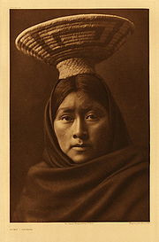
The settlers of the Pinacate and Gran Desierto de Altar are the current Tohono O'odham
(desert people) also known as Pápagos; descendants of Hohokam
culture. They like San Dieguito people, roamed the mountains coming down to the sea for food and concentrating their camps near to tinajas. During these trips, they left traces of their presence, proof of this are the network of trails ranging from tinaja to tinaja, as well as stone tools and remains of pottery
found around these water sources.
Tohono O'odham are related with the Hia C-ed O'odham
(sand dune people) and the Akimel O’odham (river people) also known as Pima
. These three groups lived in the desert regions of northern Sonora
and southern Arizona
. Los Akimel O’odham mainly lived along the Gila river
in Arizona, while the Tohono O'odham and Hia C'ed O'odham occupied the region of El Pinacate in Sonora. Although these groups were separated when Mexico lost the territory of Alta California
in the Mexican American war, still share the same origin, same language and especially the same God, I’toi, whose dwelling is the Pinacate Peaks
.
, founder of Mission San Xavier del Bac
in southern Tucson, Arizona, visited the site and return on several occasions, he and his group climbed to the top of El Pinacate, which named Santa Clara Hill.
Before 1956, few scientists and explorers had been in El Pinacate y Gran Desierto de Altar, the most famous, the group MacDougal, Hornaday and Sykes who explored the western part of the mountain on 1907.
Biosphere reserve
The Man and the Biosphere Programme of UNESCO was established in 1971 to promote interdisciplinary approaches to management, research and education in ecosystem conservation and sustainable use of natural resources.-Development:...
managed by the Federal government of Mexico
Federal government of Mexico
The federal government of Mexico is the national government of the United Mexican States, the central government established by the Constitution of the United Mexican States to share sovereignty over the United Mexican States with the governments of the 31 individual Mexican states and to represent...
, specifically by Secretariat of the Environment and Natural Resources, in collaboration with state government of Sonora
Sonora
Sonora officially Estado Libre y Soberano de Sonora is one of the 31 states which, with the Federal District, comprise the 32 Federal Entities of Mexico. It is divided into 72 municipalities; the capital city is Hermosillo....
and the Tohono O'odham
Tohono O'odham
The Tohono O'odham are a group of Native American people who reside primarily in the Sonoran Desert of the southeastern Arizona and northwest Mexico...
. It is in the Sonoran Desert
Sonoran Desert
The Sonoran Desert is a North American desert which straddles part of the United States-Mexico border and covers large parts of the U.S. states of Arizona and California and the northwest Mexican states of Sonora, Baja California, and Baja California Sur. It is one of the largest and hottest...
in Northwest Mexico
Northwest Mexico
Northwest Mexico is a region of the United Mexican States, formed by the states of Durango, Sinaloa, Chihuahua, Sonora, Baja California and Baja California Sur...
, east of Gulf of California
Gulf of California
The Gulf of California is a body of water that separates the Baja California Peninsula from the Mexican mainland...
, in the eastern part Gran Desierto de Altar
Gran Desierto de Altar
The Gran Desierto de Altar is one of the major portions of the Sonoran Desert of Mexico, including the only active erg dune region in North America. It extends across much of the northern border of the Gulf of California, reaching more than 100 kilometers east to west, and over 50 km north to...
, just below the border of Arizona
Arizona
Arizona ; is a state located in the southwestern region of the United States. It is also part of the western United States and the mountain west. The capital and largest city is Phoenix...
, United States
United States
The United States of America is a federal constitutional republic comprising fifty states and a federal district...
and north of the city of Puerto Peñasco
Puerto Peñasco
Puerto Peñasco is a city and municipality located in the northwest of the state of Sonora about 100 km from the Arizona border. It is located on the small strip of land that joins the peninsula of Baja California with the rest of Mexico. The area is part of the Altar Desert, one of the driest...
. It is one of the most significant visible landforms in North America
North America
North America is a continent wholly within the Northern Hemisphere and almost wholly within the Western Hemisphere. It is also considered a northern subcontinent of the Americas...
seen from space. A volcanic system, known as Santa Clara is the main part of the landscape, including three peaks; Pinacate
Pinacate Peaks
The Pinacate Peaks are a volcanic group of volcanic peaks and cinder cones located mostly in the Mexican state of Sonora along the international border adjacent to the U.S...
, Carnegie and Medio. In the area there are over 540 species of plants, 40 species of mammals, 200 of birds, 40 of reptiles, also amphibians and freshwater fishes. There are threatened endemic species as sonoran pronghorn, bighorn sheep, gila monster and desert tortoise.
The extension of the Biosphere Reserve is 7,146 km², greater than that of the states of Aguascalientes
Aguascalientes
Aguascalientes is one of the 31 states which, with the Federal District, comprise the 32 Federal Entities of Mexico. It is divided in 11 municipalities and its capital city is Aguascalientes....
, Colima
Colima
Colima is one of the 31 states which, with the Federal District, make up the 32 Federal Entities of Mexico. It shares its name with its capital and main city, Colima....
, Morelos
Morelos
Morelos officially Estado Libre y Soberano de Morelos is one of the 31 states which, with the Federal District, comprise the 32 Federal Entities of Mexico. It is divided in 33 municipalities and its capital city is Cuernavaca....
and Tlaxcala
Tlaxcala
Tlaxcala officially Estado Libre y Soberano de Tlaxcala is one of the 31 states which along with the Federal District comprise the 32 federative entities of Mexico. It is divided into 60 municipalities and its capital city is Tlaxcala....
separated.
Formation
El Pinacate y Gran Desierto de Altar is known for its unique physical and biological characteristics, by the presence of a volcano shield, and by the extensive areas of active dunes that surround it and the greatest concentration of MaarMaar
A maar is a broad, low-relief volcanic crater that is caused by a phreatomagmatic eruption, an explosion caused by groundwater coming into contact with hot lava or magma. A maar characteristically fills with water to form a relatively shallow crater lake. The name comes from the local Moselle...
craters. The Pinacate mountain range has orogenic features of high interest for its abruptly conformation, product of volcanic eruptions, that accumulated lava in compact rocks, sand and volcanic ashes that formed colors of special beauty and craters as El Elegante, Cerro Colorado, MacDougal y Sykes.
Picos del Pinacate (Pinacate Peaks
Pinacate Peaks
The Pinacate Peaks are a volcanic group of volcanic peaks and cinder cones located mostly in the Mexican state of Sonora along the international border adjacent to the U.S...
) are a group of volcanic peaks and volcanic cinder cones, are located north of the recreation center of Puerto Peñasco
Puerto Peñasco
Puerto Peñasco is a city and municipality located in the northwest of the state of Sonora about 100 km from the Arizona border. It is located on the small strip of land that joins the peninsula of Baja California with the rest of Mexico. The area is part of the Altar Desert, one of the driest...
. The highest peaks are Cerro del Pinacate (also called Santa Clara volcano), with an elevation of 3904 feet (1,189.9 m). Pinacate comes from náhuatl
Nahuatl
Nahuatl is thought to mean "a good, clear sound" This language name has several spellings, among them náhuatl , Naoatl, Nauatl, Nahuatl, Nawatl. In a back formation from the name of the language, the ethnic group of Nahuatl speakers are called Nahua...
pinacatl, desert endemic beetle.
The volcanoes have erupted sporadically for about 4 million years. The most recent activity was about 11 000 years. From 1965 to 1970, NASA
NASA
The National Aeronautics and Space Administration is the agency of the United States government that is responsible for the nation's civilian space program and for aeronautics and aerospace research...
sent astronauts there to train for future lunar excursions given the similarities of the land with the lunar surface.
History
Pre-Columbian era
The first inhabitants are known as San Dieguito people, they were hunter-gathererHunter-gatherer
A hunter-gatherer or forage society is one in which most or all food is obtained from wild plants and animals, in contrast to agricultural societies which rely mainly on domesticated species. Hunting and gathering was the ancestral subsistence mode of Homo, and all modern humans were...
who lived off the land, moving from the mountains to the sea of Gulf of California
Gulf of California
The Gulf of California is a body of water that separates the Baja California Peninsula from the Mexican mainland...
looking for food. The early stages of occupation seem to have ended at the beginning of ice age
Ice age
An ice age or, more precisely, glacial age, is a generic geological period of long-term reduction in the temperature of the Earth's surface and atmosphere, resulting in the presence or expansion of continental ice sheets, polar ice sheets and alpine glaciers...
about 20 thousand years ago, when drought
Drought
A drought is an extended period of months or years when a region notes a deficiency in its water supply. Generally, this occurs when a region receives consistently below average precipitation. It can have a substantial impact on the ecosystem and agriculture of the affected region...
forced people to leave the mountain range
Mountain range
A mountain range is a single, large mass consisting of a succession of mountains or narrowly spaced mountain ridges, with or without peaks, closely related in position, direction, formation, and age; a component part of a mountain system or of a mountain chain...
.
A second stage of occupation by San Dieguito people began in the late glacial period. This group returned to the mountains and lived as their ancestors. Tinaja
Tinaja
Tinaja is a term used in the American Southwest for water pockets formed in bedrock depressions that occur below waterfalls or are carved out by spring flow or seepage . Tinajas are important sources of surface water storage in these arid environments...
s must have been a reliable source of water during this time. The second stage of occupation ended with the arrival of an antipyretic period 9000 years ago, which again forced the indigenous
Indigenous peoples
Indigenous peoples are ethnic groups that are defined as indigenous according to one of the various definitions of the term, there is no universally accepted definition but most of which carry connotations of being the "original inhabitants" of a territory....
to leave the territory.
The settlers of the Pinacate and Gran Desierto de Altar are the current Tohono O'odham
Tohono O'odham
The Tohono O'odham are a group of Native American people who reside primarily in the Sonoran Desert of the southeastern Arizona and northwest Mexico...
(desert people) also known as Pápagos; descendants of Hohokam
Hohokam
Hohokam is one of the four major prehistoric archaeological Oasisamerica traditions of what is now the American Southwest. Many local residents put the accent on the first syllable . Variant spellings in current, official usage include Hobokam, Huhugam and Huhukam...
culture. They like San Dieguito people, roamed the mountains coming down to the sea for food and concentrating their camps near to tinajas. During these trips, they left traces of their presence, proof of this are the network of trails ranging from tinaja to tinaja, as well as stone tools and remains of pottery
Pottery
Pottery is the material from which the potteryware is made, of which major types include earthenware, stoneware and porcelain. The place where such wares are made is also called a pottery . Pottery also refers to the art or craft of the potter or the manufacture of pottery...
found around these water sources.
Tohono O'odham are related with the Hia C-ed O'odham
Hia C-ed O'odham
The Hia C-eḍ O'odham , also known as Areneños, Sand Papagos, or Sand Pimas are a Native American peoples whose traditional homeland lies between the Ajo Range, the Gila River, the Colorado River, and the Gulf of California...
(sand dune people) and the Akimel O’odham (river people) also known as Pima
Pima
The Pima are a group of American Indians living in an area consisting of what is now central and southern Arizona. The long name, "Akimel O'odham", means "river people". They are closely related to the Tohono O'odham and the Hia C-ed O'odham...
. These three groups lived in the desert regions of northern Sonora
Sonora
Sonora officially Estado Libre y Soberano de Sonora is one of the 31 states which, with the Federal District, comprise the 32 Federal Entities of Mexico. It is divided into 72 municipalities; the capital city is Hermosillo....
and southern Arizona
Arizona
Arizona ; is a state located in the southwestern region of the United States. It is also part of the western United States and the mountain west. The capital and largest city is Phoenix...
. Los Akimel O’odham mainly lived along the Gila river
Gila River
The Gila River is a tributary of the Colorado River, 650 miles long, in the southwestern states of New Mexico and Arizona.-Description:...
in Arizona, while the Tohono O'odham and Hia C'ed O'odham occupied the region of El Pinacate in Sonora. Although these groups were separated when Mexico lost the territory of Alta California
Alta California
Alta California was a province and territory in the Viceroyalty of New Spain and later a territory and department in independent Mexico. The territory was created in 1769 out of the northern part of the former province of Las Californias, and consisted of the modern American states of California,...
in the Mexican American war, still share the same origin, same language and especially the same God, I’toi, whose dwelling is the Pinacate Peaks
Pinacate Peaks
The Pinacate Peaks are a volcanic group of volcanic peaks and cinder cones located mostly in the Mexican state of Sonora along the international border adjacent to the U.S...
.
Explorations
There are few records of those who were the first explorers in this area. Possibly the first white man to see the mountain now known as Sierra Pinacate was the explorer Melchior Díaz on 1540. Subsequently, on 1698 the priest Eusebio KinoEusebio Kino
Eusebio Francisco Kino S.J. was an Italian Roman Catholic priest who became famous in what is now northwestern Mexico and the southwestern United States in the region then known as the Pimaria Alta...
, founder of Mission San Xavier del Bac
Mission San Xavier del Bac
Mission San Xavier del Bac is a historic Spanish Catholic mission located about 10 miles south of downtown Tucson, Arizona, on the Tohono O'odham San Xavier Indian Reservation...
in southern Tucson, Arizona, visited the site and return on several occasions, he and his group climbed to the top of El Pinacate, which named Santa Clara Hill.
Before 1956, few scientists and explorers had been in El Pinacate y Gran Desierto de Altar, the most famous, the group MacDougal, Hornaday and Sykes who explored the western part of the mountain on 1907.
Further reading
- Jack Ruby’s Kitchen Sink: Offbeat Travels through America’s Southwest, by Tom MillerTom Miller (travel writer)Tom Miller is an American author primarily known for travel literature. His ten books include The Panama Hat Trail, On the Border, Trading With the Enemy, and Jack Ruby's Kitchen Sink...
; pp. 10–26,