

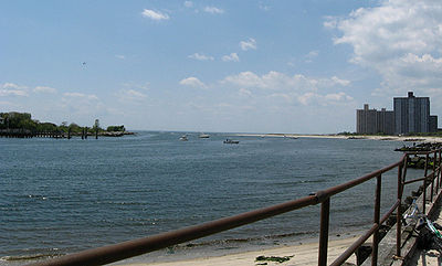
East Rockaway Inlet
Encyclopedia
Atlantic Ocean
The Atlantic Ocean is the second-largest of the world's oceanic divisions. With a total area of about , it covers approximately 20% of the Earth's surface and about 26% of its water surface area...
which separates the Rockaway Peninsula from the barrier island
Barrier island
Barrier islands, a coastal landform and a type of barrier system, are relatively narrow strips of sand that parallel the mainland coast. They usually occur in chains, consisting of anything from a few islands to more than a dozen...
which includes the Nassau County, New York
Nassau County, New York
Nassau County is a suburban county on Long Island, east of New York City in the U.S. state of New York, within the New York Metropolitan Area. As of the 2010 census, the population was 1,339,532...
communities of Atlantic Beach
Atlantic Beach, New York
Atlantic Beach is an affluent village off the South Shore of Long Island in the Town of Hempstead, Nassau County, New York. It is located on Long Beach Barrier Island, one of the outer barrier islands which it shares with Long Beach, East Atlantic Beach, Atlantic Beach Estates, Lido Beach and Point...
, Long Beach
Long Beach, New York
Long Beach is a city in Nassau County, New York. Just south of Long Island, it is located on Long Beach Barrier Island, which is the westernmost of the outer barrier islands off Long Island's South Shore. As of the United States 2010 Census, the city population was 33,275...
and Lido Beach.
According to a plaque in Long Beach, NY, the original inlet was through Long Beach directly opposite East Rockaway, NY, hence the name. A decision was made to create a new inlet between Far Rockaway and Atlantic Beach and the original was filled in with the fill from the newly created inlet.
The inlet is traversed by the Atlantic Beach Bridge
Atlantic Beach Bridge
The Atlantic Beach Bridge is a long toll drawbridge connecting Lawrence and Atlantic Beach , NY while passing over the west end of Reynolds Channel. The bridge also provides direct access to the Rockaway Peninsula via Seagirt Boulevard....
. Its eastern extension is the Reynolds Channel
Reynolds Channel
Reynolds Channel is a strait in Nassau County, New York which separates a barrier island that contains the City of Long Beach and the villages of Atlantic Beach and Lido Beach from Long Island and Barnum Island. The channel begins at the East Rockaway Inlet and ends at Point Lookout where it merges...
.
See also
- Jones InletJones InletJones Inlet is located at the westernmost end of the long Jones Beach barrier island that runs along Long Island's south shore. The inlet separates Jones Beach State Park's West End from the community of Point Lookout and connects South Oyster Bay with the Atlantic Ocean...
- Jones Beach IslandJones Beach IslandJones Beach Island is one of the outer barrier islands off the southern coast of Long Island in the U.S. state of New York. It is named for the father of Thomas Jones. It is sometimes referred to as Oak Beach Island, and the former home of the infamous Oak Beach Inn. It is separated from Long...
- Fire Island Inlet BridgeFire Island Inlet BridgeThe Fire Island Inlet Bridge, an integral part of the Robert Moses Causeway, is a two-lane, steel arch span with a concrete deck that carries Route 908 over Fire Island Inlet....
- Captree State ParkCaptree State ParkCaptree State Park is a state park in Suffolk County, New York in the USA.The park is located on the easternmost end of Jones Island , and overlooks the Fire Island Inlet and the westernmost section of Fire Island, partly in the Town of Babylon.The park offers a marina and boat launch, fishing,...
- Jones Beach State ParkJones Beach State ParkJones Beach State Park is a state park of the U.S. state of New York. It is located in southern Nassau County, in the hamlet of Wantagh, on Jones Beach Island, a barrier island linked to Long Island by the Meadowbrook State Parkway, Wantagh State Parkway and Ocean Parkway .The park is renowned for...
- State Boat Channel BridgeState Boat Channel BridgeState Boat Channel Bridge is a Suffolk County, New York Bascule bridge that crosses over the Long Island New York State Boat Channel connecting Captree Island and Jones Beach island on Robert Moses Causeway in Gilgo-Oak Beach-Captree, Babylon, NY.This 665-foot-long bascule bridge, meets the Ocean...
- Great South Bay BridgeGreat South Bay BridgeGreat South Bay Bridge is a bridge connecting the Robert Moses Causeway from Long Island's mainland over the Great South Bay, connecting to both Captree and Jones Beach Islands on the southwest central side of Long Island New York....
- Fire Island
- Robert Moses State ParkRobert Moses State Park (Long Island)Robert Moses State Park - Long Island is a state park that is located in the state of New York.The park lies in southern Suffolk County on the western end of Fire Island, one of the central barrier Islands off the southern coast of Long Island...
- Fire Island Light
- Patchogue BayPatchogue BayPatchogue Bay is a bay on the south-central shores of Long Island in the U.S. state of New York.Part of the Great South Bay, Patchogue Bay is a cove between the points of land known as Blue Point and Howells Point, and across which ferries run south to Fire Island.The Patchogue Bay bay bottom up to...
- Moriches InletMoriches InletMoriches Inlet is an inlet connecting Moriches Bay and the Atlantic Ocean. The name Moriches comes from Meritces, a Native American who owned land on Moriches Neck....