
East End Park, Leeds
Encyclopedia
East End Park is an inner city
area of east Leeds
, West Yorkshire
, England
. It is situated between Burmantofts
to the north west, Harehills
to the north east (although not a direct neighbour), Halton Moor
to the east, Richmond Hill
to the west and Cross Green
to the south west. It blends in to Halton Moor
/Osmondthorpe
area and is 1 mile to the east of Leeds city centre
in the LS9 Leeds postcode area
.
The area is situated in the vicinity of the A64
York Road, east Leeds' main thoroughfare, and is also home to a large park dating back from Victorian
times which was purchased by Leeds City Council in the late 19th century, when it was waste land. Housing in the area is made up of nineteenth-century through terraced housing, some back-to-back terraced housing, found more commonly closer to the city centre, and semi-detached
and detached houses are also in the area.
Many of the back-to-back terraced houses in the area are due to be demolished as part of the £1.3 billion EASEL regeneration scheme in east and south east Leeds
, as are many other similar properties in neighbouring areas Richmond Hill
and Cross Green
.
Crime is unevenly distributed across East End Park. The Glensdales, Templeviews and Charltons are a small cluster of predominately back-to-back streets noted for the majority of the area's crime and have subsequently become a priority area of West Yorkshire Police
, crime in the rest of the estate is much less common. The same group of streets are a focus of some of the regeneration in the area.
The area is one of the major Irish
communities in Leeds, and is home to the prestigious music venue 'The Irish Centre', the first purpose built Irish Centre in Britain. The centre opened on January 20 1970, although the official opening ceremony was held on 8 June 1970.
Leeds City Council.
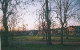
The park offers a diverse range of sporting and leisure facilities for all age ranges, including; bowling greens, tennis courts, football pitches and a basketball court. The playground and teen shelter have been recently installed and are proving very popular.
There are plenty of open spaces in the park and areas of well established woodland create a diversity of habitat and interest. There are also formal seating areas amongst the newly established rose and shrub beds.
The Friends of East End Park are a newly established community group who contribute to the development and improvement of the park. They also assist in the organisation of three Brass Band concerts each year which are funded by the local Councillors, and for the past two years have held a Fun Day for the local children during the summer holidays. It is hoped along with the Band Concerts,to make this an annual event. With the help of the Parks Department, and Councillors, the local schools have assisted in planting spring flowering bulbs, which again has been organised by The Friends
East End Park hosts many events throughout the year including the annual bonfire and fun fair which attracts up to 10,000 visitors. A tennis camp is held each August for young people.
In March 2009, Trees for Cities and Leeds City Council planted 3,000 whips at East End Park in order to create new areas of urban woodland and screen the park from the railway line that runs behind it. The planting follows planting in 2007 when, with the help of the local community, 18 large trees were planted to replace those lost in September 2006 when a freak tornado struck the city.
York Road, east Leeds' main thoroughfare, providing the area with a well established and reliable bus service. Most bus routes are operated by First Leeds
and Arriva Yorkshire
. The 19 and 19A run to Garforth
, Colton
, Halton
, the city centre, Headingley
, West Park
, Ireland Wood
and Tinshill
. The 5 runs to Halton Moor
, Osmondthorpe
and the city centre. The 40 and 40A run to Whinmoor, Swarcliffe
, Cross Gates
, Halton
and the city centre. The 56 runs to Whinmoor, Seacroft, Killingbeck
, Hyde Park
, the University of Leeds
, Headingley
and Moor Grange
. The 163 and 166 run from the city centre to Castleford
, as well as services that run along the A64
to the east coast.
The closest railway station is Leeds railway station.
Inner city
The inner city is the central area of a major city or metropolis. In the United States, Canada, United Kingdom and Ireland, the term is often applied to the lower-income residential districts in the city centre and nearby areas...
area of east Leeds
Leeds
Leeds is a city and metropolitan borough in West Yorkshire, England. In 2001 Leeds' main urban subdivision had a population of 443,247, while the entire city has a population of 798,800 , making it the 30th-most populous city in the European Union.Leeds is the cultural, financial and commercial...
, West Yorkshire
West Yorkshire
West Yorkshire is a metropolitan county within the Yorkshire and the Humber region of England with a population of 2.2 million. West Yorkshire came into existence as a metropolitan county in 1974 after the passage of the Local Government Act 1972....
, England
England
England is a country that is part of the United Kingdom. It shares land borders with Scotland to the north and Wales to the west; the Irish Sea is to the north west, the Celtic Sea to the south west, with the North Sea to the east and the English Channel to the south separating it from continental...
. It is situated between Burmantofts
Burmantofts
Burmantofts is an area of 1960s high-rise housing blocks in inner-city east Leeds, West Yorkshire, England adjacent to the city centre and St. James's Hospital. It is a racially diverse area, with sizable Afro-Caribbean and Irish communities, but suffers the social problems typical of similar areas...
to the north west, Harehills
Harehills
Harehills is an inner-city area of east Leeds, West Yorkshire, England. It is approximately north east of Leeds city centre. Harehills is situated between the A58 and the A64 .- Overview :...
to the north east (although not a direct neighbour), Halton Moor
Halton Moor
Halton Moor is a district of east Leeds, West Yorkshire, England, located around three miles east of Leeds city centre and is close to the A63. It is situated between Killingbeck to the north, Temple Newsam to the south, Osmondthorpe to the west and Halton and Colton to the east.The area is mainly...
to the east, Richmond Hill
Richmond Hill, West Yorkshire
Richmond Hill is a district of Leeds, West Yorkshire, England. The district lies to the east of the city centre. It lies between York Road , East End Park and Cross Green. The area is made up of a variety of different types of buildings and architecture...
to the west and Cross Green
Cross Green, Leeds
Cross Green is a mainly industrial area of Leeds, West Yorkshire, England. It is around to the south east of Leeds city centre.The area lies in the LS9 Leeds postcode area between Osmondthorpe, Richmond Hill and Hunslet....
to the south west. It blends in to Halton Moor
Halton Moor
Halton Moor is a district of east Leeds, West Yorkshire, England, located around three miles east of Leeds city centre and is close to the A63. It is situated between Killingbeck to the north, Temple Newsam to the south, Osmondthorpe to the west and Halton and Colton to the east.The area is mainly...
/Osmondthorpe
Osmondthorpe
Osmondthorpe is a district of east Leeds in West Yorkshire, England, although it is considered part of the Halton Moor district.It is situated in the LS9 Leeds postcode area, two miles to the east of Leeds city centre between East End Park and Halton Moor.At the edge of Osmondthorpe lies the...
area and is 1 mile to the east of Leeds city centre
Leeds City Centre
Leeds city centre is the central business district of Leeds, England. It is within the Leeds Central parliamentary constituency, represented by Hilary Benn as MP since a by-election in 1999...
in the LS9 Leeds postcode area
LS postcode area
The LS postcode area, also known as the Leeds postcode area, is a group of postcode districts around Leeds, Wetherby, Tadcaster, Pudsey, Otley and Ilkley in England...
.
The area is situated in the vicinity of the A64
A64 road
The A64 is a road in North and West Yorkshire, England which links Leeds, York and Scarborough. The A64 starts as the A64 ring road motorway in Leeds and then is a dual carriageway for the rest of its route, except parts of the road from Malton to Scarborough.The road approximates a section of the...
York Road, east Leeds' main thoroughfare, and is also home to a large park dating back from Victorian
Victorian era
The Victorian era of British history was the period of Queen Victoria's reign from 20 June 1837 until her death on 22 January 1901. It was a long period of peace, prosperity, refined sensibilities and national self-confidence...
times which was purchased by Leeds City Council in the late 19th century, when it was waste land. Housing in the area is made up of nineteenth-century through terraced housing, some back-to-back terraced housing, found more commonly closer to the city centre, and semi-detached
Semi-detached
Semi-detached housing consists of pairs of houses built side by side as units sharing a party wall and usually in such a way that each house's layout is a mirror image of its twin...
and detached houses are also in the area.
Many of the back-to-back terraced houses in the area are due to be demolished as part of the £1.3 billion EASEL regeneration scheme in east and south east Leeds
Leeds
Leeds is a city and metropolitan borough in West Yorkshire, England. In 2001 Leeds' main urban subdivision had a population of 443,247, while the entire city has a population of 798,800 , making it the 30th-most populous city in the European Union.Leeds is the cultural, financial and commercial...
, as are many other similar properties in neighbouring areas Richmond Hill
Richmond Hill, West Yorkshire
Richmond Hill is a district of Leeds, West Yorkshire, England. The district lies to the east of the city centre. It lies between York Road , East End Park and Cross Green. The area is made up of a variety of different types of buildings and architecture...
and Cross Green
Cross Green, Leeds
Cross Green is a mainly industrial area of Leeds, West Yorkshire, England. It is around to the south east of Leeds city centre.The area lies in the LS9 Leeds postcode area between Osmondthorpe, Richmond Hill and Hunslet....
.
Crime is unevenly distributed across East End Park. The Glensdales, Templeviews and Charltons are a small cluster of predominately back-to-back streets noted for the majority of the area's crime and have subsequently become a priority area of West Yorkshire Police
West Yorkshire Police
West Yorkshire Police is the territorial police force responsible for policing West Yorkshire in England. It is the fourth largest force in England and Wales by number of officers, with 5671 officers....
, crime in the rest of the estate is much less common. The same group of streets are a focus of some of the regeneration in the area.
The area is one of the major Irish
Irish people
The Irish people are an ethnic group who originate in Ireland, an island in northwestern Europe. Ireland has been populated for around 9,000 years , with the Irish people's earliest ancestors recorded having legends of being descended from groups such as the Nemedians, Fomorians, Fir Bolg, Tuatha...
communities in Leeds, and is home to the prestigious music venue 'The Irish Centre', the first purpose built Irish Centre in Britain. The centre opened on January 20 1970, although the official opening ceremony was held on 8 June 1970.
The Park
East End Park is a Victorian Park managed by Parks and Countryside, part of the Learning and Leisure Department,Leeds City Council.
The park offers a diverse range of sporting and leisure facilities for all age ranges, including; bowling greens, tennis courts, football pitches and a basketball court. The playground and teen shelter have been recently installed and are proving very popular.
There are plenty of open spaces in the park and areas of well established woodland create a diversity of habitat and interest. There are also formal seating areas amongst the newly established rose and shrub beds.
The Friends of East End Park are a newly established community group who contribute to the development and improvement of the park. They also assist in the organisation of three Brass Band concerts each year which are funded by the local Councillors, and for the past two years have held a Fun Day for the local children during the summer holidays. It is hoped along with the Band Concerts,to make this an annual event. With the help of the Parks Department, and Councillors, the local schools have assisted in planting spring flowering bulbs, which again has been organised by The Friends
East End Park hosts many events throughout the year including the annual bonfire and fun fair which attracts up to 10,000 visitors. A tennis camp is held each August for young people.
In March 2009, Trees for Cities and Leeds City Council planted 3,000 whips at East End Park in order to create new areas of urban woodland and screen the park from the railway line that runs behind it. The planting follows planting in 2007 when, with the help of the local community, 18 large trees were planted to replace those lost in September 2006 when a freak tornado struck the city.
Transport
East End Park is situated in the vicinity of the A64A64 road
The A64 is a road in North and West Yorkshire, England which links Leeds, York and Scarborough. The A64 starts as the A64 ring road motorway in Leeds and then is a dual carriageway for the rest of its route, except parts of the road from Malton to Scarborough.The road approximates a section of the...
York Road, east Leeds' main thoroughfare, providing the area with a well established and reliable bus service. Most bus routes are operated by First Leeds
First Leeds
First Leeds is one of the bus companies serving the area of West Yorkshire, England. It forms part of FirstGroup, a company operating transport services across the British Isles and in North America...
and Arriva Yorkshire
Arriva Yorkshire
Arriva Yorkshire is a division of Arriva which operates bus services around West Yorkshire, South Yorkshire, East Riding of Yorkshire and the southern areas of North Yorkshire in England.-History:Arriva Yorkshire was formed as a combination of mergers of previous...
. The 19 and 19A run to Garforth
Garforth
Garforth is a town within the City of Leeds metropolitan borough, in West Yorkshire, England. The 2001 Census lists 23,892 residents in the Garforth and Swillington ward - 80.57% of which are homeowners, 20% more than the average for Leeds. Garforth itself has 15,394 of those people...
, Colton
Colton, Leeds
Colton is a district of east Leeds, West Yorkshire, England, situated between Cross Gates to the north, Halton and Halton Moor to the west, Whitkirk to the north-west and Austhorpe to the north-east...
, Halton
Halton, Leeds
Halton is a district of east Leeds, West Yorkshire, England, situated between Cross Gates to the north, Halton Moor to the west, Colton to the east and Whitkirk to the South. Temple Newsam lies directly south of the estate.-History:...
, the city centre, Headingley
Headingley
Headingley is a suburb of Leeds in West Yorkshire, England. It is approximately two miles out of the city centre, to the north west along the A660 road...
, West Park
West Park, Leeds
West Park is a suburb of north-west Leeds, West Yorkshire, England, north of Headingley. It is a mixed area of private suburban housing and suburban council estates. The name derives from its main park containing playing fields together with a conservation area of grassy meadow ending in woodland...
, Ireland Wood
Ireland Wood
Ireland Wood is a small residential area in north-west Leeds, West Yorkshire, England. It is approximately to the north west of Leeds city centre. The original planning for Ireland Wood began in 1950....
and Tinshill
Tinshill
Tinshill is a district of Leeds, 4 miles north of Leeds city centre, West Yorkshire, England. It is situated between Horsforth and Cookridge. When the estate was planned in the 1940s it was originally known as the 'Cookridge Tower Estate'. The estate predated surrounding estates such as...
. The 5 runs to Halton Moor
Halton Moor
Halton Moor is a district of east Leeds, West Yorkshire, England, located around three miles east of Leeds city centre and is close to the A63. It is situated between Killingbeck to the north, Temple Newsam to the south, Osmondthorpe to the west and Halton and Colton to the east.The area is mainly...
, Osmondthorpe
Osmondthorpe
Osmondthorpe is a district of east Leeds in West Yorkshire, England, although it is considered part of the Halton Moor district.It is situated in the LS9 Leeds postcode area, two miles to the east of Leeds city centre between East End Park and Halton Moor.At the edge of Osmondthorpe lies the...
and the city centre. The 40 and 40A run to Whinmoor, Swarcliffe
Swarcliffe
Swarcliffe, originally the Swarcliffe Estate, is a district of Leeds, West Yorkshire, England. It is east of Leeds city centre, and within the LS14 Leeds postcode area....
, Cross Gates
Cross Gates, Leeds
Cross Gates is a large suburb in east Leeds, West Yorkshire, England. It is situated between Seacroft and Swarcliffe to the north, Whitkirk and Colton to the south, Killingbeck to the west and Austhorpe to the south east...
, Halton
Halton, Leeds
Halton is a district of east Leeds, West Yorkshire, England, situated between Cross Gates to the north, Halton Moor to the west, Colton to the east and Whitkirk to the South. Temple Newsam lies directly south of the estate.-History:...
and the city centre. The 56 runs to Whinmoor, Seacroft, Killingbeck
Killingbeck
Killingbeck is a district of east Leeds, West Yorkshire, England that is situated between Seacroft to the north, Cross Gates and Whitkirk to the east, Gipton to the west, Halton Moor to the south, Halton to the south east and Osmondthorpe to the south west. It blends in to the Cross Gates and...
, Hyde Park
Hyde Park, Leeds
Hyde Park is an inner-city area of north-west Leeds, West Yorkshire, England, situated between the University of Leeds and Headingley.It is mainly in the Hyde Park & Woodhouse ward, though some areas of what is often considered to be Hyde Park lie within the Headingley Ward . The boundary is...
, the University of Leeds
University of Leeds
The University of Leeds is a British Redbrick university located in the city of Leeds, West Yorkshire, England...
, Headingley
Headingley
Headingley is a suburb of Leeds in West Yorkshire, England. It is approximately two miles out of the city centre, to the north west along the A660 road...
and Moor Grange
Moor Grange
Moor Grange Estate is a housing estate in the West Park area of Leeds, West Yorkshire, England, which was built in the 1950s on reclaimed farmland. Work on the Moor Grange Estate began in 1955. It was originally owned by the local council, and was leased by the council to tenants as a council...
. The 163 and 166 run from the city centre to Castleford
Castleford
Castleford is the largest of the "five towns" district in the metropolitan borough of the City of Wakefield, in West Yorkshire, England. It is near Pontefract, and has a population of 37,525 according to the 2001 Census, but has seen a rise in recent years and is now around 45-50,000. To the north...
, as well as services that run along the A64
A64 road
The A64 is a road in North and West Yorkshire, England which links Leeds, York and Scarborough. The A64 starts as the A64 ring road motorway in Leeds and then is a dual carriageway for the rest of its route, except parts of the road from Malton to Scarborough.The road approximates a section of the...
to the east coast.
The closest railway station is Leeds railway station.