
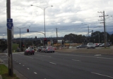
Dandenong Valley Highway
Encyclopedia
The Dandenong Valley Highway (also predominantly known as Stud Road and Dandenong Frankston Road)
stretches almost 30 kilometres from Wantirna South
in Melbourne
's eastern suburbs to Frankston
in the south. For its entire length, its main name is not actually Dandenong Valley Highway, and very few locals use it. The traffic on the highway has been significant over the years with the worst bottlenecks at Burwood Highway, Ferntree Gully Road, Wellington Road, Princes Highway, and Thompsons Road, but since the opening of the EastLink
, the traffic burden has significantly reduced along the highway with the north-south tollway, opening to traffic on 29 June 2008.
, in central Frankston. It heads as a two-lane, two-way road alongside the Frankston railway line to the Frankston Freeway
. It then roughly heads north east as a four lane dual carriageway
to Dandenong, the centre of which the road runs through as a four lane single carriageway
. After Dandenong, the road again becomes a four lane dual carriageway, heading north, through Rowville
, Scoresby
and Knox Shopping Centre in Wantirna South
. At Boronia Road in Wantirna
, the road narrows down to one lane, before eventually terminating at Mountain Highway
, in Bayswater
.
stretches almost 30 kilometres from Wantirna South
Wantirna South, Victoria
Wantirna South is a suburb in Melbourne, Victoria, Australia, 24 km south-east from Melbourne's central business district. Its Local Government Area is the City of Knox, Wantirna South is a border suburb to City of Whitehorse and City of Monash. At the 2006 Census, Wantirna South had a population...
in Melbourne
Melbourne
Melbourne is the capital and most populous city in the state of Victoria, and the second most populous city in Australia. The Melbourne City Centre is the hub of the greater metropolitan area and the Census statistical division—of which "Melbourne" is the common name. As of June 2009, the greater...
's eastern suburbs to Frankston
Frankston, Victoria
Frankston is a suburb within the Greater Melbourne metropolitan area in Victoria, Australia. It is located 40 km southeast of the state capital Melbourne at the southernmost edge of Greater Melbourne, near the beginnings of the Mornington Peninsula...
in the south. For its entire length, its main name is not actually Dandenong Valley Highway, and very few locals use it. The traffic on the highway has been significant over the years with the worst bottlenecks at Burwood Highway, Ferntree Gully Road, Wellington Road, Princes Highway, and Thompsons Road, but since the opening of the
EastLinkEastLink, Melbourne
EastLink is a A$2.5 billion tolled freeway linking a large area through the eastern and south-eastern suburbs of Melbourne, Australia. It is a part of Melbourne's Metropolitan Ring Road project....
, the traffic burden has significantly reduced along the highway with the north-south tollway, opening to traffic on 29 June 2008.
Route
Dandenong Valley Highway begins at its junction with the Nepean HighwayNepean Highway
Nepean Highway runs south from the centre of Melbourne in Victoria, Australia to Portsea, along the eastern shore of Port Phillip. It is the primary road route to central Melbourne from Melbourne's southern suburbs.- History :...
, in central Frankston. It heads as a two-lane, two-way road alongside the Frankston railway line to the Frankston Freeway
Frankston Freeway
Frankston Freeway is a very short stretch of Melbourne freeway that was designed to upgrade Wells Road to freeway standard in the 1970s and provides a link from suburban Melbourne to Frankston...
. It then roughly heads north east as a four lane dual carriageway
Dual carriageway
A dual carriageway is a class of highway with two carriageways for traffic travelling in opposite directions separated by a central reservation...
to Dandenong, the centre of which the road runs through as a four lane single carriageway
Single carriageway
A single carriageway is a road with 1, 2 or more lanes arranged within a single carriageway with no central reservation to separate opposing flows of traffic. Two-lane road or two-lane highway are single carriageway with one lane for each direction...
. After Dandenong, the road again becomes a four lane dual carriageway, heading north, through Rowville
Rowville, Victoria
Rowville is a suburb in Melbourne, Victoria, Australia, 29 km south-east from Melbourne's central business district. Its Local Government Area is the City of Knox. At the 2006 Census, Rowville had a population of 34,412....
, Scoresby
Scoresby, Victoria
Scoresby is a suburb in Melbourne, Victoria, Australia, 25 km south-east from Melbourne's central business district. Its Local Government Area is the City of Knox...
and Knox Shopping Centre in Wantirna South
Wantirna South, Victoria
Wantirna South is a suburb in Melbourne, Victoria, Australia, 24 km south-east from Melbourne's central business district. Its Local Government Area is the City of Knox, Wantirna South is a border suburb to City of Whitehorse and City of Monash. At the 2006 Census, Wantirna South had a population...
. At Boronia Road in Wantirna
Wantirna, Victoria
Wantirna is a suburb in Melbourne, Victoria, Australia, 23 km east from Melbourne's central business district. Its Local Government Area is the City of Knox. At the 2006 Census, Wantirna had a population of 13,978....
, the road narrows down to one lane, before eventually terminating at Mountain Highway
Mountain Highway
Mountain Highway is a 18 km highway in Eastern Melbourne. Mountain Highway starts from Burwood Highway and runs through The Basin, then uphill to Sassafras. For most of its length it is dual carriageway, with 2 or 3 lanes in each Direction. From Burwood Highway to Forest Road in the suburb of The...
, in Bayswater
Bayswater, Victoria
Bayswater is a suburb in Melbourne, Victoria, Australia, 28 km east from Melbourne's central business district. Its Local Government Area is the City of Knox. At the 2006 Census, Bayswater had a population of 10,738.-History:...
.
Otherwise known as
There are a variety of street names which exceed the Dandenong Valley Highway status which includes:- Stud Road (from Bayswater to Dandenong)
- Foster Street (within central Dandenong)
- Lonsdale Street (Princes Highway) (within central Dandenong)
- Dandenong-Frankston Road (from Dandenong to Frankston North)
- Dandenong Road West (from Frankston North to Frankston)
- Fletcher Road (within central Frankston)
Major intersections
Dandenong Valley Highway  |
|||
| Northbound | Distance from Dandenong (km) |
Southbound | |
 Traffic Lights (clockwise from highway) Traffic Lights (clockwise from highway) Mountain Highway Mountain Highway Mountain Highway is a 18 km highway in Eastern Melbourne. Mountain Highway starts from Burwood Highway and runs through The Basin, then uphill to Sassafras. For most of its length it is dual carriageway, with 2 or 3 lanes in each Direction. From Burwood Highway to Forest Road in the suburb of The...  to Wantirna to WantirnaWantirna, Victoria Wantirna is a suburb in Melbourne, Victoria, Australia, 23 km east from Melbourne's central business district. Its Local Government Area is the City of Knox. At the 2006 Census, Wantirna had a population of 13,978.... Waldhem Road Mountain Highway Mountain Highway Mountain Highway is a 18 km highway in Eastern Melbourne. Mountain Highway starts from Burwood Highway and runs through The Basin, then uphill to Sassafras. For most of its length it is dual carriageway, with 2 or 3 lanes in each Direction. From Burwood Highway to Forest Road in the suburb of The... to BayswaterBayswater, Victoria Bayswater is a suburb in Melbourne, Victoria, Australia, 28 km east from Melbourne's central business district. Its Local Government Area is the City of Knox. At the 2006 Census, Bayswater had a population of 10,738.-History:... |
|||
| End Stud Road (Dandenong Valley Highway) | -- | Start Stud Road (Dandenong Valley Highway) | |
| Wantirna Wantirna, Victoria Wantirna is a suburb in Melbourne, Victoria, Australia, 23 km east from Melbourne's central business district. Its Local Government Area is the City of Knox. At the 2006 Census, Wantirna had a population of 13,978.... , Ringwood Ringwood, Victoria Ringwood is a suburb in Melbourne, Victoria, Australia, east of Melbourne's central business district. Its Local Government Area is the City of Maroondah. At the 2006 Census, Ringwood had a population of 15,185.... Boronia Road  Boronia Boronia, Victoria Boronia is a suburb in Melbourne, Victoria, Australia, 29 km east from Melbourne's central business district. Its Local Government Area is the City of Knox... Boronia Road |
-- | Boronia Boronia, Victoria Boronia is a suburb in Melbourne, Victoria, Australia, 29 km east from Melbourne's central business district. Its Local Government Area is the City of Knox... Boronia Road Wantirna Wantirna, Victoria Wantirna is a suburb in Melbourne, Victoria, Australia, 23 km east from Melbourne's central business district. Its Local Government Area is the City of Knox. At the 2006 Census, Wantirna had a population of 13,978.... Boronia Road |
|
| continues as |
|||
| Wantirna South Wantirna South, Victoria Wantirna South is a suburb in Melbourne, Victoria, Australia, 24 km south-east from Melbourne's central business district. Its Local Government Area is the City of Knox, Wantirna South is a border suburb to City of Whitehorse and City of Monash. At the 2006 Census, Wantirna South had a population... (Knox City Knox City Shopping Centre Knox City Shopping Centre is a super-regional shopping centre and outdoor entertainment complex located in the outer eastern suburb of Wantirna South in the city of Melbourne, Australia. The centre opened on November 9, 1977 with an initial 88 stores and 2300 parking spaces... ) |
-- | Wantirna South Wantirna South, Victoria Wantirna South is a suburb in Melbourne, Victoria, Australia, 24 km south-east from Melbourne's central business district. Its Local Government Area is the City of Knox, Wantirna South is a border suburb to City of Whitehorse and City of Monash. At the 2006 Census, Wantirna South had a population... (Knox City Knox City Shopping Centre Knox City Shopping Centre is a super-regional shopping centre and outdoor entertainment complex located in the outer eastern suburb of Wantirna South in the city of Melbourne, Australia. The centre opened on November 9, 1977 with an initial 88 stores and 2300 parking spaces... ) |
|
| To ; Melbourne, Ferntree Gully Ferntree Gully, Victoria Ferntree Gully is a suburb in Melbourne, Victoria, Australia, in the Dandenong Ranges, 29 km east from Melbourne's central business district. It is in the Local Government Area's of the Shire of Yarra Ranges and the City of Knox... , Belgrave Belgrave, Victoria Belgrave is a suburb in Melbourne, Victoria, Australia, 35 km east from Melbourne's central business district. Its Local Government Area is the Shire of Yarra Ranges. At the 2006 Census, Belgrave had a population of 4094... Burwood Highway Burwood Highway Burwood Highway is a major transportation link with Melbourne's eastern suburbs. It begins in the suburb of Kooyong, Melbourne at the junction of the Monash Freeway as Toorak Road between Monash Freeway and Warrigal Road, and finishes in Belgrave, Victoria in the Dandenong Ranges...  |
-- | Ferntree Gully Ferntree Gully, Victoria Ferntree Gully is a suburb in Melbourne, Victoria, Australia, in the Dandenong Ranges, 29 km east from Melbourne's central business district. It is in the Local Government Area's of the Shire of Yarra Ranges and the City of Knox... , Belgrave Belgrave, Victoria Belgrave is a suburb in Melbourne, Victoria, Australia, 35 km east from Melbourne's central business district. Its Local Government Area is the Shire of Yarra Ranges. At the 2006 Census, Belgrave had a population of 4094... , Burwood Burwood, Victoria Burwood is a suburb in Melbourne, Victoria, Australia, 17 km east from Melbourne's central business district. Its Local Government Area is largely the City of Whitehorse but includes the City of Monash in its south west corner. At the 2006 Census, Burwood had a population of 11,886.-History:The... , Melbourne; To Burwood Highway Burwood Highway Burwood Highway is a major transportation link with Melbourne's eastern suburbs. It begins in the suburb of Kooyong, Melbourne at the junction of the Monash Freeway as Toorak Road between Monash Freeway and Warrigal Road, and finishes in Belgrave, Victoria in the Dandenong Ranges... |
|
| To ; Glen Waverley Glen Waverley, Victoria Glen Waverley is a suburb in Melbourne, Victoria, Australia, 19 km south-east from Melbourne's central business district. Its Local Government Area is the City of Monash... , Wantirna South Wantirna South, Victoria Wantirna South is a suburb in Melbourne, Victoria, Australia, 24 km south-east from Melbourne's central business district. Its Local Government Area is the City of Knox, Wantirna South is a border suburb to City of Whitehorse and City of Monash. At the 2006 Census, Wantirna South had a population... High Street Road  |
-- | Ferntree Gully Wantirna South, Victoria Wantirna South is a suburb in Melbourne, Victoria, Australia, 24 km south-east from Melbourne's central business district. Its Local Government Area is the City of Knox, Wantirna South is a border suburb to City of Whitehorse and City of Monash. At the 2006 Census, Wantirna South had a population... , Glen Waverley Glen Waverley, Victoria Glen Waverley is a suburb in Melbourne, Victoria, Australia, 19 km south-east from Melbourne's central business district. Its Local Government Area is the City of Monash... ; To High Street Road |
|
| Scoresby Scoresby, Victoria Scoresby is a suburb in Melbourne, Victoria, Australia, 25 km south-east from Melbourne's central business district. Its Local Government Area is the City of Knox... |
-- | Scoresby Scoresby, Victoria Scoresby is a suburb in Melbourne, Victoria, Australia, 25 km south-east from Melbourne's central business district. Its Local Government Area is the City of Knox... |
|
| To ; Oakleigh Oakleigh, Victoria Oakleigh is a suburb of Melbourne, Victoria, Australia and is located 14 km south-east from Melbourne's central business district. Its Local Government Area is the City of Monash. At the 2006 Census, Oakleigh had a population of 6,876.... , Ferntree Gully Ferntree Gully, Victoria Ferntree Gully is a suburb in Melbourne, Victoria, Australia, in the Dandenong Ranges, 29 km east from Melbourne's central business district. It is in the Local Government Area's of the Shire of Yarra Ranges and the City of Knox... Ferntree Gully Road  |
Ferntree Gully Ferntree Gully, Victoria Ferntree Gully is a suburb in Melbourne, Victoria, Australia, in the Dandenong Ranges, 29 km east from Melbourne's central business district. It is in the Local Government Area's of the Shire of Yarra Ranges and the City of Knox... , Oakleigh Oakleigh, Victoria Oakleigh is a suburb of Melbourne, Victoria, Australia and is located 14 km south-east from Melbourne's central business district. Its Local Government Area is the City of Monash. At the 2006 Census, Oakleigh had a population of 6,876.... ; To Ferntree Gully Road |
||
| Ferntree Gully Ferntree Gully, Victoria Ferntree Gully is a suburb in Melbourne, Victoria, Australia, in the Dandenong Ranges, 29 km east from Melbourne's central business district. It is in the Local Government Area's of the Shire of Yarra Ranges and the City of Knox... Kelletts Road |
-- | Lysterfield Lysterfield, Victoria Lysterfield is a suburb in Melbourne, Victoria, Australia, 32 km south-east from Melbourne's central business district. Its Local Government Area is the City of Knox and the Shire of Yarra Ranges. At the 2006 Census, Lysterfield had a population of 5,423.... Kelletts Road |
|
| Rowville Rowville, Victoria Rowville is a suburb in Melbourne, Victoria, Australia, 29 km south-east from Melbourne's central business district. Its Local Government Area is the City of Knox. At the 2006 Census, Rowville had a population of 34,412.... |
-- | Rowville Rowville, Victoria Rowville is a suburb in Melbourne, Victoria, Australia, 29 km south-east from Melbourne's central business district. Its Local Government Area is the City of Knox. At the 2006 Census, Rowville had a population of 34,412.... |
|
| To ; Mulgrave Mulgrave, Victoria Mulgrave is a suburb in Melbourne, Victoria, Australia, 21 km south-east from Melbourne's central business district. Its Local Government Area is the City of Monash. At the 2006 Census, Mulgrave had a population of 16,280.... , Oakleigh Oakleigh, Victoria Oakleigh is a suburb of Melbourne, Victoria, Australia and is located 14 km south-east from Melbourne's central business district. Its Local Government Area is the City of Monash. At the 2006 Census, Oakleigh had a population of 6,876.... Wellington Road  Lysterfield Lysterfield, Victoria Lysterfield is a suburb in Melbourne, Victoria, Australia, 32 km south-east from Melbourne's central business district. Its Local Government Area is the City of Knox and the Shire of Yarra Ranges. At the 2006 Census, Lysterfield had a population of 5,423.... , Emerald Emerald, Victoria Emerald is a town and semi-rural locality in the Greater Melbourne area, Victoria, Australia, 44 km south-east from Melbourne's central business district, outside the urban area. Its Local Government Area are the Shires of Cardinia and Yarra Ranges... Wellington Road  |
-- | Lysterfield Lysterfield, Victoria Lysterfield is a suburb in Melbourne, Victoria, Australia, 32 km south-east from Melbourne's central business district. Its Local Government Area is the City of Knox and the Shire of Yarra Ranges. At the 2006 Census, Lysterfield had a population of 5,423.... , Emerald Emerald, Victoria Emerald is a town and semi-rural locality in the Greater Melbourne area, Victoria, Australia, 44 km south-east from Melbourne's central business district, outside the urban area. Its Local Government Area are the Shires of Cardinia and Yarra Ranges... Wellington Road To ; MulgraveMulgrave, Victoria Mulgrave is a suburb in Melbourne, Victoria, Australia, 21 km south-east from Melbourne's central business district. Its Local Government Area is the City of Monash. At the 2006 Census, Mulgrave had a population of 16,280.... , Oakleigh Oakleigh, Victoria Oakleigh is a suburb of Melbourne, Victoria, Australia and is located 14 km south-east from Melbourne's central business district. Its Local Government Area is the City of Monash. At the 2006 Census, Oakleigh had a population of 6,876.... Wellington Road |
|
| Endeavour Hills Endeavour Hills, Victoria Endeavour Hills is a suburb in Melbourne, Victoria, Australia, south-east from Melbourne's central business district. Its Local Government Area is the City of Casey... Bergins Road |
-- | Endeavour Hills Endeavour Hills, Victoria Endeavour Hills is a suburb in Melbourne, Victoria, Australia, south-east from Melbourne's central business district. Its Local Government Area is the City of Casey... , Doveton Doveton, Victoria Doveton is a suburb in Melbourne, Victoria, Australia, 31 km south-east from Melbourne's central business district. Its Local Government Area is the City of Casey... Bergins Road |
|
| Brady Road |
-- | Brady Road |
|
| Warragul Warragul, Victoria Warragul is a rural centre with a population of 12,943 people east-southeast of Melbourne in Victoria. Warragul lies between the Strzelecki Ranges to the south and the Mount Baw Baw Plateau of the Great Dividing Range to the north... , Traralgon Traralgon, Victoria Traralgon is a regional city located in the Latrobe Valley in the Gippsland region of Victoria, Australia. Traralgon is a city within the City of Latrobe.... Monash Freeway Monash Freeway Monash Freeway is an urban freeway in Victoria, Australia linking Melbourne's CBD to its southeastern suburbs and the Gippsland region. The entire stretch of the Monash Freeway bears the designation...   |
-- | Warragul Warragul, Victoria Warragul is a rural centre with a population of 12,943 people east-southeast of Melbourne in Victoria. Warragul lies between the Strzelecki Ranges to the south and the Mount Baw Baw Plateau of the Great Dividing Range to the north... , Traralgon Traralgon, Victoria Traralgon is a regional city located in the Latrobe Valley in the Gippsland region of Victoria, Australia. Traralgon is a city within the City of Latrobe.... Monash Freeway Monash Freeway Monash Freeway is an urban freeway in Victoria, Australia linking Melbourne's CBD to its southeastern suburbs and the Gippsland region. The entire stretch of the Monash Freeway bears the designation... |
|
| Chadstone Chadstone, Victoria Chadstone is a suburb in Melbourne, Victoria, Australia. Its Local Government Area is the City of Monash. Landmarks include the Waverley Basketball Centre, Jordanville Community Centre and the Matthew Flinders Hotel... , Melbourne Melbourne Melbourne is the capital and most populous city in the state of Victoria, and the second most populous city in Australia. The Melbourne City Centre is the hub of the greater metropolitan area and the Census statistical division—of which "Melbourne" is the common name. As of June 2009, the greater... Monash Freeway Monash Freeway Monash Freeway is an urban freeway in Victoria, Australia linking Melbourne's CBD to its southeastern suburbs and the Gippsland region. The entire stretch of the Monash Freeway bears the designation...  |
Chadstone Chadstone, Victoria Chadstone is a suburb in Melbourne, Victoria, Australia. Its Local Government Area is the City of Monash. Landmarks include the Waverley Basketball Centre, Jordanville Community Centre and the Matthew Flinders Hotel... , Melbourne Melbourne Melbourne is the capital and most populous city in the state of Victoria, and the second most populous city in Australia. The Melbourne City Centre is the hub of the greater metropolitan area and the Census statistical division—of which "Melbourne" is the common name. As of June 2009, the greater... Monash Freeway Monash Freeway Monash Freeway is an urban freeway in Victoria, Australia linking Melbourne's CBD to its southeastern suburbs and the Gippsland region. The entire stretch of the Monash Freeway bears the designation... |
||
| Noble Park Noble Park, Victoria Noble Park is a suburb in Melbourne, Victoria, Australia, 26 km south-east from Melbourne's central business district. Its Local Government Area is the City of Greater Dandenong... , Endeavour Hills Endeavour Hills, Victoria Endeavour Hills is a suburb in Melbourne, Victoria, Australia, south-east from Melbourne's central business district. Its Local Government Area is the City of Casey... Heatherton Road  |
-- | Endeavour Hills Endeavour Hills, Victoria Endeavour Hills is a suburb in Melbourne, Victoria, Australia, south-east from Melbourne's central business district. Its Local Government Area is the City of Casey... , Noble Park Noble Park, Victoria Noble Park is a suburb in Melbourne, Victoria, Australia, 26 km south-east from Melbourne's central business district. Its Local Government Area is the City of Greater Dandenong... Heatherton Road |
|
| David Street |
-- | David Street |
|
| Dandenong Dandenong, Victoria Dandenong is a suburb and major urban centre in metropolitan Melbourne, Victoria, Australia, 30 km south-east from Melbourne's central business district. Situated on Dandenong Creek and mostly flat land at the foothills of Mount Dandenong, it is the main administrative centre for the City of... , Doveton Doveton, Victoria Doveton is a suburb in Melbourne, Victoria, Australia, 31 km south-east from Melbourne's central business district. Its Local Government Area is the City of Casey... Clow Street |
-- | Doveton Doveton, Victoria Doveton is a suburb in Melbourne, Victoria, Australia, 31 km south-east from Melbourne's central business district. Its Local Government Area is the City of Casey... , Dandenong Dandenong, Victoria Dandenong is a suburb and major urban centre in metropolitan Melbourne, Victoria, Australia, 30 km south-east from Melbourne's central business district. Situated on Dandenong Creek and mostly flat land at the foothills of Mount Dandenong, it is the main administrative centre for the City of... Clow Street |
|
| continues as Stud Road |
-- | continues as Foster Street |
|
| Dandenong Dandenong, Victoria Dandenong is a suburb and major urban centre in metropolitan Melbourne, Victoria, Australia, 30 km south-east from Melbourne's central business district. Situated on Dandenong Creek and mostly flat land at the foothills of Mount Dandenong, it is the main administrative centre for the City of... |
0.0 | Dandenong Dandenong, Victoria Dandenong is a suburb and major urban centre in metropolitan Melbourne, Victoria, Australia, 30 km south-east from Melbourne's central business district. Situated on Dandenong Creek and mostly flat land at the foothills of Mount Dandenong, it is the main administrative centre for the City of... |
|
| continues as Foster Street |
-- | End Foster Street |
|
| Traffic Lights (clockwise from Dandenong) Lonsdale Street (Princes Highway) Princes Highway The Princes Highway extends from Sydney to Port Augusta via the coast through the states of New South Wales, Victoria and South Australia, a distance of 1941 km or 1898 km via the former alignments of the highway ....  to Berwick to BerwickBerwick, Victoria Berwick is a suburb in Melbourne, Victoria, Australia, south-east from Melbourne's central business district. Its Local Government Area is the City of Casey. At the 2006 Census, Berwick had a population of 36,420.... and Frankston Frankston, Victoria Frankston is a suburb within the Greater Melbourne metropolitan area in Victoria, Australia. It is located 40 km southeast of the state capital Melbourne at the southernmost edge of Greater Melbourne, near the beginnings of the Mornington Peninsula... Foster Street (Cheltenham Road) Route 10, Melbourne Route 10, also known as the Lower Dandenong State Highway is an 18 km stretch of continuous road in the southeastern suburbs of Melbourne, Australia.- Alternate names :...  to Keysborough to KeysboroughKeysborough, Victoria Keysborough is a suburb in Melbourne, Victoria, Australia, 27 km south-east from Melbourne's central business district. Its Local Government Area is the City of Greater Dandenong... and Mentone Mentone, Victoria Mentone is a suburb in Melbourne, Victoria, Australia, 21 km south-east from Melbourne's central business district. Its Local Government Area is the City of Kingston... Lonsdale Street (Princes Highway) Princes Highway The Princes Highway extends from Sydney to Port Augusta via the coast through the states of New South Wales, Victoria and South Australia, a distance of 1941 km or 1898 km via the former alignments of the highway .... to OakleighOakleigh, Victoria Oakleigh is a suburb of Melbourne, Victoria, Australia and is located 14 km south-east from Melbourne's central business district. Its Local Government Area is the City of Monash. At the 2006 Census, Oakleigh had a population of 6,876.... and Melbourne |
|||
| -- | duplexes with Lonsdale Street (Princes Highway) Princes Highway The Princes Highway extends from Sydney to Port Augusta via the coast through the states of New South Wales, Victoria and South Australia, a distance of 1941 km or 1898 km via the former alignments of the highway .... |
||
| Webster Street |
-- | Webster Street |
|
| duplexes with Lonsdale Street (Princes Highway) Princes Highway The Princes Highway extends from Sydney to Port Augusta via the coast through the states of New South Wales, Victoria and South Australia, a distance of 1941 km or 1898 km via the former alignments of the highway .... |
-- | ||
| Traffic Lights (clockwise from Frankston) Lonsdale Street (Princes Highway) Princes Highway The Princes Highway extends from Sydney to Port Augusta via the coast through the states of New South Wales, Victoria and South Australia, a distance of 1941 km or 1898 km via the former alignments of the highway .... to DandenongDandenong, Victoria Dandenong is a suburb and major urban centre in metropolitan Melbourne, Victoria, Australia, 30 km south-east from Melbourne's central business district. Situated on Dandenong Creek and mostly flat land at the foothills of Mount Dandenong, it is the main administrative centre for the City of... and Rowville Rowville, Victoria Rowville is a suburb in Melbourne, Victoria, Australia, 29 km south-east from Melbourne's central business district. Its Local Government Area is the City of Knox. At the 2006 Census, Rowville had a population of 34,412.... Lonsdale Street (Princes Highway) Princes Highway The Princes Highway extends from Sydney to Port Augusta via the coast through the states of New South Wales, Victoria and South Australia, a distance of 1941 km or 1898 km via the former alignments of the highway .... to BerwickBerwick, Victoria Berwick is a suburb in Melbourne, Victoria, Australia, south-east from Melbourne's central business district. Its Local Government Area is the City of Casey. At the 2006 Census, Berwick had a population of 36,420.... and Warragul Warragul, Victoria Warragul is a rural centre with a population of 12,943 people east-southeast of Melbourne in Victoria. Warragul lies between the Strzelecki Ranges to the south and the Mount Baw Baw Plateau of the Great Dividing Range to the north... |
|||
| End Dandenong-Frankston Road |
-- | continues as Dandenong-Frankston Road |
|
| GIPPSLAND RAIL LINE Orbost railway line The Orbost railway line is a railway serving the Latrobe Valley and Gippsland regions of Victoria, Australia... |
-- | GIPPSLAND RAIL LINE Orbost railway line The Orbost railway line is a railway serving the Latrobe Valley and Gippsland regions of Victoria, Australia... |
|
| To ; Keysborough Keysborough, Victoria Keysborough is a suburb in Melbourne, Victoria, Australia, 27 km south-east from Melbourne's central business district. Its Local Government Area is the City of Greater Dandenong... , Berwick Berwick, Victoria Berwick is a suburb in Melbourne, Victoria, Australia, south-east from Melbourne's central business district. Its Local Government Area is the City of Casey. At the 2006 Census, Berwick had a population of 36,420.... Dandenong Bypass |
-- | Cranbourne Cranbourne, Victoria Cranbourne is a suburb in Melbourne, Victoria, Australia, 43 km south-east from Melbourne's central business district. Its Local Government Area is the City of Casey. At the 2006 Census, Cranbourne had a population of 14,750.... , Keysborough Keysborough, Victoria Keysborough is a suburb in Melbourne, Victoria, Australia, 27 km south-east from Melbourne's central business district. Its Local Government Area is the City of Greater Dandenong... ; To Dandenong Bypass |
|
| To ; Mordialloc Mordialloc, Victoria Mordialloc is a suburb in Melbourne, Victoria, Australia, 24 km south-east from Melbourne's central business district. Its Local Government Area is the City of Kingston... , Narre Warren Narre Warren, Victoria Narre Warren is a suburb of Melbourne, Victoria, Australia, 42 km south east from Melbourne's central business district. Its Local Government Area is the City of Casey. At the 2006 Census, Narre Warren had a population of 25,667. Narre Warren has a population density of over 2000 people per square... Greens Road  |
-- | Narre Warren Narre Warren, Victoria Narre Warren is a suburb of Melbourne, Victoria, Australia, 42 km south east from Melbourne's central business district. Its Local Government Area is the City of Casey. At the 2006 Census, Narre Warren had a population of 25,667. Narre Warren has a population density of over 2000 people per square... , Mordialloc Mordialloc, Victoria Mordialloc is a suburb in Melbourne, Victoria, Australia, 24 km south-east from Melbourne's central business district. Its Local Government Area is the City of Kingston... ; To Greens Road |
|
| Abbotts Road |
-- | Abbotts Road |
|
| To ; Carrum Carrum, Victoria Carrum is a suburb in Melbourne, Victoria, Australia, south-east from Melbourne's central business district. Its Local Government Area is the City of Kingston... , Keysborough Keysborough, Victoria Keysborough is a suburb in Melbourne, Victoria, Australia, 27 km south-east from Melbourne's central business district. Its Local Government Area is the City of Greater Dandenong... ; Cranbourne Cranbourne, Victoria Cranbourne is a suburb in Melbourne, Victoria, Australia, 43 km south-east from Melbourne's central business district. Its Local Government Area is the City of Casey. At the 2006 Census, Cranbourne had a population of 14,750.... , Berwick Berwick, Victoria Berwick is a suburb in Melbourne, Victoria, Australia, south-east from Melbourne's central business district. Its Local Government Area is the City of Casey. At the 2006 Census, Berwick had a population of 36,420.... Thompsons Road Thompsons Road, Melbourne Thompsons Road is a major urban arterial road in the south-eastern suburbs of Melbourne, Victoria, Australia.-Duplication Projects:Thompsons Road duplication, Carrum Downs...  .svg.png) |
-- | Cranbourne Cranbourne, Victoria Cranbourne is a suburb in Melbourne, Victoria, Australia, 43 km south-east from Melbourne's central business district. Its Local Government Area is the City of Casey. At the 2006 Census, Cranbourne had a population of 14,750.... , Patterson Lakes Patterson Lakes, Victoria Patterson Lakes is a suburb in outer south-east Melbourne, Victoria, Australia, and is located 32 km south-east of Melbourne's central business district. Its Local Government Area is the City of Kingston. In the 2006 Census Patterson Lakes had a population of 7,235 people.Patterson Lakes consists... , Carrum Carrum, Victoria Carrum is a suburb in Melbourne, Victoria, Australia, south-east from Melbourne's central business district. Its Local Government Area is the City of Kingston... ; To Thompsons Road Thompsons Road, Melbourne Thompsons Road is a major urban arterial road in the south-eastern suburbs of Melbourne, Victoria, Australia.-Duplication Projects:Thompsons Road duplication, Carrum Downs... |
|
| To Lathams Road Carrum Downs Carrum Downs, Victoria Carrum Downs is a suburb in Melbourne, Victoria, Australia, 34 km south-east from Melbourne's central business district. Its Local Government Area is the City of Frankston. At the 2006 Census, Carrum Downs had a population of 17,213.... , Cranbourne Cranbourne, Victoria Cranbourne is a suburb in Melbourne, Victoria, Australia, 43 km south-east from Melbourne's central business district. Its Local Government Area is the City of Casey. At the 2006 Census, Cranbourne had a population of 14,750.... Hall Road |
-- | Carrum Downs Carrum Downs, Victoria Carrum Downs is a suburb in Melbourne, Victoria, Australia, 34 km south-east from Melbourne's central business district. Its Local Government Area is the City of Frankston. At the 2006 Census, Carrum Downs had a population of 17,213.... Hall Road To Lathams Road |
|
| Seaford Seaford, Victoria Seaford is a suburb in Melbourne, Victoria, Australia, 36 km south-east from Melbourne's central business district. Its Local Government Area is the City of Frankston... Seaford Road Skye Skye, Victoria Skye is a suburb in Melbourne, Victoria, Australia, 38 km south-east from Melbourne's central business district. Its Local Government Area is the City of Frankston. At the 2006 Census, Skye had a population of 6898.-History:... Ballarto Road |
-- | Skye Skye, Victoria Skye is a suburb in Melbourne, Victoria, Australia, 38 km south-east from Melbourne's central business district. Its Local Government Area is the City of Frankston. At the 2006 Census, Skye had a population of 6898.-History:... Ballarto Road Seaford Seaford, Victoria Seaford is a suburb in Melbourne, Victoria, Australia, 36 km south-east from Melbourne's central business district. Its Local Government Area is the City of Frankston... Seaford Road |
|
| Flinders Flinders, Victoria Flinders is a historic town south of Melbourne, Victoria, Australia, located on the Mornington Peninsula at the point where Western Port meets Bass Strait. Its Local Government Area is the Shire of Mornington Peninsula... , Portsea Portsea, Victoria Portsea is a resort town located across Port Phillip from Melbourne, Victoria, Australia. Its Local Government Area is the Shire of Mornington Peninsula.... Peninsula Link Under Construction |
-- | Flinders Flinders, Victoria Flinders is a historic town south of Melbourne, Victoria, Australia, located on the Mornington Peninsula at the point where Western Port meets Bass Strait. Its Local Government Area is the Shire of Mornington Peninsula... , Portsea Portsea, Victoria Portsea is a resort town located across Port Phillip from Melbourne, Victoria, Australia. Its Local Government Area is the Shire of Mornington Peninsula.... Peninsula Link Under Construction |
|
| To ; Mordialloc Mordialloc, Victoria Mordialloc is a suburb in Melbourne, Victoria, Australia, 24 km south-east from Melbourne's central business district. Its Local Government Area is the City of Kingston... , Melbourne Melbourne Melbourne is the capital and most populous city in the state of Victoria, and the second most populous city in Australia. The Melbourne City Centre is the hub of the greater metropolitan area and the Census statistical division—of which "Melbourne" is the common name. As of June 2009, the greater... Peninsula Link Under Construction |
To ; Mordialloc Mordialloc, Victoria Mordialloc is a suburb in Melbourne, Victoria, Australia, 24 km south-east from Melbourne's central business district. Its Local Government Area is the City of Kingston... , Melbourne Melbourne Melbourne is the capital and most populous city in the state of Victoria, and the second most populous city in Australia. The Melbourne City Centre is the hub of the greater metropolitan area and the Census statistical division—of which "Melbourne" is the common name. As of June 2009, the greater... Peninsula Link Under Construction |
||
| Flinders Flinders, Victoria Flinders is a historic town south of Melbourne, Victoria, Australia, located on the Mornington Peninsula at the point where Western Port meets Bass Strait. Its Local Government Area is the Shire of Mornington Peninsula... , Portsea Portsea, Victoria Portsea is a resort town located across Port Phillip from Melbourne, Victoria, Australia. Its Local Government Area is the Shire of Mornington Peninsula.... Frankston Freeway Frankston Freeway Frankston Freeway is a very short stretch of Melbourne freeway that was designed to upgrade Wells Road to freeway standard in the 1970s and provides a link from suburban Melbourne to Frankston...  via Skye Road |
-- | Flinders Flinders, Victoria Flinders is a historic town south of Melbourne, Victoria, Australia, located on the Mornington Peninsula at the point where Western Port meets Bass Strait. Its Local Government Area is the Shire of Mornington Peninsula... , Portsea Portsea, Victoria Portsea is a resort town located across Port Phillip from Melbourne, Victoria, Australia. Its Local Government Area is the Shire of Mornington Peninsula.... Frankston Freeway Frankston Freeway Frankston Freeway is a very short stretch of Melbourne freeway that was designed to upgrade Wells Road to freeway standard in the 1970s and provides a link from suburban Melbourne to Frankston... via Skye Road |
|
| To ; Mordialloc Mordialloc, Victoria Mordialloc is a suburb in Melbourne, Victoria, Australia, 24 km south-east from Melbourne's central business district. Its Local Government Area is the City of Kingston... , Melbourne Melbourne Melbourne is the capital and most populous city in the state of Victoria, and the second most populous city in Australia. The Melbourne City Centre is the hub of the greater metropolitan area and the Census statistical division—of which "Melbourne" is the common name. As of June 2009, the greater... Frankston Freeway Frankston Freeway Frankston Freeway is a very short stretch of Melbourne freeway that was designed to upgrade Wells Road to freeway standard in the 1970s and provides a link from suburban Melbourne to Frankston... |
To ; Melbourne Melbourne Melbourne is the capital and most populous city in the state of Victoria, and the second most populous city in Australia. The Melbourne City Centre is the hub of the greater metropolitan area and the Census statistical division—of which "Melbourne" is the common name. As of June 2009, the greater... Frankston Freeway Frankston Freeway Frankston Freeway is a very short stretch of Melbourne freeway that was designed to upgrade Wells Road to freeway standard in the 1970s and provides a link from suburban Melbourne to Frankston... |
||
| continues as Dandenong-Frankston Road |
-- | End Dandenong-Frankston Road |
|
| Traffic Lights and Railway Crossing (clockwise from Frankston Freeway) Skye Road Dandenong Road East FRANKSTON RAIL LEVEL CROSSING Dandenong Road (Dandenong Valley Highway) to FrankstonFrankston, Victoria Frankston is a suburb within the Greater Melbourne metropolitan area in Victoria, Australia. It is located 40 km southeast of the state capital Melbourne at the southernmost edge of Greater Melbourne, near the beginnings of the Mornington Peninsula... Overton Road to  Nepean Highway Nepean HighwayNepean Highway Nepean Highway runs south from the centre of Melbourne in Victoria, Australia to Portsea, along the eastern shore of Port Phillip. It is the primary road route to central Melbourne from Melbourne's southern suburbs.- History :... Wells Road to Seaford Seaford, Victoria Seaford is a suburb in Melbourne, Victoria, Australia, 36 km south-east from Melbourne's central business district. Its Local Government Area is the City of Frankston... |
|||
| End Dandenong Road |
-- | continues as Dandenong Road |
|
| continues as Dandenong Road |
-- | Young Street .svg.png) |
|
| Young Street |
continues as Fletcher Road |
||
| Roundabout (clockwise from Dandenong Road) Fletcher Road to Cranbourne Cranbourne, Victoria Cranbourne is a suburb in Melbourne, Victoria, Australia, 43 km south-east from Melbourne's central business district. Its Local Government Area is the City of Casey. At the 2006 Census, Cranbourne had a population of 14,750.... and Flinders Flinders, Victoria Flinders is a historic town south of Melbourne, Victoria, Australia, located on the Mornington Peninsula at the point where Western Port meets Bass Strait. Its Local Government Area is the Shire of Mornington Peninsula... Bayside Shopping Centre Car Park Fletcher Road to Nepean HighwayNepean Highway Nepean Highway runs south from the centre of Melbourne in Victoria, Australia to Portsea, along the eastern shore of Port Phillip. It is the primary road route to central Melbourne from Melbourne's southern suburbs.- History :... |
|||
| Start Fletcher Road (Dandenong Valley Highway) | -- | End Fletcher Road (Dandenong Valley Highway) | |
| Traffic Lights (clockwise from highway) Nepean Highway Nepean Highway Nepean Highway runs south from the centre of Melbourne in Victoria, Australia to Portsea, along the eastern shore of Port Phillip. It is the primary road route to central Melbourne from Melbourne's southern suburbs.- History :... to MorningtonMornington, Victoria Mornington is a sea side town on the Mornington Peninsula, Victoria, Australia, located 57 km south-east of Melbourne's central business district. It is in the Local Government Area of the Shire of Mornington Peninsula.... and Portsea Portsea, Victoria Portsea is a resort town located across Port Phillip from Melbourne, Victoria, Australia. Its Local Government Area is the Shire of Mornington Peninsula.... Nepean Highway Nepean Highway Nepean Highway runs south from the centre of Melbourne in Victoria, Australia to Portsea, along the eastern shore of Port Phillip. It is the primary road route to central Melbourne from Melbourne's southern suburbs.- History :... to MordiallocMordialloc, Victoria Mordialloc is a suburb in Melbourne, Victoria, Australia, 24 km south-east from Melbourne's central business district. Its Local Government Area is the City of Kingston... and Melbourne Melbourne Melbourne is the capital and most populous city in the state of Victoria, and the second most populous city in Australia. The Melbourne City Centre is the hub of the greater metropolitan area and the Census statistical division—of which "Melbourne" is the common name. As of June 2009, the greater... |
|||