
Cranebrook, New South Wales
Encyclopedia
Cranebrook is a suburb
of Sydney
, in the state of New South Wales
, Australia
. Cranebrook is located 65 kilometres west of the Sydney central business district
, in the local government area of the City of Penrith
and is part of the Greater Western Sydney
region.
It is surrounded by the rural suburbs of Castlereagh
, Llandilo
and Londonderry
and has come to incorporate the Mount Pleasant housing estate, long regarded as a separate suburb.
in the area. James McCarthy started a cemetery in 1804. After his four year old daughter died, he set aside some land to bury her in what became one of the first Catholic cemeteries in Australia.
to the Blue Mountains. Residents on the eastern side enjoy views across the ADI Site, an area rich in Cumberland Woodland and populated with many kangaroo
s.
In the eastern side of Cranebrook, The Northern Road separates Cranebrook from an area of land known as the ADI Site, around 15 square kilometres in size. Aspects relating to the sale and development of this land have been a strong local political issue. The south side of Cranebrook is bounded by Andrews Road and the north side of Cranebrook is bounded by Smeeton Road. Nearby is McCarthys Lane Cemetery, considered the oldest Catholic
cemetery
in Australia
.
in 1979. The site supplies around 75% of Sydney’s sand and crushed aggregate requirements, including about 85% of the materials for ready mixed concrete. One of these lakes is the Sydney International Regatta Centre
which hosted the rowing
events of the Sydney 2000 Olympics. There is also the popular Penrith Whitewater Stadium
which hosted whitewater slalom events for the Sydney 2000 Olympics.
It is a popular misconception that these lakes are filled via the Nepean River but they are actually filled via rain water
and ground water. When the Nepean River floods, the lakes system can act as a weir
. A Penrith Lakes Scheme Concept Plan is currently under review to ensure the site delivers a wide range of environmental, social, cultural and economic values. Penrith Lakes has established a community advisory committee (CAC) which will meet regularly and provide advice to Penrith Lakes on the ongoing planning and development of the lakes scheme.
and Richmond
to the north, which are about 10–15 minutes by car. The distance to the Sydney CBD is 65 km and this is best traveled by either driving down The Northern Road to the M4 Motorway
or taking a train from Penrith Railway Station. Cranebrook itself has no train station (the nearest station is Penrith), however the area is serviced by buses which can take residents into Penrith.
was developed.
The Catholic primary school is Corpus Christi, located in northern Cranebrook. A non-denominational Christian private school, St Paul's Grammar School
, offers the IB Diploma Programme
.
and some low-density semi-rural housing towards the north. Whilst some of the semi-rural areas would date to when Cranebrook was first founded, much of the medium-density development has occurred within just the last 15 years. Even today there is a regular new home construction.
As such, the population is typically local families, many of whom are home-owners or aspiring home-owners. Suburbs like Cranebrook are often considered part of the mortgage belt
of Western Sydney. There are some units and semi-detached houses in the Mount Pleasant area, though the majority are detached with good size house blocks, well kept gardens and abundant mature native trees.
s are Londonderry and Penrith. It is in the Northern Ward of the local government area of the City of Penrith
. The Aboriginal
district is the Deerubbin Local Aboriginal Land Council Area.
Suburb
The word suburb mostly refers to a residential area, either existing as part of a city or as a separate residential community within commuting distance of a city . Some suburbs have a degree of administrative autonomy, and most have lower population density than inner city neighborhoods...
of Sydney
Sydney
Sydney is the most populous city in Australia and the state capital of New South Wales. Sydney is located on Australia's south-east coast of the Tasman Sea. As of June 2010, the greater metropolitan area had an approximate population of 4.6 million people...
, in the state of New South Wales
New South Wales
New South Wales is a state of :Australia, located in the east of the country. It is bordered by Queensland, Victoria and South Australia to the north, south and west respectively. To the east, the state is bordered by the Tasman Sea, which forms part of the Pacific Ocean. New South Wales...
, Australia
Australia
Australia , officially the Commonwealth of Australia, is a country in the Southern Hemisphere comprising the mainland of the Australian continent, the island of Tasmania, and numerous smaller islands in the Indian and Pacific Oceans. It is the world's sixth-largest country by total area...
. Cranebrook is located 65 kilometres west of the Sydney central business district
Sydney central business district
The Sydney central business district is the main commercial centre of Sydney, New South Wales, Australia. It extends southwards for about 3 kilometres from Sydney Cove, the point of first European settlement. Its north–south axis runs from Circular Quay in the north to Central railway station in...
, in the local government area of the City of Penrith
City of Penrith
The City of Penrith is a Local Government Area in Sydney, located about west of Sydney's central business district.- History :The Municipality of Penrith was incorporated on 12 May 1871 under the Municipalities Act 1858. On 3 March 1890, St Marys was separately incorporated, and on 26 July 1893...
and is part of the Greater Western Sydney
Greater Western Sydney
Greater Western Sydney is a term used to describe the western region of the metropolitan area of Sydney, Australia. The University of Western Sydney defines Greater Western Sydney as comprising 14 local government areas...
region.
It is surrounded by the rural suburbs of Castlereagh
Castlereagh, New South Wales
Castlereagh is a suburb of Sydney, in the state of New South Wales, Australia. Castlereagh is located 67 kilometres west of the Sydney central business district, in the local government area of the City of Penrith and is part of the Greater Western Sydney region.-History:The suburb is one of the...
, Llandilo
Llandilo, New South Wales
Llandilo is a suburb of Sydney, in the state of New South Wales, Australia. Llandilo is located 54 kilometres west of the Sydney central business district, in the local government area of the City of Penrith and is part of the Greater Western Sydney region...
and Londonderry
Londonderry, New South Wales
Londonderry is a suburb of Sydney, in the state of New South Wales, Australia. Londonderry is located 60 kilometres west of the Sydney central business district, in the local government area of the City of Penrith and is part of the Greater Western Sydney region.-History:Londonderry takes its name...
and has come to incorporate the Mount Pleasant housing estate, long regarded as a separate suburb.
History
Cranebrook takes its name from a pioneer farmer, James McCarthy, who was granted 100 acres (400,000 m²) of land in 1804 and named it "Crane Brook farm", after the abundance of cranesCrane (bird)
Cranes are a family, Gruidae, of large, long-legged and long-necked birds in the order Gruiformes. There are fifteen species of crane in four genera. Unlike the similar-looking but unrelated herons, cranes fly with necks outstretched, not pulled back...
in the area. James McCarthy started a cemetery in 1804. After his four year old daughter died, he set aside some land to bury her in what became one of the first Catholic cemeteries in Australia.
Geography
Cranebrook's geography is hilly and so many residents on the western side enjoy views across the Nepean RiverNepean River
The Nepean River is a river in the coastal region of New South Wales, Australia.The headwaters of the Nepean River rise near Robertson, about 100 kilometres south of Sydney and about 15 kilometres from the coast. The river flows north in an unpopulated water catchment area into Nepean Dam, which...
to the Blue Mountains. Residents on the eastern side enjoy views across the ADI Site, an area rich in Cumberland Woodland and populated with many kangaroo
Kangaroo
A kangaroo is a marsupial from the family Macropodidae . In common use the term is used to describe the largest species from this family, especially those of the genus Macropus, Red Kangaroo, Antilopine Kangaroo, Eastern Grey Kangaroo and Western Grey Kangaroo. Kangaroos are endemic to the country...
s.
In the eastern side of Cranebrook, The Northern Road separates Cranebrook from an area of land known as the ADI Site, around 15 square kilometres in size. Aspects relating to the sale and development of this land have been a strong local political issue. The south side of Cranebrook is bounded by Andrews Road and the north side of Cranebrook is bounded by Smeeton Road. Nearby is McCarthys Lane Cemetery, considered the oldest Catholic
Catholic
The word catholic comes from the Greek phrase , meaning "on the whole," "according to the whole" or "in general", and is a combination of the Greek words meaning "about" and meaning "whole"...
cemetery
Cemetery
A cemetery is a place in which dead bodies and cremated remains are buried. The term "cemetery" implies that the land is specifically designated as a burying ground. Cemeteries in the Western world are where the final ceremonies of death are observed...
in Australia
Australia
Australia , officially the Commonwealth of Australia, is a country in the Southern Hemisphere comprising the mainland of the Australian continent, the island of Tasmania, and numerous smaller islands in the Indian and Pacific Oceans. It is the world's sixth-largest country by total area...
.
Penrith Lakes
The western side of Cranebrook features the Penrith Lakes Scheme, a series of flooded quarries. The quarries were formed by a quarrying conglomerateConglomerate (geology)
A conglomerate is a rock consisting of individual clasts within a finer-grained matrix that have become cemented together. Conglomerates are sedimentary rocks consisting of rounded fragments and are thus differentiated from breccias, which consist of angular clasts...
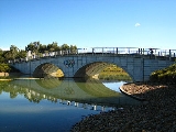
in 1979. The site supplies around 75% of Sydney’s sand and crushed aggregate requirements, including about 85% of the materials for ready mixed concrete. One of these lakes is the Sydney International Regatta Centre
Sydney International Regatta Centre
400px|thumb|Sydney International Regatta Centre BridgeThe Sydney International Regatta Centre, located in Penrith, Sydney, New South Wales, Australia, is a rowing and canoe sprint venue built for the 2000 Summer Olympics...
which hosted the rowing
Sport rowing
Rowing is a sport in which athletes race against each other on rivers, on lakes or on the ocean, depending upon the type of race and the discipline. The boats are propelled by the reaction forces on the oar blades as they are pushed against the water...
events of the Sydney 2000 Olympics. There is also the popular Penrith Whitewater Stadium
Penrith Whitewater Stadium
The Penrith Whitewater Stadium is located near Sydney, Australia. It is an artificial whitewater sporting facility which hosted the canoe/kayak slalom events at the 2000 Summer Olympics in Sydney. The facility is part of the Penrith Lakes Scheme, which is converting open-pit sand and gravel mines...
which hosted whitewater slalom events for the Sydney 2000 Olympics.
It is a popular misconception that these lakes are filled via the Nepean River but they are actually filled via rain water
Rain
Rain is liquid precipitation, as opposed to non-liquid kinds of precipitation such as snow, hail and sleet. Rain requires the presence of a thick layer of the atmosphere to have temperatures above the melting point of water near and above the Earth's surface...
and ground water. When the Nepean River floods, the lakes system can act as a weir
Weir
A weir is a small overflow dam used to alter the flow characteristics of a river or stream. In most cases weirs take the form of a barrier across the river that causes water to pool behind the structure , but allows water to flow over the top...
. A Penrith Lakes Scheme Concept Plan is currently under review to ensure the site delivers a wide range of environmental, social, cultural and economic values. Penrith Lakes has established a community advisory committee (CAC) which will meet regularly and provide advice to Penrith Lakes on the ongoing planning and development of the lakes scheme.
Commercial area
The main commercial area of Cranebrook is on Borrowdale Way which features a shopping centre and some parkland.Transport
Residents of Cranebrook can access Penrith by traveling south on The Northern Road or Castlereagh Road. The trip by car is about 5 minutes. Residents can also travel to WindsorWindsor, New South Wales
Windsor is a town in the state of New South Wales, Australia. Windsor is located in the local government area of the City of Hawkesbury. It sits on the Hawkesbury River, on the north-western outskirts of the Sydney metropolitan area. At the 2006 census, Windsor had a population of...
and Richmond
Richmond, New South Wales
Richmond is a town in New South Wales, north-west of Sydney, in the Local Government Area of the City of Hawkesbury. It is located at a latitude of 33° 35' 54" South and a longitude of 150°45' 04" east, 19 metres above sea level on the alluvial Hawkesbury River flats, at the foot of the Blue...
to the north, which are about 10–15 minutes by car. The distance to the Sydney CBD is 65 km and this is best traveled by either driving down The Northern Road to the M4 Motorway
M4 Western Motorway
The M4 Western Motorway,, is a motorway in central Sydney, New South Wales, Australia...
or taking a train from Penrith Railway Station. Cranebrook itself has no train station (the nearest station is Penrith), however the area is serviced by buses which can take residents into Penrith.
Schools
The three public primary schools are Braddock Public School, Henry Fulton Public School and Samuel Terry Public School. The local public high school is Cranebrook High School. At one point Xavier College was based in Cranebrook, while construction of its permanent site in LlandiloLlandilo, New South Wales
Llandilo is a suburb of Sydney, in the state of New South Wales, Australia. Llandilo is located 54 kilometres west of the Sydney central business district, in the local government area of the City of Penrith and is part of the Greater Western Sydney region...
was developed.
The Catholic primary school is Corpus Christi, located in northern Cranebrook. A non-denominational Christian private school, St Paul's Grammar School
St Paul's Grammar School
St Paul's Grammar School established in 1983, is an independent, coeducational, non-denominational Christian School teaching students from Pre Kindergarten to Year 12. The school is situated in Cranebrook, located at the foot of the Blue Mountains, an hour west of Sydney, New South Wales.With over...
, offers the IB Diploma Programme
IB Diploma Programme
The International Baccalaureate Diploma Programme is a two-year educational programme for students aged 16–19that provides an internationally accepted qualification for entry into higher education, and is recognised by universities worldwide. It was developed in the early to mid-1960s in Geneva by...
.
Churches
There are two churches in Cranebrook: Corpus Christi Catholic Church on Andromeda Drive and St Thomas' Anglican Church on Callisto Drive.Housing
Cranebrook is a largely residential area. It contains mostly medium-density housingMedium-density housing
Medium density housing is a term used in Australia to describe residential developments that are at higher densities than standard low-density, suburban subdivisions, but not so high that they might be regarded as high density housing. The density of standard suburban residential areas has...
and some low-density semi-rural housing towards the north. Whilst some of the semi-rural areas would date to when Cranebrook was first founded, much of the medium-density development has occurred within just the last 15 years. Even today there is a regular new home construction.
As such, the population is typically local families, many of whom are home-owners or aspiring home-owners. Suburbs like Cranebrook are often considered part of the mortgage belt
Mortgage belt
The Mortgage belt is a term used in Australian politics to signify residential suburbs which have a high concentration of families mortgaging their homes....
of Western Sydney. There are some units and semi-detached houses in the Mount Pleasant area, though the majority are detached with good size house blocks, well kept gardens and abundant mature native trees.
Politics
The state government electorateElectoral district
An electoral district is a distinct territorial subdivision for holding a separate election for one or more seats in a legislative body...
s are Londonderry and Penrith. It is in the Northern Ward of the local government area of the City of Penrith
City of Penrith
The City of Penrith is a Local Government Area in Sydney, located about west of Sydney's central business district.- History :The Municipality of Penrith was incorporated on 12 May 1871 under the Municipalities Act 1858. On 3 March 1890, St Marys was separately incorporated, and on 26 July 1893...
. The Aboriginal
Indigenous Australians
Indigenous Australians are the original inhabitants of the Australian continent and nearby islands. The Aboriginal Indigenous Australians migrated from the Indian continent around 75,000 to 100,000 years ago....
district is the Deerubbin Local Aboriginal Land Council Area.