
M4 Western Motorway
Encyclopedia
The M4 Western Motorway,, (also known as the M4 Motorway or simply M4) is a motorway in central Sydney
, New South Wales
, Australia
. It forms part of Sydney Metroad 4
.
The Western Motorway was originally constructed in several stages as the F4 Western Freeway between the late 1960s and the mid 1980s, however a lack of funding resulted in the government of Neville Wran
halting plans to construct the final stage between Mays Hill and Prospect in 1985. In December 1989 work to construct this stage began as a Build-Own-Operate-Transfer
project. In return for funding construction StateWide Roads, the consortium awarded the contract to build the stage, was given permission to toll the section between James Ruse Drive
and Silverwater Road as traffic volumes on this section were significantly higher than between Mays Hill-Prospect and would allow a shorter toll period with lower tolls. The concession held by StateWide Roads ended on 15 February 2010, with operation of the motorway returned to the Roads and Traffic Authority
and the toll removed.
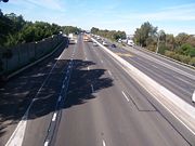
The Motorway is mostly 6 lanes wide, and carries constant heavy traffic during daylight hours, seven days a week. Built as a four lane motorway, it was widened to six lanes during 1998 to 2000, but this did little to ease the congestion. Widening the motorway any further would probably not help, as without the M4 East extension (see below), the congestion would just move further east, where traffic is deposited onto surface streets at Strathfield
.
Originally planned in the mid 1950s to start in the CBD
, the eastern section was built only as far west as Pyrmont
as part of the North West Expressway, or F3, a freeway that would connect the Sydney and Newcastle
central business districts. This section is now part of the Western Distributor
. From there it was to have joined with the Western Expressway, the F4, and the Southern Expressway, the F6, in Glebe
.
On the basis of a pre-election promise made by the Premier of New South Wales
Neville Wran
in 1976, all land reserved for the expressway between Pyrmont and the current eastern termination point at Strathfield was sold off to property developers or declassified as a freeway corridor in 1977 by the State Government. The proposed expressway ran through the seat held by the Premier Wran.
 A major extension to the M4 has been proposed and has well-advanced plans. This extension would extend the M4 beyond its current end in Strathfield
by approximately five kilometres, so that it would subsequently end in Ashfield
and be continuous with the City West Link
. Further planned upgrades to the City West Link would mean commuters going west out of the city could get to Parramatta
without passing through traffic lights. The NSW Government recently outlined a $7 billion plan to link the M4, Victoria Road
, City West Link and Sydney Airport
using a network of underground tunnels.
As of April 2005, the NSW state government has shelved plans for the M4 East extension, citing the need for an integrated plan for transport, but possibly to mitigate residents in affected suburbs which would have been affected by increased traffic had the M4 East link been approved. Future plans may include instead a continuous traffic-light-free link from the city's Western Distributor to the current end of the M4.
In the month prior to the 2011 state election
, the NRMA
released a report in which it recommended building a tunnel to connect the end of the M4 at Concord
and the start of the City West Link, relieving Parramatta Road of enough traffic to convert it into two lanes for slower-moving local traffic, two lanes of light rail
and a cycleway. The report argued that this would allow Parramatta Road
to be transformed with medium density housing, shops and cafes and that the $10.04 billion in additional stamp duty and other revenues from this would pay for the $7.38 billion price tag of the project.
The lack of this link is currently causing major problems for any commercial traffic wishing to travel between Port Botany
and the many factories and warehouses in the western suburbs. The M5 South Western Motorway
does connect directly to Port Botany, but it has chronic congestion problems of its own, and doesn't provide easy access to inner western areas of Sydney. There is so much demand for this link, that traffic not only uses the designated Metroad 4
(Parramatta Road), but also several back streets to the north and south, most of which are 2 lane residential streets.
Sydney
Sydney is the most populous city in Australia and the state capital of New South Wales. Sydney is located on Australia's south-east coast of the Tasman Sea. As of June 2010, the greater metropolitan area had an approximate population of 4.6 million people...
, New South Wales
New South Wales
New South Wales is a state of :Australia, located in the east of the country. It is bordered by Queensland, Victoria and South Australia to the north, south and west respectively. To the east, the state is bordered by the Tasman Sea, which forms part of the Pacific Ocean. New South Wales...
, Australia
Australia
Australia , officially the Commonwealth of Australia, is a country in the Southern Hemisphere comprising the mainland of the Australian continent, the island of Tasmania, and numerous smaller islands in the Indian and Pacific Oceans. It is the world's sixth-largest country by total area...
. It forms part of Sydney Metroad 4
Metroad 4
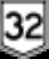
Metroad 4 is a Metroad in Sydney, New South Wales, Australia. It connects the inner-west of Sydney with the outer western suburbs. It mostly follows what was previously National Highway 32 from the Western Distributor in the CBD, west to the Great Western Highway at Lapstone...
.
The Western Motorway was originally constructed in several stages as the F4 Western Freeway between the late 1960s and the mid 1980s, however a lack of funding resulted in the government of Neville Wran
Neville Wran
Neville Kenneth Wran, AC, CNZM, QC was the Premier of New South Wales from 1976 until 1986. He was National President of the Australian Labor Party from 1980 to 1986 and Chairman of both the Lionel Murphy Foundation and the Commonwealth Scientific and Industrial Research Organisation from 1986...
halting plans to construct the final stage between Mays Hill and Prospect in 1985. In December 1989 work to construct this stage began as a Build-Own-Operate-Transfer
Build-Operate-Transfer
Build-own-operate-transfer or build-operate-transfer is a form of project financing, wherein a private entity receives a concession from the private or public sector to finance, design, construct, and operate a facility stated in the concession contract...
project. In return for funding construction StateWide Roads, the consortium awarded the contract to build the stage, was given permission to toll the section between James Ruse Drive
James Ruse Drive
James Ruse Drive is a main thoroughfare route around Parramatta, in Western Sydney. It stretches from Windsor Road, Northmead in the north to Great Western Highway , Granville in the south. It formed a section of the State route 55...
and Silverwater Road as traffic volumes on this section were significantly higher than between Mays Hill-Prospect and would allow a shorter toll period with lower tolls. The concession held by StateWide Roads ended on 15 February 2010, with operation of the motorway returned to the Roads and Traffic Authority
Roads and Traffic Authority
The Roads and Traffic Authority is a former New South Wales government agency that was responsible for major road infrastructure, licensing of drivers, and registration of motor vehicles. The RTA directly managed State roads and provided funding to local councils for regional and local roads...
and the toll removed.
The Motorway is mostly 6 lanes wide, and carries constant heavy traffic during daylight hours, seven days a week. Built as a four lane motorway, it was widened to six lanes during 1998 to 2000, but this did little to ease the congestion. Widening the motorway any further would probably not help, as without the M4 East extension (see below), the congestion would just move further east, where traffic is deposited onto surface streets at Strathfield
Strathfield, New South Wales
Strathfield is an Inner West suburb of Sydney, in the state of New South Wales, Australia. Strathfield is located 14 kilometres west of the Sydney central business district and is the administrative centre of the local government area of the Municipality of Strathfield...
.
Originally planned in the mid 1950s to start in the CBD
Sydney central business district
The Sydney central business district is the main commercial centre of Sydney, New South Wales, Australia. It extends southwards for about 3 kilometres from Sydney Cove, the point of first European settlement. Its north–south axis runs from Circular Quay in the north to Central railway station in...
, the eastern section was built only as far west as Pyrmont
Pyrmont, New South Wales
Pyrmont is an inner-city suburb of Sydney, in the state of New South Wales, Australia. Pyrmont is located 2 kilometres south-west of the Sydney central business district in the local government area of the City of Sydney...
as part of the North West Expressway, or F3, a freeway that would connect the Sydney and Newcastle
Newcastle, New South Wales
The Newcastle metropolitan area is the second most populated area in the Australian state of New South Wales and includes most of the Newcastle and Lake Macquarie Local Government Areas...
central business districts. This section is now part of the Western Distributor
Western Distributor
The Western Distributor is a primarily elevated small freeway in Sydney, New South Wales, Australia that links Victoria Road, White Bay , with the Bradfield Highway at the southern end of the Sydney Harbour Bridge...
. From there it was to have joined with the Western Expressway, the F4, and the Southern Expressway, the F6, in Glebe
Glebe, New South Wales
Glebe is an inner-city suburb of Sydney. Glebe is located 3 km south-west of the Sydney central business district and is part of the local government area of the City of Sydney, in the Inner West region....
.
On the basis of a pre-election promise made by the Premier of New South Wales
Premiers of New South Wales
The Premier of New South Wales is the head of government in the state of New South Wales, Australia. The Government of New South Wales follows the Westminster system, with a Parliament of New South Wales acting as the legislature...
Neville Wran
Neville Wran
Neville Kenneth Wran, AC, CNZM, QC was the Premier of New South Wales from 1976 until 1986. He was National President of the Australian Labor Party from 1980 to 1986 and Chairman of both the Lionel Murphy Foundation and the Commonwealth Scientific and Industrial Research Organisation from 1986...
in 1976, all land reserved for the expressway between Pyrmont and the current eastern termination point at Strathfield was sold off to property developers or declassified as a freeway corridor in 1977 by the State Government. The proposed expressway ran through the seat held by the Premier Wran.
M4 East
Strathfield, New South Wales
Strathfield is an Inner West suburb of Sydney, in the state of New South Wales, Australia. Strathfield is located 14 kilometres west of the Sydney central business district and is the administrative centre of the local government area of the Municipality of Strathfield...
by approximately five kilometres, so that it would subsequently end in Ashfield
Ashfield, New South Wales
Ashfield is a suburb in the inner-west of Sydney, in the state of New South Wales, Australia. Ashfield is about 9 kilometres south-west of the Sydney central business district and is the administrative centre for the local government area of the Municipality of Ashfield.The official name for the...
and be continuous with the City West Link
City West Link Road
City West Link Road is a link road in Sydney, Australia. It makes up a section of Metroad 4 between Leichhardt, Haberfield and Five Dock. As such, it provides an alternative route to Parramatta Road into Sydney's CBD from the Inner-West....
. Further planned upgrades to the City West Link would mean commuters going west out of the city could get to Parramatta
Parramatta, New South Wales
Parramatta is a suburb of Sydney, in the state of New South Wales, Australia. It is located in Greater Western Sydney west of the Sydney central business district on the banks of the Parramatta River. Parramatta is the administrative seat of the Local Government Area of the City of Parramatta...
without passing through traffic lights. The NSW Government recently outlined a $7 billion plan to link the M4, Victoria Road
Victoria Road, Sydney
Victoria Road is a major road in Sydney, Australia.Victoria Road connects Parramatta with the Rozelle end of Anzac Bridge. Victoria Road passes through the Sydney suburbs of Rydalmere, Ermington, West Ryde, Ryde, Gladesville and Drummoyne and is currently one of the longest roads in Sydney.The road...
, City West Link and Sydney Airport
Sydney Airport
Sydney Airport may refer to:* Sydney Airport, also known as Kingsford Smith International Airport, in Sydney, Australia* Sydney/J.A. Douglas McCurdy Airport, in Nova Scotia, Canada...
using a network of underground tunnels.
As of April 2005, the NSW state government has shelved plans for the M4 East extension, citing the need for an integrated plan for transport, but possibly to mitigate residents in affected suburbs which would have been affected by increased traffic had the M4 East link been approved. Future plans may include instead a continuous traffic-light-free link from the city's Western Distributor to the current end of the M4.
In the month prior to the 2011 state election
New South Wales state election, 2011
Elections to the 55th Parliament of New South Wales were held on Saturday, 26 March 2011. The 16-year incumbent Australian Labor Party government led by Premier Kristina Keneally was defeated in a landslide by the Liberal-National coalition opposition led by Barry O'Farrell.New South Wales has...
, the NRMA
NRMA
NRMA refers to either of two historically related Australian companies:*The National Roads and Motorists' Association, known as NRMA Motoring and Services, is a member-owned mutual organisation offering , motoring advice and other services in New South Wales and the Australian Capital...
released a report in which it recommended building a tunnel to connect the end of the M4 at Concord
Concord, New South Wales
Concord is a suburb in the inner west of Sydney, in the state of New South Wales, Australia. It is located 15 kilometres west of the Sydney central business district, in the local government area of the City of Canada Bay....
and the start of the City West Link, relieving Parramatta Road of enough traffic to convert it into two lanes for slower-moving local traffic, two lanes of light rail
Light rail
Light rail or light rail transit is a form of urban rail public transportation that generally has a lower capacity and lower speed than heavy rail and metro systems, but higher capacity and higher speed than traditional street-running tram systems...
and a cycleway. The report argued that this would allow Parramatta Road
Parramatta Road
.Parramatta Road is the major historical east-west artery of metropolitan Sydney, Australia, connecting the Sydney with Parramatta. It is the eastern-most part of the Great Western Highway. Much of its traffic has been diverted to modern expressways such as the M4 and the City West Link...
to be transformed with medium density housing, shops and cafes and that the $10.04 billion in additional stamp duty and other revenues from this would pay for the $7.38 billion price tag of the project.
The lack of this link is currently causing major problems for any commercial traffic wishing to travel between Port Botany
Port Botany, New South Wales
Port Botany is a suburb in south-eastern Sydney, in the state of New South Wales, Australia. Port Botany is located 12 kilometres south-east of the Sydney central business district, is in the local government area of the City of Randwick...
and the many factories and warehouses in the western suburbs. The M5 South Western Motorway
M5 South Western Motorway
The M5 South Western Motorway is a privately operated tolled motorway in south-western Sydney, New South Wales, Australia. It forms part of Sydney Metroad 5 and the Sydney Orbital Network...
does connect directly to Port Botany, but it has chronic congestion problems of its own, and doesn't provide easy access to inner western areas of Sydney. There is so much demand for this link, that traffic not only uses the designated Metroad 4
Metroad 4
Metroad 4 is a Metroad in Sydney, New South Wales, Australia. It connects the inner-west of Sydney with the outer western suburbs. It mostly follows what was previously National Highway 32 from the Western Distributor in the CBD, west to the Great Western Highway at Lapstone...
(Parramatta Road), but also several back streets to the north and south, most of which are 2 lane residential streets.
Exits and Interchanges
Western Motorway  |
|||
| Westbound exits | Distance to Lithgow (km) |
Distance to Sydney (km) |
Eastbound exits |
| End Western Motorway continues as Great Western Highway Great Western Highway The Great Western Highway is a highway in New South Wales, Australia. It runs 210 km from Sydney to Bathurst.Starting as Broadway at the intersection of City Road near the fringe of the Sydney CBD, and becoming Parramatta Road to Parramatta itself, the Great Western Highway heads due west from...  to Katoomba Katoomba, New South Wales Katoomba is the chief town of the City of Blue Mountains in New South Wales, Australia and the administrative headquarters of Blue Mountains City Council. It is on the Great Western Highway 110 kilometres west of Sydney and 39 kilometres south-east of Lithgow. Katoomba railway station is on the... / Lithgow Lithgow, New South Wales Lithgow is a city in the Central Tablelands of New South Wales, Australia and is the centre of the local political division City of Lithgow. It is located in a mountain valley named Lithgow's Valley by John Oxley in honour of William Lithgow, the first Auditor-General of New South Wales.Lithgow is... / Bathurst Bathurst, New South Wales -CBD and suburbs:Bathurst's CBD is located on William, George, Howick, Russell, and Durham Streets. The CBD is approximately 25 hectares and surrounds two city blocks. Within this block layout is banking, government services, shopping centres, retail shops, a park* and monuments... |
84 | 58 | Start Western Motorway from Great Western Highway Great Western Highway The Great Western Highway is a highway in New South Wales, Australia. It runs 210 km from Sydney to Bathurst.Starting as Broadway at the intersection of City Road near the fringe of the Sydney CBD, and becoming Parramatta Road to Parramatta itself, the Great Western Highway heads due west from... |
| Lapstone Lapstone, New South Wales Lapstone is a small village on the eastern escarpment of the Blue Mountains in New South Wales, Australia. Lapstone is located 62 kilometres west of Sydney in the local government area of the City of Blue Mountains and is part of the federal electorate of Macquarie. The village consists mostly of... Governors Drive |
85 | 57 | no exit |
| Leonay Leonay, New South Wales Leonay is a suburb of Sydney, in the state of New South Wales, Australia. Leonay is located 58 kilometres west of the Sydney central business district, in the local government area of the City of Penrith and is part of the Greater Western Sydney region.... , Emu Plains Emu Plains, New South Wales Emu Plains is a town, in the state of New South Wales, Australia. Emu Plains is located 58 kilometres west of the Sydney central business district, in the local government area of the City of Penrith and is part of the Greater Western Sydney region.... Leonay Parade Russell Street  |
87 | 55 | Emu Plains Emu Plains, New South Wales Emu Plains is a town, in the state of New South Wales, Australia. Emu Plains is located 58 kilometres west of the Sydney central business district, in the local government area of the City of Penrith and is part of the Greater Western Sydney region.... , Leonay Leonay, New South Wales Leonay is a suburb of Sydney, in the state of New South Wales, Australia. Leonay is located 58 kilometres west of the Sydney central business district, in the local government area of the City of Penrith and is part of the Greater Western Sydney region.... Russell Street Leonay Parade |
| Mulgoa Mulgoa, New South Wales Mulgoa is a suburb of Sydney, in the state of New South Wales, Australia. Mulgoa is located 66 kilometres west of the Sydney central business district, in the local government area of the City of Penrith and is part of the Greater Western Sydney region.... , Penrith Penrith, New South Wales Penrith is a suburb in western Sydney, in the state of New South Wales, Australia. Penrith is located west of the Sydney central business district and is the administrative centre for the local government area of the City of Penrith... Mulgoa Road |
90 | 52 | Penrith Penrith, New South Wales Penrith is a suburb in western Sydney, in the state of New South Wales, Australia. Penrith is located west of the Sydney central business district and is the administrative centre for the local government area of the City of Penrith... , Mulgoa Mulgoa, New South Wales Mulgoa is a suburb of Sydney, in the state of New South Wales, Australia. Mulgoa is located 66 kilometres west of the Sydney central business district, in the local government area of the City of Penrith and is part of the Greater Western Sydney region.... Mulgoa Road |
| Campbelltown Campbelltown, New South Wales Campbelltown is a suburb in south-western Sydney, in the state of New South Wales, Australia. Campbelltown is located 51 kilometres south-west of the Sydney central business district and is the administrative centre for the local government area of the City of Campbelltown.- History :Campbelltown... , Windsor Windsor, New South Wales Windsor is a town in the state of New South Wales, Australia. Windsor is located in the local government area of the City of Hawkesbury. It sits on the Hawkesbury River, on the north-western outskirts of the Sydney metropolitan area. At the 2006 census, Windsor had a population of... The Northern Road Metroad 9 Metroad 9 is one of Sydney, Australia's Metroads. It is the outer western Sydney Bypass connecting Campbelltown to Windsor.It replaced part of State Route 69 in December 1998 and consequently split State Route 69 into two sections. The northern section connects Windsor to Singleton...  |
93 | 49 | Windsor Windsor, New South Wales Windsor is a town in the state of New South Wales, Australia. Windsor is located in the local government area of the City of Hawkesbury. It sits on the Hawkesbury River, on the north-western outskirts of the Sydney metropolitan area. At the 2006 census, Windsor had a population of... , Campbelltown Campbelltown, New South Wales Campbelltown is a suburb in south-western Sydney, in the state of New South Wales, Australia. Campbelltown is located 51 kilometres south-west of the Sydney central business district and is the administrative centre for the local government area of the City of Campbelltown.- History :Campbelltown... The Northern Road Metroad 9 Metroad 9 is one of Sydney, Australia's Metroads. It is the outer western Sydney Bypass connecting Campbelltown to Windsor.It replaced part of State Route 69 in December 1998 and consequently split State Route 69 into two sections. The northern section connects Windsor to Singleton... |
| Liverpool Liverpool, New South Wales Liverpool is a suburb in south-western Sydney, in the state of New South Wales, Australia. Liverpool is located 32 km south-west of the Sydney central business district, and is the administrative centre of the local government area of the City of Liverpool... , St Marys St Marys, New South Wales St Marys is a suburb in western Sydney, in the state of New South Wales Australia. St Marys is located 45 kilometres west of the Sydney central business district, in the local government area of the City of Penrith.... Mamre Road |
97 | 45 | St Marys St Marys, New South Wales St Marys is a suburb in western Sydney, in the state of New South Wales Australia. St Marys is located 45 kilometres west of the Sydney central business district, in the local government area of the City of Penrith.... , Liverpool Liverpool, New South Wales Liverpool is a suburb in south-western Sydney, in the state of New South Wales, Australia. Liverpool is located 32 km south-west of the Sydney central business district, and is the administrative centre of the local government area of the City of Liverpool... Mamre Road |
| St Clair St Clair, New South Wales St Clair is a suburb of Sydney, in the state of New South Wales, Australia. St Clair is located 49 kilometres west of the Sydney central business district, in the local government area of the City of Penrith and is part of the Greater Western Sydney region... , Colyton Colyton, New South Wales Colyton is a suburb of Sydney, in the state of New South Wales, Australia. Colyton is located 43 kilometres west of the Sydney central business district, in the local government area of the City of Penrith and is part of the Greater Western Sydney region.... Erskine Park Road Roper Road |
101 | 41 | no exit |
| Canberra Canberra Canberra is the capital city of Australia. With a population of over 345,000, it is Australia's largest inland city and the eighth-largest city overall. The city is located at the northern end of the Australian Capital Territory , south-west of Sydney, and north-east of Melbourne... , Newcastle Newcastle, New South Wales The Newcastle metropolitan area is the second most populated area in the Australian state of New South Wales and includes most of the Newcastle and Lake Macquarie Local Government Areas... , Brisbane Brisbane Brisbane is the capital and most populous city in the Australian state of Queensland and the third most populous city in Australia. Brisbane's metropolitan area has a population of over 2 million, and the South East Queensland urban conurbation, centred around Brisbane, encompasses a population of... WestLink Westlink M7 Westlink M7 - formerly Western Sydney Orbital - is one of Sydney, Australia's urban motorways and a part of Metroad 7 and the Sydney Orbital Network. It connects three Metroads: M5 at Prestons, M4 at Eastern Creek and M2 at Baulkham Hills...   |
105 | 37 | Liverpool Liverpool, New South Wales Liverpool is a suburb in south-western Sydney, in the state of New South Wales, Australia. Liverpool is located 32 km south-west of the Sydney central business district, and is the administrative centre of the local government area of the City of Liverpool... , Rooty Hill Rooty Hill, New South Wales Rooty Hill is a suburb of Sydney, in the state of New South Wales, Australia. Rooty Hill is located 42 kilometres west of the Sydney central business district, in the local government area of the City of Blacktown and is part of the Greater Western Sydney region.-History:Rooty Hill was named after... Wallgrove Road |
| Rooty Hill Rooty Hill, New South Wales Rooty Hill is a suburb of Sydney, in the state of New South Wales, Australia. Rooty Hill is located 42 kilometres west of the Sydney central business district, in the local government area of the City of Blacktown and is part of the Greater Western Sydney region.-History:Rooty Hill was named after... , Liverpool Liverpool, New South Wales Liverpool is a suburb in south-western Sydney, in the state of New South Wales, Australia. Liverpool is located 32 km south-west of the Sydney central business district, and is the administrative centre of the local government area of the City of Liverpool... Wallgrove Road |
Brisbane Brisbane Brisbane is the capital and most populous city in the Australian state of Queensland and the third most populous city in Australia. Brisbane's metropolitan area has a population of over 2 million, and the South East Queensland urban conurbation, centred around Brisbane, encompasses a population of... , Newcastle Newcastle, New South Wales The Newcastle metropolitan area is the second most populated area in the Australian state of New South Wales and includes most of the Newcastle and Lake Macquarie Local Government Areas... , Canberra Canberra Canberra is the capital city of Australia. With a population of over 345,000, it is Australia's largest inland city and the eighth-largest city overall. The city is located at the northern end of the Australian Capital Territory , south-west of Sydney, and north-east of Melbourne... WestLink Westlink M7 Westlink M7 - formerly Western Sydney Orbital - is one of Sydney, Australia's urban motorways and a part of Metroad 7 and the Sydney Orbital Network. It connects three Metroads: M5 at Prestons, M4 at Eastern Creek and M2 at Baulkham Hills... |
||
| Caltex Caltex Caltex is a petroleum brand name of Chevron Corporation used in more than 60 countries in the Asia-Pacific region, the Middle East, and southern Africa.-History:... Service Centre |
107.5 | 34.5 | Caltex Caltex Caltex is a petroleum brand name of Chevron Corporation used in more than 60 countries in the Asia-Pacific region, the Middle East, and southern Africa.-History:... Service Centre |
| Blacktown Blacktown, New South Wales Blacktown is a suburb in the City of Blacktown, in Western Sydney, in the state of New South Wales, Australia. Blacktown is located 34 kilometres west of the Sydney central business district and is the administrative centre of the local government area of City of Blacktown.Blacktown is the largest... Reservoir Road |
108 | 34 | Blacktown Blacktown, New South Wales Blacktown is a suburb in the City of Blacktown, in Western Sydney, in the state of New South Wales, Australia. Blacktown is located 34 kilometres west of the Sydney central business district and is the administrative centre of the local government area of City of Blacktown.Blacktown is the largest... Reservoir Road |
| Blacktown Blacktown, New South Wales Blacktown is a suburb in the City of Blacktown, in Western Sydney, in the state of New South Wales, Australia. Blacktown is located 34 kilometres west of the Sydney central business district and is the administrative centre of the local government area of City of Blacktown.Blacktown is the largest... , Seven Hills Seven Hills, New South Wales Seven Hills is a suburb of Sydney, in the state of New South Wales, Australia. Seven Hills is located 34 kilometres west of the Sydney central business district in the local government area of the City of Blacktown. Seven Hills is part of the Greater Western Sydney region... Prospect Highway |
109 | 33 | Blacktown Blacktown, New South Wales Blacktown is a suburb in the City of Blacktown, in Western Sydney, in the state of New South Wales, Australia. Blacktown is located 34 kilometres west of the Sydney central business district and is the administrative centre of the local government area of City of Blacktown.Blacktown is the largest... , Seven Hills Seven Hills, New South Wales Seven Hills is a suburb of Sydney, in the state of New South Wales, Australia. Seven Hills is located 34 kilometres west of the Sydney central business district in the local government area of the City of Blacktown. Seven Hills is part of the Greater Western Sydney region... Prospect Highway |
| Smithfield Smithfield, New South Wales * Highest Recorded Temperature: 44.2 °C* Lowest Recorded Temperature: -2.3 °C* Warmest Month: January* Coolest Month: July* Highest Precipitation: February* Lowest Precipitation: August-Demographics:... , Wentworthville Wentworthville, New South Wales Wentworthville is a suburb of Sydney, in the state of New South Wales, Australia. Wentworthville is located 27 kilometres west of the Sydney central business district and is part of the Greater Western Sydney region. Wentworthville is split between the local government areas of the City of... , Hornsby Hornsby, New South Wales * Highest Maximum Temperature: 42 °C* Lowest Maximum Temperature: 4.9 °C* Warmest Month: January* Coolest Month: July* Highest Precipitation: February* Lowest Precipitation: July-Notable residents:... , Cumberland Highway |
114 | 28 | Smithfield Smithfield, New South Wales * Highest Recorded Temperature: 44.2 °C* Lowest Recorded Temperature: -2.3 °C* Warmest Month: January* Coolest Month: July* Highest Precipitation: February* Lowest Precipitation: August-Demographics:... , Wentworthville Wentworthville, New South Wales Wentworthville is a suburb of Sydney, in the state of New South Wales, Australia. Wentworthville is located 27 kilometres west of the Sydney central business district and is part of the Greater Western Sydney region. Wentworthville is split between the local government areas of the City of... , Hornsby Hornsby, New South Wales * Highest Maximum Temperature: 42 °C* Lowest Maximum Temperature: 4.9 °C* Warmest Month: January* Coolest Month: July* Highest Precipitation: February* Lowest Precipitation: July-Notable residents:... , Cumberland Highway |
| South Wentworthville South Wentworthville, New South Wales South Wentworthville is a suburb of Sydney, in the state of New South Wales, Australia. South Wentworthville is located 28 kilometres west of the Sydney central business district, in the local government area of the City of Holroyd and is part of the Greater Western Sydney region... , Westmead Westmead, New South Wales Westmead is a suburb of Sydney, in the state of New South Wales, Australia. Westmead is located 26 kilometres west of the Sydney central business district, in the local government area of the City of Parramatta and is part of the Greater Western Sydney region.... Coleman Street |
116 | 26 | no exit |
| Merrylands Merrylands, New South Wales Merrylands is a suburb in western Sydney, New South Wales, Australia. Merrylands is located 25 kilometres west of the Sydney central business district and is the administrative centre of the local government area of the City of Holroyd... , Parramatta Parramatta, New South Wales Parramatta is a suburb of Sydney, in the state of New South Wales, Australia. It is located in Greater Western Sydney west of the Sydney central business district on the banks of the Parramatta River. Parramatta is the administrative seat of the Local Government Area of the City of Parramatta... Burnett Street |
118 | 24 | no exit |
| no exit | 120 | 22 | Parramatta Parramatta, New South Wales Parramatta is a suburb of Sydney, in the state of New South Wales, Australia. It is located in Greater Western Sydney west of the Sydney central business district on the banks of the Parramatta River. Parramatta is the administrative seat of the Local Government Area of the City of Parramatta... , Auburn Auburn, New South Wales Auburn is a suburb in western Sydney, in the state of New South Wales Australia. Auburn is located 19 kilometres west of the Sydney central business district and is the administrative centre of the local government area of Auburn Council.-History:... , Villawood Villawood, New South Wales Villawood, a suburb of local government areas City of Bankstown and City of Fairfield, is located 25 kilometres west of the Sydney central business district, in the state of New South Wales, Australia, and is a part of the Greater Western Sydney region.... Church Street Parramatta Road Great Western Highway The Great Western Highway is a highway in New South Wales, Australia. It runs 210 km from Sydney to Bathurst.Starting as Broadway at the intersection of City Road near the fringe of the Sydney CBD, and becoming Parramatta Road to Parramatta itself, the Great Western Highway heads due west from... Woodville Road |
| Seven Hills Seven Hills, New South Wales Seven Hills is a suburb of Sydney, in the state of New South Wales, Australia. Seven Hills is located 34 kilometres west of the Sydney central business district in the local government area of the City of Blacktown. Seven Hills is part of the Greater Western Sydney region... , Windsor Windsor, New South Wales Windsor is a town in the state of New South Wales, Australia. Windsor is located in the local government area of the City of Hawkesbury. It sits on the Hawkesbury River, on the north-western outskirts of the Sydney metropolitan area. At the 2006 census, Windsor had a population of... James Ruse Drive James Ruse Drive James Ruse Drive is a main thoroughfare route around Parramatta, in Western Sydney. It stretches from Windsor Road, Northmead in the north to Great Western Highway , Granville in the south. It formed a section of the State route 55... |
121 | 21 | Seven Hills Seven Hills, New South Wales Seven Hills is a suburb of Sydney, in the state of New South Wales, Australia. Seven Hills is located 34 kilometres west of the Sydney central business district in the local government area of the City of Blacktown. Seven Hills is part of the Greater Western Sydney region... , Windsor Windsor, New South Wales Windsor is a town in the state of New South Wales, Australia. Windsor is located in the local government area of the City of Hawkesbury. It sits on the Hawkesbury River, on the north-western outskirts of the Sydney metropolitan area. At the 2006 census, Windsor had a population of... James Ruse Drive James Ruse Drive James Ruse Drive is a main thoroughfare route around Parramatta, in Western Sydney. It stretches from Windsor Road, Northmead in the north to Great Western Highway , Granville in the south. It formed a section of the State route 55... |
| FORMER TOLL PLAZA | 123 | 19 | FORMER TOLL PLAZA |
| Newcastle Newcastle, New South Wales The Newcastle metropolitan area is the second most populated area in the Australian state of New South Wales and includes most of the Newcastle and Lake Macquarie Local Government Areas... , Hornsby Hornsby, New South Wales * Highest Maximum Temperature: 42 °C* Lowest Maximum Temperature: 4.9 °C* Warmest Month: January* Coolest Month: July* Highest Precipitation: February* Lowest Precipitation: July-Notable residents:... , Carlingford Carlingford, New South Wales Carlingford is a suburb of Sydney, in the state of New South Wales, Australia. Carlingford is located 22 kilometres north-west of the Sydney central business district in the local government areas of the The Hills Shire, Hornsby Shire and the City of Parramatta... , Bankstown Bankstown, New South Wales Bankstown is a suburb of south-western Sydney, in the state of New South Wales, Australia. Bankstown is located 20 kilometres south-west of the Sydney central business district and is the administrative centre of the local government area of the City of Bankstown.-History:Prior to European... , Menai Menai, New South Wales Menai is a suburb in southern Sydney, in the state of New South Wales, Australia. Menai is located 29 kilometres south of the Sydney central business district in the local government area of the Sutherland Shire.-History:... , Wollongong Wollongong, New South Wales Wollongong is a seaside city located in the Illawarra region of New South Wales, Australia. It lies on the narrow coastal strip between the Illawarra Escarpment and the Pacific Ocean, 82 kilometres south of Sydney... Silverwater Road Metroad 6 The Metroad 6 is a Metroad in Sydney, Australia. It travels from the Metroad 1 at Princes Highway, Heathcote to Pennant Hills Road/M2 Motorway, in Carlingford.Metroad 6 replaced State Route 45 in February 1999...  |
124 | 18 | Newcastle Newcastle, New South Wales The Newcastle metropolitan area is the second most populated area in the Australian state of New South Wales and includes most of the Newcastle and Lake Macquarie Local Government Areas... , Hornsby Hornsby, New South Wales * Highest Maximum Temperature: 42 °C* Lowest Maximum Temperature: 4.9 °C* Warmest Month: January* Coolest Month: July* Highest Precipitation: February* Lowest Precipitation: July-Notable residents:... , Carlingford Carlingford, New South Wales Carlingford is a suburb of Sydney, in the state of New South Wales, Australia. Carlingford is located 22 kilometres north-west of the Sydney central business district in the local government areas of the The Hills Shire, Hornsby Shire and the City of Parramatta... , Bankstown Bankstown, New South Wales Bankstown is a suburb of south-western Sydney, in the state of New South Wales, Australia. Bankstown is located 20 kilometres south-west of the Sydney central business district and is the administrative centre of the local government area of the City of Bankstown.-History:Prior to European... , Menai Menai, New South Wales Menai is a suburb in southern Sydney, in the state of New South Wales, Australia. Menai is located 29 kilometres south of the Sydney central business district in the local government area of the Sutherland Shire.-History:... , Wollongong Wollongong, New South Wales Wollongong is a seaside city located in the Illawarra region of New South Wales, Australia. It lies on the narrow coastal strip between the Illawarra Escarpment and the Pacific Ocean, 82 kilometres south of Sydney... Silverwater Road Metroad 6 The Metroad 6 is a Metroad in Sydney, Australia. It travels from the Metroad 1 at Princes Highway, Heathcote to Pennant Hills Road/M2 Motorway, in Carlingford.Metroad 6 replaced State Route 45 in February 1999... |
| no exit | 125 | 17 | Homebush Bay Homebush Bay, New South Wales Homebush Bay was the former name of a suburb of western Sydney, in the state of New South Wales, Australia that took in the suburbs of Sydney Olympic Park, Wentworth Point and part of the neighbouring suburb of Lidcombe. Homebush Bay is located 16 kilometres west of the Sydney central business... Hill Road |
| Hurstville Hurstville, New South Wales Hurstville is a suburb in southern Sydney, in the state of New South Wales, Australia. Hurstville is located 16 kilometres south of the Sydney central business district and is part of the St George area. Hurstville is the administrative centre of the local government area of the City of... , Ryde Ryde, New South Wales Ryde is a suburb of Sydney, New South Wales, Australia. Ryde is located 13 km north-west of the Sydney central business district and 8 km east of Parramatta. Ryde is the administrative centre of the local government area of the City of Ryde and part of the Northern Suburbs area... , Mona Vale Mona Vale, New South Wales Mona Vale is a suburb in northern Sydney, in the state of New South Wales, Australia. It is located 28 kilometres north of the Sydney central business district and is the administrative centre of the local government area of Pittwater Council. Mona Vale is also part of the Northern Beaches region.-... Homebush Bay Drive / Centenary Drive Metroad 3 Metroad 3 is a Metroad in Sydney, New South Wales Australia. It replaced State Route 33 in April 1993, from Metroad 10 in Mona Vale to Metroad 1 in Blakehurst. It has many names as it goes through different suburbs. Some of these are Mona Vale Road, Ryde Road, Lane Cove Road, Concord Road and...  |
127 | 15 | Mona Vale Mona Vale, New South Wales Mona Vale is a suburb in northern Sydney, in the state of New South Wales, Australia. It is located 28 kilometres north of the Sydney central business district and is the administrative centre of the local government area of Pittwater Council. Mona Vale is also part of the Northern Beaches region.-... , Ryde Ryde, New South Wales Ryde is a suburb of Sydney, New South Wales, Australia. Ryde is located 13 km north-west of the Sydney central business district and 8 km east of Parramatta. Ryde is the administrative centre of the local government area of the City of Ryde and part of the Northern Suburbs area... , Hurstville Hurstville, New South Wales Hurstville is a suburb in southern Sydney, in the state of New South Wales, Australia. Hurstville is located 16 kilometres south of the Sydney central business district and is part of the St George area. Hurstville is the administrative centre of the local government area of the City of... Homebush Bay Drive / Centenary Drive Metroad 3 Metroad 3 is a Metroad in Sydney, New South Wales Australia. It replaced State Route 33 in April 1993, from Metroad 10 in Mona Vale to Metroad 1 in Blakehurst. It has many names as it goes through different suburbs. Some of these are Mona Vale Road, Ryde Road, Lane Cove Road, Concord Road and... |
| no exit | 129 | 13 | Concord Concord, New South Wales Concord is a suburb in the inner west of Sydney, in the state of New South Wales, Australia. It is located 15 kilometres west of the Sydney central business district, in the local government area of the City of Canada Bay.... , Strathfield Strathfield, New South Wales Strathfield is an Inner West suburb of Sydney, in the state of New South Wales, Australia. Strathfield is located 14 kilometres west of the Sydney central business district and is the administrative centre of the local government area of the Municipality of Strathfield... Concord Road |
| Start Western Motorway from Parramatta Road Metroad 4 Metroad 4 is a Metroad in Sydney, New South Wales, Australia. It connects the inner-west of Sydney with the outer western suburbs. It mostly follows what was previously National Highway 32 from the Western Distributor in the CBD, west to the Great Western Highway at Lapstone... |
130 | 12 | End Western Motorway continues as Parramatta Road Metroad 4 Metroad 4 is a Metroad in Sydney, New South Wales, Australia. It connects the inner-west of Sydney with the outer western suburbs. It mostly follows what was previously National Highway 32 from the Western Distributor in the CBD, west to the Great Western Highway at Lapstone... to Sydney Sydney Sydney is the most populous city in Australia and the state capital of New South Wales. Sydney is located on Australia's south-east coast of the Tasman Sea. As of June 2010, the greater metropolitan area had an approximate population of 4.6 million people... |