
.gif)
County Route 560 (New Jersey)
Encyclopedia
County Route 560 is a county highway
in the U.S. state
of New Jersey
. The highway extends 5.05 miles (8.1 km) from U.S. Route 206
and County Route 521
in Sandyston Township
. Route 560 ends at the Pennsylvania
state line, where it becomes Pike County Quadrant Route 2019, which connects to Pennsylvania Route 739
. Route 560's entire length is in Sandyston. However, Route 560 does pass through the hamlet of Layton
.
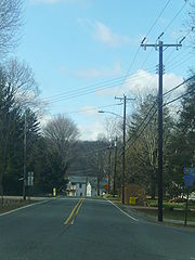 County Route 560 begins at an at-grade interchange with U.S. Route 206
and County Route 521
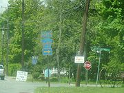
in Sandyston. The first intersection is to the left for Teneyck Lane at .2 of a mile. Route 560 heads to the northwest, intersecting with Sussex CR 615. However, the intersection is closed off heading down 615. Route 560 turns to the north into Layton, where Sussex CR 645 begins. Route 560 curves to the south and intersects with Sussex CR 640 (Bevans Road) at 2.39 miles (3.8 km).
 At the Bevans Road intersection, Route 560 turns to the east and then to the north. Route 560 enters the Delaware Water Gap National Recreation Area
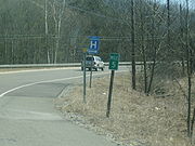
just after 3.5 miles (5.6 km). Route 560 intersects with Upper Ridge Road at 3.97 miles (6.4 km). Old Mine Road is a connector road to 206 and 521, with access to the Peters Valley Craft Center. Route 560 crosses onto the Dingmans Ferry Bridge, where it ends at the Pennsylvania state line. There it continues as QR 2019 to PA 739.
was assigned in the 1950s, it originally made the alignments of County Route 560 and the Old Mine Road north of Route 560. Then, no route originally crossed over the Dingmans Bridge to Pennsylvania Route 739
. Route 521 was later rerouted off the highway, which extended its multiplex with U.S. Route 206
. US 206 and CR 521 are now the highway's eastern terminus. When the route was completely re-routed, Tuttles Corners Road became CR 560, which was extended to the Dingmans Bridge to PA 739 (now QR 2019). The Old Mine Road segment became a federal maintained road, and there are no remains of the original 521.
County highway
A county highway is a road in the United States and in the Canadian province of Ontario that is designated and/or maintained by the county highway department...
in the U.S. state
U.S. state
A U.S. state is any one of the 50 federated states of the United States of America that share sovereignty with the federal government. Because of this shared sovereignty, an American is a citizen both of the federal entity and of his or her state of domicile. Four states use the official title of...
of New Jersey
New Jersey
New Jersey is a state in the Northeastern and Middle Atlantic regions of the United States. , its population was 8,791,894. It is bordered on the north and east by the state of New York, on the southeast and south by the Atlantic Ocean, on the west by Pennsylvania and on the southwest by Delaware...
. The highway extends 5.05 miles (8.1 km) from U.S. Route 206
U.S. Route 206
U.S. Route 206 is a long north–south United States highway in New Jersey and Pennsylvania, United States. Only about a half a mile of its length is in Pennsylvania; the Milford-Montague Toll Bridge carries it over the Delaware River into New Jersey, where it is the remainder of the route...
and County Route 521
County Route 521 (New Jersey)
County Route 521 is a county highway in the U.S. state of New Jersey. The highway extends 43.71 miles from High Street in Hope Township to the New York state line in Montague Township....
in Sandyston Township
Sandyston Township, New Jersey
- Local government :Sandyston Township is governed under the Township form of government with a three-member Township Committee. The Township Committee is elected directly by the voters in partisan elections to serve three-year terms of office on a staggered basis, with one seat coming up for...
. Route 560 ends at the Pennsylvania
Pennsylvania
The Commonwealth of Pennsylvania is a U.S. state that is located in the Northeastern and Mid-Atlantic regions of the United States. The state borders Delaware and Maryland to the south, West Virginia to the southwest, Ohio to the west, New York and Ontario, Canada, to the north, and New Jersey to...
state line, where it becomes Pike County Quadrant Route 2019, which connects to Pennsylvania Route 739
Pennsylvania Route 739
Pennsylvania Route 739 is a Pennsylvania highway contained entirely within Pike County, Pennsylvania. It was signed in 1967, and runs for almost . Its northern terminus is at U.S. Route 6 in Blooming Grove, running south to U.S. Route 209 in Delaware Township...
. Route 560's entire length is in Sandyston. However, Route 560 does pass through the hamlet of Layton
Layton, New Jersey
Layton is an unincorporated area located within Sandyston Township in Sussex County, New Jersey, United States. The area is served as United States Postal Service ZIP code 07851....
.
Route description
U.S. Route 206
U.S. Route 206 is a long north–south United States highway in New Jersey and Pennsylvania, United States. Only about a half a mile of its length is in Pennsylvania; the Milford-Montague Toll Bridge carries it over the Delaware River into New Jersey, where it is the remainder of the route...
and County Route 521
County Route 521 (New Jersey)
County Route 521 is a county highway in the U.S. state of New Jersey. The highway extends 43.71 miles from High Street in Hope Township to the New York state line in Montague Township....
in Sandyston. The first intersection is to the left for Teneyck Lane at .2 of a mile. Route 560 heads to the northwest, intersecting with Sussex CR 615. However, the intersection is closed off heading down 615. Route 560 turns to the north into Layton, where Sussex CR 645 begins. Route 560 curves to the south and intersects with Sussex CR 640 (Bevans Road) at 2.39 miles (3.8 km).
Delaware Water Gap National Recreation Area
Delaware Water Gap National Recreation Area, administered by the National Park Service, preserves almost of land along the Delaware River's New Jersey and Pennsylvania shores, stretching from the Delaware Water Gap northward almost to the New York state line...
just after 3.5 miles (5.6 km). Route 560 intersects with Upper Ridge Road at 3.97 miles (6.4 km). Old Mine Road is a connector road to 206 and 521, with access to the Peters Valley Craft Center. Route 560 crosses onto the Dingmans Ferry Bridge, where it ends at the Pennsylvania state line. There it continues as QR 2019 to PA 739.
History
When County Route 521County Route 521 (New Jersey)
County Route 521 is a county highway in the U.S. state of New Jersey. The highway extends 43.71 miles from High Street in Hope Township to the New York state line in Montague Township....
was assigned in the 1950s, it originally made the alignments of County Route 560 and the Old Mine Road north of Route 560. Then, no route originally crossed over the Dingmans Bridge to Pennsylvania Route 739
Pennsylvania Route 739
Pennsylvania Route 739 is a Pennsylvania highway contained entirely within Pike County, Pennsylvania. It was signed in 1967, and runs for almost . Its northern terminus is at U.S. Route 6 in Blooming Grove, running south to U.S. Route 209 in Delaware Township...
. Route 521 was later rerouted off the highway, which extended its multiplex with U.S. Route 206
U.S. Route 206
U.S. Route 206 is a long north–south United States highway in New Jersey and Pennsylvania, United States. Only about a half a mile of its length is in Pennsylvania; the Milford-Montague Toll Bridge carries it over the Delaware River into New Jersey, where it is the remainder of the route...
. US 206 and CR 521 are now the highway's eastern terminus. When the route was completely re-routed, Tuttles Corners Road became CR 560, which was extended to the Dingmans Bridge to PA 739 (now QR 2019). The Old Mine Road segment became a federal maintained road, and there are no remains of the original 521.
Major intersections