

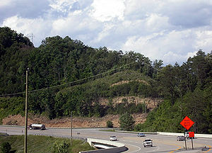
Corridor Q
Encyclopedia
Corridor Q is a highway
in the U.S. state
s of Kentucky
, Virginia
, and West Virginia
. It is part of the Appalachian Development Highway System
and U.S. Route 460
. Corridor Q runs from Corridor B (US 23/US 119) near Pikeville, Kentucky
easterly to Interstate 81 in Christiansburg, Virginia
.
Corridor Q does not meet any ADHS Corridors other than B, but it meets the planned Coalfields Expressway (U.S. Route 121) near Grundy, Virginia
, the King Coal Highway (U.S. Route 52) in Bluefield, West Virginia
, and Interstate 77 just to the east near Princeton. At its west end, traffic can continue northwesterly along Corridor B, Corridor R, Corridor I, and Interstate 64 to reach Lexington, Kentucky
. The part of Corridor Q east of Bluefield is part of the I-73/74 north–south Corridor.
 Corridor Q in Kentucky exists between Corridor B/US 23/US 119
at Yeager to the VA 80 near Breaks, Virginia
. The corridor is expected to continue southeastward to the Coalfields Expressway approximately five-miles from the Kentucky state line. The new four-lane relocation of US 460 will include interchanges at US 23, Greasy Creek Road, KY 195 and at KY 80.
Traveling further east, U.S. 460 climbs the mountain. After leaving Giles County
and entering Montgomery County
, spectacular views of the Blacksburg countryside are visible on the south side of the mountain. As the highway begins the long descent down the mountain, travelers enter Blacksburg's limits. There are several ways to access Downtown Blacksburg from U.S. 460 (Listed in order as if traveling Eastbound).
At this point, U.S. 460 travelers are now in the vicinity of Christiansburg
.
After passing the South Main Street exit, there are a few more exits for the Christiansburg area. Traffic congestion is sometimes an issue due to the numerous businesses in town and near the mall area.
Presently, U.S. 460 Business (South Main Street, but becomes North Franklin Street upon entering Christiansburg) runs through downtown Christiansburg and U.S. 460 Bypass runs just outside of the town.
into a 5.7 mile limited-access highway, connecting Blacksburg directly to I-81. The VDOT Projects and Studies website for the Smart Road project states under Phase 1, "Western end has large turnaround for normal-speed turns by test vehicles. Will link with Route 460 Business and Bypass and new Blacksburg interchange for 460 Bypass (under construction) for regular traffic when phase 3 completed". At this point in time, ramps are partially complete, but inaccessible.
comprises US 19
, US 52
and US 460
all within Mercer County
.
The section from the Virginia
state line east to US 19
/WV 112 opened in 1977 at a distance of 5.38 miles (8.7 km). It forms a southern bypass of Bluefield
and features a small concurrency with US 52
; it is signed as US 460 otherwise. During the same year, the section of US 19 and US 460 that run concurrent between WV 112 and CR 19-33 at Maple Acres opened (MP 5.38 to MP 8.68). The segment between Maple Acres and the US 19 intersection southwest of Princeton opened in 1967 (MP 8.68 to 10.70). The corridor between WV 112 and the northern US 19 intersection is signed both US 19 and US 460 (MP 5.38 to 10.70).
In 1978, a southern bypass of Princeton
opened from the northern US 19 intersection southwest of the city to the WV 104 intersection just west of Interstate 77
(MP 10.73 to MP 15.35). The four-lane road at the Interstate 77 junction opened nine-years prior (MP 15.35 to MP 15.84).
The remainder of the highway between the Interstate 77
junction and the Virginia state line at Glen Lyn
opened in 1972 and 1973 (MP 15.84 to 27.06).
The only modification to the highway, with the exclusion of various traffic signal additions between Bluefield and Princeton, is an incomplete interchange with the King Coal Highway at the eastern US 52 junction east of Bluefield. The $27 million interchange opened in the early 2000s with the four-lane upgrade of US 52 between US 460 and Interstate 77
.
Highway
A highway is any public road. In American English, the term is common and almost always designates major roads. In British English, the term designates any road open to the public. Any interconnected set of highways can be variously referred to as a "highway system", a "highway network", or a...
in the U.S. state
U.S. state
A U.S. state is any one of the 50 federated states of the United States of America that share sovereignty with the federal government. Because of this shared sovereignty, an American is a citizen both of the federal entity and of his or her state of domicile. Four states use the official title of...
s of Kentucky
Kentucky
The Commonwealth of Kentucky is a state located in the East Central United States of America. As classified by the United States Census Bureau, Kentucky is a Southern state, more specifically in the East South Central region. Kentucky is one of four U.S. states constituted as a commonwealth...
, Virginia
Virginia
The Commonwealth of Virginia , is a U.S. state on the Atlantic Coast of the Southern United States. Virginia is nicknamed the "Old Dominion" and sometimes the "Mother of Presidents" after the eight U.S. presidents born there...
, and West Virginia
West Virginia
West Virginia is a state in the Appalachian and Southeastern regions of the United States, bordered by Virginia to the southeast, Kentucky to the southwest, Ohio to the northwest, Pennsylvania to the northeast and Maryland to the east...
. It is part of the Appalachian Development Highway System
Appalachian Development Highway System
The Appalachian Development Highway System is part of the Appalachian Regional Commission in the United States. See: .-History:...
and U.S. Route 460
U.S. Route 460
U.S. Route 460 is a spur of U.S. Route 60. It currently runs for 655 miles from Norfolk, Virginia at U.S. Route 60 at Ocean View to Frankfort, Kentucky at U.S. Route 60. It passes through the states of Virginia, West Virginia, and Kentucky...
. Corridor Q runs from Corridor B (US 23/US 119) near Pikeville, Kentucky
Pikeville, Kentucky
Pikeville is a city in Pike County, Kentucky. The population was 6,903 at the 2010 census. It is the county seat of Pike County.-History:On March 25, 1822, the county's government officials decided to build a new county seat named Liberty, one and one-half mile below the mouth of the Russell Fork...
easterly to Interstate 81 in Christiansburg, Virginia
Christiansburg, Virginia
Christiansburg is a town in Montgomery County, Virginia, United States. The population was 21,041 at the 2010 census. It is the county seat of Montgomery County...
.
Corridor Q does not meet any ADHS Corridors other than B, but it meets the planned Coalfields Expressway (U.S. Route 121) near Grundy, Virginia
Grundy, Virginia
Grundy is a town in Buchanan County, Virginia, United States. The population was 1,105 at the 2000 census. It is the county seat of Buchanan County. The town is noted for its educational institutions and their role in the town's economic rebirth. In the past, the town served as a stopover for Union...
, the King Coal Highway (U.S. Route 52) in Bluefield, West Virginia
Bluefield, West Virginia
Bluefield is a city in Mercer County, West Virginia, United States. The population was 10,447 at the 2010 census. It is also the core city of the Bluefield WV-VA micropolitan area which has a population of 107,342.-Geography & Climate:...
, and Interstate 77 just to the east near Princeton. At its west end, traffic can continue northwesterly along Corridor B, Corridor R, Corridor I, and Interstate 64 to reach Lexington, Kentucky
Lexington, Kentucky
Lexington is the second-largest city in Kentucky and the 63rd largest in the US. Known as the "Thoroughbred City" and the "Horse Capital of the World", it is located in the heart of Kentucky's Bluegrass region...
. The part of Corridor Q east of Bluefield is part of the I-73/74 north–south Corridor.
Kentucky
U.S. Route 119
U.S. Route 119, commonly abbreviated as US 119, is a spur of US 19. It is a north–south route that was an original United States highway of 1926. It is often referred to as Corridor G east of US 23 and KY 80 in Kentucky to Interstate 64 at Charleston, West Virginia.- Kentucky :US 119 is a two...
at Yeager to the VA 80 near Breaks, Virginia
Breaks, Virginia
Breaks, Virginia is a small Virginia community located in Breaks, Virginia is a small [[Virginia]] community located in Breaks, Virginia is a small [[Virginia]] community located in [[Buchanan county,Breaks is located very close to the [[Kentucky]] border and is east of [[Breaks Interstate Park]]...
. The corridor is expected to continue southeastward to the Coalfields Expressway approximately five-miles from the Kentucky state line. The new four-lane relocation of US 460 will include interchanges at US 23, Greasy Creek Road, KY 195 and at KY 80.
- Section 1: US 460 will depart from US 23 at Yeager and head southeast towards Stagger Fork. An at-grade intersection will be constructed at US 23, however it will be grade-separated in 2008. This section is currently under construction http://www.us460online.com/images_072706.php.
- Section 2: US 460 will extend eastward from Stagger Fork to Greasy Creek Road. A diamond interchange is planned for the eastern terminus of this section. This section is currently under construction http://www.us460online.com/images_072706.php
- Section 3: The highway will extend further east from the Greasy Creek Road interchange to Snake Branch. This section is currently under construction http://www.us460online.com/images_072706.php.
- Section 4
- Section 4A: The relocation will continue from Snake Branch to Wolpit Branch. This section is currently under construction http://www.us460online.com/images_072706.php.
- Section 4B: US 460 will continue from Wolfpit Branch to KY 195. This section is currently under construction http://www.us460online.com/images_072706.php.
- Section 5: The highway will continue eastward from the KY 195 interchange to Laurel Branch. The KY 195 interchange will be constructed during this phase. Construction will begin on this segment in 2009.
- Section 6
- Section 6A: This section extends from Laurel Branch to Pond Creek. Construction will begin on this segment in 2010.
- Section 6B: The route is extended east to Russell Fork. Construction will begin on this segment in 2011.
- Section 6C: This involves the construction of a bridge spanning Russell Fork and KY 80. Construction will begin on this segment in 2012.
- Section 7
- Section 7JMB: This involves the construction of a bridge over Russell Fork just west of Elkhorn CityElkhorn City, KentuckyAs of the census of 2000, there were 1,060 people, 437 households, and 295 families residing in the city. The population density was 525.5 people per square mile . There were 506 housing units at an average density of 250.8 per square mile...
for John Moore Branch Road. Construction on this segment is underway. - Section 7A: This section of US 460 extends from KY 80 to 3000 feet (914.4 m) east of Beaver Creek. It includes an interchange with KY 80. Construction on this segment began in 2006.
- Section 7B: This extends from 3000 feet (914.4 m) east of Beaver Creek to KY 1373. Construction on this segment began in 2006.
- Section 7JMB: This involves the construction of a bridge over Russell Fork just west of Elkhorn City
- Section 8: US 460 will extend east from KY 1373 to the VirginiaVirginiaThe Commonwealth of Virginia , is a U.S. state on the Atlantic Coast of the Southern United States. Virginia is nicknamed the "Old Dominion" and sometimes the "Mother of Presidents" after the eight U.S. presidents born there...
state line. Construction will begin on this segment in 2007. - Section 9V: This section, constructed by the Virginia Department of TransportationVirginia Department of TransportationThe Virginia Department of Transportation is the agency of state government responsible for transportation in the state of Virginia in the United States. Headquartered in Downtown Richmond, VDOT is responsible for building, maintaining, and operating the roads, bridges and tunnels in the...
, will include the connection to VA 80. Construction will begin on this segment in 2010.
Virginia
In the early 1970s, the former Virginian Railway right-of-way along the north bank of the New River eastward from a point near the VA-WV state line near Glen Lyn to Narrows was acquired by VDOT's predecessor agency from the Norfolk and Western Railway to enable four-laning of the highway through the narrow space between the river and rocky bluffs. (The N&W main line follows the south bank through this area). Along this stretch of highway (From the WV-VA state line until Pearisburg, VA.) the speed limit fluctuates multiple times, with posted limits quickly dropping to as low as 40 miles per hour. Police presence along the highway is especially high in the town of Narrows, VA. (Where the speed limit is 40 miles per hour).Traveling further east, U.S. 460 climbs the mountain. After leaving Giles County
Giles County, Virginia
As of the census of 2000, there were 16,657 people, 6,994 households, and 4,888 families residing in the county. The population density was 47 people per square mile . There were 7,732 housing units at an average density of 22 per square mile...
and entering Montgomery County
Montgomery County, Virginia
As of the census of 2000, there were 83,629 people, 30,997 households, and 17,203 families residing in the county. The population density was 215 people per square mile . There were 32,527 housing units at an average density of 84 per square mile...
, spectacular views of the Blacksburg countryside are visible on the south side of the mountain. As the highway begins the long descent down the mountain, travelers enter Blacksburg's limits. There are several ways to access Downtown Blacksburg from U.S. 460 (Listed in order as if traveling Eastbound).
- North Main Street (Business 460): 4-way intersection (Farmingdale Lane to the right, North Main Street to the left
- Toms Creek Road: Limited-access interchange with right exit. This exit is convenient for destinations on Patrick Henry Drive (The Village Phase I and II, Terrace View, Pheasant Run Crossing, Hunter's Ridge, Pheasant Run, Collegiate Suites, University Terrace) and also destinations on the northern end of University City Blvd.
- Prices Fork Road: Limited-access interchange with right-hand exit. This exit is convenient for destinations such as Lodging (Hilton Garden Inn, Hawthorne Suites, The Inn At Virginia Tech), the University Mall area, which is on the southern end of University City Blvd. (Math Emporium, Off-Campus Bookstore, numerous dining establishments) and off-campus housing (Hethwood, Smith's Landing). From the west (U.S. 460), Prices Fork Road is the preferred way to travel into Downtown Blacksburg or one of two ways to access the Virginia Tech campus.
- Southgate Drive: 3-way intersection with a traffic signal. Runs directly onto the Virginia Tech campus. Preferred entrance point for the athletic complex and Lane Stadium. Also, the best entrance for the Virginia Tech Airport and Corporate Research Center (Both are located on Tech Center Drive, along with Virginia College of Osteopathic Medicine (VCOM))
At this point, U.S. 460 travelers are now in the vicinity of Christiansburg
Christiansburg, Virginia
Christiansburg is a town in Montgomery County, Virginia, United States. The population was 21,041 at the 2010 census. It is the county seat of Montgomery County...
.
- South Main Street (Business 460): Limited-access interchange with right-hand exit Heading north on Main Street will take you back towards Blacksburg. Heading south takes travelers past Montgomery Regional Hospital and into the business district of Christiansburg.
After passing the South Main Street exit, there are a few more exits for the Christiansburg area. Traffic congestion is sometimes an issue due to the numerous businesses in town and near the mall area.
Presently, U.S. 460 Business (South Main Street, but becomes North Franklin Street upon entering Christiansburg) runs through downtown Christiansburg and U.S. 460 Bypass runs just outside of the town.
Future
Future plans include converting the Smart RoadVirginia Smart Road
The Virginia Smart Road, also known as simply the Smart Road or Smart Highway, is a short, limited access road in Montgomery County, Virginia used for the testing of pavement technologies and as a proving ground for new transportation technologies. The Smart Road is currently a stretch of road...
into a 5.7 mile limited-access highway, connecting Blacksburg directly to I-81. The VDOT Projects and Studies website for the Smart Road project states under Phase 1, "Western end has large turnaround for normal-speed turns by test vehicles. Will link with Route 460 Business and Bypass and new Blacksburg interchange for 460 Bypass (under construction) for regular traffic when phase 3 completed". At this point in time, ramps are partially complete, but inaccessible.
West Virginia
Corridor Q in West VirginiaWest Virginia
West Virginia is a state in the Appalachian and Southeastern regions of the United States, bordered by Virginia to the southeast, Kentucky to the southwest, Ohio to the northwest, Pennsylvania to the northeast and Maryland to the east...
comprises US 19
U.S. Route 19
U.S. Route 19 is a north–south U.S. Highway. Despite encroaching Interstate Highways, the route has remained a long-haul route, connecting the Gulf of Mexico with Lake Erie....
, US 52
U.S. Route 52
U.S. Route 52 is a United States highway that runs across the northern, eastern and southeastern regions of the United States. Contrary to most other even-numbered U.S...
and US 460
U.S. Route 460
U.S. Route 460 is a spur of U.S. Route 60. It currently runs for 655 miles from Norfolk, Virginia at U.S. Route 60 at Ocean View to Frankfort, Kentucky at U.S. Route 60. It passes through the states of Virginia, West Virginia, and Kentucky...
all within Mercer County
Mercer County, West Virginia
-External links:* * * * * * *...
.
The section from the Virginia
Virginia
The Commonwealth of Virginia , is a U.S. state on the Atlantic Coast of the Southern United States. Virginia is nicknamed the "Old Dominion" and sometimes the "Mother of Presidents" after the eight U.S. presidents born there...
state line east to US 19
U.S. Route 19
U.S. Route 19 is a north–south U.S. Highway. Despite encroaching Interstate Highways, the route has remained a long-haul route, connecting the Gulf of Mexico with Lake Erie....
/WV 112 opened in 1977 at a distance of 5.38 miles (8.7 km). It forms a southern bypass of Bluefield
Bluefield, West Virginia
Bluefield is a city in Mercer County, West Virginia, United States. The population was 10,447 at the 2010 census. It is also the core city of the Bluefield WV-VA micropolitan area which has a population of 107,342.-Geography & Climate:...
and features a small concurrency with US 52
U.S. Route 52
U.S. Route 52 is a United States highway that runs across the northern, eastern and southeastern regions of the United States. Contrary to most other even-numbered U.S...
; it is signed as US 460 otherwise. During the same year, the section of US 19 and US 460 that run concurrent between WV 112 and CR 19-33 at Maple Acres opened (MP 5.38 to MP 8.68). The segment between Maple Acres and the US 19 intersection southwest of Princeton opened in 1967 (MP 8.68 to 10.70). The corridor between WV 112 and the northern US 19 intersection is signed both US 19 and US 460 (MP 5.38 to 10.70).
In 1978, a southern bypass of Princeton
Princeton, West Virginia
Princeton is a city in Mercer County, West Virginia, United States. The population was 7,652 at the 2000 census. It is part of the Bluefield, WV-VA micropolitan area which has a population of 111,586. It is the county seat of Mercer County...
opened from the northern US 19 intersection southwest of the city to the WV 104 intersection just west of Interstate 77
Interstate 77
Interstate 77 is an Interstate Highway in the eastern United States. It traverses diverse terrain, from the mountainous state of West Virginia to the rolling farmlands of North Carolina and Ohio. It largely supplants the old U.S...
(MP 10.73 to MP 15.35). The four-lane road at the Interstate 77 junction opened nine-years prior (MP 15.35 to MP 15.84).
The remainder of the highway between the Interstate 77
Interstate 77
Interstate 77 is an Interstate Highway in the eastern United States. It traverses diverse terrain, from the mountainous state of West Virginia to the rolling farmlands of North Carolina and Ohio. It largely supplants the old U.S...
junction and the Virginia state line at Glen Lyn
Glen Lyn, Virginia
Glen Lyn is a town in Giles County, Virginia, United States, at the confluence of the East and New Rivers. The population was 151 at the 2000 census...
opened in 1972 and 1973 (MP 15.84 to 27.06).
The only modification to the highway, with the exclusion of various traffic signal additions between Bluefield and Princeton, is an incomplete interchange with the King Coal Highway at the eastern US 52 junction east of Bluefield. The $27 million interchange opened in the early 2000s with the four-lane upgrade of US 52 between US 460 and Interstate 77
Interstate 77
Interstate 77 is an Interstate Highway in the eastern United States. It traverses diverse terrain, from the mountainous state of West Virginia to the rolling farmlands of North Carolina and Ohio. It largely supplants the old U.S...
.