
Copake, New York
Encyclopedia
Copake is a town
in Columbia County
, United States
. New York
, United States
. The population was 3,278 at the 2000 census. The town derives its name from a lake, which was known to the natives as Cook-pake, or Ack-kook-peek, meaning "Snake Pond." The town borders Taconic State Park
.
The Town of Copake is on the south eastern border of the county.
The Township of Copake was formed in 1824 by splitting it from the Town of Granger that was renamed Taghkanic. A former early industry was iron
mining and smelting. Adjacent to the village of Copake Falls in Taconic State Park
is the "Ore Pit", a former iron mine, now a 40 feet (12.2 m) deep swimming pond.
had a home in West Copake.
Mariah Carey
had a home in Craryville, located on the ourskirts of Copake.
, the town has a total area of 42.1 square miles (109 km²), of which, 41 square miles (106.2 km²) of it is land and 1.2 square miles (3.1 km²) of it (2.75%) is water.
The town is easily accessible from New York City via the Taconic State Parkway or NY RT 22 and is a popular destination for second home owners escaping busy Manhattan. Metro-North Railroad is also located about 20 minutes south of the town with service to and from Grand Central Terminal.
The east town line is the border of Berkshire County
, Massachusetts
.
of 2000, there were 3,278 people, 1,280 households, and 869 families residing in the town. The population density
was 80.0 people per square mile (30.9/km²). There were 2,185 housing units at an average density of 53.3 per square mile (20.6/km²). The racial makeup of the town was 96.55% White, 0.70% African American, 0.46% Native American, 0.12% Asian, 0.58% from other races
, and 1.59% from two or more races. Hispanic or Latino of any race were 2.29% of the population.
There were 1,280 households out of which 27.2% had children under the age of 18 living with them, 54.3% were married couples
living together, 8.4% had a female householder with no husband present, and 32.1% were non-families. 25.9% of all households were made up of individuals and 11.7% had someone living alone who was 65 years of age or older. The average household size was 2.45 and the average family size was 2.89.
In the town the population was spread out with 21.4% under the age of 18, 6.1% from 18 to 24, 28.1% from 25 to 44, 26.2% from 45 to 64, and 18.3% who were 65 years of age or older. The median age was 42 years. For every 100 females there were 104.7 males. For every 100 females age 18 and over, there were 101.5 males.
The median income for a household in the town was $42,261, and the median income for a family was $46,544. Males had a median income of $32,004 versus $25,341 for females. The per capita income
for the town was $23,088. About 6.5% of families and 8.1% of the population were below the poverty line, including 11.8% of those under age 18 and 4.5% of those age 65 or over.
Town
A town is a human settlement larger than a village but smaller than a city. The size a settlement must be in order to be called a "town" varies considerably in different parts of the world, so that, for example, many American "small towns" seem to British people to be no more than villages, while...
in Columbia County
Columbia County, New York
Columbia County is a county located in the U.S. state of New York. As of the 2010 census, the population was 63,096. The county seat is Hudson. The name comes from the Latin feminine form of the name of Christopher Columbus, which was at the time of the formation of the county a popular proposal...
, United States
United States
The United States of America is a federal constitutional republic comprising fifty states and a federal district...
. New York
New York
New York is a state in the Northeastern region of the United States. It is the nation's third most populous state. New York is bordered by New Jersey and Pennsylvania to the south, and by Connecticut, Massachusetts and Vermont to the east...
, United States
United States
The United States of America is a federal constitutional republic comprising fifty states and a federal district...
. The population was 3,278 at the 2000 census. The town derives its name from a lake, which was known to the natives as Cook-pake, or Ack-kook-peek, meaning "Snake Pond." The town borders Taconic State Park
Taconic State Park
Taconic State Park is located in Columbia and Dutchess County, New York abutting Massachusetts and Connecticut within the Taconic Mountains. The state park is located off New York State Route 344 south of Interstate 90 and north of New York City...
.
The Town of Copake is on the south eastern border of the county.
History
Copake is part of the 1686 Taconic Grant to Robert Livingston for about 400 acres (1.6 km²) of good land and 2200 acres (8.9 km²) of woodland. After it was purchased from the Indians it turned out to be 160000 acres (647.5 km²) and he established the English style Livingston Manor. The Manor extended well into what is now Massachuetts. The first lease given by Livingston in Copake was for about 85 acres (343,983.1 m²) in 1687 to Matthews Abraham Van Deusen. Because New England claimed ownership west to the Hudson River a border dispute broke out. The Boston Bay Colony laid out three townships west of the Taconic Mountains in 1755. Most of the present Town of Copake was in one of the townships. New settlers were given 100 acre (0.404686 km²) free and some of Livingston’s tenants refused to pay rent. The border was settled in 1757 by the Lords Commissioners of Trade in London. Farmers west of the border continued to protest, however. In 1844 a rally organized by the Taconic Mutual Association took place in the center of the hamlet. After the rally the arrest of several of the leaders sparked wider protests. Eventually the Anti-Rent Party was formed in New York State and New York instituted land reform. The Anti-Rent Party called for a Homestead Act to develop the western land. It became part of the Republican Party and was important in the election of Lincoln in 1860.The Township of Copake was formed in 1824 by splitting it from the Town of Granger that was renamed Taghkanic. A former early industry was iron
Iron
Iron is a chemical element with the symbol Fe and atomic number 26. It is a metal in the first transition series. It is the most common element forming the planet Earth as a whole, forming much of Earth's outer and inner core. It is the fourth most common element in the Earth's crust...
mining and smelting. Adjacent to the village of Copake Falls in Taconic State Park
Taconic State Park
Taconic State Park is located in Columbia and Dutchess County, New York abutting Massachusetts and Connecticut within the Taconic Mountains. The state park is located off New York State Route 344 south of Interstate 90 and north of New York City...
is the "Ore Pit", a former iron mine, now a 40 feet (12.2 m) deep swimming pond.
Former residents of note
Henry AstorHenry Astor
Four members of the Astor family were named Henry:1. Henry Astor was the brother of furrier and 18th century New York City real estate mogul John Jacob Astor....
had a home in West Copake.
Mariah Carey
Mariah Carey
Mariah Carey is an American singer-songwriter, record producer, and actress. She made her recording debut with the release of her eponymous studio album in 1990, under the guidance of Columbia Records executive Tommy Mottola, whom she later married in 1993...
had a home in Craryville, located on the ourskirts of Copake.
Geography
According to the United States Census BureauUnited States Census Bureau
The United States Census Bureau is the government agency that is responsible for the United States Census. It also gathers other national demographic and economic data...
, the town has a total area of 42.1 square miles (109 km²), of which, 41 square miles (106.2 km²) of it is land and 1.2 square miles (3.1 km²) of it (2.75%) is water.
The town is easily accessible from New York City via the Taconic State Parkway or NY RT 22 and is a popular destination for second home owners escaping busy Manhattan. Metro-North Railroad is also located about 20 minutes south of the town with service to and from Grand Central Terminal.
The east town line is the border of Berkshire County
Berkshire County, Massachusetts
Berkshire County is a non-governmental county located on the western edge of the U.S. state of Massachusetts. As of the 2010 census, the population was 131,219. Its largest city and traditional county seat is Pittsfield...
, Massachusetts
Massachusetts
The Commonwealth of Massachusetts is a state in the New England region of the northeastern United States of America. It is bordered by Rhode Island and Connecticut to the south, New York to the west, and Vermont and New Hampshire to the north; at its east lies the Atlantic Ocean. As of the 2010...
.
Demographics
As of the censusCensus
A census is the procedure of systematically acquiring and recording information about the members of a given population. It is a regularly occurring and official count of a particular population. The term is used mostly in connection with national population and housing censuses; other common...
of 2000, there were 3,278 people, 1,280 households, and 869 families residing in the town. The population density
Population density
Population density is a measurement of population per unit area or unit volume. It is frequently applied to living organisms, and particularly to humans...
was 80.0 people per square mile (30.9/km²). There were 2,185 housing units at an average density of 53.3 per square mile (20.6/km²). The racial makeup of the town was 96.55% White, 0.70% African American, 0.46% Native American, 0.12% Asian, 0.58% from other races
Race (United States Census)
Race and ethnicity in the United States Census, as defined by the Federal Office of Management and Budget and the United States Census Bureau, are self-identification data items in which residents choose the race or races with which they most closely identify, and indicate whether or not they are...
, and 1.59% from two or more races. Hispanic or Latino of any race were 2.29% of the population.
There were 1,280 households out of which 27.2% had children under the age of 18 living with them, 54.3% were married couples
Marriage
Marriage is a social union or legal contract between people that creates kinship. It is an institution in which interpersonal relationships, usually intimate and sexual, are acknowledged in a variety of ways, depending on the culture or subculture in which it is found...
living together, 8.4% had a female householder with no husband present, and 32.1% were non-families. 25.9% of all households were made up of individuals and 11.7% had someone living alone who was 65 years of age or older. The average household size was 2.45 and the average family size was 2.89.
In the town the population was spread out with 21.4% under the age of 18, 6.1% from 18 to 24, 28.1% from 25 to 44, 26.2% from 45 to 64, and 18.3% who were 65 years of age or older. The median age was 42 years. For every 100 females there were 104.7 males. For every 100 females age 18 and over, there were 101.5 males.
The median income for a household in the town was $42,261, and the median income for a family was $46,544. Males had a median income of $32,004 versus $25,341 for females. The per capita income
Per capita income
Per capita income or income per person is a measure of mean income within an economic aggregate, such as a country or city. It is calculated by taking a measure of all sources of income in the aggregate and dividing it by the total population...
for the town was $23,088. About 6.5% of families and 8.1% of the population were below the poverty line, including 11.8% of those under age 18 and 4.5% of those age 65 or over.
Communities and locations in Copake
- Camphill VillageCamphill MovementThe Camphill Movement is an initiative for social change inspired by anthroposophy. Camphill communities are residential "life-sharing" communities and schools for adults and children with learning disabilities, mental health problems and other special needs, which provide services and support for...
– A therapeutic community for developmentally disabledDevelopmental disabilityDevelopmental disability is a term used in the United States and Canada to describe lifelong disabilities attributable to mental or physical impairments, manifested prior to age 18. It is not synonymous with "developmental delay" which is often a consequence of a temporary illness or trauma during...
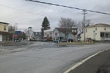
adults. - Copake (formerly "Copake Flats") – The hamlet of Copake is in the south part of the town.
- Copake Falls – A hamlet north of Copake village.
- Copake Iron Works – A former community in the town, now in the state park.
- Copake LakeCopake Lake, New YorkCopake Lake is a community in Columbia County, New York, United States. The population was 823 at the 2010 census.Copake Lake census region is named after Copake Lake, a lake by the west town line of the Town of Copake...
– The name of 1: a lakeLakeA lake is a body of relatively still fresh or salt water of considerable size, localized in a basin, that is surrounded by land. Lakes are inland and not part of the ocean and therefore are distinct from lagoons, and are larger and deeper than ponds. Lakes can be contrasted with rivers or streams,...
on the western town line; 2: a community within the cdp. - Craryville (formerly "Bains Corner") – A hamlet in the northwest part of the town.
- Taconic Shores – A community (property owners association) northwest of Copake village encircling Robinson Pond.
- Taconic State ParkTaconic State ParkTaconic State Park is located in Columbia and Dutchess County, New York abutting Massachusetts and Connecticut within the Taconic Mountains. The state park is located off New York State Route 344 south of Interstate 90 and north of New York City...
– - Weedmines – A location at the south town line.
- West Copake (formerly "Andersons Corners") – A hamlet in the southwest part of the town and southwest of Copake village.