Clay Belt
Encyclopedia

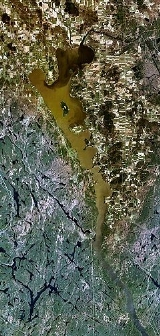
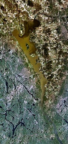
The Clay Belt is a vast tract of fertile soil
Fertile soil
Fertile soil has the following properties:*It is rich in nutrients necessary for basic plant nutrition, including nitrogen, phosphorus and potassium....
in northeastern
Northeastern Ontario
Northeastern Ontario is the region within the Canadian province of Ontario which lies north and east of Lakes Superior and Huron.Northeastern Ontario consists of the districts of Algoma, Sudbury, Cochrane, Timiskaming, Nipissing and Manitoulin; and the single-tier municipality of Greater...
Ontario
Ontario
Ontario is a province of Canada, located in east-central Canada. It is Canada's most populous province and second largest in total area. It is home to the nation's most populous city, Toronto, and the nation's capital, Ottawa....
, Canada, between the area of Cochrane District, and Abitibi County, Quebec
Abitibi County, Quebec
Abitibi County is an historical County in northwestern Quebec. Its County seat was in Amos. It extended from the Ontario border in the west to the Gouin Reservoir in the east, and included the communities of La Sarre and Val-d'Or in addition to Amos...
covering around 29,000,000 acres (120,000 km2) in total. It is generally subdivided into the Great Clay Belt to the north running eastward from Kapuskasing, and the Lesser Clay Belt to its south, running from Englehart down to the Wabi River to the northern tip of Lake Timiskaming
Lake Timiskaming
Lake Timiskaming is a large freshwater lake on the provincial border between Ontario and Quebec, Canada. The lake, which forms part of the Ottawa River, is in length and covers an area of almost . Its water level ranges between and above sea-level, with a mean annual average of . The lake is...
. The Clay Belt is the result of the draining of the Glacial Lake Ojibway
Glacial Lake Ojibway
Glacial Lake Ojibway was a prehistoric lake in what is now Northern Ontario and Quebec in Canada. Ojibway was the last of the great proglacial lakes of the last ice age. Comparable in size to Lake Agassiz , and north of the Great Lakes, it was at its greatest extent c. 8,500 years BP.Lake Ojibway...
around 8,000 B.C., whose lakebed sediment forms the modern landform. The Clay Belt is surrounded by Canadian Shield
Canadian Shield
The Canadian Shield, also called the Laurentian Plateau, or Bouclier Canadien , is a vast geological shield covered by a thin layer of soil that forms the nucleus of the North American or Laurentia craton. It is an area mostly composed of igneous rock which relates to its long volcanic history...
, forming an island of "southern flatlands" in the midst of the hilly and rocky surroundings. Similar "glaciolacustrine deposits
Glaciolacustrine deposits
Sediments deposited into lakes that have come from glaciers are called glaciolacustrine deposits. These lakes include ice margin lakes or other types formed from glacial erosion or deposition. Sediments in the bedload and suspended load are carried into lakes and deposited...
" dot the northern areas of Ontario, Quebec and Labrador.
The area was first mapped by Dr. Robert Bell and his assistant Arthur Barlow in 1887, as part of a wider series of surveys in northern Ontario. In 1899, Barlow wrote a report on the geology and natural resources of the area, which suggested that the rich belt of clay that lay north of Lake Temiskaming was ideal for agricultural settlement. The area has a rich clay soil, in contrast to the low fertility of the muskeg and exposed bedrock shield surrounding it. Moreover, the combination of its general fertility, flat topography, high water table and relative accessibility to an extensive network of roads for logging and mining make it suitable for some types of farming. The following year, the government announced plans to develop the area by tapping its natural resources.
Soon after, Bernhard Eduard Fernow traveled the area at the behest of the Federal Commission of Conservation, ostensibly to survey the area of the Canadian National Railway
Canadian National Railway
The Canadian National Railway Company is a Canadian Class I railway headquartered in Montreal, Quebec. CN's slogan is "North America's Railroad"....
transcontinental
Transcontinental railroad
A transcontinental railroad is a contiguous network of railroad trackage that crosses a continental land mass with terminals at different oceans or continental borders. Such networks can be via the tracks of either a single railroad, or over those owned or controlled by multiple railway companies...
main line
Main line (railway)
The Mainline or Main line of a railway is a track that is used for through trains or is the principal artery of the system from which branch lines, yards, sidings and spurs are connected....
(formerly the Grand Trunk) and the potential for fire. He makes extensive mention of the condition of the timber, and has a somewhat tempered view of their potential commercial value. He then moves on to a somewhat more positive report on the soil and its suitability for farming, saying its future is "bright". Wishing to avoid the "Trent watershed" problem, an earlier failed settlement attempt, he suggested setting up an experimental farm to test what "treatment is necessary on the various soils". Such a farm was set up in Kapuskasing on the west side of the river to explore and develop crops and systems for farming the area.
The Canadian government encouraged immigrants to settle there as farmers during and after World War I
World War I
World War I , which was predominantly called the World War or the Great War from its occurrence until 1939, and the First World War or World War I thereafter, was a major war centred in Europe that began on 28 July 1914 and lasted until 11 November 1918...
. Governments of the day were mistakenly impressed with the agricultural potential of the Great Clay Belt. Under the Returned Soldiers and Sailors Act of 1917 the Kapuskasing Soldier Colony was established to settle veterans returned from the Great War. Settlers received homesteads, grants and guaranteed loans and were paid for clearing their own land. But by 1920 only nine of more than a hundred original settlers remained. The farming consisted of some grains
Cereal
Cereals are grasses cultivated for the edible components of their grain , composed of the endosperm, germ, and bran...
, mostly oats
OATS
OATS - Open Source Assistive Technology Software - is a source code repository or "forge" for assistive technology software. It was launched in 2006 with the goal to provide a one-stop “shop” for end users, clinicians and open-source developers to promote and develop open source assistive...
, and vegetables. In spite of numerous rocky outcrop
Outcrop
An outcrop is a visible exposure of bedrock or ancient superficial deposits on the surface of the Earth. -Features:Outcrops do not cover the majority of the Earth's land surface because in most places the bedrock or superficial deposits are covered by a mantle of soil and vegetation and cannot be...
s some farming was successfully established within the Great Clay Belt, however, it proved to be impractical because of the short growing season. The clay soil is tremendously fertile, but long snowy winters coupled with unpredictable rainfall during the short growing season meant most farming yielded little.
By 1935, immigration to the Great Clay Belt virtually ended. One farmer, describing why he returned to urban life, stated that, in the Great Clay Belt, "there are seven months of snow, two months rain, and all the rest is black flies and mosquitoes." Some of the farmers returned to Toronto and Montreal. Some moved west to the prairie provinces of Manitoba
Manitoba
Manitoba is a Canadian prairie province with an area of . The province has over 110,000 lakes and has a largely continental climate because of its flat topography. Agriculture, mostly concentrated in the fertile southern and western parts of the province, is vital to the province's economy; other...
, Saskatchewan
Saskatchewan
Saskatchewan is a prairie province in Canada, which has an area of . Saskatchewan is bordered on the west by Alberta, on the north by the Northwest Territories, on the east by Manitoba, and on the south by the U.S. states of Montana and North Dakota....
and Alberta
Alberta
Alberta is a province of Canada. It had an estimated population of 3.7 million in 2010 making it the most populous of Canada's three prairie provinces...
once the National Transcontinental Railway
National Transcontinental Railway
The National Transcontinental Railway was a historic Canadian railway between Winnipeg and Moncton. Much of the line is now operated by the Canadian National Railway.-The Grand Trunk partnership:...
was completed. Many of the farmers shifted to mining once minerals were found in the area. Others entered the logging industry. Some towns still remaining today include Cochrane
Cochrane, Ontario
Cochrane is a town in northern Ontario, Canada. It is located east of Kapuskasing, northeast of Timmins, south of Moosonee, and north of Iroquois Falls. It is about a one-hour drive from Timmins, the major city of the region. It is the seat of Cochrane District...
, New Liskeard, Timmins
Timmins
Timmins is a city in northeastern Ontario, Canada on the Mattagami River. At the time of the Canada 2006 Census, Timmins' population was 42,997...
, Kapuskasing, and even as far west as Hearst
Hearst, Ontario
Hearst is a town in the Canadian province of Ontario. It is located in Northern Ontario, approximately west of Kapuskasing, approximately north of Toronto and east of Thunder Bay on Highway 11...
.
The Little Clay Belt is an area analogous to the Great Clay Belt, and likewise is located in Northeastern Ontario. Unfortunately, neither the Great nor the Little Clay Belt seems able to attract any sort of sustainable industry to employ people for long periods of time. Both regions go through periodic "boom and bust" cycles, depending upon the fortunes of the pulp and paper industries, and the mining industries.

