
City and District of St Albans
Encyclopedia
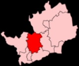
The City of St Albans s, also known as the City and District of St Albans or District of St Albans, is a local government district, in Hertfordshire
, England
. It was created in 1974 and since then has held the status of non-metropolitan district
and city
. The local authority is St Albans City Council. It has routes to the M1 motorway
via the A414 road
(formerly the M10 motorway), and rail routes to London St Pancras
and Watford
via St Albans City railway station and St Albans Abbey railway station
respectively.
(population c. 58,000), Harpenden
(population c. 27,600), the parish
es of Colney Heath
, Harpenden Rural
, London Colney
, Redbourn
, St Michael's, St Stephen
's (including the villages of Chiswell Green
and Bricket Wood
), Sandridge
and Wheathampstead
. Nearby places outside the district include Hatfield
to the east, Welwyn Garden City
to the northeast, Luton
and Dunstable
to the northwest, Hemel Hempstead
to the west, Watford
to the southwest and Borehamwood
to the south.
The district was created on 1 April 1974 as a merger of the City of St Albans
, the Harpenden Urban District and most of St Albans Rural District
. City status had been granted to the municipal borough
of St Albans in 1877, following the elevation of St Albans Abbey to cathedral. The status was granted to the entire district by letters patent
dated 9 July 1974.
Hertfordshire
Hertfordshire is a ceremonial and non-metropolitan county in the East region of England. The county town is Hertford.The county is one of the Home Counties and lies inland, bordered by Greater London , Buckinghamshire , Bedfordshire , Cambridgeshire and...
, England
England
England is a country that is part of the United Kingdom. It shares land borders with Scotland to the north and Wales to the west; the Irish Sea is to the north west, the Celtic Sea to the south west, with the North Sea to the east and the English Channel to the south separating it from continental...
. It was created in 1974 and since then has held the status of non-metropolitan district
Non-metropolitan district
Non-metropolitan districts, or colloquially shire districts, are a type of local government district in England. As created, they are sub-divisions of non-metropolitan counties in a so-called "two-tier" arrangement...
and city
City status in the United Kingdom
City status in the United Kingdom is granted by the British monarch to a select group of communities. The holding of city status gives a settlement no special rights other than that of calling itself a "city". Nonetheless, this appellation carries its own prestige and, consequently, competitions...
. The local authority is St Albans City Council. It has routes to the M1 motorway
M1 motorway
The M1 is a north–south motorway in England primarily connecting London to Leeds, where it joins the A1 near Aberford. While the M1 is considered to be the first inter-urban motorway to be completed in the United Kingdom, the first road to be built to motorway standard in the country was the...
via the A414 road
A414 road
The A414 is a major road in England. It runs from the A41 at a junction west of Hemel Hempstead in Hertfordshire, through the town to junction 8 of the M1 motorway at Buncefield, and running parallel to the M1 until junction 7, heading south of St Albans, east through Hatfield, Hertford, then...
(formerly the M10 motorway), and rail routes to London St Pancras
St Pancras railway station
St Pancras railway station, also known as London St Pancras and since 2007 as St Pancras International, is a central London railway terminus celebrated for its Victorian architecture. The Grade I listed building stands on Euston Road in St Pancras, London Borough of Camden, between the...
and Watford
Watford Junction railway station
On 23 January 1975, an express train from Manchester to Euston derailed just south of Watford Junction after striking some stillages that had fallen on to the track. It then collided with a sleeper service from Euston to Glasgow. The driver of the Manchester train was killed, and eight passengers...
via St Albans City railway station and St Albans Abbey railway station
St Albans Abbey railway station
St Albans Abbey railway station serves the city of St Albans, in Hertfordshire, England, being situated about 1 km south of the city centre in the St Stephen's area of the city. It is the terminus of the Abbey Line from Watford Junction, which is part of the London Midland franchise...
respectively.
Geography
The district includes St AlbansSt Albans
St Albans is a city in southern Hertfordshire, England, around north of central London, which forms the main urban area of the City and District of St Albans. It is a historic market town, and is now a sought-after dormitory town within the London commuter belt...
(population c. 58,000), Harpenden
Harpenden
Harpenden is a town in Hertfordshire, England.The town's total population is just under 30,000.-Geography and administration:There are two civil parishes: Harpenden and Harpenden Rural....
(population c. 27,600), the parish
Parish
A parish is a territorial unit historically under the pastoral care and clerical jurisdiction of one parish priest, who might be assisted in his pastoral duties by a curate or curates - also priests but not the parish priest - from a more or less central parish church with its associated organization...
es of Colney Heath
Colney Heath
Colney Heath is a large village south-east of St Albans, Hertfordshire, United Kingdom.The population of the ward of Colney Heath at the time of the 2001 census was 5,449....
, Harpenden Rural
Harpenden Rural
Harpenden Rural is a civil parish in the City and District of St Albans in Hertfordshire, England, to the west of Harpenden parish itself. It was created in 1898 when the old Harpenden parish was split into two - one urban and one rural....
, London Colney
London Colney
London Colney is a village and civil parish in Hertfordshire, England. It is located to the north of London, at Junction 22 of the M25 motorway....
, Redbourn
Redbourn
Redbourn is a village and civil parish in Hertfordshire, United Kingdom, lying on Watling Street, 3 miles from Harpenden, 4 miles from St Albans and 5 miles from Hemel Hempstead. It has a population of around 6,000.-History:...
, St Michael's, St Stephen
St Stephen, Hertfordshire
St Stephen is a civil parish in the City and District of St Albans, Hertfordshire, England. The parish is to the south-west of St Albans proper, and includes the areas of Park Street, Chiswell Green, How Wood, Bricket Wood, and Frogmore....
's (including the villages of Chiswell Green
Chiswell Green
Chiswell Green is an area, originally a village, in St Albans, Hertfordshire with a population of approximately 2,800, in the City and District of St Albans.It is situated 2 miles south of St Albans on the North Orbital Road, close to Junction 21A of the M25....
and Bricket Wood
Bricket Wood
Bricket Wood is a village in the county of Hertfordshire, England, approximately 4½ miles from St Albans. It is part of the parish of St Stephen. Its railway station is served by a London Midland service that runs between St Albans Abbey and Watford Junction stations.Close to the village stands...
), Sandridge
Sandridge
Sandridge is a small village and civil parish between St Albans and Wheathampstead in Hertfordshire, England, United Kingdom.-Early history:...
and Wheathampstead
Wheathampstead
Wheathampstead is a village and civil parish in the City and District of St Albans, in Hertfordshire, England. It is north of St Albans and in the Hitchin and Harpenden parliamentary constituency....
. Nearby places outside the district include Hatfield
Hatfield, Hertfordshire
Hatfield is a town and civil parish in Hertfordshire, England in the borough of Welwyn Hatfield. It has a population of 29,616, and is of Saxon origin. Hatfield House, the home of the Marquess of Salisbury, is the nucleus of the old town...
to the east, Welwyn Garden City
Welwyn Garden City
-Economy:Ever since its inception as garden city, Welwyn Garden City has attracted a strong commercial base with several designated employment areas. Among the companies trading in the town are:*Air Link Systems*Baxter*British Lead Mills*Carl Zeiss...
to the northeast, Luton
Luton
Luton is a large town and unitary authority of Bedfordshire, England, 30 miles north of London. Luton and its near neighbours, Dunstable and Houghton Regis, form the Luton/Dunstable Urban Area with a population of about 250,000....
and Dunstable
Dunstable
Dunstable is a market town and civil parish located in Bedfordshire, England. It lies on the eastward tail spurs of the Chiltern Hills, 30 miles north of London. These geographical features form several steep chalk escarpments most noticeable when approaching Dunstable from the north.-Etymology:In...
to the northwest, Hemel Hempstead
Hemel Hempstead
Hemel Hempstead is a town in Hertfordshire in the East of England, to the north west of London and part of the Greater London Urban Area. The population at the 2001 Census was 81,143 ....
to the west, Watford
Watford
Watford is a town and borough in Hertfordshire, England, situated northwest of central London and within the bounds of the M25 motorway. The borough is separated from Greater London to the south by the urbanised parish of Watford Rural in the Three Rivers District.Watford was created as an urban...
to the southwest and Borehamwood
Borehamwood
-Film industry:Since the 1920s, the town has been home to several film studios and many shots of its streets are included in final cuts of 20th century British films. This earned it the nickname of the "British Hollywood"...
to the south.
Governance
The local authority is St Albans City Council, which also calls itself St Albans City and District Council and St Albans District Council. The irregular sounding name reflects the diverse nature of the area covered, with two main urban areas and several villages; typically districts with the status of cities are known simply as Cities, for example the City of Peterborough or the City of York.The district was created on 1 April 1974 as a merger of the City of St Albans
St Albans
St Albans is a city in southern Hertfordshire, England, around north of central London, which forms the main urban area of the City and District of St Albans. It is a historic market town, and is now a sought-after dormitory town within the London commuter belt...
, the Harpenden Urban District and most of St Albans Rural District
St Albans Rural District
St Albans was, from 1894 to 1974, a rural district in the administrative county of Hertfordshire, England.The district was formed by the Local Government Act 1894 from the area of the existing St Albans rural sanitary district. An elected rural district council replaced the rural sanitary authority...
. City status had been granted to the municipal borough
Municipal borough
Municipal boroughs were a type of local government district which existed in England and Wales between 1835 and 1974, in Northern Ireland from 1840 to 1973 and in the Republic of Ireland from 1840 to 2002...
of St Albans in 1877, following the elevation of St Albans Abbey to cathedral. The status was granted to the entire district by letters patent
Letters patent
Letters patent are a type of legal instrument in the form of a published written order issued by a monarch or president, generally granting an office, right, monopoly, title, or status to a person or corporation...
dated 9 July 1974.