

Charlton Avenue (Hamilton, Ontario)
Encyclopedia

Charlton Avenue, is a Lower City collector road in Hamilton, Ontario
Hamilton, Ontario
Hamilton is a port city in the Canadian province of Ontario. Conceived by George Hamilton when he purchased the Durand farm shortly after the War of 1812, Hamilton has become the centre of a densely populated and industrialized region at the west end of Lake Ontario known as the Golden Horseshoe...
, Canada
Canada
Canada is a North American country consisting of ten provinces and three territories. Located in the northern part of the continent, it extends from the Atlantic Ocean in the east to the Pacific Ocean in the west, and northward into the Arctic Ocean...
. This collector road starts of just West of Dundurn Street
Dundurn Street (Hamilton, Ontario)
Dundurn Street, is a Lower City arterial road in Hamilton, Ontario, Canada. It is a two-way street that starts off at Mountain Face Park, Niagara Escarpment in front of the Bruce Trail as a collector road, right behind Hillcrest Avenue and then turns into a four lane thoroughfare from Aberdeen...
as a one-way street (Westbound) up to James Street South
James Street (Hamilton, Ontario)
James Street is a Lower City arterial road in Hamilton, Ontario, Canada. It starts off at the base of the Niagara Escarpment from James Mountain Road, a mountain-access road in the city, originally was a one-way street going south throughout but now has sections of it that are two-way...
where it then switches over to a two-way street
Two-way street
A two-way street is a street that allows vehicles to travel in both directions. On most two-way streets, especially main streets, a line is painted down the middle of the road to remind drivers to stay on their side of the road. Sometimes one portion of a street is two-way, the other portion one-way...
the rest of the way eastward and ends at Wentworth Street South
Wentworth Street (Hamilton, Ontario)
Wentworth Street, is a Lower City arterial road in Hamilton, Ontario, Canada. It starts off at the base of the Niagara Escarpment on Charlton Avenue East just before the CP lines as a two-way street for 2-blocks up past Cumberland Avenue up to Rutherford Avenue where it then switches over to a...
right in front of Mountain Face Park and the Escarpment Rail Trail.
History
Charlton Avenue was named after Benjamin Ernest CharltonBenjamin Ernest Charlton
Benjamin Ernest Charlton was the mayor of Hamilton, Ontario from 1867 and 1873-1874...
, (1835-1901), teacher, manufacturer, politician and mayor of Hamilton. Originally Charlton Street was named Hannah Street.
Wentworth Street, at the base of the Niagara Escarpment
Niagara Escarpment
The Niagara Escarpment is a long escarpment, or cuesta, in the United States and Canada that runs westward from New York State, through Ontario, Michigan, Wisconsin and Illinois...
(mountain) was the site of the city's second Incline railway (1895-1936). Back then, the Incline railway on Wentworth Street was known as the Eastend Incline Railway but was often called, The Mount Hamilton Incline Railway. The city's first Incline railway on James Street South
James Street (Hamilton, Ontario)
James Street is a Lower City arterial road in Hamilton, Ontario, Canada. It starts off at the base of the Niagara Escarpment from James Mountain Road, a mountain-access road in the city, originally was a one-way street going south throughout but now has sections of it that are two-way...
, (1892-1932), was known as the Hamilton & Barton Incline Railway.
Landmarks
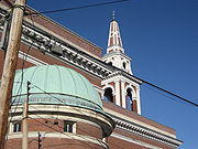


- St. John The Evangelist Church
- Ryerson Middle School
- Locke Street Shopping districtLocke Street (Hamilton, Ontario)Locke Street, is a Lower City collector road in Hamilton, Ontario, Canada. It starts off at Aberdeen Avenue as a two-way street going through the Locke Street shopping district up to Main Street where it then becomes a one-way street until it crosses King Street and becomes two-way again going...
(Antique shops, Art galleries, Cafes & fine dining Restaurants) - Hamilton Amateur Athletic Association GroundsHamilton Amateur Athletic Association GroundsThe Hamilton Amateur Athletic Association Grounds is a park located on the north side of Charlton Avenue West,between Locke Street South and Queen Street South, in Hamilton, Ontario, Canada. The park served as home to the Hamilton Tigers from 1872-1949...
- Hamilton Tennis Club
- Central Presbyterian Church
- First Christian Reformed Church, Hamilton
- Durand Park
- James Street South Shopping District
- St. Joseph's Hospital
- McMaster UniversityMcMaster UniversityMcMaster University is a public research university whose main campus is located in Hamilton, Ontario, Canada. The main campus is located on of land in the residential neighbourhood of Westdale, adjacent to Hamilton's Royal Botanical Gardens...
- Division of Cardiology, Dept. of Medicine, St. Joseph's Hospital
- McMaster University
- Church of the Ascension (1-block north of Charlton Avenue on John Street SouthJohn Street (Hamilton, Ontario)John Street, is a Lower City arterial road in Hamilton, Ontario, Canada. Originally it was known as Mountain Road or Ancaster Road. It starts off at the base of Arkledun Avenue, a Mountain-access road in the city, just east of St.Joseph's Hospital where it's a one-way street going north and tunnels...
) - Oakland Square (shopping plaza)
- Olympia Apartments, (Hamilton's 3rd-tallest building)
- Canadian Pacific RailwayCanadian Pacific RailwayThe Canadian Pacific Railway , formerly also known as CP Rail between 1968 and 1996, is a historic Canadian Class I railway founded in 1881 and now operated by Canadian Pacific Railway Limited, which began operations as legal owner in a corporate restructuring in 2001...
line - Escarpment Rail Trail
- Mountain Face Park
- Wentworth Street Stairway (Access to the Upper City, "Mountain"), old site of the Wentworth Street Incline railway, (1895-1936)
- Bruce TrailBruce TrailThe Bruce Trail is a hiking trail in southern and central Ontario, Canada.-General:The trail follows the edge of the Niagara Escarpment, one of the thirteen UNESCO World Biosphere Reserves in Canada, for almost...
- Niagara EscarpmentNiagara EscarpmentThe Niagara Escarpment is a long escarpment, or cuesta, in the United States and Canada that runs westward from New York State, through Ontario, Michigan, Wisconsin and Illinois...
(mountain)
Communities
Note: Listing of neighbourhoods from West to East.- Kirkendall North
- Durand
- Corktown
- Stinson
Roads that are parallel with Charlton Avenue
Lower City Roads:- Burlington StreetBurlington StreetBurlington Street is a road in Hamilton, Ontario, stretching along the south shore of Hamilton Harbour in Lake Ontario. Burlington Street has four different statuses along the route. In its western terminus, it is a collector route ending at Bay Street North...
, West/East - Barton StreetBarton Street (Hamilton, Ontario)Barton Street is an arterial road in the Lower City of Hamilton, Ontario, Canada. It's also the longest street in the city. It starts off at the Western end of town at Locke Street North and is a two-way street that stretches eastward through a number of different and varied communities in the...
, West/East - Cannon StreetCannon Street (Hamilton, Ontario)Cannon Street, is a Lower City collector road in Hamilton, Ontario, Canada. It starts off at Queen Street North as a one-way street up to Sherman Avenue North where it then switches over to a two-way street the rest of the way Eastward and ends just past Kenilworth Avenue North on Barons Avenue...
, West/East - Wilson StreetWilson Street (Hamilton, Ontario)Wilson Street is a Lower City collector road in Hamilton, Ontario, Canada. It starts off at James Street North and works its way East and ends at Sherman Avenue North...
- King William StreetKing William Street (Hamilton, Ontario)400px|thumb|Theatre AquariusKing William Street is a Lower City collector road in Hamilton, Ontario, Canada. It starts off at the western-end at James Street North and is a one-way street until Mary Street, where it becomes a two-way street that ends at Wentworth Street North.-History:In 1922,...
- King Street, West/East
- Main StreetMain Street (Hamilton, Ontario)Main Street, is a Lower City arterial road in Hamilton, Ontario, Canada. It starts east of Wilson Street in Ancaster at White Chapel Cemetery as a two-way street and switches over to a one-way street at Paradise Road South, in Westdale, where it continues up to the Delta where it once again...
, West/East - Queenston RoadQueenston Road (Hamilton, Ontario)Queenston Road is a two-way Lower City arterial road in Hamilton, Ontario, Canada. Also known as Highway 8. It starts off at the Queenston Traffic Circle and travels eastward over the Red Hill Valley Parkway and into Stoney Creek past the Fruitland and Winona communities and into Niagara Region as... - Jackson StreetJackson Street (Hamilton, Ontario)Jackson Street, is a Lower City collector road in Hamilton, Ontario, Canada. It starts off West of Locke Street South at Jackson Playground as a one-way street up to Queen Street South where it then switches over to a two-way street and is interrupted at Bay Street South the site of the Hamilton...
, West/East - Hunter StreetHunter Street (Hamilton, Ontario)Hunter Street is a Lower City collector road in Hamilton, Ontario, Canada. It is a one-way street that starts West of Locke Street at Hill Street Park and ends two blocks East of Victoria Avenue at Emerald Street...
, West/East - Augusta StreetAugusta Street (Hamilton, Ontario)Augusta Street is a Lower City collector road in Hamilton, Ontario, Canada. A two-way collector road that starts off on James Street South and ends 4-blocks East at Shamrock Park just past Walnut Street South.-History:thumb|Augusta Street, landmark...
- Charlton Avenue, West/East
- Aberdeen AvenueAberdeen Avenue (Hamilton, Ontario)Aberdeen Avenue is a Lower City arterial road in Hamilton, Ontario, Canada. It starts off just West of Longwood Road South and East of Highway 403 as a two-way thoroughfare up to Queen Street South where it then switches over to a one-way collector road to Bay Street South and then to another...
Niagara Escarpment (Mountain) Roads:
- Concession StreetConcession Street (Hamilton, Ontario)Concession Street is an Upper City arterial road in Hamilton, Ontario, Canada. It starts at Belvidere Avenue, just West of Sam Lawrence Park, and extends eastward past Mountain Drive Park on Upper Gage Avenue and ends shortly thereafter at East 43rd Street.Note: East of East 43rd Street the road...
- Queensdale Avenue West/ East
- Scenic Drive - Fennell AvenueFennell Avenue (Hamilton, Ontario)Fennell Avenue, is an Upper City arterial road in Hamilton, Ontario, Canada. It starts of just West Garth Street on the West mountain and is a two-way street throughout that extends eastward and ends at Mountain Brow Boulevard, a road that wraps around the edge of the Niagara Escarpment on...
, West/East - Sanatorium Road
- Mohawk RoadMohawk Road (Hamilton, Ontario)Mohawk Road, is an Upper City arterial road in Hamilton, Ontario, Canada. It is a two-way street throughout that starts just West of Highway 403 & Meadowlands and travels eastward linking up with the Lincoln M. Alexander Parkway. Mohawk Road east of Highway 403 resumes again in front of Iroquoia...
, West/East - Limeridge RoadLimeridge Road (Hamilton, Ontario)Limeridge Road is a two-way Upper City collector road in Hamilton, Ontario, Canada. It starts off just West of Garth Street/William McCulloch Park as Limeridge Court and cuts across the Hamilton mountain eastward running parallel with the Lincoln M...
West/East - Lincoln M. Alexander ParkwayLincoln M. Alexander ParkwayThe Lincoln Alexander Parkway, officially nicknamed "The Linc", is a municipal expressway in the Canadian city of Hamilton, Ontario. Located on the Hamilton mountain, atop the Niagara Escarpment...
- Mud Street, (Hamilton City Road 11) - Stone Church RoadStone Church Road (Hamilton, Ontario)Stone Church Road, is a two-way Upper City east-west arterial road in Hamilton, Ontario, Canada. It starts at Golf Links Road, just east of Meadowlands, and goes across the Escarpment and ends at Upper Mount Albion Road....
, West/East  ; Rymal Road, West/East
- Twenty Road
Roads that cross Charlton Avenue
Note: Listing of streets from West to East.- Dundurn StreetDundurn Street (Hamilton, Ontario)Dundurn Street, is a Lower City arterial road in Hamilton, Ontario, Canada. It is a two-way street that starts off at Mountain Face Park, Niagara Escarpment in front of the Bruce Trail as a collector road, right behind Hillcrest Avenue and then turns into a four lane thoroughfare from Aberdeen...
, South - Locke Street, South
- Queen StreetQueen Street (Hamilton, Ontario)Queen Street, is a Lower City arterial road in Hamilton, Ontario, Canada. It starts off at Beckett Drive, a mountain-access road in the city and is a two-way street up to Herkimer Street and a one-way street the rest of the way north up to the Canadian National Railway Yard where the road turns...
, South - Hess StreetHess Street (Hamilton, Ontario)Hess Street, is a Lower City collector road in Hamilton, Ontario, Canada. It starts off at the base of the Niagara Escarpment right before Aberdeen Avenue, and is a one-way street going north past the Durand and Central neighbourhoods. Between Main and King Street West is where you will find Hess...
, South - Caroline Street, South
- Bay StreetBay Street (Hamilton)Bay Street is a Lower City arterial road in Hamilton, Ontario, Canada. It starts at Inglewood Drive, just South of Aberdeen Avenue, as a collector road with only two lanes, then eventually becomes a six lane thoroughfare at its peak. Bay Street also passes through Downtown Hamilton, where many...
, South - MacNab StreetMacNab Street (Hamilton, Ontario)MacNab Street, is a Lower City collector road in Hamilton, Ontario, Canada. It starts in the Durand neighbourhood on Markland Street, as a one-way street going north to Bold Street, where it becomes two-way for one block until Hurst Place where it's cut off by a wall for the Hunter Street railway...
, South - James StreetJames Street (Hamilton, Ontario)James Street is a Lower City arterial road in Hamilton, Ontario, Canada. It starts off at the base of the Niagara Escarpment from James Mountain Road, a mountain-access road in the city, originally was a one-way street going south throughout but now has sections of it that are two-way...
, South - Hughson StreetHughson Street (Hamilton, Ontario)Hughson Street is a Lower City collector road in Hamilton, Ontario, Canada. It starts at Charlton Avenue East at St. Joseph's hospital and runs north to Haymarket Street in the downtown where it's cut off by the Hamilton GO Transit station. Up to this point it is a two-way street...
, South - John StreetJohn Street (Hamilton, Ontario)John Street, is a Lower City arterial road in Hamilton, Ontario, Canada. Originally it was known as Mountain Road or Ancaster Road. It starts off at the base of Arkledun Avenue, a Mountain-access road in the city, just east of St.Joseph's Hospital where it's a one-way street going north and tunnels...
, South - Catharine StreetCatharine Street (Hamilton, Ontario)Catharine Street, is a Lower City collector road in Hamilton, Ontario, Canada. It starts off at Charlton Avenue East at Woolverton Park in the Corktown neighbourhood as a one-way street , tunnels underneath the Hunter Street Railway bridge and stretches up to Barton Street East where it then turns...
, South - Ferguson AvenueFerguson Avenue (Hamilton, Ontario)Ferguson Avenue, is a Lower City collector road in Hamilton, Ontario, Canada. Is a two-way street throughout that starts off at the base of the Mountain on Foster Street. It's interrupted 3-blocks north at Corktown Park where Canadian Pacific Railway lines passes through it...
, South - Wellington StreetWellington Street (Hamilton, Ontario)Wellington Street, is a Lower City arterial road in Hamilton, Ontario, Canada. It starts off at Charlton Avenue East as a two-way street for only one block where it's then blocked off by the Corktown Park and a couple of Canadian National Railway lines that cut through it...
, South - Victoria AvenueVictoria Avenue (Hamilton, Ontario)Victoria Avenue, is a Lower City arterial road in Hamilton, Ontario, Canada. It starts off as a ramp and part of a Mountain-access road, the Claremont Access, on Hunter Street East in the Stinson neighbourhood...
, South (Victoria Ave. mountain-access ramp flows over Charlton Ave.) - Wentworth StreetWentworth Street (Hamilton, Ontario)Wentworth Street, is a Lower City arterial road in Hamilton, Ontario, Canada. It starts off at the base of the Niagara Escarpment on Charlton Avenue East just before the CP lines as a two-way street for 2-blocks up past Cumberland Avenue up to Rutherford Avenue where it then switches over to a...
, South
External links
- Durand Neighbourhood
- Kirkendall Neighbourhood
- Locke Street.com
- Locke Street South Shopping District
- Bruce Trail Association
- Hikes on the Bruce Trail
- Google Maps: Charlton Avenue (Hybrid)