
Changlang
Encyclopedia
Census town
In India, a census town is one which has:# A minimum population of 5,000# At least 75% of male working population engaged in non-agricultural pursuits# A density of population of at least 400 persons per km2.In Ireland, a census town is;...
and headquarters of the Changlang district
Changlang District
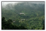
Changlang district is located in the Indian state of Arunachal Pradesh, located south of Lohit district and north of Tirap district. As of 2011 it is the second most populous district of Arunachal Pradesh , after Papum Pare.-Post-independence:...
in the India
India
India , officially the Republic of India , is a country in South Asia. It is the seventh-largest country by geographical area, the second-most populous country with over 1.2 billion people, and the most populous democracy in the world...
n state
States and territories of India
India is a federal union of states comprising twenty-eight states and seven union territories. The states and territories are further subdivided into districts and so on.-List of states and territories:...
of Arunachal Pradesh
Arunachal Pradesh
Arunachal Pradesh is a state of India, located in the far northeast. It borders the states of Assam and Nagaland to the south, and shares international borders with Burma in the east, Bhutan in the west, and the People's Republic of China in the north. The majority of the territory is claimed by...
. Its native people includes Tangsa
Tangsa
The Tangsa, termed Tangshang in Myanmar , is a community of several tens of thousands living in Changlang and Tirap Districts of Arunachal Pradesh,and parts of Tinsukia District of Assam, in north-eastern India, and across the border in Sagaing Region, Myanmar . The Tangshang in Myanmar were...
Naga(Lungchang, pangsha,hawi etc.), Lisu, Nocte, Singpho and many more.
More than 50 dialects (languages) are spoken here. Among all the districts in Arunachal Pradesh, Changlang is unique for its cultures, traditions, and languages (dialects). Many dialects of Changlang district are believed to be endangered, and some dialects are already extinct. One of the many reasons for this is believed to be the influx of mainland India's Hindi language and culture into north India.
Inner line Permit (ILP) was introduced by Indian government as one of many initiatives to protect fragile cultures, traditions and dialects of the North East people (excluding that of Assam) of India including Changlang. ILP was unsuccessfully challenged in Guwahati
Guwahati
Guwahati, Pragjyotishpura in ancient Assam formerly known as Gauhati is a metropolis,the largest city of Assam in India and ancient urban area in North East India, with a population of 963,429. It is also the largest metropolitan area in north-eastern India...
Court during 2008 by mainland India. {ILP is the equivalent of a second-degree Indian passport; people (Indians and foreigners) visiting protected areas require ILP}.
During the Burma Campaign
Burma Campaign
The Burma Campaign in the South-East Asian Theatre of World War II was fought primarily between British Commonwealth, Chinese and United States forces against the forces of the Empire of Japan, Thailand, and the Indian National Army. British Commonwealth land forces were drawn primarily from...
of World War II
World War II
World War II, or the Second World War , was a global conflict lasting from 1939 to 1945, involving most of the world's nations—including all of the great powers—eventually forming two opposing military alliances: the Allies and the Axis...
, the Changlang district
Changlang District
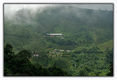
Changlang district is located in the Indian state of Arunachal Pradesh, located south of Lohit district and north of Tirap district. As of 2011 it is the second most populous district of Arunachal Pradesh , after Papum Pare.-Post-independence:...
was where the Ledo Road
Ledo Road
The Ledo Road was built during World War II so that the Western Allies could supply the Chinese as an alternative to the Burma Road which had been cut by the Japanese in 1942. It was renamed the Stilwell Road in early 1945 at the suggestion of Chiang Kai-shek...
began, and a neglected World War II war cemetery can still be visited at Jairampur
Jairampur
Jairampur is a census town in Changlang district in the Indian state of Arunachal Pradesh.-Demographics:Jairampur is a ADC HQ of Changlang district . A small hilly town along the Indo-Myanmar border and Namchik basin is covered with evergreen tropical rain forest...
. It is situated nearby Indian Army Camp of Jairampur. Unlike mainland India, Britain never colonized Changlang. Changlanese natives during the silk road era knew about Tea trading and tea traders. A Singpho(they are called Jinpo or jingphaw in Myanmar and China) leader of Changlang district then (now those areas comes under upper assam) is believed to be responsible for disclosing secrets of Tea planting/cultivation/plantation to the British.
India has been criticized many times by human rights groups from UN for not giving Ethnic Minority Status to North Eastern people of India including Changlang. Indian government has put Native people into Scheduled Tribes which is not appropriate because there are sub tribes in a tribe;again in one of sub tribes there are again sub tribes i.e. sub-sub-sub..... tribes; such categorizing of local people is unethical and hegemony in nature.
In recent times, Naga
Naga people
The term Naga people refers to a conglomeration of several tribes inhabiting the North Eastern part of India and north-western Burma. The tribes have similar cultures and traditions, and form the majority ethnic group in the Indian state of Nagaland...
Militants (both Kaplang faction{kaplang was born as Burmese side changlanese naga} as well as Muiwa faction)who were demanding for Nagalim(Land of Naga people which includes Myanmar)had given Indian Army sleepless night.The conflict situations has cool down in past 2–3 years. Arunachal Pradesh
Arunachal Pradesh
Arunachal Pradesh is a state of India, located in the far northeast. It borders the states of Assam and Nagaland to the south, and shares international borders with Burma in the east, Bhutan in the west, and the People's Republic of China in the north. The majority of the territory is claimed by...
Home ministry recently has asked Indian Army Biggies to withdraw excess army men.Changlang also suffered from lost Generation as many youngsters were abducted by naga militants to recruit in their armies, many of them never return; some of them are believed to be still fighting in Myanmar.
Changlang has become one of major districts in importance to Arunachal Government due to crude oil, coal and mineral resources other than tourism and hydro power.
Demographics
India censusCensus
A census is the procedure of systematically acquiring and recording information about the members of a given population. It is a regularly occurring and official count of a particular population. The term is used mostly in connection with national population and housing censuses; other common...
, Changlang had a population of 6394. Males constitute 56% of the population and females 44%. Changlang has an average literacy rate of 72%, higher than the national average of 59.5%; with male literacy of 78% and female literacy of 65%. 14% of the population is under 6 years of age.