

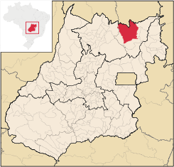
Cavalcante
Encyclopedia
| Cavalcante | |
|---|---|
| State | Goiás Goiás Goiás is a state of Brazil, located in the central part of the country. The name Goiás comes from the name of an indigenous community... |
| Coordinates: | 13°47′40"S 47°27′20"W |
| Area: | 6,953.6 km² |
| Population: | 9,875(IBGE 2007) |
| Population density | 1.42 inhab/km² |
| Urban population | 3,976 (2007) |
| Rural population | 5,899 (2007) |
| Elevation: | 823m |
| Postcode (CEP): | 73790-000 |
| IBGE statistical microregion: | 018 Chapada dos Veadeiros Chapada dos Veadeiros Microregion The Chapada dos Veadeiros Microregion is an IBGE statistical region in north-central Goiás state, Brazil. It includes 8 cities with a population of 60,267 in a total area of 21,476 km²... |
| Became a city: | 1833 |
| Mayor: | Josias Magalhães Costa Sobrinho |
| Distance to Goiânia Goiânia -Climate:The city has a tropical wet and dry climate with an average temperature of . There's a wet season, from October to April, and a dry one, from May to September. Annual rainfall is around 1,520 mm.... : |
510 km. |
| Website: | n/a |
Town
A town is a human settlement larger than a village but smaller than a city. The size a settlement must be in order to be called a "town" varies considerably in different parts of the world, so that, for example, many American "small towns" seem to British people to be no more than villages, while...
and municipality
Municipality
A municipality is essentially an urban administrative division having corporate status and usually powers of self-government. It can also be used to mean the governing body of a municipality. A municipality is a general-purpose administrative subdivision, as opposed to a special-purpose district...
in northern Goiás
Goiás
Goiás is a state of Brazil, located in the central part of the country. The name Goiás comes from the name of an indigenous community...
state, Brazil
Brazil
Brazil , officially the Federative Republic of Brazil , is the largest country in South America. It is the world's fifth largest country, both by geographical area and by population with over 192 million people...
. It is one of the poorest municipalities in the state. It is home to communities of descendants of runaway slaves called Kalungas.
Location
It is located just north of the Chapada dos Veadeiros National ParkChapada dos Veadeiros National Park
Brazil's Chapada dos Veadeiros National Park is located in the Chapada dos Veadeiros, an ancient plateau with an estimated age of 1.8 billion years. Based in the Brazilian state of Goias, the Park was created on January 11, 1961 by President Juscelino Kubitscheck, and listed as a World Heritage...
and is connected by tarmacked road with Teresina de Goiás
Teresina de Goiás
Teresina de Goiás is a small town and municipality in northern Goiás state, Brazil.-Location:It is part of the region of the statistical micro-region of Chapada dos Veadeiros and is located north of the Federal District and Brasília. It is 67 km north of Alto Paraíso de Goiás. The nearest...
. It is part of the Chapada dos Veadeiros
Chapada dos Veadeiros
Chapada dos Veadeiros is located in the state of Goias, in the Central West region of Brazil. It is a geographical area filled with breath taking mountains, rivers, and waterfalls. The area is known for the national park of Chapada dos Veadeiros. The national park was created in 1961, it has been...
micro-region. The distance to the state capital of Goiânia
Goiânia
-Climate:The city has a tropical wet and dry climate with an average temperature of . There's a wet season, from October to April, and a dry one, from May to September. Annual rainfall is around 1,520 mm....
is 510 km and most residents have greater contact with Brasília than with the state capital. Highway connections from Goiânia
Goiânia
-Climate:The city has a tropical wet and dry climate with an average temperature of . There's a wet season, from October to April, and a dry one, from May to September. Annual rainfall is around 1,520 mm....
are made by BR-153 / Anápolis
Anápolis
Anápolis is the third largest city in the State of Goiás in Brazil. It lies in the center of a rich agricultural region and has become a leader in food processing and pharmaceutical plants.-Location and population:...
/ Alexânia
Alexânia
Alexânia is a small town and municipality in central Goiás state, Brazil. Alexânia is known for its alleged extraterrestrial sightings in the late sixties and early seventies. The Areias River passes through the municipality.-Location:...
/ BR-060 / Planaltina
Planaltina
Planaltina is one of the administrative districts of the Federal District of Brazil, with an area of 1,534 kmª and a population of 147,114 in 2000, of whom 134,663 were classified as urban and 12,451 as rural...
/ GO-430 / GO-118 / BR-010 / São João da Aliança / Alto Paraíso de Goiás
Alto Paraíso de Goiás
Alto Paraíso de Goiás is a small town and a municipality in northeastern Goiás state, Brazil. It has become known for its ecological and New Age tourism.-Location:...
/ Teresina de Goiás
Teresina de Goiás
Teresina de Goiás is a small town and municipality in northern Goiás state, Brazil.-Location:It is part of the region of the statistical micro-region of Chapada dos Veadeiros and is located north of the Federal District and Brasília. It is 67 km north of Alto Paraíso de Goiás. The nearest...
/ GO-241.
Neighboring municipalities and states are:
- north: TocantinsTocantins (state)Tocantins is one of the states of Brazil. . The state was formed in 1988 out of the northern part of Goiás, and construction began on the capital, Palmas, in 1989, in contrast to most of the other cities in the state which date back to the Portuguese colonial period...
- south: Alto Paraíso de GoiásAlto Paraíso de GoiásAlto Paraíso de Goiás is a small town and a municipality in northeastern Goiás state, Brazil. It has become known for its ecological and New Age tourism.-Location:...
- west: Colinas do SulColinas do SulColinas do Sul is a small town and municipality in north-central Goiás state, Brazil.-Location:Colinas is located in the Chapada dos Veadeiros statistical micro-region and is almost directly north of Brasília, to which it is connected by G0-327 as far as Alto Paraíso de Goiás then by G0-118 south...
and MinaçuMinaçuMinaçu is a small city and municipality in the north of the state of Goiás, Brazil. There is a large asbestos mine in the municipality.-Location and climate:... - east: Teresina de GoiásTeresina de GoiásTeresina de Goiás is a small town and municipality in northern Goiás state, Brazil.-Location:It is part of the region of the statistical micro-region of Chapada dos Veadeiros and is located north of the Federal District and Brasília. It is 67 km north of Alto Paraíso de Goiás. The nearest...
The economy
The economy is based on cattle raising (60,777 head in 2006) and agriculture. The main crops cultivated are rice and corn, although in modest production. There was one bank—Banco do Brasil S.A. (Agosto/2007)Agricultural data 2006
- Farms: 1,228
- Total area: 331,175 ha.
- Area of permanent crops: 10,681 ha.
- Area of perennial crops: 32,505 ha.
- Area of natural pasture: 186,001 ha.
- Area of woodland and forests: 72,521 ha.
- Persons dependent on farming: 4,000
- Number of tractors: 703
- Cattle herd: 60,777
- Main crop: corn with 1,500 ha
Tourism
Founded in 1740 with the discovery of gold, Cavalcante still has traces of the colonial architecture of the gold period. Located 330 km. from BrasíliaBrasília
Brasília is the capital city of Brazil. The name is commonly spelled Brasilia in English. The city and its District are located in the Central-West region of the country, along a plateau known as Planalto Central. It has a population of about 2,557,000 as of the 2008 IBGE estimate, making it the...
it has waterfalls, streams and trails. Crossing the low mountains one can reach the springs of hot mineral water that gave the name to a now extinct mining town—Água Quente.
Cavalcante was once considered in the golden age of mining to be a great producer of gold and other minerals. Now livestock raising is the strong point of the local economy. The town also gets some tourism, which enters the Chapada dos Veadeiros National Park
Chapada dos Veadeiros National Park
Brazil's Chapada dos Veadeiros National Park is located in the Chapada dos Veadeiros, an ancient plateau with an estimated age of 1.8 billion years. Based in the Brazilian state of Goias, the Park was created on January 11, 1961 by President Juscelino Kubitscheck, and listed as a World Heritage...
in Alto Paraíso de Goiás
Alto Paraíso de Goiás
Alto Paraíso de Goiás is a small town and a municipality in northeastern Goiás state, Brazil. It has become known for its ecological and New Age tourism.-Location:...
, 100 km to the south. Many tourists come to visit the more than 150 cataloged waterfalls, most of which can only be visited on foot. On a dirt road that borders the national park there are connections with Colinas do Sul
Colinas do Sul
Colinas do Sul is a small town and municipality in north-central Goiás state, Brazil.-Location:Colinas is located in the Chapada dos Veadeiros statistical micro-region and is almost directly north of Brasília, to which it is connected by G0-327 as far as Alto Paraíso de Goiás then by G0-118 south...
and the Serra da Mesa artificial lake.
History
The first settlers arrived in the region in 1736 looking for gold. Soon gold was discovered near the stream called Lava Pés and the village began to grow taking the name of Cavalcante, after Julião Cavalcante its founder. By 1806 the gold had run out and the population declined accordingly. In 1831 the town was elevated to the status of "vila". In 1953 it became a municipality. In 1957 the district of Colinas do SulColinas do Sul
Colinas do Sul is a small town and municipality in north-central Goiás state, Brazil.-Location:Colinas is located in the Chapada dos Veadeiros statistical micro-region and is almost directly north of Brasília, to which it is connected by G0-327 as far as Alto Paraíso de Goiás then by G0-118 south...
broke off to form its own municipality. Likewise, in 1988 the district of Teresina de Goiás
Teresina de Goiás
Teresina de Goiás is a small town and municipality in northern Goiás state, Brazil.-Location:It is part of the region of the statistical micro-region of Chapada dos Veadeiros and is located north of the Federal District and Brasília. It is 67 km north of Alto Paraíso de Goiás. The nearest...
was dismembered.
Kalunga
Nearby there is a community, called the KalungaKalunga
The Kalungas are descendants of run-away slaves who lived in remote settlements in northeastern Goiás state, Brazil. Most of the 4,000 Kalungas, who are of mixed race, black and native Indian, live in very poor conditions in near the town of Cavalcante, Goiás.All of the area occupied by the...
, who are black descendants of the slaves who escaped into the interior to form communities called quilombos. These runaway slaves lived in isolation, building their own identity and their own culture, with African elements added to European elements, mainly the traditional Catholicism of the rural milieu, and intermingling with the indigenous population.
Today the Kalunga (approximately 4,500 people) occupy a territory that takes in part of the municipalities of Cavalcante, Monte Alegre and Teresina de Goiás. In these territories there are four main population centers: the region of Contenda and Vão do Calunga, Vão de Almas, Vão do Moleque and the former Ribeirão dos Negros, later renamed Ribeirão dos Bois.http://www.macamp.com.br/_Cidades/GO-Cavalc.htm
Health and education
- Hospital: 01 with 18 beds
- Infant mortality rate in 2000: 30.02
- Literacy rate in 2000: 61.7 (one of the lowest in the state)
- MHDI: 0.609
- State ranking: 241 (out of 242 municipalities)
- National ranking: 4,509 (out of 5,507 municipalities)