
Carnarvon Highway
Encyclopedia
The Carnarvon Highway is a state highway
of Queensland
, linking Moree
south of the NSW/QLD border, via the town of St George
, eventually to the township of Rolleston
. North of Roma
it is known as the Carnarvon Developmental Road. National Route 46 runs from Moree
to St George
. The A7 then continues north from St George
to Rolleston
, which continues along the Dawson Highway
and Gregory Highway
to Emerald
and Charters Towers
.
It is the main access road to the Carnarvon National Park
.
and central Queensland
, connecting the Newell Highway
at Gilgandra
with Walgett
, St George
, Roma
, Emerald
and Charters Towers
. The highway was a strategic route to take B-doubles and other large vehicles (which cannot use the Bruce Highway
) to the Queensland ports north of Rockhampton
.
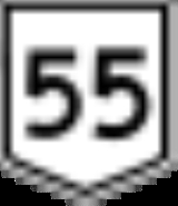
Today, NR55 only covers 340km of the Castlereagh Highway
, having been replaced by the alpha-numeric designation A55 within Queensland during 2004. A7 has now replaced the NR55 route of the Carnarvon Highway between Rolleston
and St George
. National Route 46, newly signposted, now extends from St George
to Moree
.
NR55 signs were first erected in New South Wales
between Gilgandra
and Walgett
. It had then been extended from Walgett
to the Queensland border at Hebel
, in the late 1970s - where it originally terminated.
NR55 first appeared in Queensland
on the Gregory
and Dawson Highway
s, between Emerald
and Rolleston
, during the early 1980s.
This is where for many years there was an oddity between the Queensland
and New South Wales
interpretation of the path that NR55 would take. It created the situation where the southern end of route NR55 (Carnarvon Highway) was located over 100 kilometres west from the northern end of route NR55 (Castlereagh Highway
).
Eventually, NR55 was taken as an extension of the Castlereagh Highway
between the Queenland/New South Wales border and St George
. With the change in alphanumeric route numbering in the mid 2000s, NR55 runs between St George
and Roma
as A55, and was replaced with National Route 46 between St George
and Moree
, and the A7 between Roma
and Rolleston
.
Highway
A highway is any public road. In American English, the term is common and almost always designates major roads. In British English, the term designates any road open to the public. Any interconnected set of highways can be variously referred to as a "highway system", a "highway network", or a...
of Queensland
Queensland
Queensland is a state of Australia, occupying the north-eastern section of the mainland continent. It is bordered by the Northern Territory, South Australia and New South Wales to the west, south-west and south respectively. To the east, Queensland is bordered by the Coral Sea and Pacific Ocean...
, linking Moree
Moree, New South Wales
Moree is a large town in Moree Plains Shire in northern New South Wales, Australia. It is located on the banks of the Mehi River in the centre of the rich black-soil plains....
south of the NSW/QLD border, via the town of St George
St George, Queensland
St George is a town of approximately 2400 people in south-western Queensland, Australia. It is the administrative centre for the Shire of Balonne. It was named by Major Thomas Mitchell who crossed the Balonne River on St George's Day, 23 April 1846. At the 2006 census, St George had a population of...
, eventually to the township of Rolleston
Rolleston, Queensland
Rolleston is a small town on the Comet River in Central Queensland. It is located in the Central Highlands Regional Council local government area, west of Gladstone and northwest of Brisbane. Springsure, the nearest town lies south-east. Rolleston lies on the junction of the Carnarvon, Gregory...
. North of Roma
Roma, Queensland
Roma is a town in the western Darling Downs area of Queensland, Australia, by rail WNW of Brisbane. It is situated at the junction of the Warrego and Carnarvon highways...
it is known as the Carnarvon Developmental Road. National Route 46 runs from Moree
Moree, New South Wales
Moree is a large town in Moree Plains Shire in northern New South Wales, Australia. It is located on the banks of the Mehi River in the centre of the rich black-soil plains....
to St George
St George, Queensland
St George is a town of approximately 2400 people in south-western Queensland, Australia. It is the administrative centre for the Shire of Balonne. It was named by Major Thomas Mitchell who crossed the Balonne River on St George's Day, 23 April 1846. At the 2006 census, St George had a population of...
. The A7 then continues north from St George
St George, Queensland
St George is a town of approximately 2400 people in south-western Queensland, Australia. It is the administrative centre for the Shire of Balonne. It was named by Major Thomas Mitchell who crossed the Balonne River on St George's Day, 23 April 1846. At the 2006 census, St George had a population of...
to Rolleston
Rolleston, Queensland
Rolleston is a small town on the Comet River in Central Queensland. It is located in the Central Highlands Regional Council local government area, west of Gladstone and northwest of Brisbane. Springsure, the nearest town lies south-east. Rolleston lies on the junction of the Carnarvon, Gregory...
, which continues along the Dawson Highway
Dawson Highway
The Dawson Highway is a state highway in Queensland, Australia. It runs for approximately 400 km between Gladstone and Springsure where it terminates...
and Gregory Highway
Gregory Highway
The Gregory Highway is a state highway in Queensland that serves the major coal-mining centres of Central Queensland. The highway was named after Augustus Gregory, an early explorer....
to Emerald
Emerald, Queensland
Emerald is a town located in the Central Highlands district of Central Queensland, Australia. At the 2006 census, Emerald had a population of 10,999. The town is the business centre for the Central Highlands Regional Council....
and Charters Towers
Charters Towers, Queensland
Charters Towers is a city in northern Queensland, Australia. It is located 137 kilometres inland from Townsville on the Flinders Highway. In 2006 the population was 7,979 people, some 450 fewer than in the 2001 census. During the last quarter of the 19th century the town boomed as the rich gold...
.
It is the main access road to the Carnarvon National Park
Carnarvon National Park
Carnarvon National Park is located in the Southern Brigalow Belt bioregion in Central Queensland , 593 km northwest of Brisbane...
.
Route Numbering
National Route 55 (NR55) was a former north-south route through central northern New South WalesNew South Wales
New South Wales is a state of :Australia, located in the east of the country. It is bordered by Queensland, Victoria and South Australia to the north, south and west respectively. To the east, the state is bordered by the Tasman Sea, which forms part of the Pacific Ocean. New South Wales...
and central Queensland
Queensland
Queensland is a state of Australia, occupying the north-eastern section of the mainland continent. It is bordered by the Northern Territory, South Australia and New South Wales to the west, south-west and south respectively. To the east, Queensland is bordered by the Coral Sea and Pacific Ocean...
, connecting the Newell Highway
Newell Highway
The Newell Highway is the longest highway in New South Wales, Australia. It runs parallel to the eastern coast about 400 kilometres inland, and is the main inland direct road link from Victoria to Queensland, bypassing the more congested coastal areas of New South Wales...
at Gilgandra
Gilgandra, New South Wales
Gilgandra, is a town and Local Government Area in the Central West region of New South Wales, Australia. It is located on the junction of the Newell Highway, Oxley Highway and Castlereagh Highway. It can be reached in about six hours by car from Sydney. Like Coonabarabran, Gilgandra can be...
with Walgett
Walgett, New South Wales
Walgett is a town in North-West New South Wales, Australia and the seat of Walgett Shire. It is at the junction of the Barwon and Namoi rivers and near the junction of the Kamilaroi and Castlereagh Highways...
, St George
St George, Queensland
St George is a town of approximately 2400 people in south-western Queensland, Australia. It is the administrative centre for the Shire of Balonne. It was named by Major Thomas Mitchell who crossed the Balonne River on St George's Day, 23 April 1846. At the 2006 census, St George had a population of...
, Roma
Roma, Queensland
Roma is a town in the western Darling Downs area of Queensland, Australia, by rail WNW of Brisbane. It is situated at the junction of the Warrego and Carnarvon highways...
, Emerald
Emerald, Queensland
Emerald is a town located in the Central Highlands district of Central Queensland, Australia. At the 2006 census, Emerald had a population of 10,999. The town is the business centre for the Central Highlands Regional Council....
and Charters Towers
Charters Towers, Queensland
Charters Towers is a city in northern Queensland, Australia. It is located 137 kilometres inland from Townsville on the Flinders Highway. In 2006 the population was 7,979 people, some 450 fewer than in the 2001 census. During the last quarter of the 19th century the town boomed as the rich gold...
. The highway was a strategic route to take B-doubles and other large vehicles (which cannot use the Bruce Highway
Bruce Highway
The Bruce Highway is a major highway in Queensland, Australia. Commencing in the state capital, Brisbane, it passes through areas close to the eastern coast to Cairns in Far North Queensland. The route is a part of the Australian National Highway and also part of Highway 1...
) to the Queensland ports north of Rockhampton
Rockhampton, Queensland
Rockhampton is a city and local government area in Queensland, Australia. The city lies on the Fitzroy River, approximately from the river mouth, and some north of the state capital, Brisbane....
.
Today, NR55 only covers 340km of the Castlereagh Highway
Castlereagh Highway
The Castlereagh Highway is a state highway in New South Wales, Australia, also extending some kilometres into Queensland. It has been given the route number 55. The highway was recently extended past Gilgandra to include state route 86...
, having been replaced by the alpha-numeric designation A55 within Queensland during 2004. A7 has now replaced the NR55 route of the Carnarvon Highway between Rolleston
Rolleston, Queensland
Rolleston is a small town on the Comet River in Central Queensland. It is located in the Central Highlands Regional Council local government area, west of Gladstone and northwest of Brisbane. Springsure, the nearest town lies south-east. Rolleston lies on the junction of the Carnarvon, Gregory...
and St George
St George, Queensland
St George is a town of approximately 2400 people in south-western Queensland, Australia. It is the administrative centre for the Shire of Balonne. It was named by Major Thomas Mitchell who crossed the Balonne River on St George's Day, 23 April 1846. At the 2006 census, St George had a population of...
. National Route 46, newly signposted, now extends from St George
St George, Queensland
St George is a town of approximately 2400 people in south-western Queensland, Australia. It is the administrative centre for the Shire of Balonne. It was named by Major Thomas Mitchell who crossed the Balonne River on St George's Day, 23 April 1846. At the 2006 census, St George had a population of...
to Moree
Moree, New South Wales
Moree is a large town in Moree Plains Shire in northern New South Wales, Australia. It is located on the banks of the Mehi River in the centre of the rich black-soil plains....
.
NR55 signs were first erected in New South Wales
New South Wales
New South Wales is a state of :Australia, located in the east of the country. It is bordered by Queensland, Victoria and South Australia to the north, south and west respectively. To the east, the state is bordered by the Tasman Sea, which forms part of the Pacific Ocean. New South Wales...
between Gilgandra
Gilgandra, New South Wales
Gilgandra, is a town and Local Government Area in the Central West region of New South Wales, Australia. It is located on the junction of the Newell Highway, Oxley Highway and Castlereagh Highway. It can be reached in about six hours by car from Sydney. Like Coonabarabran, Gilgandra can be...
and Walgett
Walgett, New South Wales
Walgett is a town in North-West New South Wales, Australia and the seat of Walgett Shire. It is at the junction of the Barwon and Namoi rivers and near the junction of the Kamilaroi and Castlereagh Highways...
. It had then been extended from Walgett
Walgett, New South Wales
Walgett is a town in North-West New South Wales, Australia and the seat of Walgett Shire. It is at the junction of the Barwon and Namoi rivers and near the junction of the Kamilaroi and Castlereagh Highways...
to the Queensland border at Hebel
Hebel, Queensland
Hebel is a hamlet in Balonne Shire, in south-western Queensland, Australia. It is situated north of the border with New South Wales on the Castlereagh Highway. At the 2006 census, Hebel and the surrounding area had a population of 149....
, in the late 1970s - where it originally terminated.
NR55 first appeared in Queensland
Queensland
Queensland is a state of Australia, occupying the north-eastern section of the mainland continent. It is bordered by the Northern Territory, South Australia and New South Wales to the west, south-west and south respectively. To the east, Queensland is bordered by the Coral Sea and Pacific Ocean...
on the Gregory
Gregory Highway
The Gregory Highway is a state highway in Queensland that serves the major coal-mining centres of Central Queensland. The highway was named after Augustus Gregory, an early explorer....
and Dawson Highway
Dawson Highway
The Dawson Highway is a state highway in Queensland, Australia. It runs for approximately 400 km between Gladstone and Springsure where it terminates...
s, between Emerald
Emerald, Queensland
Emerald is a town located in the Central Highlands district of Central Queensland, Australia. At the 2006 census, Emerald had a population of 10,999. The town is the business centre for the Central Highlands Regional Council....
and Rolleston
Rolleston, Queensland
Rolleston is a small town on the Comet River in Central Queensland. It is located in the Central Highlands Regional Council local government area, west of Gladstone and northwest of Brisbane. Springsure, the nearest town lies south-east. Rolleston lies on the junction of the Carnarvon, Gregory...
, during the early 1980s.
This is where for many years there was an oddity between the Queensland
Queensland
Queensland is a state of Australia, occupying the north-eastern section of the mainland continent. It is bordered by the Northern Territory, South Australia and New South Wales to the west, south-west and south respectively. To the east, Queensland is bordered by the Coral Sea and Pacific Ocean...
and New South Wales
New South Wales
New South Wales is a state of :Australia, located in the east of the country. It is bordered by Queensland, Victoria and South Australia to the north, south and west respectively. To the east, the state is bordered by the Tasman Sea, which forms part of the Pacific Ocean. New South Wales...
interpretation of the path that NR55 would take. It created the situation where the southern end of route NR55 (Carnarvon Highway) was located over 100 kilometres west from the northern end of route NR55 (Castlereagh Highway
Castlereagh Highway
The Castlereagh Highway is a state highway in New South Wales, Australia, also extending some kilometres into Queensland. It has been given the route number 55. The highway was recently extended past Gilgandra to include state route 86...
).
Eventually, NR55 was taken as an extension of the Castlereagh Highway
Castlereagh Highway
The Castlereagh Highway is a state highway in New South Wales, Australia, also extending some kilometres into Queensland. It has been given the route number 55. The highway was recently extended past Gilgandra to include state route 86...
between the Queenland/New South Wales border and St George
St George, Queensland
St George is a town of approximately 2400 people in south-western Queensland, Australia. It is the administrative centre for the Shire of Balonne. It was named by Major Thomas Mitchell who crossed the Balonne River on St George's Day, 23 April 1846. At the 2006 census, St George had a population of...
. With the change in alphanumeric route numbering in the mid 2000s, NR55 runs between St George
St George, Queensland
St George is a town of approximately 2400 people in south-western Queensland, Australia. It is the administrative centre for the Shire of Balonne. It was named by Major Thomas Mitchell who crossed the Balonne River on St George's Day, 23 April 1846. At the 2006 census, St George had a population of...
and Roma
Roma, Queensland
Roma is a town in the western Darling Downs area of Queensland, Australia, by rail WNW of Brisbane. It is situated at the junction of the Warrego and Carnarvon highways...
as A55, and was replaced with National Route 46 between St George
St George, Queensland
St George is a town of approximately 2400 people in south-western Queensland, Australia. It is the administrative centre for the Shire of Balonne. It was named by Major Thomas Mitchell who crossed the Balonne River on St George's Day, 23 April 1846. At the 2006 census, St George had a population of...
and Moree
Moree, New South Wales
Moree is a large town in Moree Plains Shire in northern New South Wales, Australia. It is located on the banks of the Mehi River in the centre of the rich black-soil plains....
, and the A7 between Roma
Roma, Queensland
Roma is a town in the western Darling Downs area of Queensland, Australia, by rail WNW of Brisbane. It is situated at the junction of the Warrego and Carnarvon highways...
and Rolleston
Rolleston, Queensland
Rolleston is a small town on the Comet River in Central Queensland. It is located in the Central Highlands Regional Council local government area, west of Gladstone and northwest of Brisbane. Springsure, the nearest town lies south-east. Rolleston lies on the junction of the Carnarvon, Gregory...
.
List of towns on the Carnarvon Highway
- MoreeMoréeMorée is a commune in the Loir-et-Cher department of central France.-See also:*Communes of the Loir-et-Cher department...
- Ashley
- GarahGarahGarah may refer to:*Garah, Afghanistan* Garah, New South Wales, Australia...
- Mungindi
- St GeorgeSt George, QueenslandSt George is a town of approximately 2400 people in south-western Queensland, Australia. It is the administrative centre for the Shire of Balonne. It was named by Major Thomas Mitchell who crossed the Balonne River on St George's Day, 23 April 1846. At the 2006 census, St George had a population of...
- SuratSurat, QueenslandSurat is a small rural town on the Balonne River, approximately south of Roma on the Carnarvon Highway. It is west of Brisbane. At the 2006 census, Surat had a population of 436.The district was first mapped by Surveyor-General Sir Thomas Mitchell in 1846...
- RomaRoma, QueenslandRoma is a town in the western Darling Downs area of Queensland, Australia, by rail WNW of Brisbane. It is situated at the junction of the Warrego and Carnarvon highways...
- InjuneInjune, QueenslandInjune is a small town in western Queensland, Australia. The town is located on the Carnarvon Highway, north of the regional centre of Roma. A railway connected Injune with Roma from 1920 until 1966...
- RollestonRolleston, QueenslandRolleston is a small town on the Comet River in Central Queensland. It is located in the Central Highlands Regional Council local government area, west of Gladstone and northwest of Brisbane. Springsure, the nearest town lies south-east. Rolleston lies on the junction of the Carnarvon, Gregory...
See also
- Highways in AustraliaHighways in AustraliaThis is a list of highways in Australia, listed alphabetically along with each highway's route number and location. Note that some highways service more than one state or territory.-Route numbering systems:...
- List of highways in Queensland
- List of highways in New South Wales
- Mungindi BridgeMungindi BridgeThe Mungindi Bridge is a road bridge over the Barwon River on the Carnarvon Highway on the Queensland/New South Wales border at Mungindi, New South Wales, Australia.-Old bridge:...