
Carabooda, Western Australia
Encyclopedia
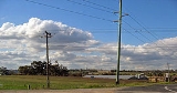
Carabooda is a rural locality in outer northern Perth
, Western Australia
. Its Local Government Area
is the City of Wanneroo.
The region gives its name to a distinctive form of building limestone
called Carabooda limestone. An abandoned theme park is located on Karoborup Road - it was known as Dizzy Lamb Park, and specialised in vintage cars and military vehicles until its closure in 2000.
Aboriginal
word. The current spelling was in use by 1867, and it was approved as a suburb name in 1982. The name "Karoborup" survives in a regional road through the suburb.
to the west, Cutler Road and Old Yanchep Road to the east and Walding Road (near the Yanchep turnoff) to the north.
At the ABS
2006 census, Carabooda had a population of 510 people living in 180 dwellings. Carabooda is a sparsely populated agricultural suburb, and several plant nurseries and wineries and a wildlife park are located in the area.
490 bus route between Clarkson train station
and Two Rocks
along Wanneroo Road
. However, the service was relocated to Marmion Avenue
and the nearby suburb of Yanchep
on 14 December 2008, and Carabooda is presently not served.
historically, although most have been won by the Coalition
in recent times, especially at federal level.
Perth, Western Australia
Perth is the capital and largest city of the Australian state of Western Australia and the fourth most populous city in Australia. The Perth metropolitan area has an estimated population of almost 1,700,000....
, Western Australia
Western Australia
Western Australia is a state of Australia, occupying the entire western third of the Australian continent. It is bounded by the Indian Ocean to the north and west, the Great Australian Bight and Indian Ocean to the south, the Northern Territory to the north-east and South Australia to the south-east...
. Its Local Government Area
Local Government Areas of Western Australia
The Australian state of Western Australia is divided into 141 local government areas...
is the City of Wanneroo.
The region gives its name to a distinctive form of building limestone
Limestone
Limestone is a sedimentary rock composed largely of the minerals calcite and aragonite, which are different crystal forms of calcium carbonate . Many limestones are composed from skeletal fragments of marine organisms such as coral or foraminifera....
called Carabooda limestone. An abandoned theme park is located on Karoborup Road - it was known as Dizzy Lamb Park, and specialised in vintage cars and military vehicles until its closure in 2000.
History
The suburb of Carabooda (spelled Karoborup or Karroborup in earlier documents) takes its name from the lake nearby. The lake name was first recorded by J.W. Gregory in January 1843, and is a NoongarNoongar
The Noongar are an indigenous Australian people who live in the south-west corner of Western Australia from Geraldton on the west coast to Esperance on the south coast...
Aboriginal
Indigenous Australians
Indigenous Australians are the original inhabitants of the Australian continent and nearby islands. The Aboriginal Indigenous Australians migrated from the Indian continent around 75,000 to 100,000 years ago....
word. The current spelling was in use by 1867, and it was approved as a suburb name in 1982. The name "Karoborup" survives in a regional road through the suburb.
Geography
Carabooda is bounded by Romeo Road/Karoborup Road to the south, the proposed Mitchell FreewayMitchell Freeway
Mitchell Freeway is a long freeway in Perth, Western Australia, linking Perth's central business district with its outer northern suburbs. It is allocated Route 2 for its entire length and is named after former state Premier and Governor Sir James Mitchell....
to the west, Cutler Road and Old Yanchep Road to the east and Walding Road (near the Yanchep turnoff) to the north.
At the ABS
Australian Bureau of Statistics
The Australian Bureau of Statistics is Australia's national statistical agency. It was created as the Commonwealth Bureau of Census and Statistics on 8 December 1905, when the Census and Statistics Act 1905 was given Royal assent. It had its beginnings in section 51 of the Constitution of Australia...
2006 census, Carabooda had a population of 510 people living in 180 dwellings. Carabooda is a sparsely populated agricultural suburb, and several plant nurseries and wineries and a wildlife park are located in the area.
Transport
Carabooda was formerly served by the TransperthTransperth
Transperth is the brand name of the public transport system in Perth, Western Australia. It is operated by the Public Transport Authority.-History:...
490 bus route between Clarkson train station
Clarkson railway station, Perth
Clarkson is a Transperth bus and train station located north of Perth, Western Australia, in the suburb of Clarkson. It presently serves as the terminus for the Joondalup Line. It is located east of Ocean Keys Shopping Centre....
and Two Rocks
Two Rocks, Western Australia
Two Rocks is an outer suburb of Perth, Western Australia, located 61 kilometres north of Perth's central business district. It is part of the City of Wanneroo local authority and straddles the northernmost boundaries of the Perth metropolitan area....
along Wanneroo Road
Wanneroo Road
Wanneroo Road is an important arterial road in Perth, Australia. It is about 75 kilometres long. It links Perth with the City of Wanneroo, and the Towns of Yanchep and Lancelin...
. However, the service was relocated to Marmion Avenue
Marmion Avenue
Marmion Avenue is a major arterial road in Perth, Western Australia, designated State Route 71.It runs through the northern coastal suburbs of Perth from the end of West Coast Highway in Trigg and Karrinyup, to the outer northern suburb of Yanchep...
and the nearby suburb of Yanchep
Yanchep, Western Australia
Yanchep is an outer coastal suburb of Perth, Western Australia, located 56 kilometres north of Perth's central business district. It is part of the City of Wanneroo local government area. It was built by entrepreneur Alan Bond in the 1970s for the 1977 America's Cup...
on 14 December 2008, and Carabooda is presently not served.
Politics
Carabooda's political leanings are unclear due to its small size and the lack of a polling booth. The nearest large booths tend to favour the Australian Labor PartyAustralian Labor Party
The Australian Labor Party is an Australian political party. It has been the governing party of the Commonwealth of Australia since the 2007 federal election. Julia Gillard is the party's federal parliamentary leader and Prime Minister of Australia...
historically, although most have been won by the Coalition
Coalition (Australia)
The Coalition in Australian politics refers to a group of centre-right parties that has existed in the form of a coalition agreement since 1922...
in recent times, especially at federal level.