
Capricorn Highway
Encyclopedia
The Capricorn Highway is located in Central Queensland
, Australia
, and links the city of Rockhampton
with western Queensland. The highway is approximately 560 kilometres long, and joins the Landsborough Highway
at Barcaldine
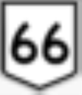
. Formerly National Route 66, Queensland began to convert to the alphanumeric system much of Australia had adopted in the early-2000s and is now designated as A4. The highway runs parallel with the Tropic of Capricorn
, hence its name.
Other towns situated along the highway include (from east to west):
Gracemere
, Westwood
, Duaringa
, Dingo, Blackwater
, Emerald
, Bogantungan
, Alpha
and Jericho
.
Running virtually east/west, the highway traverses the area known as the Central Highlands, and crosses the Great Dividing Range
between Alpha and Jericho.
Queensland
Queensland is a state of Australia, occupying the north-eastern section of the mainland continent. It is bordered by the Northern Territory, South Australia and New South Wales to the west, south-west and south respectively. To the east, Queensland is bordered by the Coral Sea and Pacific Ocean...
, Australia
Australia
Australia , officially the Commonwealth of Australia, is a country in the Southern Hemisphere comprising the mainland of the Australian continent, the island of Tasmania, and numerous smaller islands in the Indian and Pacific Oceans. It is the world's sixth-largest country by total area...
, and links the city of Rockhampton
Rockhampton, Queensland
Rockhampton is a city and local government area in Queensland, Australia. The city lies on the Fitzroy River, approximately from the river mouth, and some north of the state capital, Brisbane....
with western Queensland. The highway is approximately 560 kilometres long, and joins the Landsborough Highway
Landsborough Highway
Landsborough Highway is a western Queensland highway running in the northwest-southeast direction from Morven to Cloncurry. The Landsborough Highway runs through vast tracts of land that was once occupied by William Landsborough, an Australian explorer of the 19th century...
at Barcaldine
Barcaldine, Queensland
Barcaldine is a small town in Western Queensland, Australia, approximately by road west of the city of Rockhampton. The town is situated on Lagoon Creek, which flows into the Alice River approximately five kilometres south of the Barcaldine. This is the administrative centre of the Barcaldine...
. Formerly National Route 66, Queensland began to convert to the alphanumeric system much of Australia had adopted in the early-2000s and is now designated as A4. The highway runs parallel with the Tropic of Capricorn
Tropic of Capricorn
The Tropic of Capricorn, or Southern tropic, marks the most southerly latitude on the Earth at which the Sun can be directly overhead. This event occurs at the December solstice, when the southern hemisphere is tilted towards the Sun to its maximum extent.Tropic of Capricorn is one of the five...
, hence its name.
Other towns situated along the highway include (from east to west):
Gracemere
Gracemere, Queensland
Gracemere is a town located on the Capricorn Highway in Central Queensland, Australia, approximately 9 kilometres west of the city of Rockhampton. Because of the proximity of the town to Rockhampton, Gracemere has become a dormitory town, with many residents commuting the short distance to work in...
, Westwood
Westwood, Queensland
Westwood is a town in Central Queensland, Australia, south west of the city of Rockhampton. At the 2006 census, Westwood and the surrounding area had a population of 253....
, Duaringa
Duaringa, Queensland
Duaringa is a small town in central Queensland, Australia. The town lies on the Capricorn Highway, 116 kilometres west of Rockhampton...
, Dingo, Blackwater
Blackwater, Queensland
Blackwater is the major town of a significant coal mining area in Central Queensland, Australia. At the 2006 census, Blackwater had a population of 5,031....
, Emerald
Emerald, Queensland
Emerald is a town located in the Central Highlands district of Central Queensland, Australia. At the 2006 census, Emerald had a population of 10,999. The town is the business centre for the Central Highlands Regional Council....
, Bogantungan
Bogantungan, Queensland
Bogantungan is a small township situated in central Queensland, Australia. It lies approximately 350 kilometres west of the city of Rockhampton....
, Alpha
Alpha, Queensland
The township of Alpha is located in central western Queensland, Australia. The Capricorn Highway passes through the town, which lies on Alpha Creek. At the 2006 census, Alpha had a population of 402....
and Jericho
Jericho, Queensland
Jericho is a rural village situated on the Capricorn Highway in Queensland, Australia. At the 2006 census, Jericho and the surrounding region had a population of 309.-History:...
.
Running virtually east/west, the highway traverses the area known as the Central Highlands, and crosses the Great Dividing Range
Great Dividing Range
The Great Dividing Range, or the Eastern Highlands, is Australia's most substantial mountain range and the third longest in the world. The range stretches more than 3,500 km from Dauan Island off the northeastern tip of Queensland, running the entire length of the eastern coastline through...
between Alpha and Jericho.
See also
- Highways in AustraliaHighways in AustraliaThis is a list of highways in Australia, listed alphabetically along with each highway's route number and location. Note that some highways service more than one state or territory.-Route numbering systems:...
- List of highways in Queensland