
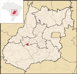
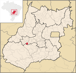
Cachoeira de Goiás
Encyclopedia
| Cachoeira de Goiás | |
|---|---|
| State | Goiás Goiás Goiás is a state of Brazil, located in the central part of the country. The name Goiás comes from the name of an indigenous community... |
| Area: | 417.1 km² |
| Population: | 1,410 (IBGE 2007) |
| Population density: | 3.39 inhab/km² (2007) |
| Postcode (CEP): | 76125-000 |
| Became a city: | 1953 |
| Mayor: | Marlúcio Pinheiro Duarte |
| Distance to Goiânia Goiânia -Climate:The city has a tropical wet and dry climate with an average temperature of . There's a wet season, from October to April, and a dry one, from May to September. Annual rainfall is around 1,520 mm.... : |
172 km. |
| IBGE statistical microregion: | Iporá Microregion Iporá Microregion The Iporá Microregion is a geographical region in central-western Goiás state, Brazil. The most important city is Iporá. For a map see -Important Data :*Population: 58,845 *Cities: 10*Total Area: 7,096.60 km²... |
| Website: | none (29/03/2008) |
| Coordinates: | 16°40′39"S 50°38′47"W |
Town
A town is a human settlement larger than a village but smaller than a city. The size a settlement must be in order to be called a "town" varies considerably in different parts of the world, so that, for example, many American "small towns" seem to British people to be no more than villages, while...
and municipality
Municipality
A municipality is essentially an urban administrative division having corporate status and usually powers of self-government. It can also be used to mean the governing body of a municipality. A municipality is a general-purpose administrative subdivision, as opposed to a special-purpose district...
in eastern Goiás
Goiás
Goiás is a state of Brazil, located in the central part of the country. The name Goiás comes from the name of an indigenous community...
state, Brazil
Brazil
Brazil , officially the Federative Republic of Brazil , is the largest country in South America. It is the world's fifth largest country, both by geographical area and by population with over 192 million people...
.
Location
- Distance to the state capital: 172 km.
- Distance to regional center (IporáIporáIporá is a small city and municipality in west-central Goiás state, Brazil. The population was 31,060 in a total area of 1,026.4 km² . It is known as the City of the Clear Waters because of its many streams and rivers.-Location:...
): 77 km. - Highway connections: state highway BR-069 west from GoiâniaGoiânia-Climate:The city has a tropical wet and dry climate with an average temperature of . There's a wet season, from October to April, and a dry one, from May to September. Annual rainfall is around 1,520 mm....
, through TrindadeTrindade-Transportation:Trindade are linked with São Tomé and Príncipe's only highways linking to the capital city of São Tomé, another linking Neves and Santana and another linking to Guadalupe as well....
, São Luís de Montes BelosSão Luís de Montes BelosSão Luís de Montes Belos is a small city and municipality in the State of Goiás, Brazil.-Location:It is located in the Anicuns Microregion, 123 kilometers from the state capital, Goiânia, to which it is connected by highway GO-060...
, and then GO-417 for 44 kilometers southwest to Cachoeira de Goiás. For all highway connections see Seplan. Neighboring municipalities are IvolândiaIvolândiaIvolândia is a small town and municipality in eastern Goiás state, Brazil. The population was 2,718 in a total area of 1,262.8 km² .-Location:*Distance to regional center : 56 km....
, MoiporáMoiporáMoiporá is a small town and municipality in eastern Goiás state, Brazil.-Distances and Highway Connections:*Distance to the state capital: 160 km.*Distance to regional center : 76 km....
, AurilândiaAurilândiaAurilândia is a small town and municipality in eastern Goiás state, Brazil.-Location:The distance to the state capital is 146 km. while the distance to the main regional center São Luís de Montes Belos is 23 km....
, and ParaúnaParaúnaParaúna is a small town and municipality in southwestern Goiás state, Brazil. It has strange rock formations and is a large producer of cotton and soybeans.-Location:...
.
Demographics
The population growth rate from 1996 to 2007 was 0.25%. Out of the total population of 1,410, 1,106 were considered urban while 304 were considered rural. The population has increased by about 200 persons since the census of 1980 with the urban population doubling and the rural population decreasing by half.The economy
The economy is based on cattle raising (24,000 head in 2006), agriculture, retail establishments, and several modest transformation industries.Agricultural data 2006
- Farms: 109
- Total area: 28,823 ha.
- Area of permanent crops: not available
- Area of perennial crops: not available
- Area of natural pasture: 22,025 ha.
- Area of woodland and forests: 5,812 ha.
- Persons dependent on farming: 300
- Farms with tractors: 13
- Number of tractors: 20
- Cattle herd: 24,000 head
Health and education
- Infant mortality in 2000: 35.47
- Literacy rate in 2000: 82.4
- Schools: 02
- Total number of students: 425
- Municipal Human Development IndexHuman Development IndexThe Human Development Index is a composite statistic used to rank countries by level of "human development" and separate "very high human development", "high human development", "medium human development", and "low human development" countries...
: 0.704
History
The settlement of Cachoeira de Goiás began in 1892 when Manoel Fernandes Pereira and other families built a chapel honoring the Divine Spirit. The growth was slow until Coronel Francisco Seabra de Guimarães worked to make it a district of the capital GoiásGoiás, Goiás
Goiás is a small city and municipality in the state of Goiás in Brazil. The population was 24,072 in a total area of 3,108 km² . It is the former capital of the state and preserves much of its colonial heritage...
with the name of Cachoeira da Fumaça. In 1938 it became a district of the municipality of Paraúna
Paraúna
Paraúna is a small town and municipality in southwestern Goiás state, Brazil. It has strange rock formations and is a large producer of cotton and soybeans.-Location:...
with the name Moitu, of unknown origin. In 1948 it became a district in the municipality of Aurilândia
Aurilândia
Aurilândia is a small town and municipality in eastern Goiás state, Brazil.-Location:The distance to the state capital is 146 km. while the distance to the main regional center São Luís de Montes Belos is 23 km....
, finally becoming independent in 1953.
See also
List of municipalities in GoiásMicroregions of Goiás