
Braunstonbury
Encyclopedia
The lost village of Braunstonbury lies in low ground south-west of the village
of Braunston
in the English
county of Northamptonshire
. Its site is on the eastern bank of the River Leam
, which also marks the border between Northamptonshire and Warwickshire
.
Adjacent to the site on the west side of the river Leam is the site of the lost village of Wolfhampcote
which straddled the county border of both counties.
in the county of Shropshire
. At the time of the dissolution of the monasteries
the settlement and land was sold to the Earl of Rutland, who already owned property in the vicinity. An estate map of 1785 shows the area lacking any buildings although the undoubted medieval boundaries of Braunstonbury are shown.
s. On the western boundary are the remains of a bank approximately 1.5 to 2 metres high. On the southern boundary is a low bank which runs into the remains of a (now disused) railway line that was built across part of the southern boundary. There are also the remains of a low bank on the eastern boundary of the village. Cutting across the north-west corner of the site is a hollowed way which was once the lane that connected the village to nearby Braunston. In the north-west corner there is a very defined rectangular ditch around a raised platform where once stood a medieval manor house
. The rest of the village can be made out by extensive earthworks and some traces of stonework can be found. A large quantity of medieval pottery
dating from the 14th and 15th centuries has been found along the edge of a stream that runs along the northern boundary of the settlement. The stream once fed the fishponds that filled the low valley here.
. The remains of the original route of the Oxford Canal
, which was abandoned in the 1830s, can be traced through the area. There are also the remains of two abandoned railway lines, the first being the old Weedon to Leamington Spa
railway, which closed in 1963, and the second being the Great Central Railway
, which closed in 1966. The former passes over the southern boundaries of the village and quite close to Wolfhampcote church.
Village
A village is a clustered human settlement or community, larger than a hamlet with the population ranging from a few hundred to a few thousand , Though often located in rural areas, the term urban village is also applied to certain urban neighbourhoods, such as the West Village in Manhattan, New...
of Braunston
Braunston
Braunston is a village and civil parish in the county of Northamptonshire, England. It has a population of 1,675 . Braunston is situated just off the A45 main road and lies between the towns of Rugby and Daventry....
in the English
England
England is a country that is part of the United Kingdom. It shares land borders with Scotland to the north and Wales to the west; the Irish Sea is to the north west, the Celtic Sea to the south west, with the North Sea to the east and the English Channel to the south separating it from continental...
county of Northamptonshire
Northamptonshire
Northamptonshire is a landlocked county in the English East Midlands, with a population of 629,676 as at the 2001 census. It has boundaries with the ceremonial counties of Warwickshire to the west, Leicestershire and Rutland to the north, Cambridgeshire to the east, Bedfordshire to the south-east,...
. Its site is on the eastern bank of the River Leam
River Leam
The River Leam is a river which flows through eastern and southern Warwickshire. It is a small river about 25–30 miles long. The town of Leamington Spa lies on, and is named after, the River Leam....
, which also marks the border between Northamptonshire and Warwickshire
Warwickshire
Warwickshire is a landlocked non-metropolitan county in the West Midlands region of England. The county town is Warwick, although the largest town is Nuneaton. The county is famous for being the birthplace of William Shakespeare...
.
Adjacent to the site on the west side of the river Leam is the site of the lost village of Wolfhampcote
Wolfhampcote
Wolfhampcote is an abandoned village and civil parish in the English counties of Warwickshire and Northamptonshire, which it straddles.The old village of Wolfhampcote is located west of the A45 road near Braunston in Northamptonshire, and can be reached by a track from the main A45 road, or by a...
which straddled the county border of both counties.
History
Very little information is known about Braunstonbury, probably because it was regarded as part of the nearby village of Braunston. It has never been listed separately in taxation records. It is thought that the settlement was part of the 11th-century manor which belonged to William Trusbott. The settlement passed to his daughter, Hilary de Bulliers, who in turn left the village to the Abbey of LilleshallLilleshall Hall
Lilleshall Hall is a large former country house and estate located near Lilleshall in Shropshire, England. It was founded as an Augustinian Abbey in the 12th century, with its estate running to some...
in the county of Shropshire
Shropshire
Shropshire is a county in the West Midlands region of England. For Eurostat purposes, the county is a NUTS 3 region and is one of four counties or unitary districts that comprise the "Shropshire and Staffordshire" NUTS 2 region. It borders Wales to the west...
. At the time of the dissolution of the monasteries
Dissolution of the Monasteries
The Dissolution of the Monasteries, sometimes referred to as the Suppression of the Monasteries, was the set of administrative and legal processes between 1536 and 1541 by which Henry VIII disbanded monasteries, priories, convents and friaries in England, Wales and Ireland; appropriated their...
the settlement and land was sold to the Earl of Rutland, who already owned property in the vicinity. An estate map of 1785 shows the area lacking any buildings although the undoubted medieval boundaries of Braunstonbury are shown.
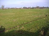
Remains Today
The remains of the village lie within an almost square area of land bounded to the north by a low valley which was once occupied by fishpondFishpond
Fishpond was the code name given to an extension to the British H2S airborne radar system fitted to Royal Air Force Avro Lancaster and Handley Page Halifax heavy bombers during World War II...
s. On the western boundary are the remains of a bank approximately 1.5 to 2 metres high. On the southern boundary is a low bank which runs into the remains of a (now disused) railway line that was built across part of the southern boundary. There are also the remains of a low bank on the eastern boundary of the village. Cutting across the north-west corner of the site is a hollowed way which was once the lane that connected the village to nearby Braunston. In the north-west corner there is a very defined rectangular ditch around a raised platform where once stood a medieval manor house
Manor house
A manor house is a country house that historically formed the administrative centre of a manor, the lowest unit of territorial organisation in the feudal system in Europe. The term is applied to country houses that belonged to the gentry and other grand stately homes...
. The rest of the village can be made out by extensive earthworks and some traces of stonework can be found. A large quantity of medieval pottery
Pottery
Pottery is the material from which the potteryware is made, of which major types include earthenware, stoneware and porcelain. The place where such wares are made is also called a pottery . Pottery also refers to the art or craft of the potter or the manufacture of pottery...
dating from the 14th and 15th centuries has been found along the edge of a stream that runs along the northern boundary of the settlement. The stream once fed the fishponds that filled the low valley here.
In the Vicinity
The area around the lost settlement is rich in industrial archaeologyIndustrial archaeology
Industrial archaeology, like other branches of archaeology, is the study of material culture from the past, but with a focus on industry. Strictly speaking, industrial archaeology includes sites from the earliest times to the most recent...
. The remains of the original route of the Oxford Canal
Oxford Canal
The Oxford Canal is a narrow canal in central England linking Oxford with Coventry via Banbury and Rugby. It connects with the River Thames at Oxford, to the Grand Union Canal at the villages of Braunston and Napton-on-the-Hill, and to the Coventry Canal at Hawkesbury Junction in Bedworth just...
, which was abandoned in the 1830s, can be traced through the area. There are also the remains of two abandoned railway lines, the first being the old Weedon to Leamington Spa
Leamington Spa
Royal Leamington Spa, commonly known as Leamington Spa or Leamington or Leam to locals, is a spa town in central Warwickshire, England. Formerly known as Leamington Priors, its expansion began following the popularisation of the medicinal qualities of its water by Dr Kerr in 1784, and by Dr Lambe...
railway, which closed in 1963, and the second being the Great Central Railway
Great Central Railway
The Great Central Railway was a railway company in England which came into being when the Manchester, Sheffield and Lincolnshire Railway changed its name in 1897 in anticipation of the opening in 1899 of its London Extension . On 1 January 1923, it was grouped into the London and North Eastern...
, which closed in 1966. The former passes over the southern boundaries of the village and quite close to Wolfhampcote church.