
.gif)
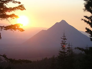
Black Butte (Siskiyou County, California)
Encyclopedia
Dacite
Dacite is an igneous, volcanic rock. It has an aphanitic to porphyritic texture and is intermediate in composition between andesite and rhyolite. The relative proportions of feldspars and quartz in dacite, and in many other volcanic rocks, are illustrated in the QAPF diagram...
lava dome
Lava dome
|250px|thumb|right|Image of the [[rhyolitic]] lava dome of [[Chaitén Volcano]] during its 2008–2009 eruption.In volcanology, a lava dome is a roughly circular mound-shaped protrusion resulting from the slow extrusion of viscous lava from a volcano...
s in a butte
Butte
A butte is a conspicuous isolated hill with steep, often vertical sides and a small, relatively flat top; it is smaller than mesas, plateaus, and table landform tables. In some regions, such as the north central and northwestern United States, the word is used for any hill...
,
a parasitic satellite cone
Satellite cone
A parasitic cone is the cone-shaped accumulation of volcanic material not part of the central vent of a volcano. One forms by eruptions from fractures on the flank of the volcano. These fractures occur because of the flank of the volcano is unstable...
of Mount Shasta
Mount Shasta
Mount Shasta is located at the southern end of the Cascade Range in Siskiyou County, California and at is the second highest peak in the Cascades and the fifth highest in California...
. It is located directly adjacent to Interstate 5
Interstate 5
Interstate 5 is the main Interstate Highway on the West Coast of the United States, running largely parallel to the Pacific Ocean coastline from Canada to Mexico . It serves some of the largest cities on the U.S...
at milepost 742 between the city of Mount Shasta
Mount Shasta, California
Mount Shasta is a city in Siskiyou County, California, located at around 3,600 ft on the flanks of Mount Shasta, a prominent northern California landmark. The city is less than southwest of the summit of its namesake volcano...
and Weed, California
Weed, California
Weed is a city located in Siskiyou County, California. As of the 2010 Census, the town had a total population of 2,967, down from 2,979 at the 2000 census. There are several unincorporated communities adjacent to, or just outside Weed proper. These include Edgewood, Carrick, Lake Shastina, Rancho...
. The highway crosses a 3912 ft (1,192 m) pass, Black Butte Summit, at the western base of the lava domes. The lava domes were extruded at the foot of the cone of Shastina
Shastina
Shastina is the highest satellite cone of Mount Shasta, and one of four overlapping volcanic cones which together form the most voluminous stratovolcano in the Cascade Range. At , Shastina is taller than Mount Adams and would rank as the third highest volcano in the Cascades behind Mount Rainier...
following the period of its major eruptions about 9,000–10,000 years ago.
A United States Forest Service
United States Forest Service
The United States Forest Service is an agency of the United States Department of Agriculture that administers the nation's 155 national forests and 20 national grasslands, which encompass...
fire lookout tower
Fire lookout tower
A fire lookout tower, fire tower or lookout tower, provides housing and protection for a person known as a "fire lookout" whose duty it is to search for wildfires in the wilderness...
was built on the summit in the 1930s, but destroyed during the Columbus Day Storm of 1962
Columbus Day Storm of 1962
The Columbus Day Storm of 1962 was an extratropical cyclone that ranked among the most intense to strike the United States Pacific Northwest since at least 1948, likely since the January 9, 1880 "Great Gale" and snowstorm...
. A new lookout was built in 1963 and operated until 1973. The building was moved by helicopter to a new location in 1975 and only the concrete foundation remains today. A 2.5 miles (4 km) long trail leads to the summit from a trailhead
Trailhead
A trailhead is the point at which a trail begins, where the trail is often intended for hiking, biking, horseback riding, or off-road vehicles...
accessible by dirt road
Dirt road
Dirt road is a common term for an unpaved road made from the native material of the land surface through which it passes, known to highway engineers as subgrade material. Dirt roads are suitable for vehicles; a narrower path for pedestrians, animals, and possibly small vehicles would be called a...
s off the Everitt Memorial Highway.
The summit boasts an outstanding view of the southwest side of Shasta and Shastina, and on clear days Mount McLoughlin
Mount McLoughlin
Mount McLoughlin is a steep-sided lava cone built on top of a shield volcano in the Cascade Range of southern Oregon and within the Sky Lakes Wilderness area. It is one of the volcanic peaks in the Cascade Volcanic Arc. The mountain is north of Mount Shasta, south of Crater Lake, and west of Upper...
is easily visible 70 miles (113 km) to the north in Oregon.