
Arizona State Route 264
Encyclopedia
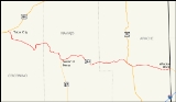
State Route 264 is a highway in northeastern Arizona
that runs from its junction with US 160 in Tuba City
to the border with New Mexico
. The roadway is still numbered 264 into New Mexico to its junction with US 491.
. From here, it heads east, passing through Polacca
and Keams Canyon
. SR 264 continues to the southeast until it curves back toward the east at an intersection with BIA Route 6. SR 264 continues east to a junction with US 191 in Burnside
and the two run concurrently until they reach Ganado
. US 191 heads south from this junction as SR 264 heads east. SR 264 continues east to Window Rock
just prior to crossing the New Mexico
border and continuing as New Mexico State Route 264.
SR 264 is one of two major east–west routes crossing the expansive Navajo Indian Reservation, the other being US 160. It also bisects the Hopi Reservation
. Much of this territory is sparsely inhabited and is home to wide open, scenic vistas. While it does not pass through any large cities or towns, it does pass through Window Rock
, seat of government for the Navajo Nation
, as well as near Old Oraibi, which is generally considered the oldest continuously inhabited settlement in North America.
Arizona
Arizona ; is a state located in the southwestern region of the United States. It is also part of the western United States and the mountain west. The capital and largest city is Phoenix...
that runs from its junction with US 160 in Tuba City
Tuba City, Arizona
Tuba City is a census-designated place in Coconino County, Arizona, United States. The population was 8,225 at the 2000 census. It is the Dine' Nation's largest community, slightly larger than Shiprock, New Mexico. The Hopi town of Moenkopi lies directly to its southeast.The name of the town...
to the border with New Mexico
New Mexico
New Mexico is a state located in the southwest and western regions of the United States. New Mexico is also usually considered one of the Mountain States. With a population density of 16 per square mile, New Mexico is the sixth-most sparsely inhabited U.S...
. The roadway is still numbered 264 into New Mexico to its junction with US 491.
Route description
The western terminus of SR 264 is located at a junction with US 160 in Tuba City. The highway heads towards the southeast and then south from this junction until it reaches BIA Route 6710. At this junction, SR 264 begins to heads towards the southeast. It continues on this heading until it curves towards the south southeast of Coal Mine Mesa. The highway curves back towards the east and then north as it follows the terrain of the area. The highway curves back towards the east just prior to an intersection with BIA Route 6660. It continues towards the east to a junction with BIA Route 62 where SR 264 curves towards the southeast. The highway curves towards the south just prior to passing through Hotevilla. It curves back towards the east when it reaches Old Oraibi. The highway curves back towards the south until it reaches the northern terminus of SR 87 in Second MesaSecond Mesa, Arizona
Second Mesa is a census-designated place in Navajo County, Arizona on the Hopi Reservation. As of the 2000 census, the CDP population was 814, spread among three Hopi Indian villages atop the 5,700-foot mesa: Musungnuvi , Supawlavi , and Songoopavi...
. From here, it heads east, passing through Polacca
Polacca, Arizona
Polacca is an unincorporated community in Navajo County, Arizona, United States. Polacca is located along Arizona State Route 264 northeast of Second Mesa. Polacca has a post office with ZIP code 86042. The community is named for Tewa Indian Tom Polacca....
and Keams Canyon
Keams Canyon, Arizona
Keams Canyon is a census-designated place in Navajo County, Arizona, United States. The population was 260 at the 2000 census.-Geography:Keams Canyon is located at ....
. SR 264 continues to the southeast until it curves back toward the east at an intersection with BIA Route 6. SR 264 continues east to a junction with US 191 in Burnside
Burnside, Arizona
Burnside is a census-designated place in Apache County, Arizona, United States. The population was 632 at the 2000 census.-Geography:Burnside is located at ....
and the two run concurrently until they reach Ganado
Ganado, Arizona
Ganado is a census-designated place in Apache County, Arizona, United States. The population was 1,505 at the 2000 census.Ganado is part of the Navajo Nation...
. US 191 heads south from this junction as SR 264 heads east. SR 264 continues east to Window Rock
Window Rock, Arizona
Window Rock is the seat of government and capital of the Navajo Nation, the largest territory of a sovereign Native American nation in North America. Window Rock contains the Navajo Nation Council, the Navajo Nation Zoological and Botanical Park, as well as the Navajo Nation World War II Memorial...
just prior to crossing the New Mexico
New Mexico
New Mexico is a state located in the southwest and western regions of the United States. New Mexico is also usually considered one of the Mountain States. With a population density of 16 per square mile, New Mexico is the sixth-most sparsely inhabited U.S...
border and continuing as New Mexico State Route 264.
SR 264 is one of two major east–west routes crossing the expansive Navajo Indian Reservation, the other being US 160. It also bisects the Hopi Reservation
Hopi Reservation
The Hopi Reservation, or simply Hopi, is a Native American reservation for the Hopi and Arizona Tewa people, surrounded entirely by the Navajo Nation, in Navajo and Coconino counties of Arizona, USA. The site in north-eastern Arizona has a land area of 2,531.773 sq mi and as of the 2000 census had...
. Much of this territory is sparsely inhabited and is home to wide open, scenic vistas. While it does not pass through any large cities or towns, it does pass through Window Rock
Window Rock, Arizona
Window Rock is the seat of government and capital of the Navajo Nation, the largest territory of a sovereign Native American nation in North America. Window Rock contains the Navajo Nation Council, the Navajo Nation Zoological and Botanical Park, as well as the Navajo Nation World War II Memorial...
, seat of government for the Navajo Nation
Navajo Nation
The Navajo Nation is a semi-autonomous Native American-governed territory covering , occupying all of northeastern Arizona, the southeastern portion of Utah, and northwestern New Mexico...
, as well as near Old Oraibi, which is generally considered the oldest continuously inhabited settlement in North America.
History
Although SR 264 became a state highway in 1961, maps of the area would indicate that the route itself has existed as a dirt road as early as 1927. By 1935, portions of the route had been improved. The section between Oraibi and Keams Canyon and the section from northwest of Ganado and the New Mexico border had been improved for travel. By 1938, the route had been improved further to a gravel road. By the time the route became a state highway in 1961, the route had been paved.Junction list
| County | Location | Mile | Junction | Notes |
|---|---|---|---|---|
| Coconino Coconino County, Arizona -2010:Whereas according to the 2010 U.S. Census Bureau:*61.7% White*1.2% Black*27.3% Native American*1.4% Asian*0.1% Native Hawaiian or Pacific Islander*3.1% Two or more races*5.2% Other races*13.5% Hispanic or Latino -2000:... |
0.00 | |||
| Navajo Navajo County, Arizona -2010:Whereas according to the 2010 U.S. Census Bureau:*49.3% White*0.9% Black*43.4% Native American*0.5% Asian*0.1% Native Hawaiian or Pacific Islander*2.5% Two or more races*3.3% Other races*10.8% Hispanic or Latino -2000:... |
62.46 | |||
| 119.26 | West end of US 191 overlap | |||
| 125.14 | East end of US 191 overlap | |||
| 154.36 |