
Araçu
Encyclopedia
| Araçu | |
|---|---|
| State | Goiás Goiás Goiás is a state of Brazil, located in the central part of the country. The name Goiás comes from the name of an indigenous community... |
| Area: | 154 square kilometre |
| Population: | 3,880 (IBGE 2007) |
| Elevation: | 716 m (2,349.1 ft) above sea level |
| Postcode (CEP): | 75410-000 |
| IBGE statistical microregion: | Anápolis Microregion Anápolis Microregion The Anápolis Microregion is a region of central Goiás state, Brazil, including municipalities surrounding the city of Anápolis. For a map see *Population: 517,221 inhabitants *Cities: 19*Total Area: 8,386.80 km²... |
| Became a city: | 1958 |
| Distance to Goiânia Goiânia -Climate:The city has a tropical wet and dry climate with an average temperature of . There's a wet season, from October to April, and a dry one, from May to September. Annual rainfall is around 1,520 mm.... : |
75 km (46.6 mi) |
| Website: | none |
| Coordinates: | 16°21′23"S 49°41′16"W |

Town
A town is a human settlement larger than a village but smaller than a city. The size a settlement must be in order to be called a "town" varies considerably in different parts of the world, so that, for example, many American "small towns" seem to British people to be no more than villages, while...
and municipality
Municipality
A municipality is essentially an urban administrative division having corporate status and usually powers of self-government. It can also be used to mean the governing body of a municipality. A municipality is a general-purpose administrative subdivision, as opposed to a special-purpose district...
in central Goiás
Goiás
Goiás is a state of Brazil, located in the central part of the country. The name Goiás comes from the name of an indigenous community...
state, Brazil
Brazil
Brazil , officially the Federative Republic of Brazil , is the largest country in South America. It is the world's fifth largest country, both by geographical area and by population with over 192 million people...
.
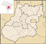
Location
Araçu is part of the Anápolis MicroregionAnápolis Microregion
The Anápolis Microregion is a region of central Goiás state, Brazil, including municipalities surrounding the city of Anápolis. For a map see *Population: 517,221 inhabitants *Cities: 19*Total Area: 8,386.80 km²...
and is a short distance northwest of the state capital, Goiânia
Goiânia
-Climate:The city has a tropical wet and dry climate with an average temperature of . There's a wet season, from October to April, and a dry one, from May to September. Annual rainfall is around 1,520 mm....
. It has boundaries with Itaberaí
Itaberaí
Itaberaí is a small city and municipality in central Goiás state, Brazil. Itaberaí is a large producer of agricultural products including corn, rice, soybeans, tomatoes, and sugarcane.-Location:...
, Itauçu
Itauçu
Itauçu is a small town and municipality in central Goiás state, Brazil.-Location:Itauçu is located 64 km. northwest of the state capital, Goiânia and is part of the Anápolis Microregion...
, and Caturaí
Caturaí
Caturaí is a small town and municipality in central Goiás state, Brazil.Caturaí is 32 kilometers north of Goiânia and belongs to the Anápolis Microregion. It is connected to the state capital by highway GO-070...
. The distance to the state capital, Goiânia
Goiânia
-Climate:The city has a tropical wet and dry climate with an average temperature of . There's a wet season, from October to April, and a dry one, from May to September. Annual rainfall is around 1,520 mm....
, is 75 km (46.6 mi) and highway connections are made by GO-070 / Goianira
Goianira
Goianira is a small city and municipality in central Goiás state, Brazil, located 32 kilometers northwest of the state capital, Goiânia. The population was 24,110 in a total area of 200.4 km² . Goianira is becoming a major producer of shoes.Goianira is four kilometers east of highway BR-457 /...
/ GO-523 / Caturaí
Caturaí
Caturaí is a small town and municipality in central Goiás state, Brazil.Caturaí is 32 kilometers north of Goiânia and belongs to the Anápolis Microregion. It is connected to the state capital by highway GO-070...
/ GO-222.
Demographics
The population density was 25.26 inhab/km² (2007) with 3,343 people living in the urban areas and 537 living in the rural areas. The population growth rate was 0.49% for the period 1996/2007)The economy
The economy is based on cattle raising (19,500 head in 2006), services, public administration, and agriculture. The main agricultural products in 2006 were bananas, coffee, garlic, rice, sugarcane, beans, corn, and tomatoes. There were no financial institutions reported in 2007.- Industrial establishments: 6
- Retail commerce establishments: 26
- Automobiles: 314
Agricultural data 2006
- Farms: 171
- Total area: 18379 ha (45,415.5 acre)
- Area of permanent crops: 426 ha (1,052.7 acre)
- Area of perennial crops: 1311 ha (3,239.5 acre)
- Area of natural pasture: 13330 ha (32,939.1 acre)
- Area of woodland and forests: 2735 ha (6,758.3 acre)
- Persons dependent on farming: 620
- Farms with tractors: 33
- Number of tractors: 47
- Cattle herd: 19,500 head IBGE
Health and education
There was one small hospital with 16 beds in 2006. The infant mortality rate was 17.97 in 2000. In the educational sector there were 1,093 students attending primary and middle schools. The literacy rate was 81.5% in 2000.(IBGE 2004). The classification on the Human Development Index
Human Development Index
The Human Development Index is a composite statistic used to rank countries by level of "human development" and separate "very high human development", "high human development", "medium human development", and "low human development" countries...
was 0.733. This ranked 130 (out of 242 municipalities) in the state and
2,337 out of 5,507 municipalities in the country.
History
Araçu began on the ranch owned by José Jacinto da Silva, where there was a cemetery built in 1911. In 1912 Silva donated part of his land for the building of a chapel. From 1925 to 1930 with the arrival of the families of Antônio Camargo and João Faria, the settlement known as São Sebastião do Salobro, began to grow. In 1935 it belonged to the municipality of ItauçuItauçu
Itauçu is a small town and municipality in central Goiás state, Brazil.-Location:Itauçu is located 64 km. northwest of the state capital, Goiânia and is part of the Anápolis Microregion...
and in 1941 it became a district with the name Araçu, a Tupi term that means "Terra Grande" (Large Land). In 1958 it was dismembered from Itauçu and became a municipality. Source: Sepin