

22d Space Operations Squadron
Encyclopedia
United States Air Force
The United States Air Force is the aerial warfare service branch of the United States Armed Forces and one of the American uniformed services. Initially part of the United States Army, the USAF was formed as a separate branch of the military on September 18, 1947 under the National Security Act of...
unit of the 50th Network Operations Group
50th Network Operations Group
The 50th Network Operations Group is a unit of the 50th Space Wing at Schriever Air Force Base, Colorado. 50th NOG is the single focal point for operating and maintaining the $8.2 billion Air Force Satellite Control Network and all 50 SW communications and computer systems...
, itself a part of the 50th Space Wing
50th Space Wing
The 50th Space Wing is a wing of the United States Air Force under the major command of Air Force Space Command . It was activated on 30 January 1992, replacing the 2d Space Wing, which was deactivated on the same date.-Overview:...
, and is located at Schriever Air Force Base
Schriever Air Force Base
Schriever Air Force Base is a base of the United States Air Force located approximately 10 miles east of Peterson AFB near Colorado Springs in El Paso County, Colorado, United States.-Overview:...
, Colorado
Colorado
Colorado is a U.S. state that encompasses much of the Rocky Mountains as well as the northeastern portion of the Colorado Plateau and the western edge of the Great Plains...
. 22 SOPS develops, publishes, executes, and enforces the network operations tasking order, as well as operating and maintaining worldwide remote tracking stations and associated communications systems comprising the Air Force Satellite Control Network
Air Force Satellite Control Network
The Air Force Satellite Control Network provides support for the operation, control, and maintenance of a variety of United States Department of Defense and some non-DoD satellites. This involves continual execution of the tasks involved in Tracking, Telemetry, and Command...
(AFSCN). It additionally coordinates launch and on-orbit operations of Department of Defense
United States Department of Defense
The United States Department of Defense is the U.S...
and other national agencies' satellites in support of warfighters, the President
President of the United States
The President of the United States of America is the head of state and head of government of the United States. The president leads the executive branch of the federal government and is the commander-in-chief of the United States Armed Forces....
, and the Secretary of Defense. Lastly, the squadron supports NASA
NASA
The National Aeronautics and Space Administration is the agency of the United States government that is responsible for the nation's civilian space program and for aeronautics and aerospace research...
's space mission.
History
Constituted 22d Space Operations Squadron on 10 July 1991, it was activated on 1 Oct 1991. It operated as part of the 2d Satellite Tracking (later, 750th Space) Group750th Space Group
The United States Air Force's 750th Space Group was a space operations unit located at Onizuka Air Force Station, California.-History:The 750 SG deactivated in June 1999, following the recommendation of the 1995 Department of Defense Base Realignment and Closure commission...
. In 2004 it changed from being under the 50th Operations Group to the 50th Network Operations Group. As part of 22 SOPS, the Colorado Tracking Station (CTS) enjoys a unique status as the only on-base satellite tracking facility. Originally built in the late 1980s, the station has undergone a number of upgrades that continue even today.
In late 2006, the station is scheduled to receive a new equipment core, which will allow further automation of the satellite operations. The new core, part of the Remote Tracking Station (RTS) Block Change (RBC) includes computer processor upgrades, and new hardware/software to allow the tracking station equipment to better interface with the upgraded satellite operations centers (SOCs). This system also involves a 13-meter diameter, 3-axis antenna. This new antenna adds the capability to track low earth orbiting satellites "over the top".
The Squadron is now led by its eleventh commander, Lieutenant Colonel David C. Arnold.
Beginning October 1, 2006, the tracking station began reduced operations, owing to "fiscal constraints".
Geographically separated units
All the following are remote tracking stations for the Air Force Satellite Control NetworkAir Force Satellite Control Network
The Air Force Satellite Control Network provides support for the operation, control, and maintenance of a variety of United States Department of Defense and some non-DoD satellites. This involves continual execution of the tasks involved in Tracking, Telemetry, and Command...
(AFSCN).
- Detachment 1: Vandenberg Tracking Station (COOK), Vandenberg Air Force BaseVandenberg Air Force BaseVandenberg Air Force Base is a United States Air Force Base, located approximately northwest of Lompoc, California. It is under the jurisdiction of the 30th Space Wing, Air Force Space Command ....
, CaliforniaCaliforniaCalifornia is a state located on the West Coast of the United States. It is by far the most populous U.S. state, and the third-largest by land area...
. Transitioning to 21 SOPS. - Detachment 2: Diego Garcia Tracking Station (REEF), Diego GarciaDiego GarciaDiego Garcia is a tropical, footprint-shaped coral atoll located south of the equator in the central Indian Ocean at 7 degrees, 26 minutes south latitude. It is part of the British Indian Ocean Territory [BIOT] and is positioned at 72°23' east longitude....
, British Indian Ocean TerritoryBritish Indian Ocean TerritoryThe British Indian Ocean Territory or Chagos Islands is an overseas territory of the United Kingdom situated in the Indian Ocean, halfway between Africa and Indonesia... - Detachment 3: Thule Tracking Station (POGO)http://www.thule.af.mil/library/factsheets/factsheet.asp?id=4882, Thule Air BaseThule Air BaseThule Air Base or Thule Air Base/Pituffik Airport , is the United States Air Force's northernmost base, located north of the Arctic Circle and from the North Pole on the northwest side of the island of Greenland. It is approximately east of the North Magnetic Pole.-Overview:Thule Air Base is the...
, GreenlandGreenlandGreenland is an autonomous country within the Kingdom of Denmark, located between the Arctic and Atlantic Oceans, east of the Canadian Arctic Archipelago. Though physiographically a part of the continent of North America, Greenland has been politically and culturally associated with Europe for... - Detachment 4: Hawaii Tracking Station (HULA), Kaena PointKaena Point Satellite Tracking StationThe Kaena Point Satellite Tracking Station is a United States Air Force military installation in Kaena Point on the island of Oahu in Hawaii. It is a remote tracking station of the Air Force Satellite Control Network responsible for tracking satellites in orbit, many of which support the United...
, HawaiiHawaiiHawaii is the newest of the 50 U.S. states , and is the only U.S. state made up entirely of islands. It is the northernmost island group in Polynesia, occupying most of an archipelago in the central Pacific Ocean, southwest of the continental United States, southeast of Japan, and northeast of... - Detachment 5: Guam Tracking Station (GUAM), GuamGuamGuam is an organized, unincorporated territory of the United States located in the western Pacific Ocean. It is one of five U.S. territories with an established civilian government. Guam is listed as one of 16 Non-Self-Governing Territories by the Special Committee on Decolonization of the United...
- OL-AE: Telemetry and Command Station (LION)http://www.afspc.af.mil/news/story.asp?storyID=123021658, RAF OakhangerRAF OakhangerRAF Station Oakhanger was a Royal Air Force station in Hampshire split over three operational sites with accommodation in nearby Bordon. The main site and operations centre was near the village of Oakhanger with two other sites nearby...
, United KingdomUnited KingdomThe United Kingdom of Great Britain and Northern IrelandIn the United Kingdom and Dependencies, other languages have been officially recognised as legitimate autochthonous languages under the European Charter for Regional or Minority Languages... - Colorado Tracking Station (PIKE), Schriever AFB
Awards
The Aldridge Trophy 1996 (AFSPC Guardian ChallengeGuardian Challenge
The United States Air Force's Space and Missile Combat Competition, currently known as Guardian Challenge is a military competition that recognizes the best space and missile combat crews in Air Force Space Command.-See also:...
)
Outstanding Unit Award
Outstanding Unit Award
The Air Force Outstanding Unit Award is an award of the United States Air Force which was first created in 1954. The award is presented as a ribbon to any command of the U.S...
s:
- September 90 - August 91
- September 93 - August 95
- October 98 - September 00
- October 00 - September 1
- October 1 - October 2
- October 2 - October 3
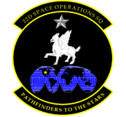
Emblem
The squadron's emblem was approved on 13 April 1995. It is blazonBlazon
In heraldry and heraldic vexillology, a blazon is a formal description of a coat of arms, flag or similar emblem, from which the reader can reconstruct the appropriate image...
ed as follows:
Sable, an opinicus passant Argent between in chief a mullet of the like and in base, a Mercator projectionMercator projectionThe Mercator projection is a cylindrical map projection presented by the Belgian geographer and cartographer Gerardus Mercator, in 1569. It became the standard map projection for nautical purposes because of its ability to represent lines of constant course, known as rhumb lines or loxodromes, as...
[actually represented as Goode homolosineGoode homolosine projectionThe Goode homolosine projection is pseudocylindrical, equal-area, composite map projection used for world maps. Normally it is presented with multiple interruptions...] of the globe Azure gridlined of the second, land masses of the first, and charged on the "United States" with a mullet Or; all within a diminished bordure of the like.