
1984 Pacific hurricane season
Encyclopedia
The 1984 Pacific hurricane season officially started May 15, 1984 in the eastern Pacific, and June 1, 1984 in the central Pacific, and lasted until November 30, 1984. These dates conventionally delimit the period of each year when most tropical cyclones form in the northeastern Pacific Ocean
.
. In the central Pacific, there was a major hurricane and two tropical storms. There was at least one tropical depression that did not strengthen into a storm.
. It took a due west path for its entire life, but it never affected land.
had no significant convection until June 25, when it strengthened into Tropical Depression Four-E. As it strengthened into a Tropical Storm, it received the name Douglas. It strengthened into a hurricane the next day. It hit its peak intensity of a Category Four on the SSHS on June 28. The next day, Douglas weakened into a category 3, then a category 2 late the same day. It later weakened into a Tropical Storm on June 5, then on June 6, the storm met its demise as it dissipated. Douglas was the strongest storm of the season. Its remnants brought rain to Maui
and the Big Island.
enough to prompt an evacuation. However, intense shear disintegrated the cyclone. There was no damage.
, encountered shear, and lost tropical characteristics.
. Its remnants recurved and brought minor levels of rain to California.
.
, Mexico
.
on September 22. It dissipated the next day.
on October 3.
. It was upgraded to Tropical Storm Rachel on October 9, as it continued westward into the open waters of the Pacific Ocean
. Rachel was downgraded to a tropical depression on October 11, as it began to turn northwest. The depression then dissipated in open waters on October 16.http://weather.unisys.com/hurricane/e_pacific/1984/RACHEL/track.dat
, if any. Deaths in parentheses are additional and indirect (an example of an indirect death would be a traffic accident), but are still storm-related. Damage and deaths include totals while the storm was extratropical or a wave or low.
, the first time names were reused since the modern naming system began. Names that were not assigned are marked in gray.
Three names from the Central Pacific list were used - Keli, Lala, and Moke. This was the first usage for all of these names.
Pacific Ocean
The Pacific Ocean is the largest of the Earth's oceanic divisions. It extends from the Arctic in the north to the Southern Ocean in the south, bounded by Asia and Australia in the west, and the Americas in the east.At 165.2 million square kilometres in area, this largest division of the World...
.
Storms
There were 18 tropical storms in the eastern Pacific this season. Twelve became hurricanes. Of those, six became major hurricanes by reaching Category 3 intensity or higher on the Saffir-Simpson Hurricane ScaleSaffir-Simpson Hurricane Scale
The Saffir–Simpson Hurricane Scale , or the Saffir–Simpson Hurricane Wind Scale , classifies hurricanes — Western Hemisphere tropical cyclones that exceed the intensities of tropical depressions and tropical storms — into five categories distinguished by the intensities of their sustained winds...
. In the central Pacific, there was a major hurricane and two tropical storms. There was at least one tropical depression that did not strengthen into a storm.
Tropical Storm Alma
Alma was a short-lived storm. It developed from a disturbance that later strengthened into Tropical Depression One-E on May 17. It continued strengthening until May 19, when it strengthened into Tropical Storm Alma, the first tropical cyclone and named storm of the season. Alma hit its peak intensity of a strong tropical storm of 60 mph (95 km/h) later that day. No one died as a result of the storm. On May 21, it was downgraded into a depression. Later that same day, Alma was declared dissipated as it degenerated into an open troughTrough (meteorology)
A trough is an elongated region of relatively low atmospheric pressure, often associated with fronts.Unlike fronts, there is not a universal symbol for a trough on a weather chart. The weather charts in some countries or regions mark troughs by a line. In the United States, a trough may be marked...
. It took a due west path for its entire life, but it never affected land.
Hurricane Boris
The first Hurricane of the season, Boris was a minimal hurricane whose path included a loop, a rarity in this basin. Boris lasted from May 28 to June 18, a total of 21 days, one of the longest lasting hurricanes ever, and one of the longest-lived storms on record for the East Pacific. It had no effect on land, so as a result, no one died, just like the rest of the storms in the season.Hurricane Douglas
A disturbance off the coast of MexicoMexico
The United Mexican States , commonly known as Mexico , is a federal constitutional republic in North America. It is bordered on the north by the United States; on the south and west by the Pacific Ocean; on the southeast by Guatemala, Belize, and the Caribbean Sea; and on the east by the Gulf of...
had no significant convection until June 25, when it strengthened into Tropical Depression Four-E. As it strengthened into a Tropical Storm, it received the name Douglas. It strengthened into a hurricane the next day. It hit its peak intensity of a Category Four on the SSHS on June 28. The next day, Douglas weakened into a category 3, then a category 2 late the same day. It later weakened into a Tropical Storm on June 5, then on June 6, the storm met its demise as it dissipated. Douglas was the strongest storm of the season. Its remnants brought rain to Maui
Maui
The island of Maui is the second-largest of the Hawaiian Islands at and is the 17th largest island in the United States. Maui is part of the state of Hawaii and is the largest of Maui County's four islands, bigger than Lānai, Kahoolawe, and Molokai. In 2010, Maui had a population of 144,444,...
and the Big Island.
Hurricane Elida
Elida was a powerful category 4 hurricane, but it had no impacts on any land.Hurricane Fausto
Fausto was a strong category 2 hurricane. It paralleled Baja California, but the hurricane turned away before striking.Hurricane Genevieve
Genevieve approached Baja California Sur, but dissipated without making landfall.Tropical Storm Hernan
Hernan was a short-lived and weak tropical storm which had no effects on land.Hurricane Iselle
Iselle was a powerful category 4 hurricane, but the storm never affected any land.Hurricane Keli
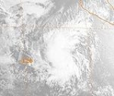
Hurricane Keli was a major hurricane that threatened Johnston AtollJohnston Atoll
Johnston Atoll is a atoll in the North Pacific Ocean about west of Hawaii. There are four islands located on the coral reef platform, two natural islands, Johnston Island and Sand Island, which have been expanded by coral dredging, as well as North Island and East Island , an additional two...
enough to prompt an evacuation. However, intense shear disintegrated the cyclone. There was no damage.
Tropical Storm Lala
Lala formed from Tropical Depression Fourteen-E, which moved in from the east.Tropical Storm Moke
Moke had uncertain beginnings, as it developed from a cold-core low that eventually became a tropical storm just east of the dateline. It passed close to Kure AtollKure Atoll
Kure Atoll or Ocean Island is an atoll in the Pacific Ocean beyond Midway Atoll in the Northwestern Hawaiian Islands at . The only land of significant size is called Green Island and is habitat for hundreds of thousands of seabirds...
, encountered shear, and lost tropical characteristics.
Hurricane Marie
Hurricane Marie dissipated off the coast of Baja CaliforniaBaja California
Baja California officially Estado Libre y Soberano de Baja California is one of the 31 states which, with the Federal District, comprise the 32 Federal Entities of Mexico. It is both the northernmost and westernmost state of Mexico. Before becoming a state in 1953, the area was known as the North...
. Its remnants recurved and brought minor levels of rain to California.
Tropical Depression Seventeen-E
This tropical depression formed in the Gulf of TehuantepecGulf of Tehuantepec
Gulf of Tehuantepec is a large body of water on the Pacific coast of the Isthmus of Tehuantepec, southeastern Mexico, at . Most of the hurricanes that form in the Eastern Pacific organize in or near this body of water...
.
Tropical Depression Eighteen-E
This tropical depression formed along the coast near ZihuatanejoZihuatanejo
Zihuatanejo or Ixtapa-Zihuatanejo, is the fourth-largest city in the Mexican state of Guerrero. Politically the city belongs to the municipality of Zihuatanejo de Azueta in the western part of Guerrero, but both are commonly referred to as Zihuatanejo...
, Mexico
Mexico
The United Mexican States , commonly known as Mexico , is a federal constitutional republic in North America. It is bordered on the north by the United States; on the south and west by the Pacific Ocean; on the southeast by Guatemala, Belize, and the Caribbean Sea; and on the east by the Gulf of...
.
Hurricane Norbert
Norbert was a hurricane that took a truly bizarre path. It drifted south, then east, then north, then west, and then south again as it traced out a spiral around its place of cyclogenesis. Norbert then turned east again before accelerating to the northwest. It recurved slightly and it weakened to a small storm before making landfall in Baja California.Hurricane Odile
Odile took an erratic path before making landfall near AcapulcoAcapulco
Acapulco is a city, municipality and major sea port in the state of Guerrero on the Pacific coast of Mexico, southwest from Mexico City. Acapulco is located on a deep, semi-circular bay and has been a port since the early colonial period of Mexico’s history...
on September 22. It dissipated the next day.
Hurricane Polo
As a tropical depression, Polo made landfall in the extreme southern part of the Baja California PeninsulaBaja California Peninsula
The Baja California peninsula , is a peninsula in northwestern Mexico. Its land mass separates the Pacific Ocean from the Gulf of California. The Peninsula extends from Mexicali, Baja California in the north to Cabo San Lucas, Baja California Sur in the south.The total area of the Baja California...
on October 3.
Tropical Storm Rachel
A tropical depression formed on October 7, several hundred miles south of MexicoMexico
The United Mexican States , commonly known as Mexico , is a federal constitutional republic in North America. It is bordered on the north by the United States; on the south and west by the Pacific Ocean; on the southeast by Guatemala, Belize, and the Caribbean Sea; and on the east by the Gulf of...
. It was upgraded to Tropical Storm Rachel on October 9, as it continued westward into the open waters of the Pacific Ocean
Pacific Ocean
The Pacific Ocean is the largest of the Earth's oceanic divisions. It extends from the Arctic in the north to the Southern Ocean in the south, bounded by Asia and Australia in the west, and the Americas in the east.At 165.2 million square kilometres in area, this largest division of the World...
. Rachel was downgraded to a tropical depression on October 11, as it began to turn northwest. The depression then dissipated in open waters on October 16.http://weather.unisys.com/hurricane/e_pacific/1984/RACHEL/track.dat
Tropical Depression Twenty-Four-E
This tropical depression quickly dissipated over cool water.Season effects
This is a table of the storms in 1984 and their landfall(s)Landfall (meteorology)
Landfall is the event of a tropical cyclone or a waterspout coming onto land after being over water. When a waterspout makes landfall it is reclassified as a tornado, which can then cause damage inland...
, if any. Deaths in parentheses are additional and indirect (an example of an indirect death would be a traffic accident), but are still storm-related. Damage and deaths include totals while the storm was extratropical or a wave or low.
1984 storm names
The following names were used for named storms that formed in the eastern Pacific in 1984. Since no one was killed and there was no severe damage from any of this season's storms, no names were retired, so the list of names was used again in the 1990 season1990 Pacific hurricane season
The 1990 Pacific hurricane season is the fifth most active season on record. The 1990 season officially started on May 15 in the eastern Pacific, and on June 1 in the central Pacific, and lasted until November 30. These dates conventionally delimit the period of each year when most tropical...
, the first time names were reused since the modern naming system began. Names that were not assigned are marked in gray.
|
|
|
Three names from the Central Pacific list were used - Keli, Lala, and Moke. This was the first usage for all of these names.
See also
- List of Pacific hurricanes
- List of Pacific hurricane seasons
- 1984 Atlantic hurricane season1984 Atlantic hurricane seasonThe 1984 Atlantic hurricane season officially began on June 1, 1984, and lasted until November 30, 1984. These dates conventionally delimit the period of each year when most tropical cyclones form in the Atlantic basin. The 1984 season was an active one in terms of named storms, but most of them...
- 1984 Pacific typhoon season1984 Pacific typhoon seasonThe 1984 Pacific typhoon season has no official bounds, but most tropical cyclones tend to form in the northwestern Pacific Ocean between May and November. These dates conventionally delimit the period of each year when most tropical cyclones form in the northwestern Pacific Ocean...
- 1984 North Indian Ocean cyclone season
- Southern Hemisphere tropical cyclone seasons: 1983–84, 1984–85