
Wallace County, New South Wales
Encyclopedia
Cadastral divisions of New South Wales
Lands administrative divisions of New South Wales refers to the 141 counties within the Australian state of New South Wales, which are further subdivided into 7,459 parishes. There are also three Land Divisions, around 100 Land Districts, and several other types of districts as well as land boards...
. The Snowy River
Snowy River
The Snowy River is a major river in south-eastern Australia. It originates on the slopes of Mount Kosciuszko, Australia's highest mainland peak, draining the eastern slopes of the Snowy Mountains in New South Wales, before flowing through the Snowy River National Park in Victoria and emptying into...
is the boundary to the south and south-east, and the Murrumbidgee River
Murrumbidgee River
The Murrumbidgee River is a major river in the state of New South Wales, Australia, and the Australian Capital Territory . A major tributary of the Murray River, the Murrumbidgee flows in a west-northwesterly direction from the foot of Peppercorn Hill in the Fiery Range of the Snowy Mountains,...
is the northern boundary. It includes the area around Jindabyne.
Wallace County was named in honour of Sir John Alexander Dunlop Agnew Wallace (1775-1857) Sixth Baronet.
Parishes within this county
A full list of parishes found within this county; their current LGA and mapping coordinates to the approximate centre of each location is as follows:| Parish | LGA | Coordinates |
|---|---|---|
| Abington | Snowy River Shire | 36°28′54"S 148°36′04"E |
| Adaminaby | Snowy River Shire | 36°05′54"S 148°49′04"E |
| Adaminiby | Snowy River Shire | 36°05′53"S 148°48′34"E |
| Addicumbene | Snowy River Shire | 36°02′54"S 148°36′04"E |
| Arable | Snowy River Shire | 36°23′54"S 148°58′04"E |
| Backalum | Snowy River Shire | 36°02′54"S 148°56′04"E |
| Beloka | Snowy River Shire | 36°28′54"S 148°45′04"E |
| Beurina | Snowy River Shire | 36°43′54"S 148°15′04"E |
| Blakefield | Snowy River Shire | 36°34′54"S 148°30′04"E |
| Bloomfield | Snowy River Shire | 36°34′54"S 148°20′04"E |
| Bobundara | Snowy River Shire | 36°28′54"S 148°55′04"E |
| Bolaira | Snowy River Shire | 35°59′54"S 148°46′04"E |
| Bradley | Snowy River Shire | 36°20′54"S 148°56′04"E |
| Buckenderra | Snowy River Shire | 36°10′54"S 148°48′04"E |
| Bulgundara | Snowy River Shire | 36°26′54"S 148°47′04"E |
| Bullenbalong | Snowy River Shire | 36°13′54"S 148°41′04"E |
| Cabramurra | Snowy River Shire | 35°59′54"S 148°35′04"E |
| Caddigat | Snowy River Shire | 35°59′54"S 148°52′04"E |
| Chippendale | Snowy River Shire | 35°55′54"S 148°45′04"E |
| Clapton | Snowy River Shire | 36°39′54"S 148°18′04"E |
| Clyde | Snowy River Shire | 36°26′54"S 148°35′04"E |
| Coolamatong | Snowy River Shire | 36°23′54"S 148°48′04"E |
| Coonhoonbula | Snowy River Shire | 36°34′54"S 148°54′04"E |
| Cootralantra | Snowy River Shire | 36°18′54"S 148°55′04"E |
| Crackenback | Snowy River Shire | 36°25′54"S 148°28′04"E |
| Eucumbene | Snowy River Shire | 36°07′54"S 148°36′04"E |
| Gabramatta | Snowy River Shire | 35°49′54"S 148°45′04"E |
| Gooandra | Snowy River Shire | 35°46′54"S 148°32′04"E |
| Gordon | Snowy River Shire | 36°24′54"S 148°52′04"E |
| Grose | Snowy River Shire | 36°41′54"S 148°28′04"E |
| Gungarlin | Tumbarumba Shire Council]] | 36°09′54"S 148°28′04"E |
| Guthega | Snowy River Shire | 36°20′54"S 148°24′04"E |
| Gygederick | Snowy River Shire | 36°13′54"S 148°49′04"E |
| Ingebirah | Snowy River Shire | 36°36′19"S 148°26′24"E |
| Ingeegoodbee | Snowy River Shire | 36°49′54"S 148°20′04"E |
| Jimenbuen | Snowy River Shire | 36°41′54"S 148°53′04"E |
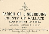
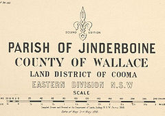
| Jinderboine | Snowy River Shire | 36°24′54"S 148°42′04"E |
| Kalkite | Snowy River Shire | 36°13′54"S 148°35′04"E |
| Kiandra | Snowy River Shire | 35°52′54"S 148°30′04"E |
| Kosciusko]] | Snowy River Shire | 36°29′54"S 148°17′04"E |
| Kosciuszko | Snowy River Shire | 36°29′54"S 148°17′04"E |
| Lake | Snowy River Shire | 36°12′54"S 148°54′04"E |
| Marrinumbla | Snowy River Shire | 36°32′54"S 148°49′04"E |
| Matong | Snowy River Shire | 36°42′54"S 148°48′04"E |
| Middlingbank | Snowy River Shire | 36°11′54"S 148°40′04"E |
| Mitchell | Snowy River Shire | 36°20′54"S 148°28′04"E |
| Mowamba | Snowy River Shire | 36°28′54"S 148°32′04"E |
| Mowamba | Snowy River Shire | 36°31′54"S 148°27′04"E |
| Moyangul | Snowy River Shire | 36°43′54"S 148°19′04"E |
| Munyang | Snowy River Shire | 36°16′26"S 148°27′38"E |
| Murroo | Snowy River Shire | 36°07′54"S 148°56′04"E |
| Myack | Snowy River Shire | 36°18′54"S 148°47′04"E |
| Myalla | Snowy River Shire | 36°26′54"S 149°01′04"E |
| Napier | Snowy River Shire | 36°46′54"S 148°48′04"E |
| Nimmo | Snowy River Shire | 36°10′54"S 148°35′04"E |
| Numbla | Snowy River Shire | 36°37′54"S 148°46′04"E |
| Nungar | Snowy River Shire | 35°54′54"S 148°38′04"E |
| Popong | Snowy River Shire | 36°39′54"S 148°40′04"E |
| Seymour | Snowy River Shire | 36°04′18"S 148°42′49"E |
| Tantangara | Snowy River Shire | 35°48′54"S 148°37′04"E |
| The Peak | Snowy River Shire | 36°25′54"S 149°06′04"E |
| Thredbo | Snowy River Shire | 31°30′54"S 148°23′04"E |
| Tongaroo | Snowy River Shire | 36°43′54"S 148°55′04"E |
| Townsend | Snowy River Shire | 36°19′54"S 148°41′04"E |
| Wallgrove | Snowy River Shire | 35°59′54"S 148°42′04"E |
| Wambrook | Snowy River Shire | 36°10′54"S 148°56′04"E |
| Wilson | Snowy River Shire | 36°34′54"S 148°41′04"E |
| Wullwye | Snowy River Shire | 36°27′54"S 148°56′04"E |