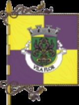
Vila Flor
Encyclopedia
Vila Flor (ˈvilɐ ˈfloɾ) is a municipality in Portugal
with a total area of 265.8 km² and a total population of 7,737 inhabitants (as of 2004).
The municipality is composed of 19 parishes and is located in the district of Bragança
.
The present mayor is Artur Vaz Pimentel, elected by the Socialist Party
.
The municipal holiday is August 24.
Portugal
Portugal , officially the Portuguese Republic is a country situated in southwestern Europe on the Iberian Peninsula. Portugal is the westernmost country of Europe, and is bordered by the Atlantic Ocean to the West and South and by Spain to the North and East. The Atlantic archipelagos of the...
with a total area of 265.8 km² and a total population of 7,737 inhabitants (as of 2004).
The municipality is composed of 19 parishes and is located in the district of Bragança
Bragança (district)
Bragança District is a traditional political division of Portugal, in the northeast corner bordering on Spain, covering 7.4% of the nations continental landmass. The capital of the district, Bragança, is 217 kilometres from Porto, the second largest town in Portugal, and 107 kilometres and 169...
.
The present mayor is Artur Vaz Pimentel, elected by the Socialist Party
Socialist Party (Portugal)
The Socialist Party , abbreviated to PS, is a social-democratic political party in Portugal. It was founded on 19 April 1973 in the German city of Bad Münstereifel, by militants from Portuguese Socialist Action ....
.
The municipal holiday is August 24.
Parishes
- Assares
- Benlhevai
- Candoso
- Carvalho de Egas
- Freixiel
- Lodões
- Mourão
- Nabo
- Róios
- Samões
- Sampaio
- Santa Comba de Vilariça
- Seixo de Manhoses
- Trindade
- Vale de Torno
- Vale Frechoso
- Vila Flor
- Vilarinho das Azenhas
- Vilas Boas

