

Upper Sugarloaf Key
Encyclopedia
Florida Keys
The Florida Keys are a coral archipelago in southeast United States. They begin at the southeastern tip of the Florida peninsula, about south of Miami, and extend in a gentle arc south-southwest and then westward to Key West, the westernmost of the inhabited islands, and on to the uninhabited Dry...
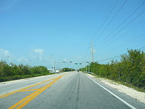
. It located between MM20.5-MM19 and bridge number 28/29 at Bow Channel/Park Key. . U.S. 1
U.S. Route 1 in Florida
U.S. Route 1 in Florida runs along the state's east coast from Key West to its crossing of the St. Marys River into Georgia north of Boulogne, and south of Folkston. US 1 was designated through Florida when the U.S. Highway System was established in 1926.US 1 runs in the state of Florida, and...
(or the Overseas Highway
Overseas Highway
The Overseas Highway is a highway carrying U.S. Route 1 through the Florida Keys. Large parts of it were built on the former right-of-way of the Overseas Railroad, the Key West Extension of the Florida East Coast Railway. Completed in 1912, the Overseas Railroad was heavily damaged and partially...
) crosses the key at approximately mile markers 19--20.5.
Upper Sugarloaf Key is located about 15 miles east of Key West
Key West
Key West is an island in the Straits of Florida on the North American continent at the southernmost tip of the Florida Keys. Key West is home to the southernmost point in the Continental United States; the island is about from Cuba....
, between Park Key
Park Key
Park Key is an uninhabited island in the lower Florida Keys about 14 miles east of Key West. It is 1500 Meters long, and between 75 and 260 Meters wide . It measures 28,5 hectares in area....
and Cudjoe Key. It is the upper arm of a large island, Sugarloaf Key
Sugarloaf Key
Sugarloaf Key is a single island in the lower Florida Keys that forms a loop on the Atlantic Ocean side giving the illusion of separate islands. Although frequently referred to simply and with technical accuracy as "Sugarloaf Key", this island contains two distinct island communities, known as...
, that includes Lower Sugarloaf Key
Lower Sugarloaf Key
Lower Sugarloaf Key is the lower arm of an island known as Sugarloaf Key in the lower Florida Keys about 13 miles east of Key West.U.S. 1 crosses the key at approximately mile markers 16.5–17.5. Due to the routing of U.S...
.
"Upper Sugarloaf Key" is the upper portion of the island of Sugarloaf Key
Sugarloaf Key
Sugarloaf Key is a single island in the lower Florida Keys that forms a loop on the Atlantic Ocean side giving the illusion of separate islands. Although frequently referred to simply and with technical accuracy as "Sugarloaf Key", this island contains two distinct island communities, known as...
; hence the name. The island is "U"-shaped, with Upper Sugarloaf Sound and Park Key
Park Key
Park Key is an uninhabited island in the lower Florida Keys about 14 miles east of Key West. It is 1500 Meters long, and between 75 and 260 Meters wide . It measures 28,5 hectares in area....
in the center.
"Upper Sugarloaf Key" has a public school, church, restaurant, and KOA campground.
Sugarloaf Elementary School
Primary education
A primary school is an institution in which children receive the first stage of compulsory education known as primary or elementary education. Primary school is the preferred term in the United Kingdom and many Commonwealth Nations, and in most publications of the United Nations Educational,...
and Sugarloaf Middle School
Middle school
Middle School and Junior High School are levels of schooling between elementary and high schools. Most school systems use one term or the other, not both. The terms are not interchangeable...
are located at the intersection of US Route
United States Numbered Highways
The system of United States Numbered Highways is an integrated system of roads and highways in the United States numbered within a nationwide grid...
1 and Crane Blvd.
Great White Heron National Wildlife Refuge
Great White Heron National Wildlife Refuge
The Great White Heron National Wildlife Refuge is part of the United States National Wildlife Refuge System, located in a region known as the 'Backcountry', which reaches from north of Marathon to north of Key West. It is along the north side of the Keys in that area that border the Gulf of Mexico...
is located at the far end of Crane Boulevard.
The name Sugarloaf, is variously attributed as coming from either an Indian mound on the east side of Upper Sugarloaf Key, north of the present highway, which was said to look like an old-fashioned loaf of sugar or from the variety of pineapple called 'sugarloaf' that was once grown in the area. These pineapples are rarely seen in commercial use since they are soft and do not travel well.
Sugarloaf? Upper Sugarloaf? Lower Sugarloaf? While there is plenty of debate over names, the road signs
Traffic sign
Traffic signs or road signs are signs erected at the side of roads to provide information to road users. With traffic volumes increasing over the last eight decades, many countries have adopted pictorial signs or otherwise simplified and standardized their signs to facilitate international travel...
that are present as one approaches each island clearly indicate that Upper Sugarloaf Key and Lower Sugarloaf Key are the names in use for these distinct communities upon the larger island of Sugarloaf Key
Sugarloaf Key
Sugarloaf Key is a single island in the lower Florida Keys that forms a loop on the Atlantic Ocean side giving the illusion of separate islands. Although frequently referred to simply and with technical accuracy as "Sugarloaf Key", this island contains two distinct island communities, known as...
.