

Umburatiba
Encyclopedia
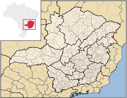
Minas Gerais
Minas Gerais is one of the 26 states of Brazil, of which it is the second most populous, the third richest, and the fourth largest in area. Minas Gerais is the Brazilian state with the largest number of Presidents of Brazil, the current one, Dilma Rousseff, being one of them. The capital is the...
. Its population as of 2007 was 2,776 living in a total area of 405 km². The city belongs to the statistical mesoregion
Mesoregion (Brazil)
Mesoregions are subdivisions of Brazilian states, grouping together various municipalities in proximity and with common characteristics. They were created by the Brazilian Institute of Geography and Statistics for statistical purposes and do not, therefore, constitute an administrative area....
of Vale do Mucuri and to the statistical microregion
Microregion (Brazil)
Microregions are legally defined administrative areas in Brazil consisting of groups of municipalities bordering urban areas. Microregions are grouped together into mesoregions....
of Nanuque
Nanuque
Nanuque is a municipality in the northeast of the Brazilian state of Minas Gerais. As of 2007 the population was 40,307 in a total area of 1,515 km². It is part of the IBGE statistical meso-region of Vale do Mucuri and the micro-region of Nanuque...
. It became a municipality in 1962.
Umburatiba is located at an elevation of 238 meters on the state boundary with Bahia
Bahia
Bahia is one of the 26 states of Brazil, and is located in the northeastern part of the country on the Atlantic coast. It is the fourth most populous Brazilian state after São Paulo, Minas Gerais and Rio de Janeiro, and the fifth-largest in size...
. The nearest major population center is Nanuque
Nanuque
Nanuque is a municipality in the northeast of the Brazilian state of Minas Gerais. As of 2007 the population was 40,307 in a total area of 1,515 km². It is part of the IBGE statistical meso-region of Vale do Mucuri and the micro-region of Nanuque...
.
The distance to Nanuque
Nanuque
Nanuque is a municipality in the northeast of the Brazilian state of Minas Gerais. As of 2007 the population was 40,307 in a total area of 1,515 km². It is part of the IBGE statistical meso-region of Vale do Mucuri and the micro-region of Nanuque...
is 100 km; and the distance to the state capital, Belo Horizonte
Belo Horizonte
Belo Horizonte is the capital of and largest city in the state of Minas Gerais, located in the southeastern region of Brazil. It is the third largest metropolitan area in the country...
, is 673 km. Neighboring municipalities are: Machacalis
Machacalis
Machacalis is a Brazilian municipality located in the northeast of the state of Minas Gerais. Its population as of 2007 was 6,855 living in a total area of 329 km². The city belongs to the statistical mesoregion of Vale do Mucuri and to the statistical microregion of Nanuque. It became a...
, Bertópolis
Bertópolis
Bertópolis is a municipality in the northeast of the Brazilian state of Minas Gerais. As of 2007 the population was 4,588 in a total area of 426 km². The elevation is 278 meters. It became a municipality in 1962. The postal code is 39875-000....
, Carlos Chagas
Carlos Chagas, Minas Gerais
Carlos Chagas is a Brazilian municipality located in the northeast of the state of Minas Gerais. Its population as of 2007 was 20,812 living in a total area of 3,199 km². The city belongs to the statistical mesoregion of Vale do Mucuri and to the statistical microregion of Nanuque. It became a...
, Itanhém
Itanhém
Itanhém is a town and municipality in the state of Bahia in the North-East region of Brazil.-References:...
(Bahia), and Medeiros Neto
Medeiros Neto
Medeiros Neto is a town and municipality in the state of Bahia in the North-East region of Brazil.-References:...
(Bahia).
The main economic activities are services, small industries, and subsistence agriculture. The GDP in 2005 was R$12 million, with 7 million from services, 1 million from industry, and 4 million from agriculture. There were 97 rural producers on 65,000 hectares of land. Only 9 farms had tractors (2006). 300 persons were dependent on agriculture. The main crops were coconuts, sugarcane, beans, and corn. There were 29,000 head of cattle (2006). There were no banks (2007) and 60 automobiles (74 motorcycles), giving a ratio of 45 inhabitants per automobile.
The social indicators rank it in the bottom tier of municipalities in the state.
- Municipal Human Development IndexHuman Development IndexThe Human Development Index is a composite statistic used to rank countries by level of "human development" and separate "very high human development", "high human development", "medium human development", and "low human development" countries...
: 0.618 (2000) - State ranking: 810 out of 853 municipalities as of 2000
- National ranking: 4,351 out of 5,138 municipalities as of 2000
- Literacy rate: 71%
- Life expectancy: 60 (average of males and females)
- Degree of urbanization: 55.81 (2000)
- Percentage of urban dwellings connected to sewage system: 70.90
- Infant mortality rate: 18.52
The highest ranking municipality in Minas Gerais in 2000 was Poços de Caldas
Poços de Caldas
Poços de Caldas is a city and municipality in south-western Minas Gerais state, Brazil, in the microregion of the same name. Its estimated population in 2009 was 151,449 inhabitants...
with 0.841, while the lowest was Setubinha
Setubinha
Setubinha is a municipality in the northeast of the Brazilian state of Minas Gerais. As of 2007 the population was 10,834 in a total area of 536 km². The elevation is 729 metres. It is part of the IBGE statistical microregion of Teófilo Otoni...
with 0.568. Nationally the highest was São Caetano do Sul
São Caetano do Sul
São Caetano do Sul is a city in São Paulo state in Brazil, located in the Greater São Paulo Metropolitan Area. It is the city with the highest per capita income in Brazil and it also has the highest Human Development Index .-Geography:São Caetano do Sul is located on a plateau that is part of the...
in São Paulo with 0.919, while the lowest was Setubinha. In more recent statistics (considering 5,507 municipalities) Manari in the state of Pernambuco
Pernambuco
Pernambuco is a state of Brazil, located in the Northeast region of the country. To the north are the states of Paraíba and Ceará, to the west is Piauí, to the south are Alagoas and Bahia, and to the east is the Atlantic Ocean. There are about of beaches, some of the most beautiful in the...
has the lowest rating in the country--0,467--putting it in last place.
There were 4 health clinics (2 specialized) (2006). Patients with more serious health conditions are transported to Nanuque. Educational needs were met by 3 primary schools, 1 middle school, and 2 pre-primary schools.
See also
- List of municipalities in Minas Gerais